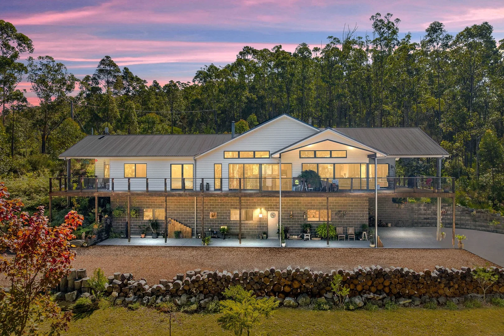
44 Narambi Close
Moruya, NSW 2537
Explore the area
Explore around Moruya, from school days to weekends.
- schools in Moruya
- 3
- activity providers in the suburb
- 1
- parks in the suburb
- 7
- libraries in the suburb
- 2
- council area (km²)
- 3,428.17
- residents (ABS, June 2024)
- 41,142
- children aged 0–14
- 5,713
- schools
- 15
- public places listed
- 79
- kids’ activity providers listed
- 12
Most-listed activities: Art Centre, Swimming, AFL
Population figures: Australian Bureau of Statistics
Moruya by the numbers
Official published figures for the suburb, shown as their own dated facts — not combined into a score.
Recorded offences (12 months)
539
2026-06
Parks, playgrounds & public spaces
Things to do near this home
Explore nearby play centres and family attractions from the directory. Check ages, entry prices and opening hours with the venue.
Find more ideas by age, budget and indoor or outdoor setting on Things to do. Dated events are in What’s on. See what’s on
Discover local guides & family ideas
Read local family guides and practical articles as you explore life around this home.
Most Livable Suburbs in New South Wales for Families (2026)
Sydney lists more kids' activities in our directory than any other suburb in NSW. This page ranks NSW suburbs by how much a family moving there could actually do with their kids, then adds what else…
Read more →
Free Kids' Activities in Sydney: What's On, Libraries, Free Trials
There are 11 free events listed in and around Sydney for the next month, 1,630 libraries, parks and community spaces we hold inside the city, and 26 kids' activity providers offering a free class or…
Read more →Everyday essentials & getting around
Open the map to choose a destination and check journey times from this address. Walking routes, step-free access and travel times have not been verified.
Flood & development checks
Property-specific flood risk and announced developments have not been verified. Search this address in the official maps and ask the council for current flood information.
Source: AroundSchools directory. Distances are straight-line distances, not walking routes. Confirm facilities on the linked detail pages. Directory update dates are not supplied for this summary.
Property Details
20200 m²
House
RESIDENTIAL
What's Nearby
Nearby Schools
Carroll College
2494 George Bass Drive, Broulee NSW 2537 Australia
St Mary’s Primary School - Moruya
Queen Street, Moruya NSW 2537 Australia
Moruya Public School
22 Evans St, Moruya NSW 2537
St Peter's Anglican College
61 Train Street, Broulee NSW 2537 Australia
Broulee Public School
Cambridge Cresc, Broulee NSW 2537
Moruya High School
Moruya High School, MORUYA NSW 2537
Nearby schools do not imply enrolment eligibility. Confirm catchments, year levels and childcare availability directly with the provider.