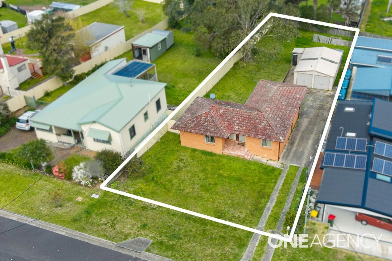
12 Wolseley Street
Milton, NSW 2538
Explore the area
Explore around Milton, from school days to weekends.
- council area (km²)
- 4,567.201
- residents (ABS, June 2024)
- 110,803
- children aged 0–14
- 17,536
- schools
- 35
- public places listed
- 152
- kids’ activity providers listed
- 30
Most-listed activities: Tennis, Karate, AFL
Population figures: Australian Bureau of Statistics
Milton by the numbers
Official published figures for the suburb, shown as their own dated facts — not combined into a score.
Recorded offences (12 months)
70
2026-06
Nearby places to eat
9 within about 1.2km. A few of them — listed by distance, not by how good they are.
Kindred Coffee · What's Up Bowl · Milton Woodfire Pizza Cafe · Beurre Moisette Patisserie · Pilgrims Vegetarian Cafe · Duke & Co. · Driftwood Cafe · The Heritage Bakery
Source: © State of New South Wales (Department of Communities and Justice), NSW Bureau of Crime Statistics and Research (BOCSAR) · © OpenStreetMap contributors (ODbL)
Parks, playgrounds & public spaces
Milton Library
Princes Hwy, Milton, New South Wales, 2538
452 m straight-line distance
Milton Show Ground
Croobyar Rd, Milton, New South Wales, 2538
486 m straight-line distance
Milton Rainforest Reserve
Church St, Milton, New South Wales, 2538
527 m straight-line distance
Mick Ryam Park
Princes Hwy, Milton, New South Wales, 2538
714 m straight-line distance
Things to do near this home
Explore nearby play centres and family attractions from the directory. Check ages, entry prices and opening hours with the venue.
Find more ideas by age, budget and indoor or outdoor setting on Things to do. Dated events are in What’s on. See what’s on
Discover local guides & family ideas
Read local family guides and practical articles as you explore life around this home.
Most Livable Suburbs in New South Wales for Families (2026)
Sydney lists more kids' activities in our directory than any other suburb in NSW. This page ranks NSW suburbs by how much a family moving there could actually do with their kids, then adds what else…
Read more →
Free Kids' Activities in Sydney: What's On, Libraries, Free Trials
There are 11 free events listed in and around Sydney for the next month, 1,630 libraries, parks and community spaces we hold inside the city, and 26 kids' activity providers offering a free class or…
Read more →Everyday essentials & getting around
Open the map to choose a destination and check journey times from this address. Walking routes, step-free access and travel times have not been verified.
Flood & development checks
Property-specific flood risk and announced developments have not been verified. Search this address in the official maps and ask the council for current flood information.
Source: AroundSchools directory. Distances are straight-line distances, not walking routes. Confirm facilities on the linked detail pages. Directory update dates are not supplied for this summary.
Property Details
1107 m²
House
RESIDENTIAL
Nearby Properties
Recently sold nearby
Homes that have sold close to this address. We don’t show sale prices.
Ulladulla, NSW 2539
Land Size: 650 m²
Property Type: House
Listing Type: Residential
Status: Active
Summary: Easy-Care Living
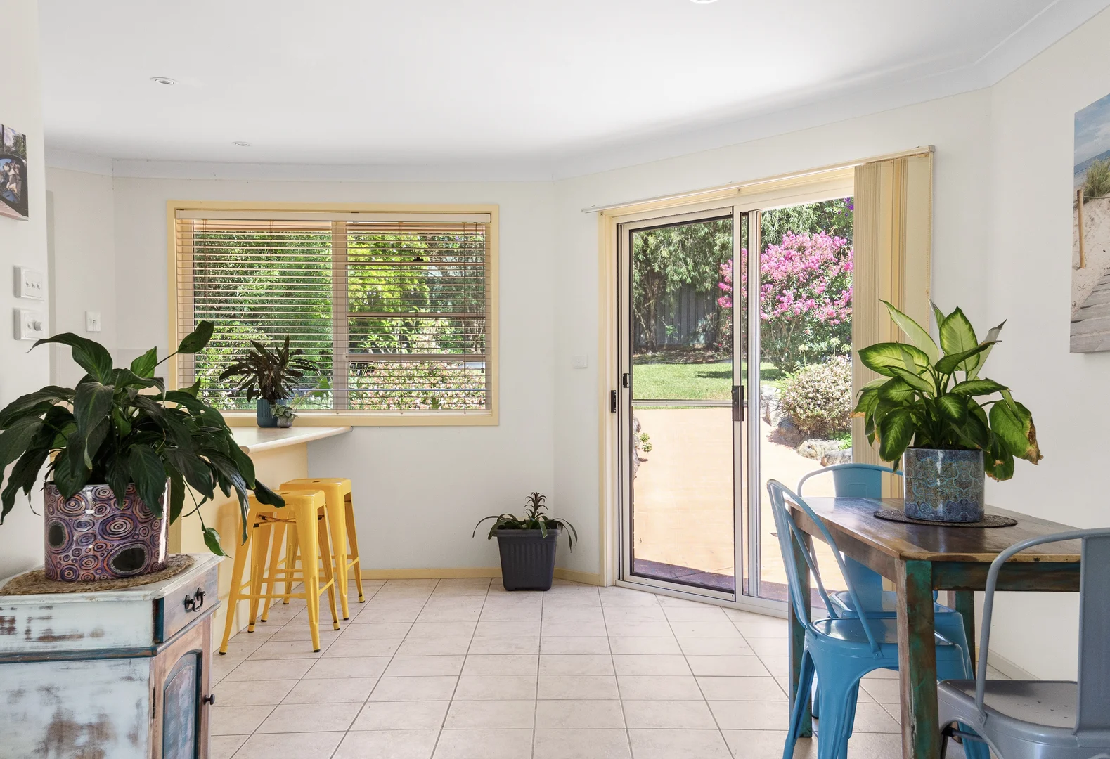
Description: Immaculately maintained and beautifully presented, this low-maintenance home offers effortless living. Light-filled interiors and a practical open-plan design create a welcoming and comfortable atmosphere throughout. - Perfect for first-home buyers, investors, or downsizers, this property delivers easy-care living without sacrificing style or functionality. - Well appointed kitchen with dishwasher - Master bedroom featuring a walk-in robe and an ensuite - Two additional bedrooms, each with built-in robes - Three-way family bathroom with bath, shower and separate wc - Open-plan, sun-filled kitchen and dining area flows seamlessly to a spacious paved outdoor entertaining - Low-maintenance, fully fenced backyard - Spacious lounge with reverse cycle air conditioning - Single remote-control garage with internal access Ideally located just a 4-minute drive to Ulladulla Harbour, 3 minutes to South Mollymook Beach and Surf Club, as well as the Mollymook Golf Club and Golf Course. Enjoy easy access to the prestigious Hill Top Championship Golf Course, only 4 minutes away, and the charming historic village of Milton, just a 6-minute drive.
Agent: Stephanie Ash - stephanieash@mcgrath.com.au
Agent: Eve McDonald - evemcdonald@mcgrath.com.au
Mollymook Beach, NSW 2539
Land Size: 658 m²
Property Type: House
Listing Type: Residential
Status: Active
Summary: Unwind by the Ocean
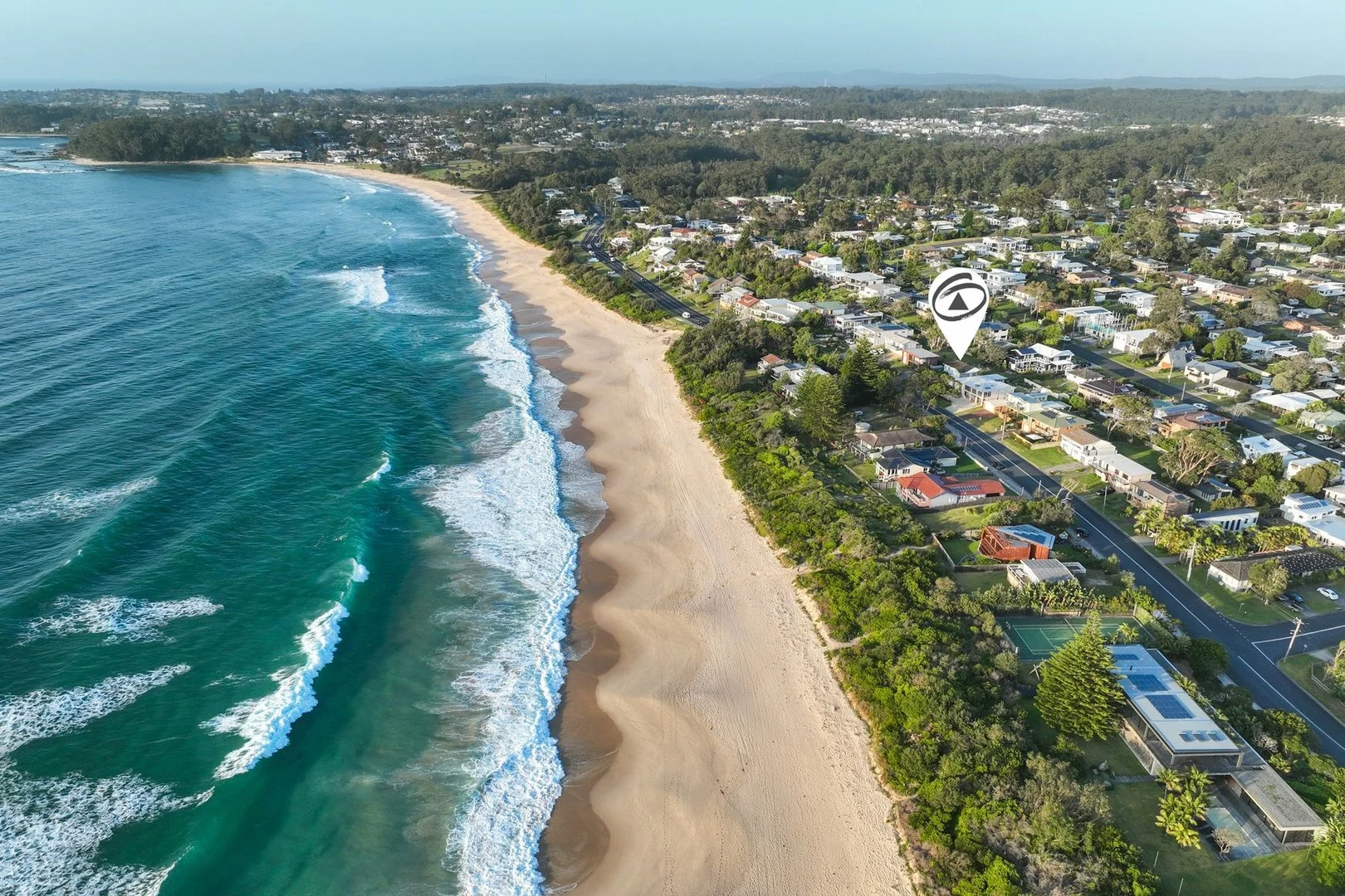
Description: Imagine waking up to the sound of waves crashing and panoramic ocean views from the comfort of your own holiday home! This spacious 3-bedroom property, located directly across from the iconic Mollymook Beach, offers everything you need for the perfect coastal escape. Whether you're looking to enjoy a day at the beach, explore the nearby cafes, or indulge in a delicious meal at local restaurants and clubs, everything is just a short stroll away. Start your mornings with a beachside coffee, take a leisurely walk along the sandy shore, or simply relax on the deck as you watch the sun dip below the horizon. Inside, you'll find three comfortable bedrooms, perfect for families or groups of friends. The open-plan living and dining areas provide ample space to relax, unwind, and make memories together, all while taking in those unbeatable ocean views. For inspections, please contact Andrew Creech on 0455 445 741. Disclaimer: All information contained herein is gathered from sources we believe to be reliable. However, we cannot guarantee its accuracy and interested persons should rely on their own enquiries.
Agent: Andrew Creech - andrew@fnproperty.au - 02 4455 3999
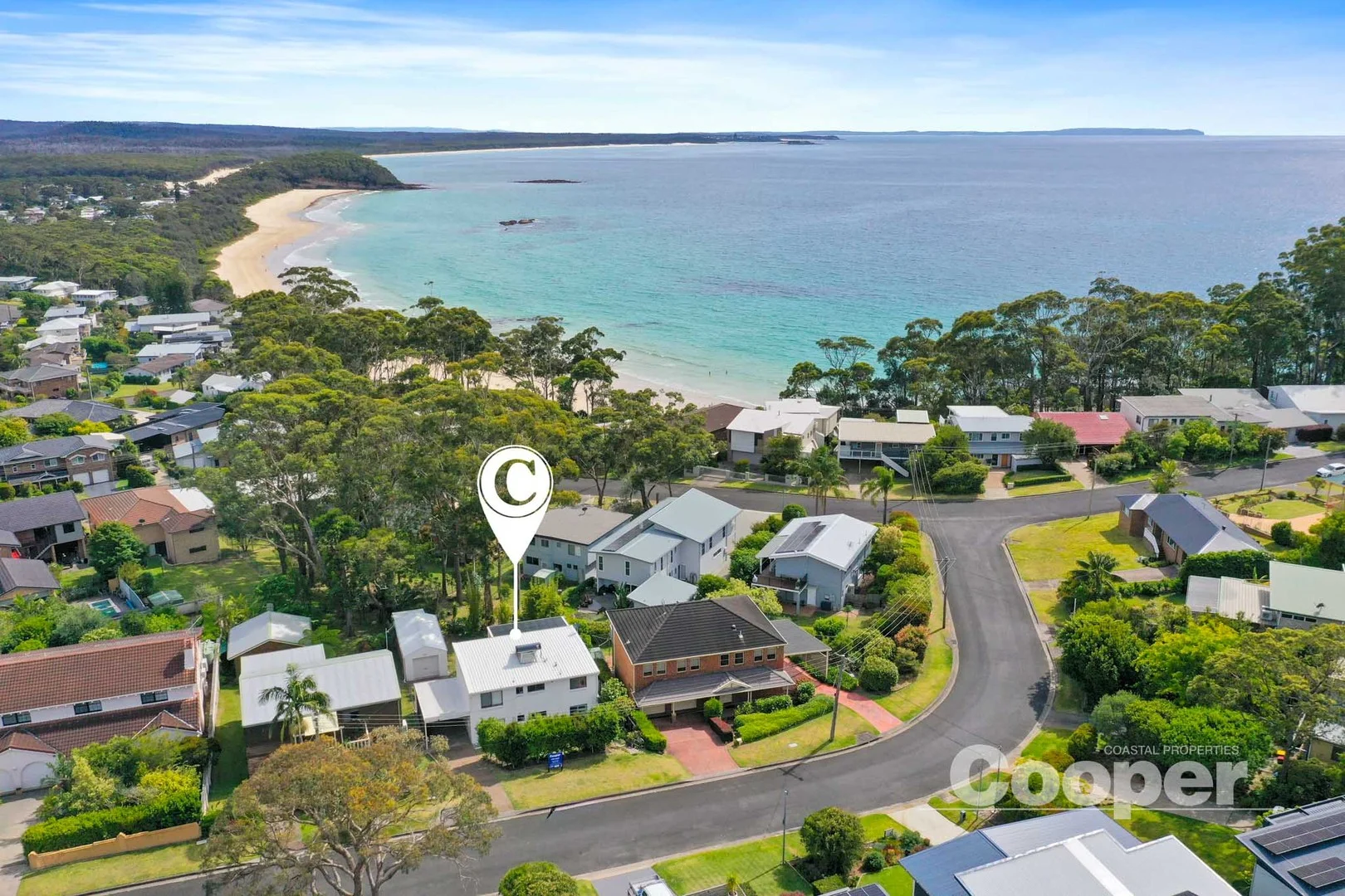
Narrawallee, NSW 2539
Land Size: 664 m²
Property Type: House
Listing Type: Residential
Status: Active
Summary: Coastal classic with Ocean Views just 400m to Narrawallee Beach!
Description: Perfectly positioned in a quiet street on the sought-after eastern side of Manning Avenue, this well-loved two-storey home offers relaxed coastal living with bright open interiors, north-facing decks on both levels and plenty of potential to update or enjoy as is. With four bedrooms, two bathrooms, lock-up garage and carport, it's an ideal beach escape or permanent home - all just moments from cafés, dining and the pristine shores of Narrawallee and Mollymook beaches. We love: * Raked ceilings * Air conditioning and fans * Decks on both levels * Easy care vinyl floors and tiles * Lock up garage and carport * Quiet street, close to beaches and local shops
Agent: Craig Cooper - craig@coopercoastalproperties.com.au
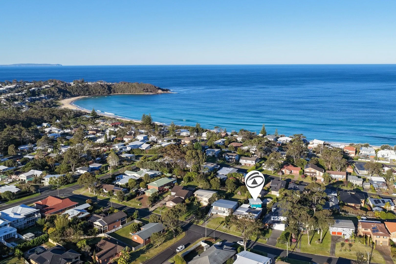
Mollymook Beach, NSW 2539
Land Size: 858 m²
Property Type: House
Listing Type: Residential
Status: Active
Summary: Coastal Lifestyle with Dual Living in Mollymook Beach
Description: Positioned in one of Mollymook's most sought-after pockets, this versatile property offers the perfect blend of lifestyle, space, and potential. Just moments from the beach, golf course, local clubs, and vibrant cafés, it's a home that captures the very best of coastal living. The main residence features three generous bedrooms and multiple living areas, creating plenty of space for the whole family. Flowing from the living zones is a private outdoor deck, ideal for entertaining or simply relaxing in the fresh coastal air. At the rear, a fully self-contained two-bedroom studio provides excellent flexibilityperfect for extended family, guests, or potential rental income. Enjoy distant ocean views from the property, while practical features such as a single lock-up garage, a large double shed, and convenient side access add to the appeal. Whether you're seeking a permanent home, a coastal getaway, or an investment with multiple options, this property is a rare opportunity in a tightly held location. Disclaimer: All information contained herein is gathered from sources we believe to be reliable. However, we cannot guarantee its accuracy and interested persons should rely on their own enquiries.
Agent: Andrew Creech - andrew@fnproperty.au - 02 4455 3999
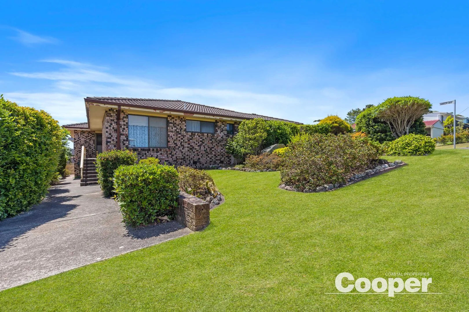
Mollymook Beach, NSW 2539
Land Size: 662 m²
Property Type: House
Listing Type: Residential
Status: Active
Summary: Walk to Beach & Bannisters
Description: Perfectly positioned to capture cooling coastal breezes and elevated area views, this home offers the quintessential Mollymook lifestyle. Start the day with a short stroll to North Mollymook beach for a swim or surf in the pristine waters. Later wander to your choice of local favourites for an afternoon drink, then savour world class dining at Rick Stein's, Bannister Pavillion or Gwylo restaurants before taking a leisurely walk home to drift off to sleep, all within earshot of the ocean. The classic 3 bedroom home has been lovingly held by one family for 35 years, offering a solid foundation for first home owners, or those ready to update and make it their own. Featuring two living areas, two bathrooms and an eat-in kitchen, it also includes internal access to the single garage for everyday convenience. Established gardens enhance privacy on the corner block while the secure backyard provides a safe space for children and pets, or simply a peaceful spot to unwind and embrace the laid back coastal lifestyle.
Agent: Craig Cooper - craig@coopercoastalproperties.com.au
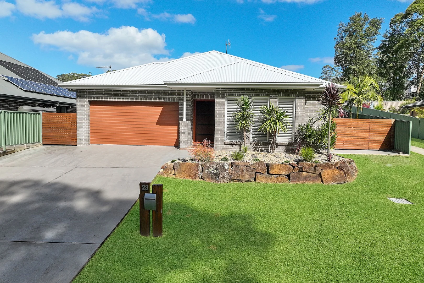
Mollymook, NSW 2539
Land Size: 882 m²
Property Type: House
Listing Type: Residential
Status: Active
Summary: Single-Level Living in Magnificent Mollymook
Description: Leave the everyday behind and embrace the serene coastal beauty of Mollymook-where pristine beaches, sparkling ocean views, and world-class golf courses set the scene for an exceptional lifestyle. Nestled in one of the area's most peaceful streets, this stunning sun-drenched residence offers privacy, space, and effortless sophistication. Set on a generous 882sqm fully fenced and beautifully landscaped block, this elegant single-level home has been thoughtfully designed for relaxed family living and seamless entertaining. From the moment you step inside, soaring 12-foot ceilings create an immediate sense of space and quality. The home features four oversized bedrooms, including a luxurious master retreat complete with a spacious walk-in robe and a divine ensuite that delivers true resort-style indulgence. At the heart of the home, the chef's kitchen is a culinary delight, showcasing a 900mm gas cooktop and electric oven, premium built-in appliances, a large pantry, and sleek Caesarstone benchtops-perfectly suited to both everyday living and hosting guests. The well-considered floorplan offers multiple living and lounge areas, all enhanced by ducted air conditioning for year-round comfort. Glass stacker doors flow effortlessly from the main living space to a spectacular covered entertaining deck, overlooking immaculate gardens and manicured lawns. A dedicated fire pit area with built-in wrap-around seating provides the perfect setting for unforgettable evenings with family and friends. North-facing and ideally positioned opposite a tranquil bushland reserve, this home offers a peaceful retreat while remaining just minutes from Mollymook Beach and the vibrant townships of Milton and Ulladulla. This is more than a home-it's a lifestyle. A place to unwind, connect, and create lasting memories in one of the South Coast's most breathtaking locations. Call Kate Wise on 0404 413 866 to arrange a private inspection. FEATURES INCLUDE: • 4 Bedrooms • 2 Bathrooms • Multiple living and lounge areas • Magnificent Chefs' kitchen • Ducted air-conditioning throughout • Covered entertaining alfresco area • Fully fenced and beautifully landscaped gardens • Double remote lock up garage • 10kw Solar • North facing overlooking bushland reserve • Short walk to Mollymook beach • Holiday and Permanent Rental figures available upon request
Agent: Kate Wise - kate.wise@raywhite.com - 02 4454 1333
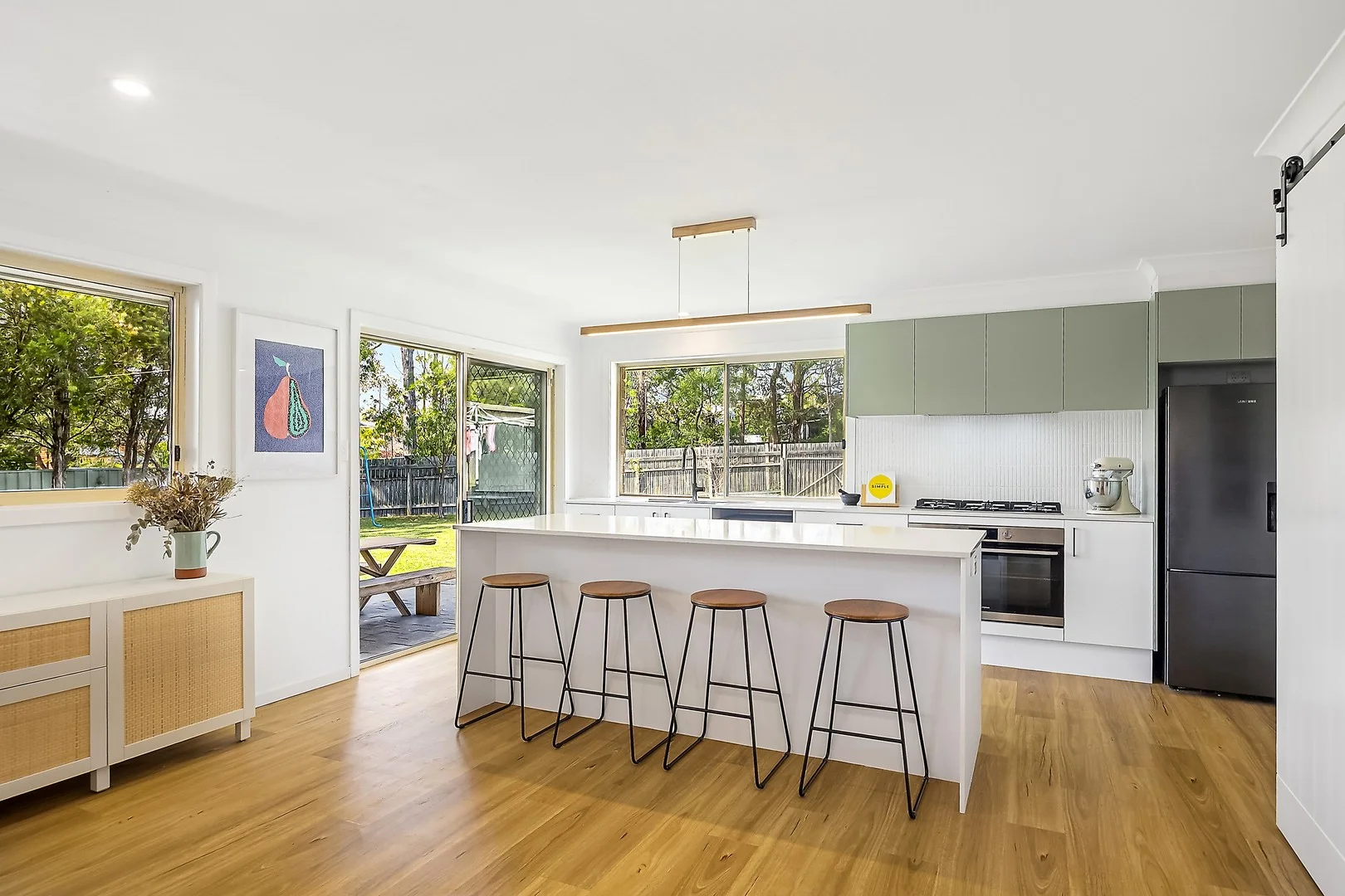
Ulladulla, NSW 2539
Land Size: 745.9 m²
Property Type: House
Listing Type: Residential
Status: Active
Summary: Bright and Airy Home Backing onto Tranquil Reserve
Description: Recently updated, this three bedroom home sits on a generous parcel in a quiet cul-de-sac, backing onto a tranquil reserve. Perfect for family living and entertaining, the home combines modern comfort with a private, natural setting. - Light filled open plan kitchen, living and dining seamlessly connects with undercover alfresco - Designer kitchen with stone bench tops, quality appliances and feature pendant lighting, features butlers pantry - Seperate home office or rumpus room - Master bedroom with built in robe, ceiling fan and AC - Two additional bedrooms with built in robes and ceiling fans - Three way bathroom with bath tub, shower and seperate toilet - Expansive level back yard, with reserve backdrop and carport providing vehicle side access - Additional features include, internal laundry, single garage and a spacious fully fenced yard Enjoy ultimate convenience with schools, beaches, and shops just minutes away. Just a 5 min drive to Ulladulla Primary and High School, 5 min drive to Mollymook Beach, 6 min drive to Ulladulla's town centre and essential services, 6 min drive to Milton's shops and restaurants, and only a 1min walk to the nearest early childcare centre.
Agent: Stephanie Ash - stephanieash@mcgrath.com.au
Agent: Eve McDonald - evemcdonald@mcgrath.com.au
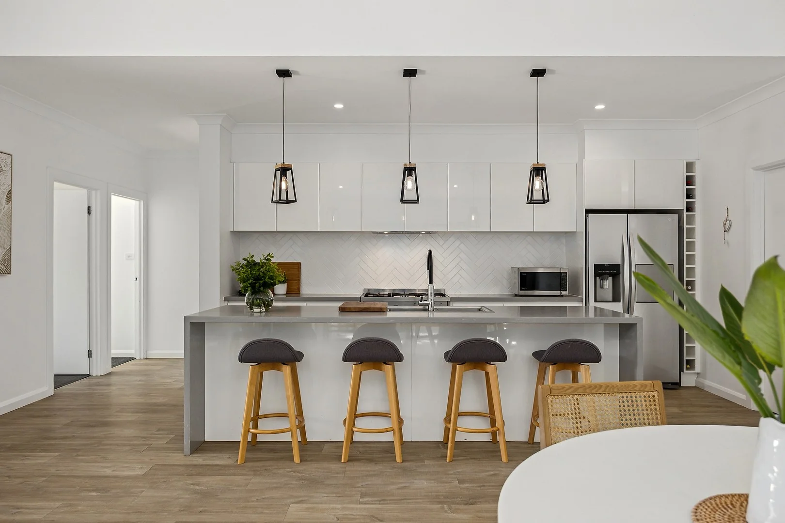
Narrawallee, NSW 2539
Land Size: 683.9 m²
Property Type: House
Listing Type: Residential
Status: Active
Summary: Refined Modern Living Filled with Natural Light
Description: Bathed in natural light, this stunning residence delivers a seamless blend of open-plan living and relaxed coastal style. Designed for effortless indooroutdoor entertaining, the home captures the essence of beachside living and is ideally located just 3-minute drive to Narrawallee's pristine beaches and inlet. - Soaring ceilings and a grand entry create an immediate sense of space and sophistication - Modern kitchen with stone bench tops, premium appliances and a generous island with breakfast bar - Luxurious master suite complete with walk-in robe and elegant ensuite - Three additional bedrooms, each with builtin robes - Study / additional storage space or wine cellar. - Multiple living zones flowing seamlessly to the outdoor entertaining area - Oversized double garage with additional workshop space - Convenient side access providing secure parking for a boat or caravan
Agent: Sophie Eriksson - sophieeriksson@mcgrath.com.au
Agent: Eve McDonald - evemcdonald@mcgrath.com.au
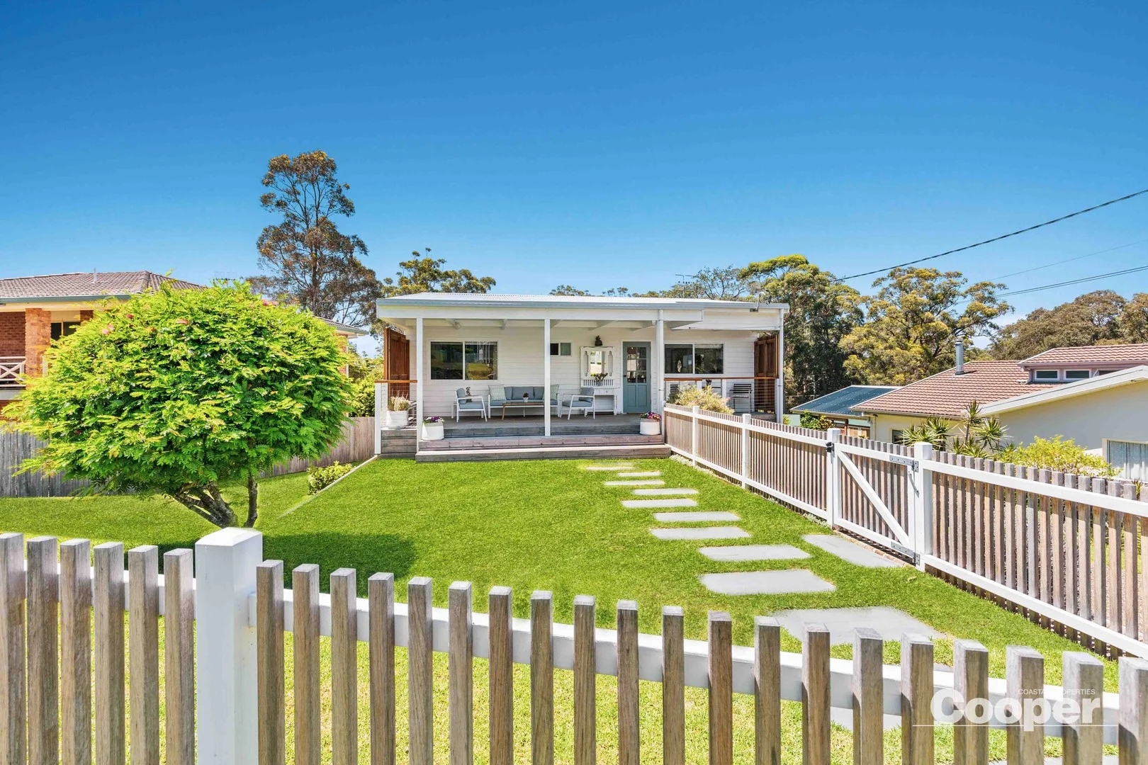
Mollymook Beach, NSW 2539
Land Size: 670.26 m²
Property Type: House
Listing Type: Residential
Status: Active
Summary: Relaxed Coastal Living Just Moments from Mollymook Beach
Description: Discover the ease and charm of beachside living in this beautifully renovated coastal retreat, quietly nestled in a leafy, elevated street just a short stroll to the pristine shores of Mollymook Beach. Start your mornings with a peaceful walk or swim, then wander up for a coffee from the local van, deli or bakery at Mollymook shopping centre all just moments from your doorstep. Inside, the bright and airy four bedroom home has been thoughtfully renovated to blend style with comfort. The stunning new kitchen features a gas cooktop, quality electric appliances, a generous island bench, and plenty of storage perfect for everyday living and effortless entertaining. Coastal-inspired timber accents, crisp white interiors, hybrid floors, ceiling fans and reverse cycle air conditioning complete the tranquil seaside feel. Step outside to find multiple spaces designed for relaxation and connection: - A wide sunny front verandah with northeast aspect - A private, leafy covered rear deck - A lower-level entertaining deck that opens to a specious, securely fenced backyard with a fire pit. The downstairs area also provides a private retreat for guest or extended family, while under house storage keeps your beach gear and garden tools neatly tucked away. A hot and cold outdoor shower, low maintenance landscaped gardens, and side access to the rear yard all add to the functionality of this well designed home. We love: Elevated outlook on a quiet, leafy street Three entertaining decks to enjoy all seasons Fully renovated with quality finishes throughout Professionally landscaped, low-maintenance gardens Securely fenced perfect for kids or pets Private guest area on the lower level Only 400m level walk to Bannisters, Gwylo and local shops Just 800m to Mollymook Beach
Agent: Craig Cooper - craig@coopercoastalproperties.com.au
What's Nearby



Nearby Schools

Milton Public School
Thomas St, Milton NSW 2538
St Mary Star of the Sea Catholic Primary School - Milton
Cork'S Lane, Milton NSW 2538 Australia

Ulladulla Public School
Green St, Ulladulla NSW 2539

Ulladulla High School
South St, Ulladulla NSW 2539

Sussex Inlet Public School
Sussex Inlet Primary School, SUSSEX INLET NSW 2540
St Georges Basin Public School
Tallyan Point Rd, Basin View NSW 2540
Nearby schools do not imply enrolment eligibility. Confirm catchments, year levels and childcare availability directly with the provider.