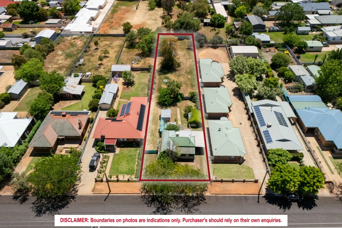
137 Anzac Street
Temora, NSW 2666
Neighbourhood & everyday essentials
Explore around Temora, from school days to weekends.
Area figures
- schools in Temora
- 4
Find schools, playgrounds and children’s classes. Browse by age to plan school days and weekends.
Area figures
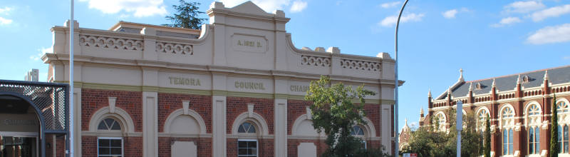
- residents (ABS, June 2024)
- 6,023
- children aged 0–14
- 1,101
- schools
- 5
- parks & libraries
- 6
- kids’ activity providers listed
- 3
Most-listed activities: AFL, Auskick, Taekwondo
Population figures: Australian Bureau of Statistics
Explore local libraries, community spaces, schools and council programs across the wider area.
Parks, playgrounds & public spaces
Paleface Park
Loftus St, Temora, New South Wales, 2666
206 m straight-line distance
Boginderra Hill Nature Reserve
Loftus St, Temora, New South Wales, 2666
323 m straight-line distance
Gloucester Park
Loftus St, Temora, New South Wales, 2666
468 m straight-line distance
Hillview Park Community Garden & Landcare Nursery
Deutcher St, Temora, New South Wales, 2666
578 m straight-line distance
Things to do near this home
Explore nearby play centres and family attractions from the directory. Check ages, entry prices and opening hours with the venue.
Find more ideas by age, budget and indoor or outdoor setting on Things to do. Dated events are in What’s on. See what’s on
Discover local guides & family ideas
Read local family guides and practical articles as you explore life around this home.

Kids' Activities per Child: Australia's Best- and Thinnest-Covered Council Areas (2026)
Across Australia's big council areas, the AroundSchools directory lists a median of about 10 kids' activity providers for every 10,000 children — but in Melbourne's Wyndham it is 3.9, and in the City…
Read more →
Most Livable Suburbs in New South Wales for Families (2026)
Sydney lists more kids' activities in our directory than any other suburb in NSW. This page ranks NSW suburbs by how much a family moving there could actually do with their kids, then adds what else…
Read more →Everyday essentials & getting around
Open the map to choose a destination and check journey times from this address. Walking routes, step-free access and travel times have not been verified.
Flood & development checks
Property-specific flood risk and announced developments have not been verified. Search this address in the official maps and ask the council for current flood information.
Source: AroundSchools directory. Distances are straight-line distances, not walking routes. Confirm facilities on the linked detail pages. Directory update dates are not supplied for this summary.
Property Details
1764 m²
House
RESIDENTIAL
What's Nearby



Nearby Schools

Temora High School
Anzac St, Temora NSW 2666

St Anne's Central School
125 De Boos Street, Temora NSW 2666 Australia

Temora Public School
De Boos St, Temora NSW 2666

Temora West Public School
Truskett St, Temora NSW 2666

Ariah Park Central School
Reid St, Ariah Park NSW 2665

Stockinbingal Public School
Britannia St, Stockinbingal NSW 2725
Nearby schools do not imply enrolment eligibility. Confirm catchments, year levels and childcare availability directly with the provider.
Nearby Properties
Recently sold nearby
Homes that have sold close to this address. We don’t show sale prices.
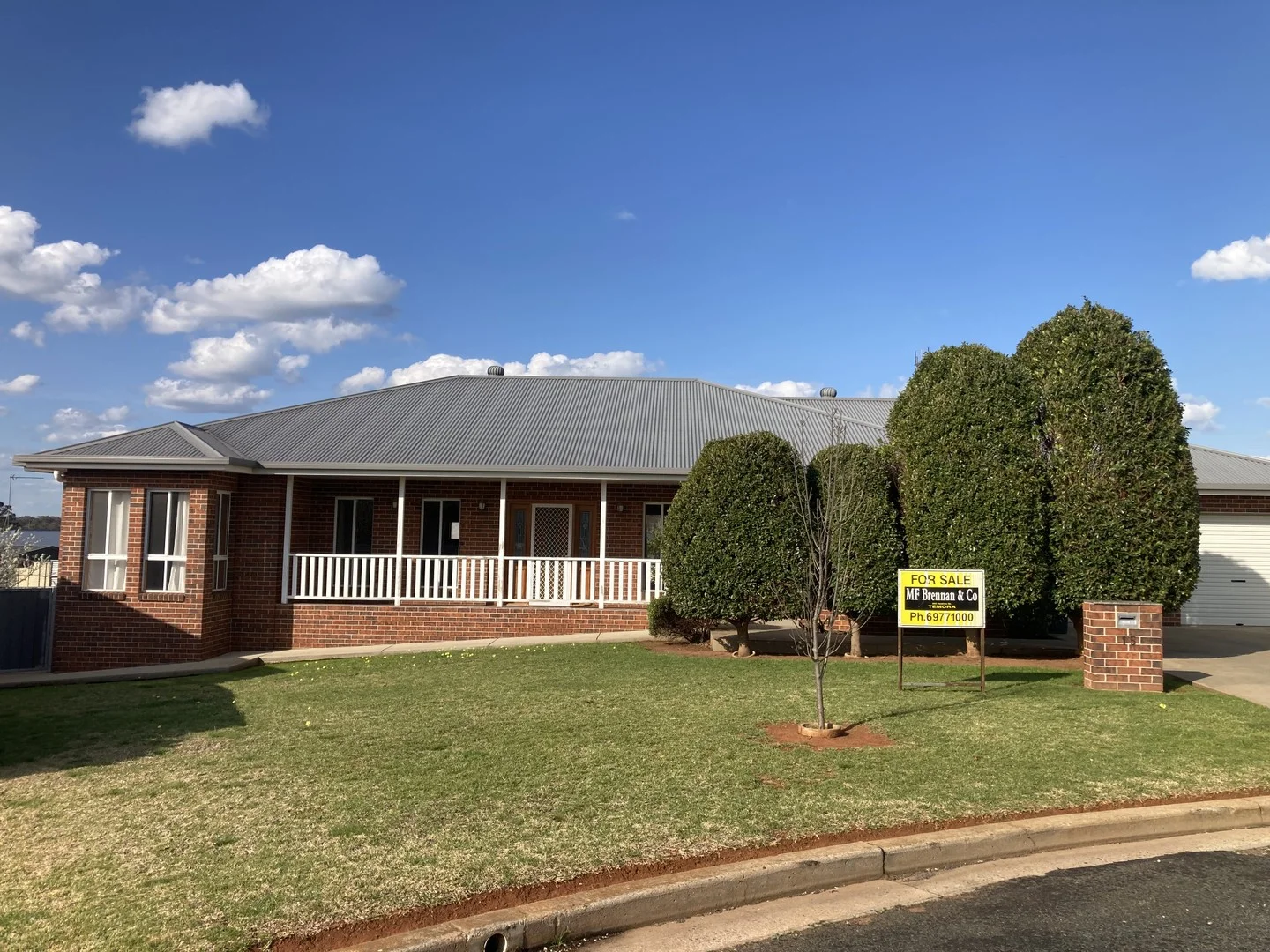
Temora, NSW 2666
Land Size: 990 m²
Property Type: House
Listing Type: Residential
Status: Active
Summary: First Class Executive Residence
Description: 4-bedroom home with Colourbond roof in sought after "William Street Cul-de-Sac". Features include: -4 carpeted bedrooms; master features an ensuite & walk-in wardrobe -Kitchen with granite benchtops- work benches & island & top-quality appliances -Open-plan living -Spacious dining room & large main living area -2nd living area with cosy wood heater -Fully-tiled bathroom with shower recess, deep bath & granite vanity -Large laundry with toilet & shower -Home features polished floorboards throughout -Double garage with remote doors -Comforts being reverse-cycle ducted air conditioning, wood combustion heater & gas hot water system -Tiled front porch & under-house storage -22,500 litre water tank & pergola This home is complete in every way including quality blinds & curtains. The only thing left for you to do is unpack, sit back and enjoy this wonderful home. Call now to make an appointment Asking $695,000 "We have obtained all information in this document from sources we believe to be reliable, however, we cannot guarantee its accuracy. Prospective buyers are advised to carry out their own investigations".
Agent: Terry O'Rafferty - terry@mfbrennan.com.au - 02 6977 1000
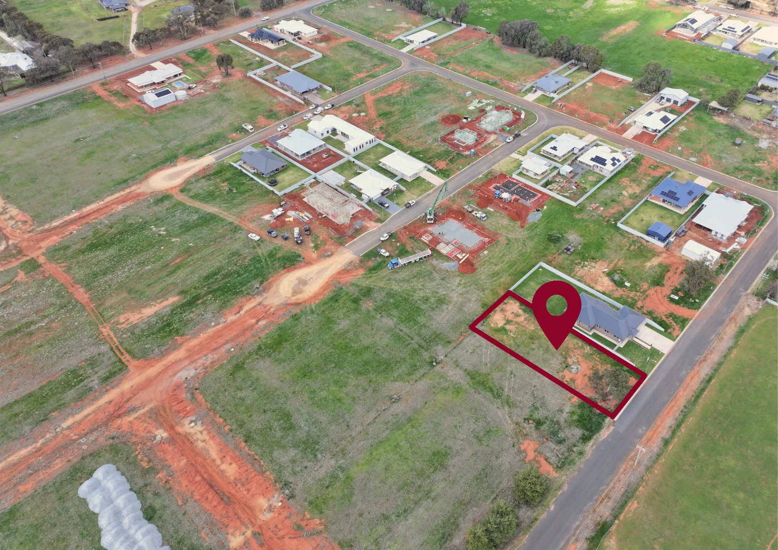
Temora, NSW 2666
Land Size: 1020 m²
Property Type: Vacant Land
Listing Type: Residential
Status: Active
Summary: PREMIER PARCEL - Build Today!
Description: • Premier parcel located in the newly registered Dustin Rose Estate. • Fantastic frontage from French Street, of 20m, and depth of 50m. • Power, water, gas, sewer all connected. • No Builder Restrictions. • Generous block ready for a new owner!
Agent: Jess Stewart - jess@millerandjames.com.au - 02 6977 1333
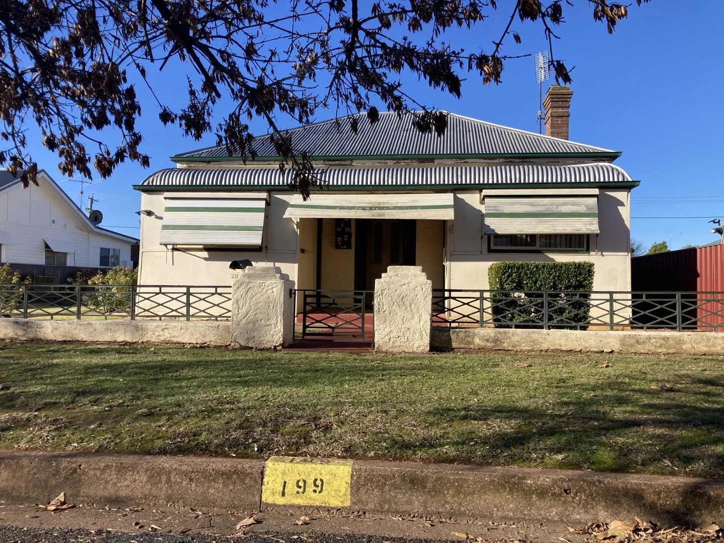
Temora, NSW 2666
Land Size: 1012 m²
Property Type: House
Listing Type: Residential
Status: Active
Summary: Central to Renovate
Description: Very central double brick home located on a generous 1012sqm parcel of land with rear entry. Home comprises 3 bedrooms, newer kitchen/dining with gas stove, loungeroom with air conditioner, bathroom/laundry. Externally the home has 2 carports, double garden shed, covered BBQ area. Home is in need of TLC to make into a more comfortable residence. Property also lends itself to re-development of site with a generous level block, close proximity to shops & rear entry. Asking $339,000. Ready to negotiate. "We have obtained all information in this document from sources we believe to be reliable, however, we cannot guarantee its accuracy. Prospective buyers are advised to carry out their own investigations".
Agent: Terry O'Rafferty - terry@mfbrennan.com.au - 02 6977 1000
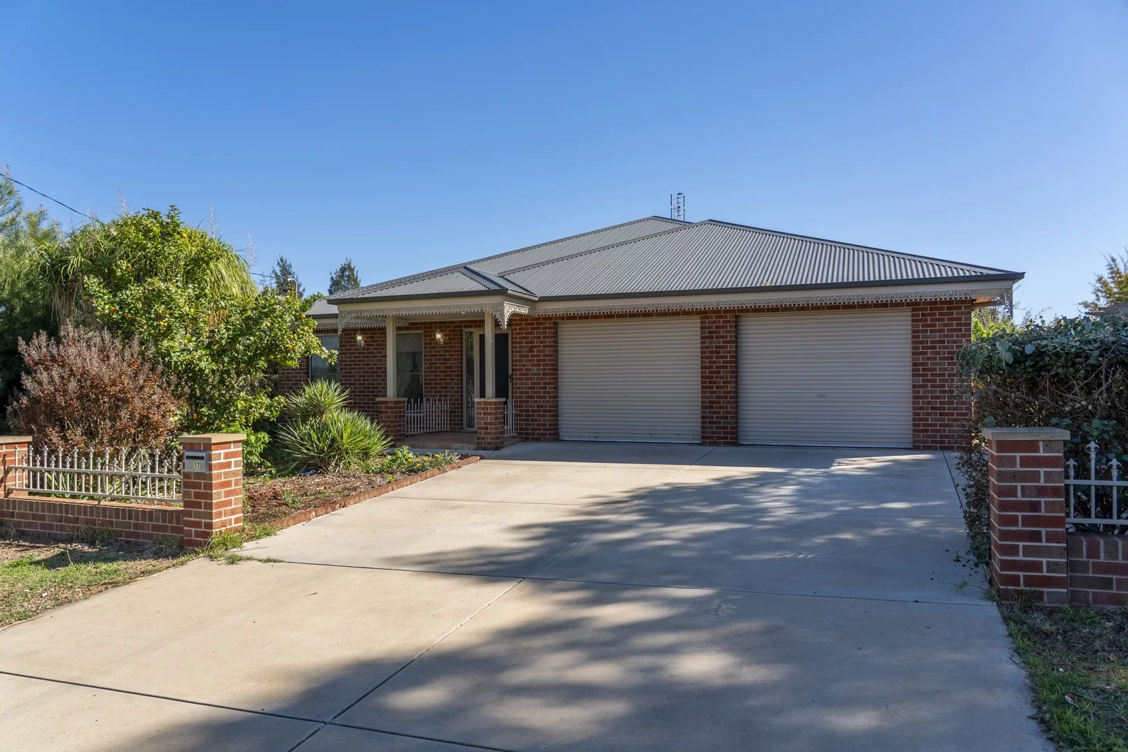
Temora, NSW 2666
Land Size: 906 m²
Property Type: House
Listing Type: Residential
Status: Active
Summary: Quality Build, Modern Style
Description: Set on a generous 903sqm (approx.) block, this 7-year-old brick veneer home with a Colourbond roof showcases quality and craftsmanship. A wide entryway leads to the formal living room, complete with ornate cornices, ceiling rose, carpet flooring, and a natural gas bayonet. The open-plan kitchen and dining area features Caesarstone benches, ample storage, gas stove, electric wall oven, servery window, and a large breakfast bar, flowing through to the spacious living area and patio. The master suite offers a walk-in robe and ensuite with walk-in shower and toilet, while bedrooms two and three include built-in robes, ceiling fans, and carpet. The main bathroom features a large shower, vanity, and separate toilet, while the tiled laundry includes extra storage and third toilet to complete the practical layout. Comfort is assured year-round with ducted reverse cycle heating and cooling plus natural gas bayonets. Outside, enjoy a northeast-facing veranda/patio with lights and fans, oversized double garage, Colourbond shed with concrete floor and water tank, and established gardens with vegie beds and citrus trees.
Agent: Jess Stewart - jess@millerandjames.com.au - 02 6977 1333

Temora, NSW 2666
Land Size: 404685.642 m²
Property Type: Rural
Listing Type: Residential
Status: Active
Summary: Rural lifestyle on the edge of Town
Description: Elders Wagga is pleased to bring to the market 289 Bundawarrah Road, Temora - Approx 100 acres - Currently run as a piggery - Approx 4.3km north of Temora and 57km north east of Wagga Wagga - Approx. 80% arable - 3 Bedroom homestead that has recently been renovated - Extensive improvements including processing yards, ecohuts, machinery shed, workshop, fuel shed, hay shed and basic sheep yards To arrange an inspection or for a copy of the Information Memorandum, please contact Angus Macleod of Elders on 0414 670 286.
Agent: Angus Macleod - angus.macleod@elders.com.au - 02 6923 4666