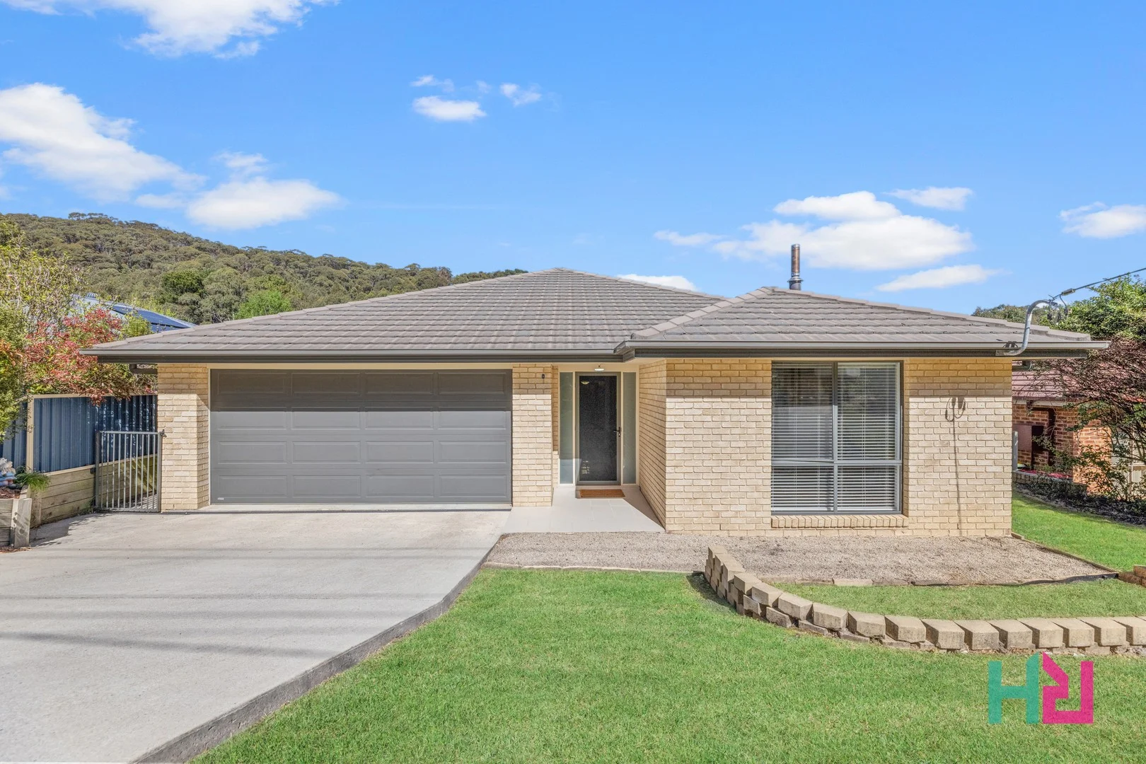
138 Hartley Valley Road
Lithgow, NSW 2790
Neighbourhood & everyday essentials
Explore around Lithgow, from school days to weekends.
Area figures
- schools in Lithgow
- 6
Find schools, playgrounds and children’s classes. Browse by age to plan school days and weekends.
Area figures
- residents (ABS, June 2024)
- 20,740
- children aged 0–14
- 3,278
- schools
- 13
- parks & libraries
- 29
- kids’ activity providers listed
- 4
Most-listed activities: Swimming, Boxing, Taekwondo
Population figures: Australian Bureau of Statistics
Explore local libraries, community spaces, schools and council programs across the wider area.
Parks, playgrounds & public spaces
Blast Furnace Park
Blast Furnace Park Rd, Lithgow, New South Wales, 2790
714 m straight-line distance
Lithgow Public Library
Main St, Lithgow, New South Wales, 2790
1.8 km straight-line distance
Lithgow Library / Learning Centre
Main St, Lithgow, New South Wales, 2790
1.8 km straight-line distance
Marjorie Jackson Reserve
Lithgow, New South Wales, 2790
1.9 km straight-line distance
Things to do near this home
Explore nearby play centres and family attractions from the directory. Check ages, entry prices and opening hours with the venue.
Find more ideas by age, budget and indoor or outdoor setting on Things to do. Dated events are in What’s on. See what’s on
Discover local guides & family ideas
Read local family guides and practical articles as you explore life around this home.

Kids' Activities per Child: Australia's Best- and Thinnest-Covered Council Areas (2026)
Across Australia's big council areas, the AroundSchools directory lists a median of about 10 kids' activity providers for every 10,000 children — but in Melbourne's Wyndham it is 3.9, and in the City…
Read more →
Most Livable Suburbs in New South Wales for Families (2026)
Sydney lists more kids' activities in our directory than any other suburb in NSW. This page ranks NSW suburbs by how much a family moving there could actually do with their kids, then adds what else…
Read more →Everyday essentials & getting around
Open the map to choose a destination and check journey times from this address. Walking routes, step-free access and travel times have not been verified.
Flood & development checks
Property-specific flood risk and announced developments have not been verified. Search this address in the official maps and ask the council for current flood information.
Source: AroundSchools directory. Distances are straight-line distances, not walking routes. Confirm facilities on the linked detail pages. Directory update dates are not supplied for this summary.
Property Details
882 m²
House
RESIDENTIAL
What's Nearby

Haktari Taekwondo Academy
Main St, Lithgow

JM Robson Aquatic Centre
Lithgow

Lithgow Public Library
Main St, Lithgow
Lithgow Library / Learning Centre
Main St, Lithgow

Glanmire Oval
Sandford Ln, Lithgow
Lithgow Valley Reserve
Clarence

Hot Hits Tennis
James St, Lithgow
JM Robson Aquatic Centre
Barton St, Lithgow
State Mine Heritage Park & Railway
State Mine Gully Rd, Marrangaroo
Nearby Schools

St Patrick's Primary School - Lithgow
Mort Street, Lithgow NSW 2790 Australia

Lithgow High School
1 Pau St, Lithgow NSW 2790

Lithgow Public School
163 Mort St, Lithgow NSW 2790

Zig Zag Public School
23 Victoria Ave, Lithgow NSW 2790, Australia

Cooerwull Public School
319 Main St, Lithgow NSW 2790
La Salle Academy
Rabaul Street, Lithgow NSW 2790 Australia
Nearby schools do not imply enrolment eligibility. Confirm catchments, year levels and childcare availability directly with the provider.
Nearby Properties
Recently sold nearby
Homes that have sold close to this address. We don’t show sale prices.
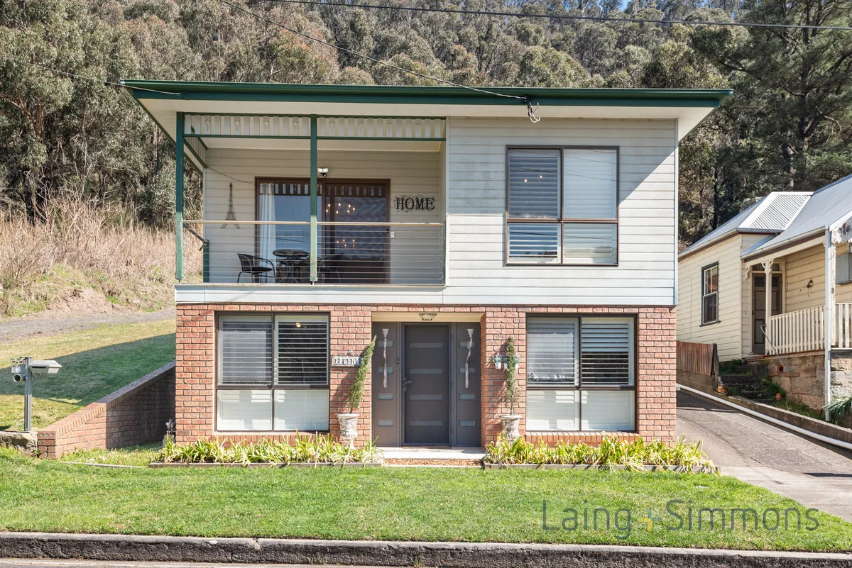
Lithgow, NSW 2790
Land Size: 666 m²
Property Type: House
Listing Type: Residential
Status: Active
Summary: Highset Private Location
Description: Stylish Family Home with Urban Views in a Private Lithgow Setting Nestled in a quiet pocket of Lithgow, this beautifully presented home offers elevated urban views and a lifestyle of comfort and convenience. Light-filled and spacious, the open-plan living and dining area creates a welcoming heart of the home, perfect for entertaining or relaxing with family. Kitchen & Living, Renovated kitchen featuring quality appliances, including a premium 900mm gas cooker. Expansive open plan living and dining area with abundant natural light. All bedrooms include built-in wardrobes. Master suite boasts a walk-in robe and private ensuite. Renovated main bathroom with full-sized bath and separate shower. Ground floor offers a versatile 4th bedroom or home office with its own entrance. Gas central heating and reverse cycle Split Air conditioning add to the creature comforts. Secure garage and workshop for extra storage and functionality.
Agent: Graham Hodson - 2766.29396@leaddrop.rexsoftware.com - 02 6351 3422
Agent: Paris Hall - paris.hall@lsre.com.au - 02 6351 3422
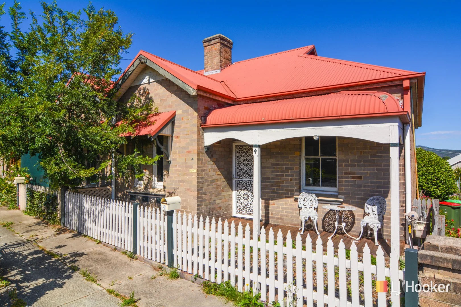
Lithgow, NSW 2790
Land Size: 363 m²
Property Type: Semi-Detached
Listing Type: Residential
Status: Active
Summary: Double Brick Semi in the Centre of Town
Description: There's plenty to like about this full brick semi. The home has retained many original character features including timber lining board ceilings, picture rails, cast iron fireplaces, and an original fuel stove. The floorplan features 3 large bedrooms, a lounge room with gas heater, a modern kitchen with gas stove, and a tidy bathroom. The under house laundry has exposed sandstone footings and an original clawfoot bath. There is rear lane access to the yard, along with a lock up workshop and outhouse. A great option for an investor.
Agent: Jamie Giokaris - jgiokaris@ljhlithgow.com.au - 02 6351 2548
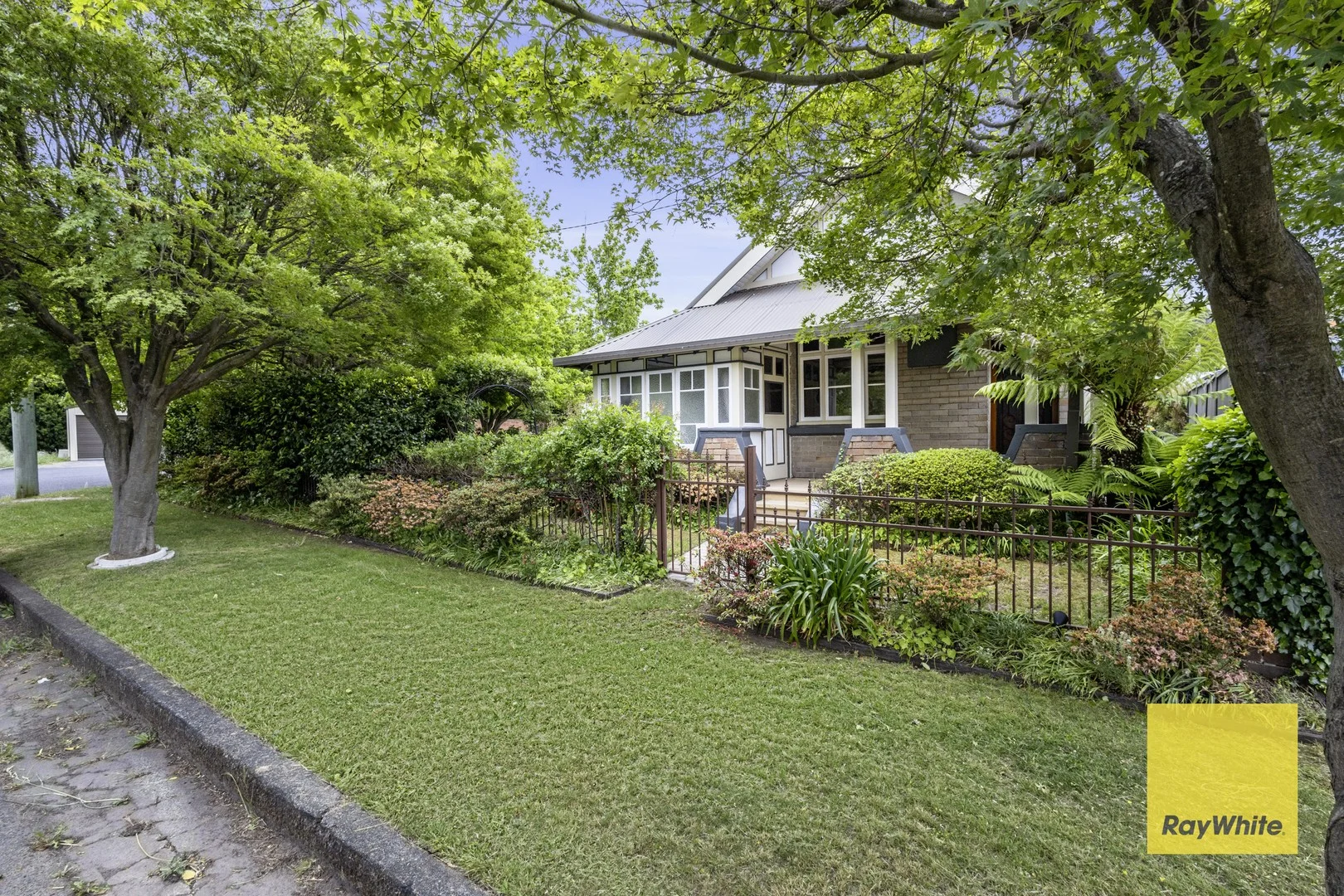
Lithgow, NSW 2790
Land Size: 373.1 m²
Property Type: House
Listing Type: Residential
Status: Active
Summary: RESTORED ELEGANCE AT ITS FINEST
Description: Family home of over 50 years, this Edwardian style double brick abode has been tastefully restored in every aspect, and gracefully nestled within a private garden. Prepare to be greeted by striking original details that hint at the home's rich history, showcasing intricate woodwork, stained glass, and unique character throughout. A well appointed lounge room flows into the adjoining dining area, warmed by gas heating and light filled by large windows with plantation shutters. The kitchen is fully equipped for the culinary enthusiast, featuring an impressive oven, gas cooktop, and stainless steel appliances. Each bedroom boasts its own personality, with feature fireplaces, air conditioning, and the main including a walk-in wardrobe. The generously sized laundry and combined sunroom lead to a completely updated bathroom, designed with modern convenience and everyday living in mind. Feel a world away in the lush surrounds that make this home feel like a tranquil retreat. Primely positioned on a corner block and complete with a welcoming front porch, fully fenced yard, pop up sprinkler system, dusk to dawn garden lighting, and an off street parking space. Located with easy access to town amenities, it's just 1.3km from the Blast Furnace Park and the top end of Main Street, plus 1.7km to the Lithgow Station and Marjorie Jackson Oval. Don't miss out on the opportunity to step into home ownership where timeless charm and contemporary comfort meet.
Agent: Jaharn Torok - jaharn.torok@raywhite.com - 02 6351 2222
Lithgow, NSW 2790
Land Size: 1094 m²
Property Type: House
Listing Type: Residential
Status: Active
Summary: Charming Double Brick Home with Development Potential
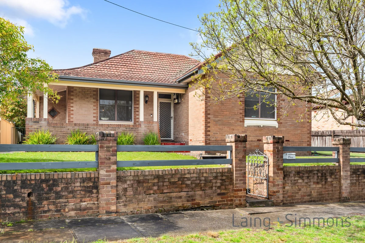
Description: Perfectly positioned just minutes from Lithgow's vibrant Town Centre, this beautifully renovated double brick residence offers both character and opportunity. Set on a generous 1,094m² block, the property may lend itself to future development (subject to Council approval), making it an ideal investment or lifestyle choice. Property Features: Flexible floor plan with three spacious bedrooms, including a master with ensuite Separate lounge and dining area adjacent to a well-appointed kitchen Polished floorboards and decorative plasterwork that reflect the home's rich history Expansive allotment with rear lane access Abundant storage via a double Colourbond garage and a single double brick garage Ample space for a trailer, boat, caravanand still room to spare! Tenancy & Investment Appeal: Currently occupied by A-Class tenants, immediate rental income for savvy investors. Location Highlights: Sought-after Padley Street address Short stroll to shops, cafes, and essential services Inspection Details: Viewings by open homes as scheduled. Don't miss this rare opportunity to secure a versatile property in one of Lithgow's most desirable pockets. Disclaimer: We have obtained all information in this document from sources we believe to be reliable; however, we cannot guarantee its accuracy. Prospective purchasers are advised to carry out their own investigations.
Agent: Paris Hall - paris.hall@lsre.com.au - 02 6351 3422
Agent: Graham Hodson - 2766.29396@leaddrop.rexsoftware.com - 02 6351 3422
Lithgow, NSW 2790
Land Size: 312 m²
Property Type: House
Listing Type: Residential
Status: Active
Summary: Classic Home with Character in Hermitage Flat
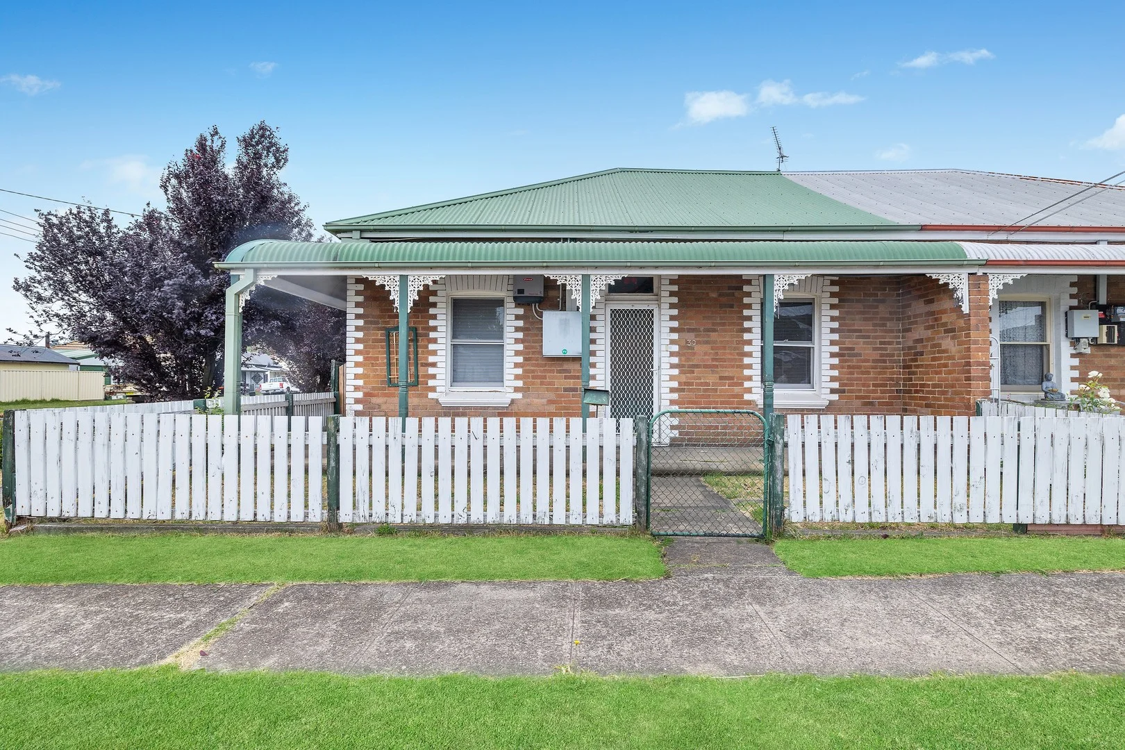
Description: This charming 3 bedroom, 1 bathroom home in Hermitage Flat is a golden opportunity for buyers eager to add their personal touch and create their ideal living space. Nestled on a 312sqm block, the property brims with potential and enjoys a convenient location just minutes from Lithgow's main street, local schools, public transport, and sporting grounds, offering a perfect blend of accessibility and lifestyle. - Three large bedrooms, each offering generous space and natural light - Easy flow floorplan throughout the entire property, connecting living, dining and kitchen areas seamlessly - Double brick construction providing solid structure and durability - Small, easy-to-maintain yard ideal for low-upkeep gardening or outdoor relaxation - Cottage-style Street appeal with charming facade and welcoming entrance - Solar panels to reduce energy costs and increase sustainability - New wiring throughout ensuring modern electrical safety and reliability - Original fireplace offering a classic feature and cozy focal point for cooler months - Close to Lithgow main street and shopping precinct, providing convenience for daily needs - Walking distance to schools and sporting grounds, perfect for families and active lifestyles
Agent: Stacey Field - staceyfield@mcgrath.com.au - 02 6352 5125
Agent: Paige Ward - paigeward@mcgrath.com.au
Lithgow, NSW 2790
Land Size: 1018 m²
Property Type: House
Listing Type: Residential
Status: Active
Summary: The Right Neighbourhood
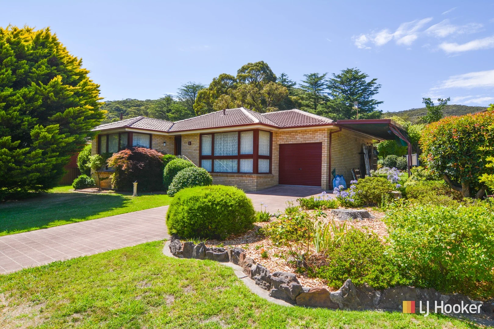
Description: A fantastic family home, situated in one of Lithgow's best central locations. With low maintenance brick veneer construction and beautifully established gardens and private grounds, this well presented property will suit first home buyers, investors and retirees. The internal layout consists of 3 bedrooms (all with built-in wardrobes), loungeroom, modern eat-in kitchen, modern bathroom, large rear family room and two toilets. The home is efficiently heated by a natural gas central heating system, there is a covered rear pergola and front access to an attached single garage and single carport. Make sure this one is on your open home list.
Agent: Jamie Giokaris - jgiokaris@ljhlithgow.com.au - 02 6351 2548
Lithgow, NSW 2790
Land Size: 110 m²
Property Type: Townhouse
Listing Type: Residential
Status: Active
Summary: Low Maintenance Living
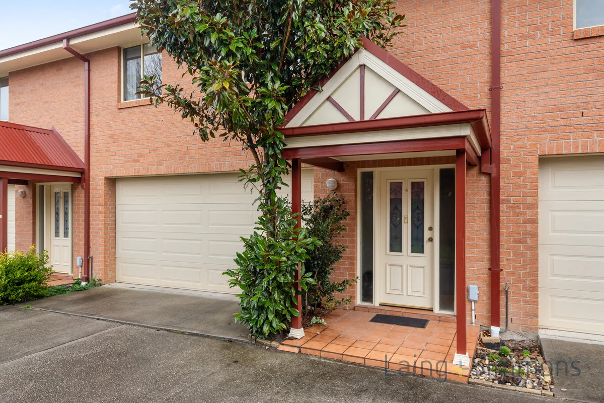
Description: Discover this low-maintenance haven ideal for busy professionals, small families or investors. This sleek brick townhouse boasts contemporary finishes, thoughtful design and an effortless indoor-outdoor flow. Nestled just 800 metres from Main Street shops and the railway station, you'll love the convenience and the views from your private balcony. Property Highlights 3 bedrooms over two levels 2 bedrooms with built-in wardrobes Spacious timber-finish kitchen with ample storage and bench space Open-plan living and dining area with polished floorboards Brand-new split-system air conditioning throughout Modern bathroom with shower over bath Separate powder room on ground floor Double lock-up garage with internal access Fully fenced, paved courtyard low-maintenance gardening Disclaimer: We have obtained all information in this document from sources we believe to be reliable; however, we cannot guarantee its accuracy. Prospective purchasers are advised to carry out their own investigations.
Agent: Paris Hall - paris.hall@lsre.com.au - 02 6351 3422
Agent: Graham Hodson - 2766.29396@leaddrop.rexsoftware.com - 02 6351 3422
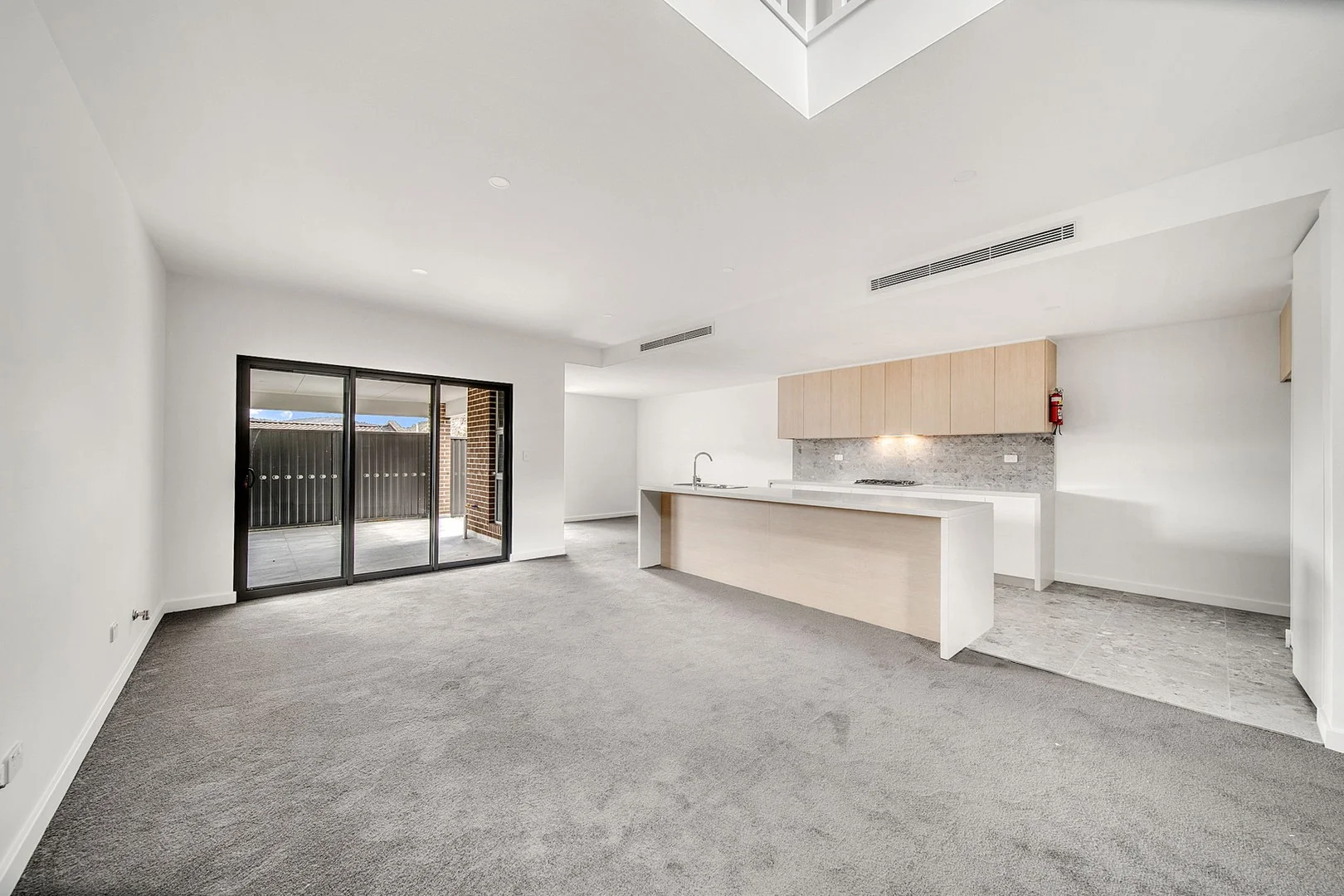
Lithgow, NSW 2790
Property Type: Townhouse
Listing Type: Residential
Status: Active
Summary: LUXURY TOWNHOUSE
Description: Showcasing a combination of natural beauty and contemporary design, this exceptional townhouse is located in Haneli Estate and has been thoughtfully crafted to maximise natural light and feature sleek modern lines. A true testament to luxurious living in a tranquil setting with breath taking views across the region. Experience the best of both worlds, with a home that keeps you connected to modern conveniences while providing a serene escape from the outside world. Property Highlights include: • 3 Bedrooms with built-in wardrobes • Study nook • 2 Bathrooms that feature wall hung basins, semi frameless showers and the main bathroom boasts a free standing bathtub. • Double stone kitchen bench tops, terrazzo tiles, with LED lighting on the underside of kitchen cupboards, Westinghouse oven, cooktop and dishwasher. • Full security video intercom systems • Samsung fully ducted heating and cooling with gas provisions for a gas heater • Downlights throughout and gas instantaneous hot water heating • Courtyard and double garage for secure parking Perched high on the hill and close to a number of amenities, including 1.1km to Lithgow Public School, 1.5km to Lithgow's CBD and 1.6km to Lithgow Train Station. Currently leased for $565 per week.
Agent: Jaharn Torok - jaharn.torok@raywhite.com - 02 6351 2222
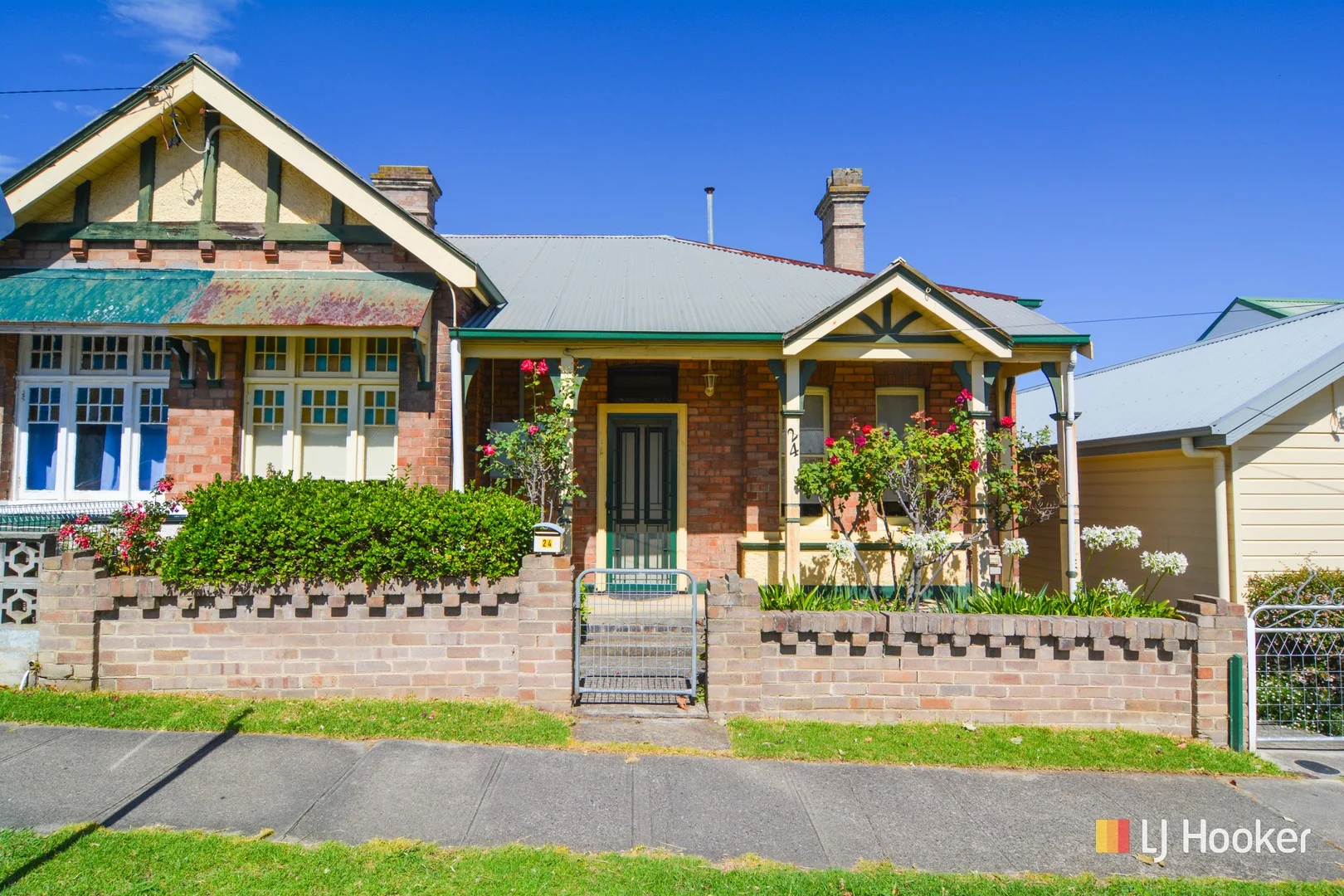
Lithgow, NSW 2790
Land Size: 252.9 m²
Property Type: Semi-Detached
Listing Type: Residential
Status: Active
Summary: Prime Position Above CBD
Description: A comfortable and well maintained full brick semi, perfect for an investor or retiree. A conventional 3 bedroom plan with living room, modern eat-in kitchen, modern recently renovated bathroom, separate laundry and toilet. The home is efficiently heated by natural gas ducted central heating and there is a high standard of internal fit-out. The easy care rear yard is fully enclosed and there is a good sized front verandah that enjoys the morning sunshine. A convenient central location close to 2 schools and 400 metres to Main Street shops.
Agent: Jamie Giokaris - jgiokaris@ljhlithgow.com.au - 02 6351 2548
Agent: Blake Edgell - bedgell@ljhlithgow.com.au - 02 6351 2548