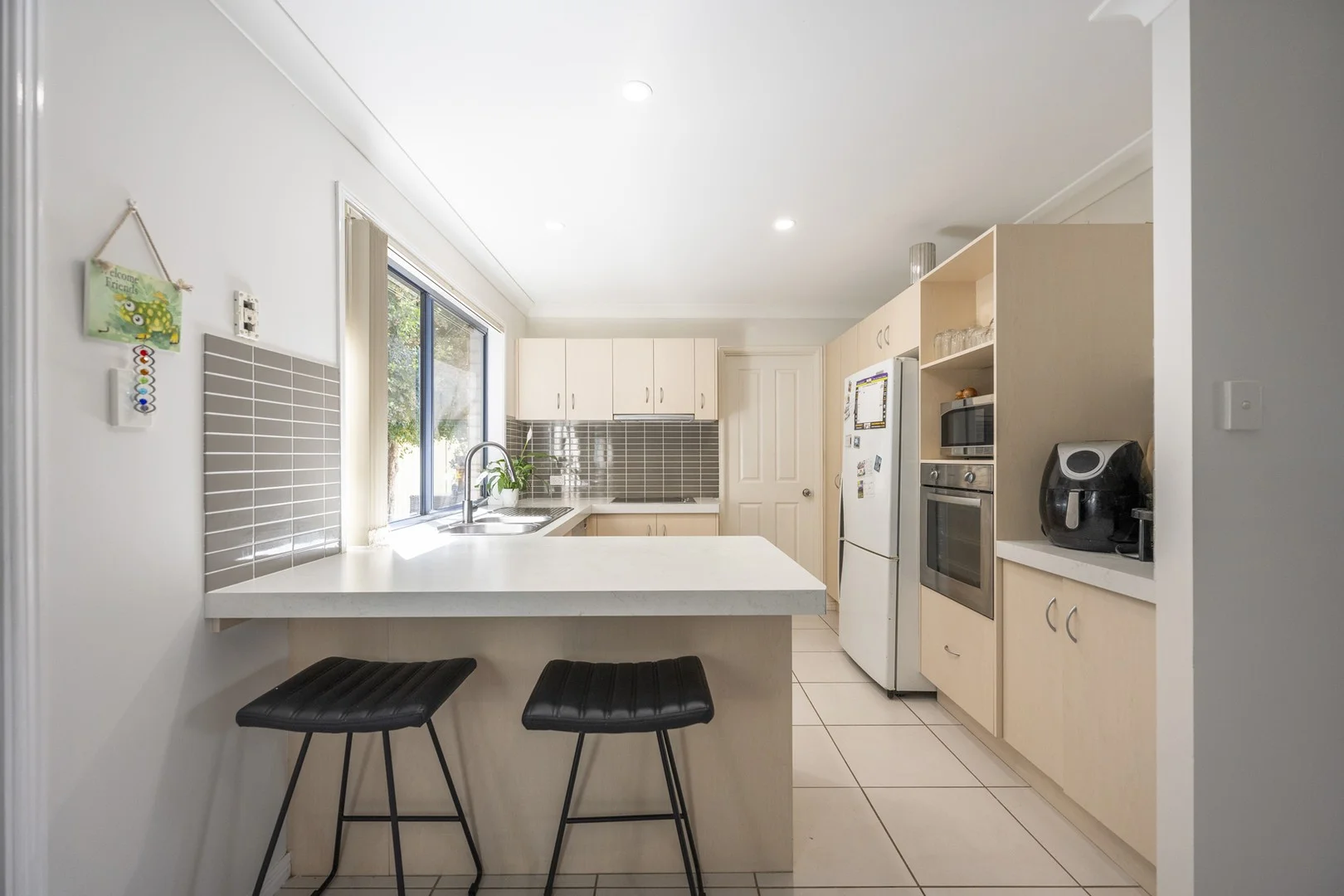
30A Milton Street
Grafton, NSW 2460
Neighbourhood & everyday essentials
Explore around Grafton, from school days to weekends.
Area figures
- schools in Grafton
- 6
Find schools, playgrounds and children’s classes. Browse by age to plan school days and weekends.
Area figures
- residents (ABS, June 2024)
- 56,037
- children aged 0–14
- 9,050
- schools
- 36
- parks & libraries
- 65
- kids’ activity providers listed
- 10
Most-listed activities: Tennis, Yacht, AFL
Population figures: Australian Bureau of Statistics
Explore local libraries, community spaces, schools and council programs across the wider area.
Parks, playgrounds & public spaces
Apollo Eleven Park
Powell St, Grafton, New South Wales, 2460
660 m straight-line distance
Westward Park
Mary St, Grafton, New South Wales, 2460
1.2 km straight-line distance
Grafton Library
Pound St, Grafton, New South Wales, 2460
1.9 km straight-line distance
Fisher Park
Prince St, Grafton, New South Wales, 2460
1.9 km straight-line distance
Things to do near this home
Explore nearby play centres and family attractions from the directory. Check ages, entry prices and opening hours with the venue.
Find more ideas by age, budget and indoor or outdoor setting on Things to do. Dated events are in What’s on. See what’s on
Discover local guides & family ideas
Read local family guides and practical articles as you explore life around this home.
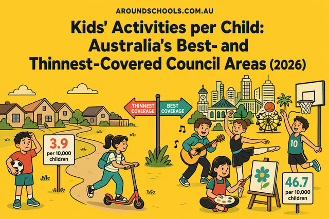
Kids' Activities per Child: Australia's Best- and Thinnest-Covered Council Areas (2026)
Across Australia's big council areas, the AroundSchools directory lists a median of about 10 kids' activity providers for every 10,000 children — but in Melbourne's Wyndham it is 3.9, and in the City…
Read more →
Most Livable Suburbs in New South Wales for Families (2026)
Sydney lists more kids' activities in our directory than any other suburb in NSW. This page ranks NSW suburbs by how much a family moving there could actually do with their kids, then adds what else…
Read more →Everyday essentials & getting around
Open the map to choose a destination and check journey times from this address. Walking routes, step-free access and travel times have not been verified.
Flood & development checks
Property-specific flood risk and announced developments have not been verified. Search this address in the official maps and ask the council for current flood information.
Source: AroundSchools directory. Distances are straight-line distances, not walking routes. Confirm facilities on the linked detail pages. Directory update dates are not supplied for this summary.
Property Details
534 m²
House
RESIDENTIAL
What's Nearby

Grafton Jacaranda Season
Grafton

Grafton Aquatic Centre
Turf St, Grafton

Grafton Library
Pound St, Grafton
Grafton Showgrounds
Prince St, Grafton

Grafton City Tennis Club
Prince St, Grafton
Ellem Oval
Prince St, Grafton

Grafton Auskick Centre
Prince Street, Grafton

Clarence River Yacht Club
Grafton

C4 Brazilian Jiu Jitsu Grafton
Pound St, Grafton
Nearby Schools

Westlawn Public School
239 North St, Grafton NSW 2460, Australia
St Mary's Primary School - Grafton
171 Turf Street, Grafton NSW 2460 Australia

Grafton High School
Grafton High School, GRAFTON NSW 2460

Grafton Public School
Queen St, Grafton NSW 2460

Clarence Valley Anglican School
39 Victoria Street, Grafton NSW 2460 Australia

South Grafton Public School
Vere St, South Grafton NSW 2460
Nearby schools do not imply enrolment eligibility. Confirm catchments, year levels and childcare availability directly with the provider.
Nearby Properties
Recently sold nearby
Homes that have sold close to this address. We don’t show sale prices.
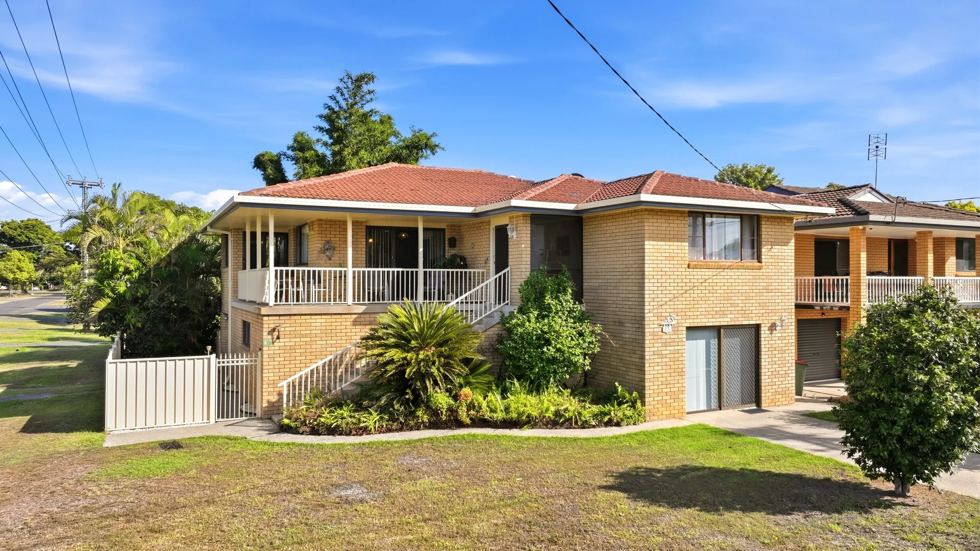
Grafton, NSW 2460
Land Size: 552 m²
Property Type: House
Listing Type: Residential
Status: Active
Summary: SPACE & FLEXIBILITY ON A CORNER BLOCK IN WESTLAWN
Description: Auction Details: Wednesday 1st of April 6:00pm Grafton District Services Club *Building & Pest Inspection Reports Available Upon Request* Situated on a 552m² (approx.) corner block in the desirable Westlawn area, 83 Cranworth Street, Grafton stands as a solid and well-maintained double-storey brick and tile residence. The property offers a great blend of space, practicality, and potential, perfectly suited to families or anyone seeking a generous home in a peaceful neighbourhood. The current owners are committed to their relocation, and the property is set to be sold at auction on the 1st of April. A spacious front verandah welcomes you and provides a lovely spot to relax and take in the streetscape. Inside, the formal living room transitions effortlessly into the dining area, which then flows to the kitchen, creating a natural and connected living space. The home features three bedrooms, two of which include built-in wardrobes, and a large main bathroom with a separate toilet. The layout is designed for easy living, with each space thoughtfully arranged to make the most of the home's proportions and light. The downstairs level is a rare and valuable inclusion, offering a large tiled rumpus room ideal for entertaining or as a retreat for kids and guests. This level also includes a second bathroom, a functional laundry, multiple storage rooms, and an impressive garage/workshop area with ample space for tools, projects, or additional vehicles. Please refer to the floorplan provided for an understanding of the layout. Outdoors, the fully fenced backyard ensures privacy and plenty of room for pets or play, complemented by a handy garden shed for storage. With the addition of a 15-panel solar system, this home combines substance and sustainability in one appealing package. Notable features include: - 552m2 (approx.) corner block - 3 bedrooms - 2 bathrooms - Ample garage/workshop space - Dual Street frontage - Brick & tile construction - 15 panel solar system - Rental appraisal $570 - $580 per week 83 Cranworth Street is a property that's ready to move into and enjoy, with scope to make it your own in a well-loved part of Grafton. Contact Craig Franklin from Ray White TKG on 0422 260 192 to declare your interest and to book your inspection. Disclaimer: All information disclosed herein has been provided from sources we believe to be reliable however we cannot guarantee its accuracy. It is respectfully advised that interested parties carry out their own due diligence.
Agent: Craig Franklin - craig.franklin@raywhite.com
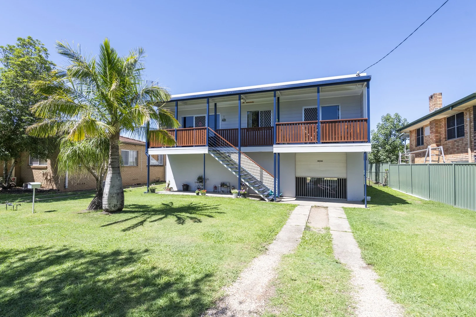
Grafton, NSW 2460
Land Size: 546 m²
Property Type: House
Listing Type: Residential
Status: Active
Summary: PERFECT FOR FIRST HOME BUYERS OR INVESTORS
Description: This 4 bedroom home has a little bit more to offer - the current owner has improved the interior and yard and it now offers a modern kitchen and living areas upstairs, great outdoor areas courtesy of the back deck and covered entertaining under it - plus all this comes with a downstairs space boasting a huge double garage and workshop, two separate rumpus rooms and an extra shower and toilet. Located over the road from Westlawn Primary and St Mary's Primary School it is also handy to the local corner store just metres away and the CRJC race course, PCYC and more. There is dual street frontage with Hoof at the front and Fanning Avenue at the back - this is handy if you intend to develop the yard further with a swimming pool or sheds. From the front you experience the verandah which is big enough for an outdoor setting. Inside the main lounge-living and kitchen are open plan and modern. The bedrooms and bathrooms on this floor are all in good order. Out the back the big back deck is going to get alot of use but when the sun is shining don't forget the ground floor covered space as well. The garage and workshop are the most flexible areas along with those 2 extra rooms and the shower and toilet downstairs they could be a teenagers retreat perhaps. Owner relocated due to work and must now sell - for the investors we have excellent tenants keen to move in at $550 per week. Discuss the price guide with agents today. Building reports available.
Agent: Angus McKimm - angus@mckimms.com.au - 0266421811
Grafton, NSW 2460
Land Size: 628 m²
Property Type: House
Listing Type: Residential
Status: Active
Summary: Renovate, Invest or Nest Rare Alice Street Opportunity
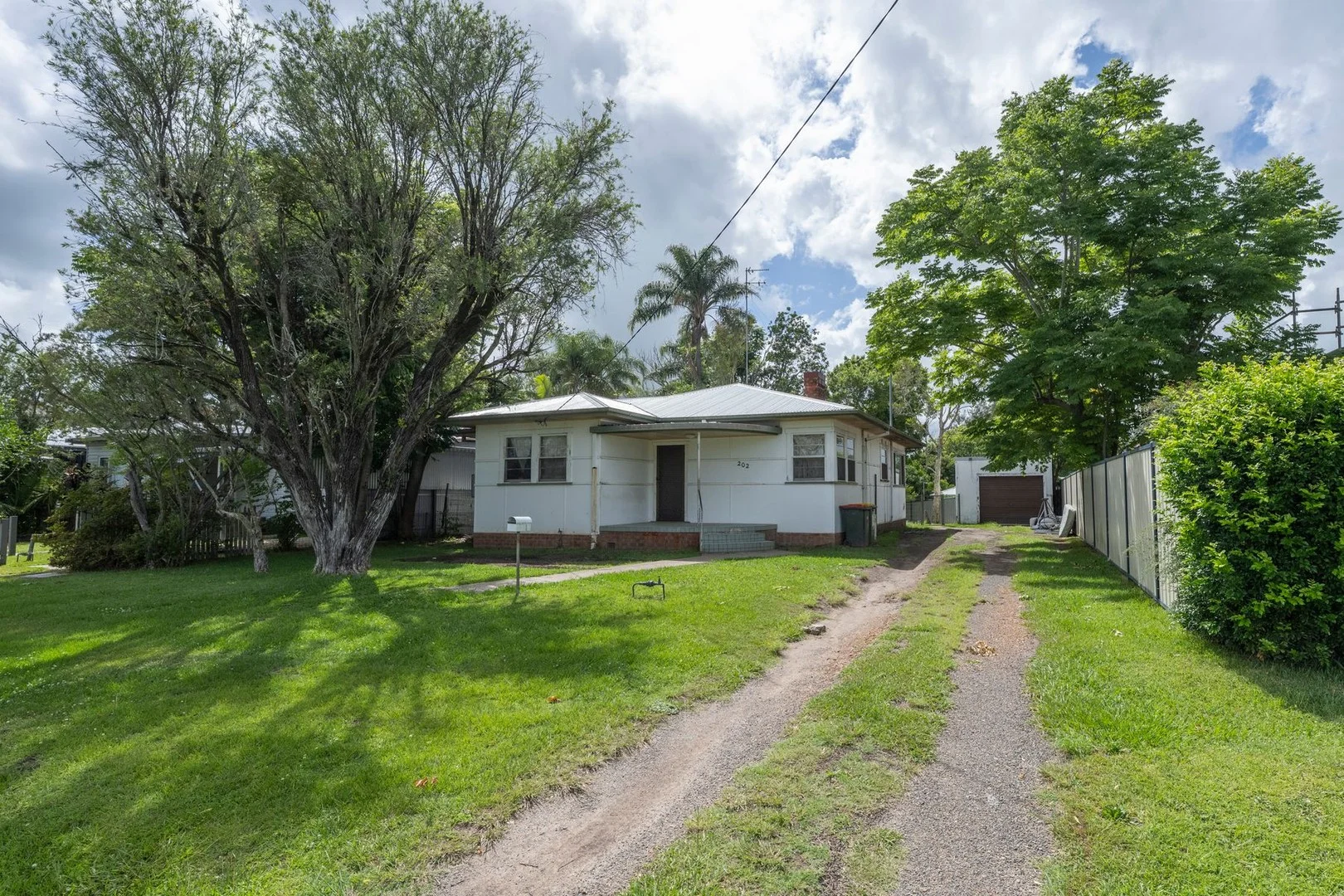
Description: Set in one of Grafton's most tightly held and highly sought-after streets, this classic 1950s home on Alice Street presents a rare opportunity to secure a flood-free property just five minutes from the CBD and around the corner to the Grafton Base Hospital. Solid, well-proportioned and packed with potential, this home is ideal for renovators, investors or owner-occupiers looking to add value in a great location. Key Features: Positioned only 5 minutes from Grafton CBD Solid 1950s three-bedroom home full of renovation potential 626m² block with spacious backyard for kids and pets Formal front living room with kitchen and dining to the rear Excellent scope to modernise and open up the layout Single-bay lock-up garage with convenient rear yard access Easy-access home with minimal steps throughout Previously rented for $500 per week Ideal opportunity for investors, renovators or future owner-occupiers Building and Pest reports are available on request For more information or to arrange an inspection. call Andrew Brien on 0457 166 967. DISCLAIMER All of the information contained in this document is from sources the Agent and Vendor believe to be reliable; however, we cannot guarantee its accuracy and prospective purchasers should rely on their own enquiries
Agent: Andrew Brien - andrewb@doughertyproperty.com.au - 0266422722
Grafton, NSW 2460
Land Size: 582 m²
Property Type: House
Listing Type: Residential
Status: Active
Summary: CHARMING HOME IN PRIME GRAFTON LOCATION - AUCTION 1ST APRIL
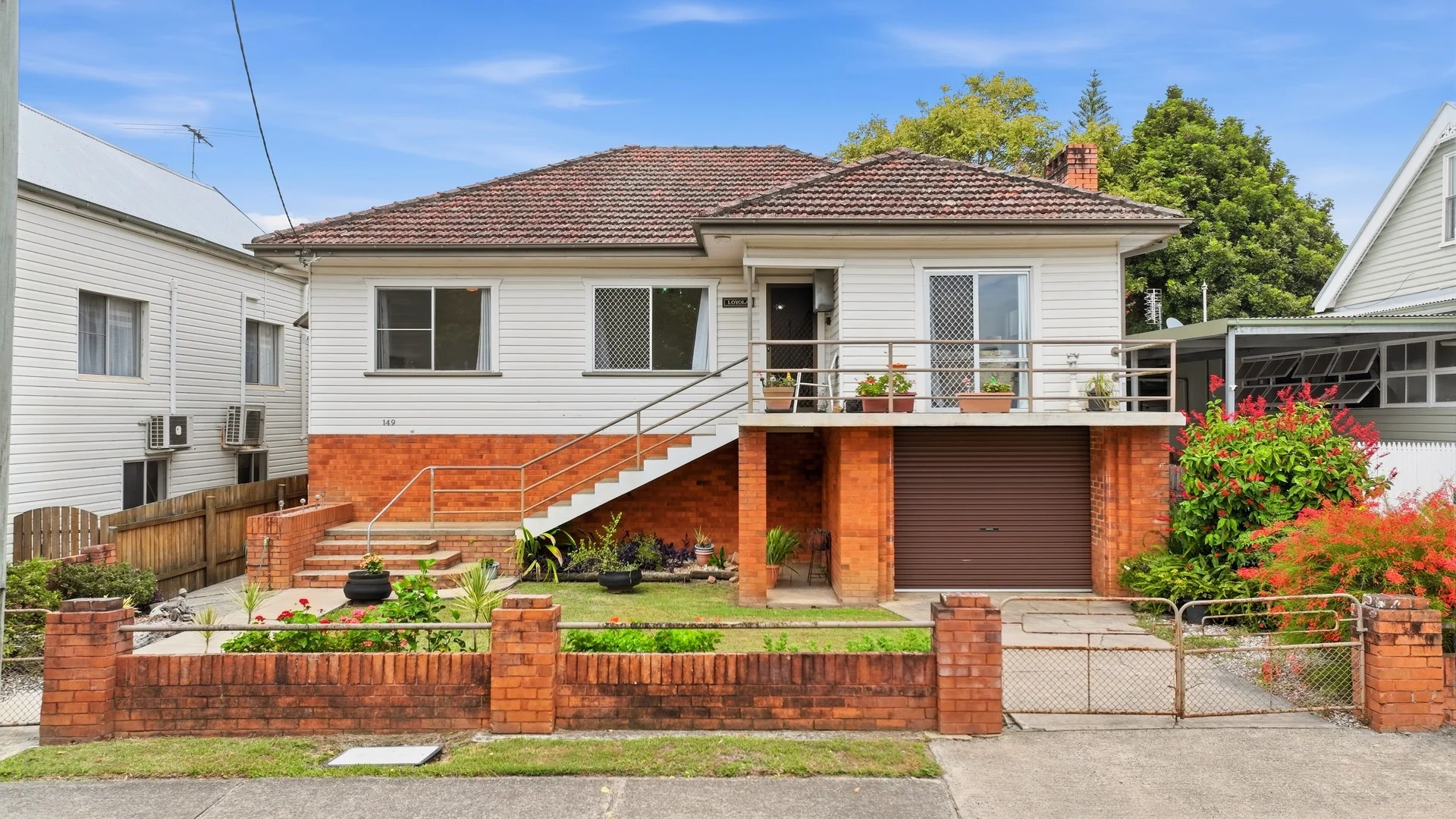
Description: Auction Details: Wednesday 1st of April 6:00pm Grafton District Services Club *Building & Pest Inspection Reports Available Upon Request* Welcome to 149 Dobie Street, Grafton - a property that perfectly balances comfort, functionality, and convenience. Positioned on a 582m² (approx.) block and just a short walk from Grafton's CBD, this home presents an outstanding opportunity for families, first-home buyers, or investors wanting to secure a well-located property with great potential. With auction day set for the 1st of April, now is the time to take advantage of this sought-after address. Inside, the home offers a practical and welcoming layout. The formal living room flows effortlessly into the dining area, which is open plan with the kitchen, creating a central hub that's ideal for everyday living and entertaining. A split-system air conditioner in the dining room ensures you'll stay comfortable year-round, while the adjoining sunroom at the back provides the perfect spot to unwind with a morning coffee or enjoy the afternoon sun. Accommodation includes four well-sized bedrooms and one bathroom, offering plenty of space for the whole family. Beneath the home, you'll find a secure garage, additional storage or workshop space, and a functional laundry, adding extra value and flexibility to the property. Please refer to the floor-plan provided for an understanding of the layout. Outside, the fully fenced and spacious backyard provides a safe, private area for children and pets to play, as well as ample room for gardening or outdoor entertaining. With its solid structure, versatile layout, and unbeatable location, 149 Dobie Street is a home that delivers both comfort and potential in equal measure. Contact Dave Dart on 0427 440 808 to declare your interest and book your inspection. Disclaimer: All information disclosed herein has been provided from sources we believe to be reliable; however, we cannot guarantee its accuracy. It is respectfully advised that interested parties carry out their own due diligence.
Agent: Dave Dart - dave.dart@raywhite.com
Grafton, NSW 2460
Land Size: 754 m²
Property Type: Townhouse
Listing Type: Residential
Status: Active
Summary: Quality Townhouse in Central Grafton Location
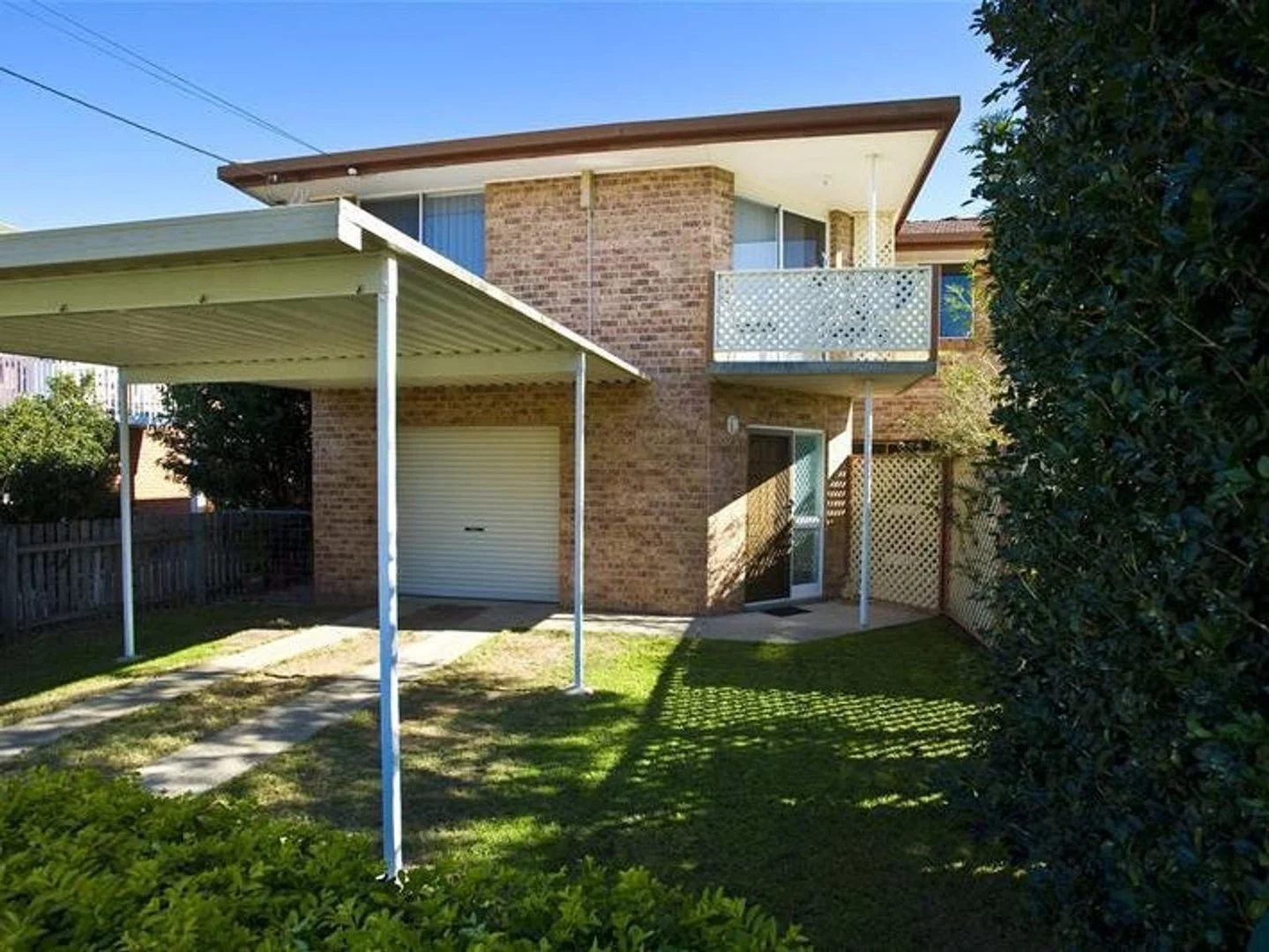
Description: Enjoy the convenience and comfort of this centrally located two-story brick townhouse, just a short walk to sporting fields and Grafton's CBD. Downstairs features a versatile third bedroom, second living area, separate bathroom and laundry, internal access from the single garage, plus a screened outdoor entertaining area overlooking the fully fenced backyard. Upstairs, an air-conditioned, open-plan living space flows to the kitchen and bathroom, with two generous bedrooms featuring built-in wardrobes. An excellent investment opportunity, currently returning $470 per week. Rates; $3,120 PA Insurance: 2,130 PA #Building and Pest reports available on request #photos were taken before the tenant moved in DISCLAIMER: All information contained in this document has been provided by sources the Agent and Vendor believe to be reliable; however, we cannot guarantee its accuracy, and prospective purchasers should rely on their own enquiries.
Agent: Andrew Brien - andrewb@doughertyproperty.com.au - 0266422722
Agent: Mark Paterson - markp@doughertyproperty.com.au
Grafton, NSW 2460
Land Size: 538 m²
Property Type: House
Listing Type: Residential
Status: Active
Summary: SOLID GRAFTON OPPORTUNITY - MUST BE SOLD
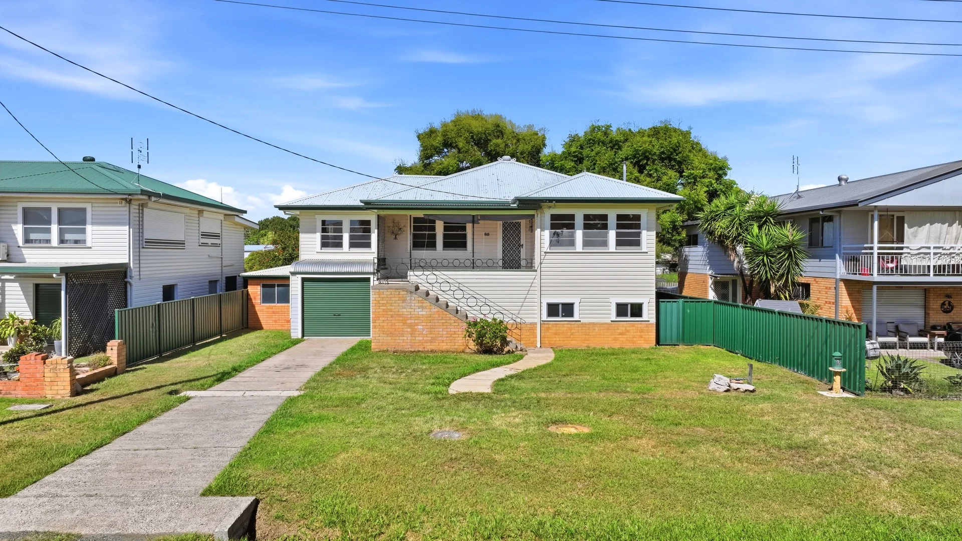
Description: Auction Details: Wednesday 1st of April 6:00pm Grafton District Services Club *Building & Pest Inspection Reports Available Upon Request* Tucked away in a quiet pocket of Grafton, 85 Powell Street offers an inviting lifestyle and solid value for those seeking a peaceful setting and a home with great potential. Sitting on a 538m² (approx.) block that backs onto a tranquil paddock, this property enjoys a calming backdrop rarely found so close to town. Whether you're looking for your first home, a family base, or an investment opportunity, this residence presents an ideal chance to secure real estate in a sought-after location. Upstairs, the home features three bedrooms, including a master fitted with built-in wardrobes. The main level also includes a formal living area, open plan kitchen and dining space, and a bright sunroom that invites natural light. thoughtful floor plan ensures easy movement between living areas, making it a practical and appealing layout for day-to-day life. Downstairs, you'll find ample storage options, a second bathroom, laundry, and garage space, giving you plenty of flexibility for hobbies, work areas, or future updates. The generous under-house area also offers scope for those wanting to add value over time. Please refer to the floorplan provided for an understanding of the layout. Notable features include: - 538m2 (approx.) block - 3 bedrooms - 2 bathroom - Ample storage and garage space - Rental appraisal $550 per week Set to be sold at auction on the 1st of April, this property represents an affordable opportunity in a peaceful part of Grafton. 85 Powell Street will be sold - don't miss the chance to make it yours. Contact John Cameron from Ray White TKG on 0422 260 192 to declare your interest and to book your inspection. Disclaimer: All information disclosed herein has been provided from sources we believe to be reliable however we cannot guarantee its accuracy. It is respectfully advised that interested parties carry out their own due diligence.
Agent: John Cameron - john.cameron@raywhite.com
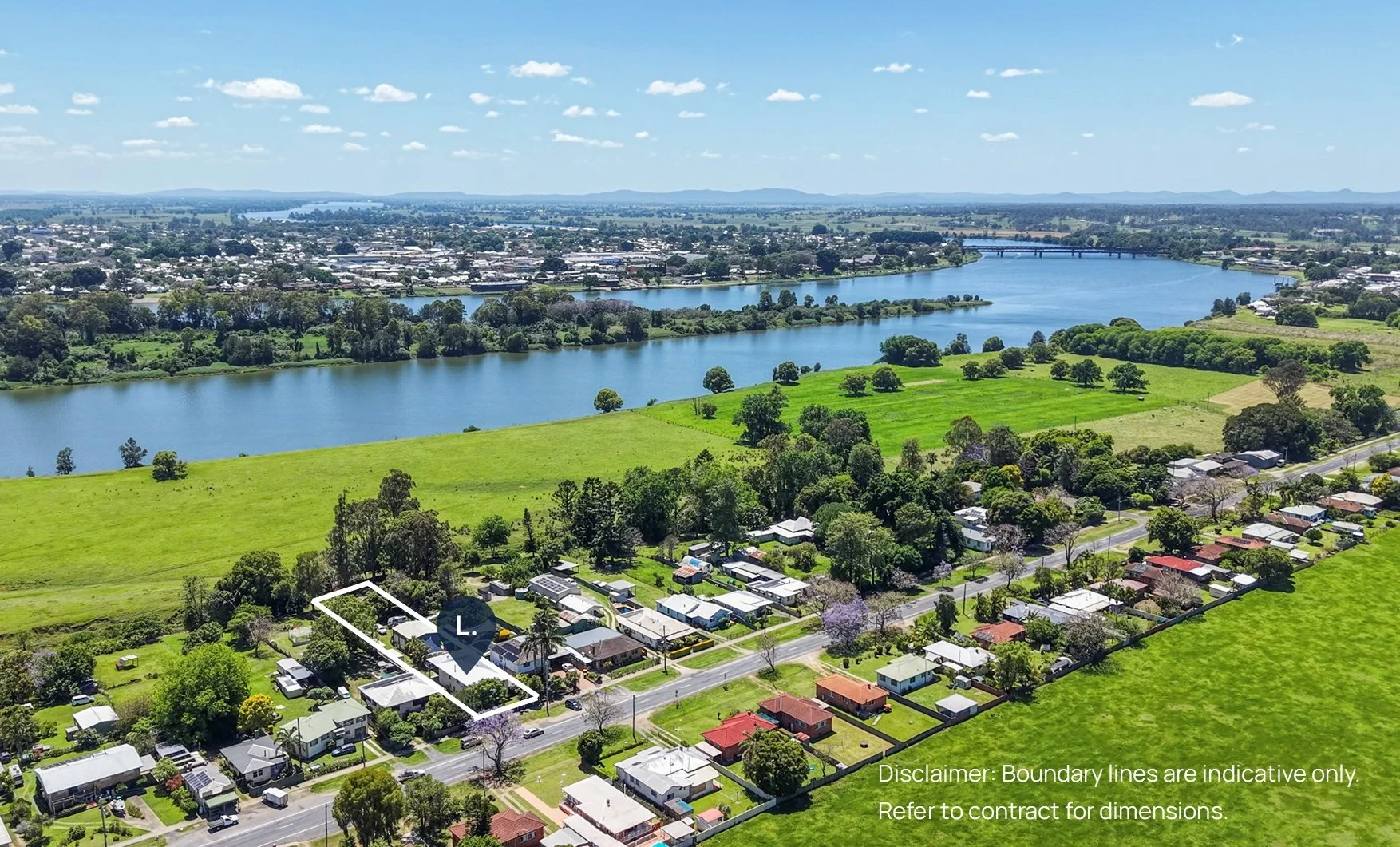
South Grafton, NSW 2460
Land Size: 2005 m²
Property Type: House
Listing Type: Residential
Status: Active
Summary: Your Christmas Gift to Yourself
Description: Introducing 297 Ryan Street, South Grafton-a spacious family home set on an impressive 2,005m² block. Offering five bedrooms and two bathrooms, huge shed and sparkling pool, this home delivers the flexibility and room families need. The upstairs living flows onto a generous back deck, perfectly positioned to overlook the brilliant pool-ideal for summer entertaining. Downstairs you'll find ample storage, plus even more car accommodation spread throughout the property. For those needing serious shedding, the three-bay Colourbond shed with its high roof provides space for boats, caravans, tools or hobbies. All of this sits just a couple of kilometres from the Grafton CBD, giving you convenience without compromising privacy or space. This is an opportunity not to be missed. To register your interest or arrange an inspection, please contact Terry Deefholts on 0413299176 or Kat Boychuk 0488178674. DISCLAIMER: The information contained in the advertising of this property is based on information provided to the agents, and the vendor and agents expressly disclaim any liability arising therefrom. The accuracy of the information cannot be guaranteed, and prospective purchasers should make their own enquiries and form their own judgement as to these matters.
Agent: Terry Deefholts - terry.deefholts@lifestylegroup.com.au - 02 6642 1122
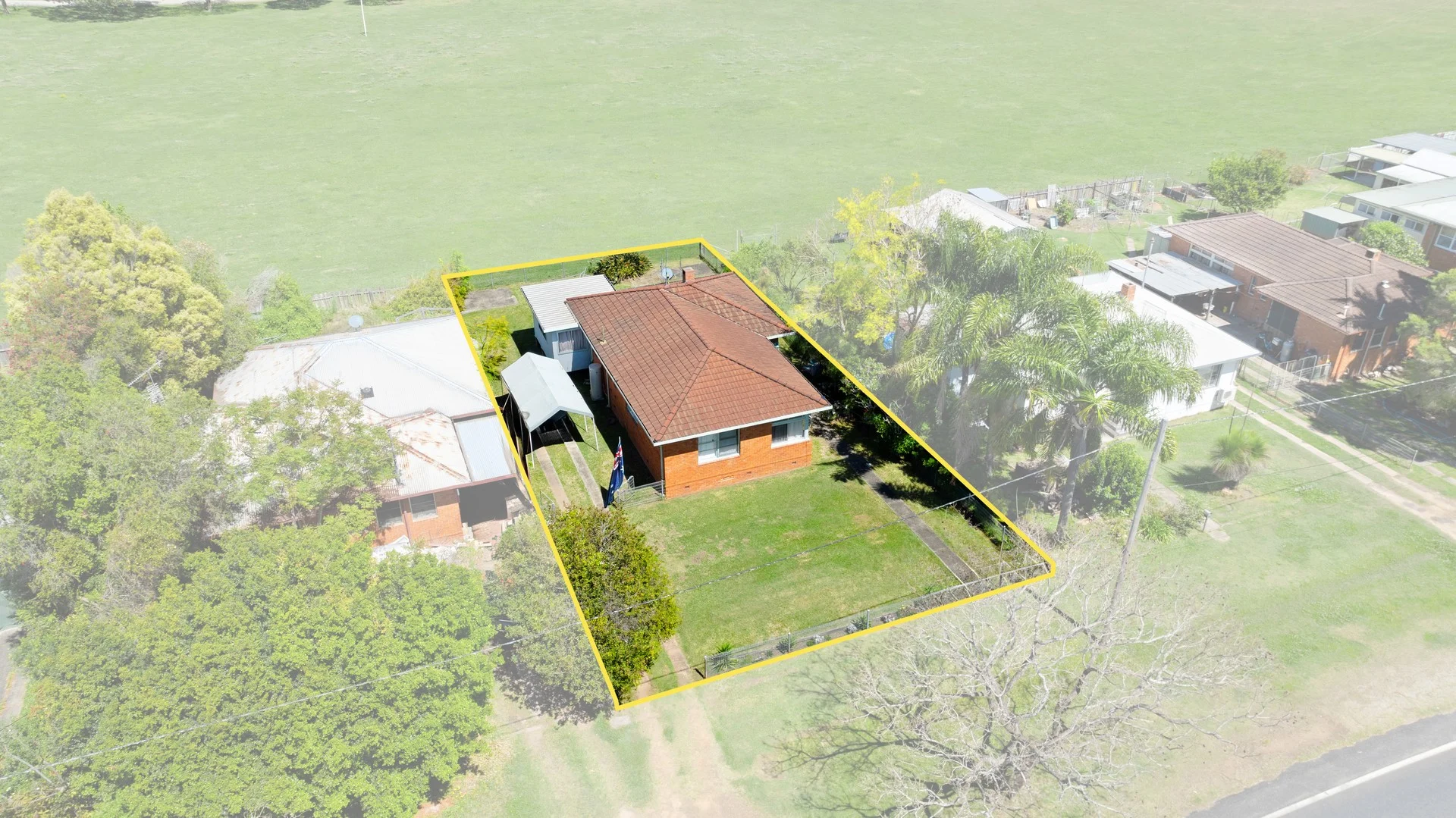
South Grafton, NSW 2460
Land Size: 614 m²
Property Type: House
Listing Type: Residential
Status: Active
Summary: SOUTH GRAFTON'S MOST AFFORDABLE PROPERTY
Description: Auction Details: Wednesday 1st April 6:00pm Grafton District Services Club *Building & Pest Inspection Reports Available Upon Request* Whether you are searching for your first home or a solid investment, 260 Ryan Street, South Grafton is an opportunity not to be missed. Selling at auction on the 01 April 2026, this low set brick and tile home sits on a 614m² (approx.) block and promises a low-maintenance lifestyle in a convenient location. We have clear instructions - time to sell. New owners will be welcomed upon the fall of the hammer. Set against the tranquil backdrop of the paddocks behind, the home enjoys a peaceful outlook that enhances the sense of space and privacy. Inside, you'll find three bedrooms, a formal living area, and a study, offering flexibility. The open-plan kitchen and dining area creates a central hub for daily living, while the spacious sunroom with air conditioning provides the perfect spot for relaxing year-round. Practicality is also a key feature, with a well-appointed bathroom with separate toilet and an internal laundry. Freshly painted with new flooring throughout, the home is move-in ready, leaving nothing to do but enjoy. Please refer to the floorplan provided for an understanding of the layout. For those considering investment, a rental appraisal of $400-$420 per week ensures strong yield potential with a tenant already in place, while the property's low-maintenance brick and tile construction makes it an easy long-term hold. Notable features include: - 614m2 (approx.) block - 3 bedrooms - 1 bathroom - Fresh paint - New flooring - Air conditioning - Rental appraisal $400 - $420 per week Combining functionality, comfort, and an enviable outlook, 260 Ryan Street is a home that will appeal to a wide range of buyers. Contact The Jake Kroehnert Team from Ray White TKG on 0422 260 192 to declare your interest and to book your inspection. Disclaimer: All information disclosed herein has been provided from sources we believe to be reliable however we cannot guarantee its accuracy. It is respectfully advised that interested parties carry out their own due diligence.
Agent: Jake Kroehnert - jake.kroehnert@raywhite.com - 6642 3844
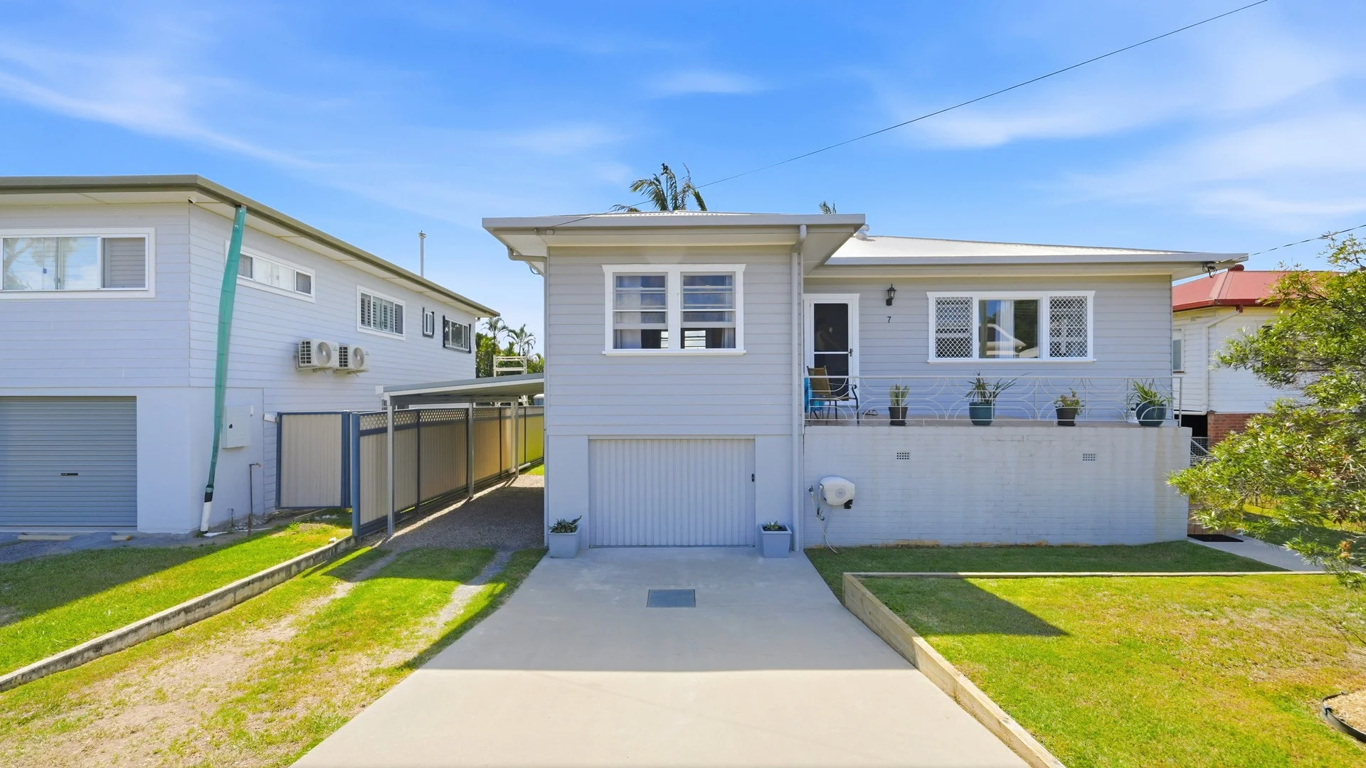
Grafton, NSW 2460
Land Size: 696 m²
Property Type: House
Listing Type: Residential
Status: Active
Summary: RIGHT SPOT, RIGHT FEEL - 7 MILLER STREET, GRAFTON
Description: Auction Details: Wednesday 1st of April 6:00pm Grafton District Services Club *Building & Pest Inspection Reports Available Upon Request* Set in the sought-after Dovedale area, 7 Miller Street, Grafton presents an outstanding opportunity for buyers seeking a spacious and well-presented home with plenty of versatility. Positioned on a 696m² (approx.) block with glimpses of the Clarence River between the homes across the road, this property combines generous proportions with a highly desirable location. Selling at auction on the 1st of April, it's an address that will appeal to families, investors, and those looking to move into one of Grafton's most coveted pockets. Upstairs, the home delivers an inviting and practical layout. The open-plan living and dining area flows seamlessly into the kitchen, which then connects directly to the undercover rear deck - an ideal setup for entertaining or simply enjoying the outdoors. The front verandah adds another welcoming space to unwind and take in the peaceful surrounds. The main bathroom has been beautifully renovated, and all four bedrooms are fitted with built-in robes. With three air conditioners spread throughout the home, the interior remains comfortable across the seasons. Downstairs features a single garage with additional storage and workshop space, perfect for those who need extra room for tools or hobbies. There's also a second bathroom and laundry on this level, adding functionality to the layout. A carport extends along the side of the home, providing covered parking for two vehicles. Please refer to the floorplan provided for an understanding of the layout. Notable features include: - 696m2 (approx.) block - 4 bedrooms - 2 bathrooms - 3 x air conditioners - Garage & carport - Rental appraisal $570 - $700 per week Offering a generous block and a premium Dovedale location, 7 Miller Street is a property that combines space and lifestyle in equal measure. Make sure to mark the 1st of April auction on your calendar - opportunities like this are seldom seen. Contact Craig Franklin from Ray White TKG on 0422 260 192 to declare your interest and to book your inspection. Disclaimer: All information disclosed herein has been provided from sources we believe to be reliable however we cannot guarantee its accuracy. It is respectfully advised that interested parties carry out their own due diligence.
Agent: Craig Franklin - craig.franklin@raywhite.com