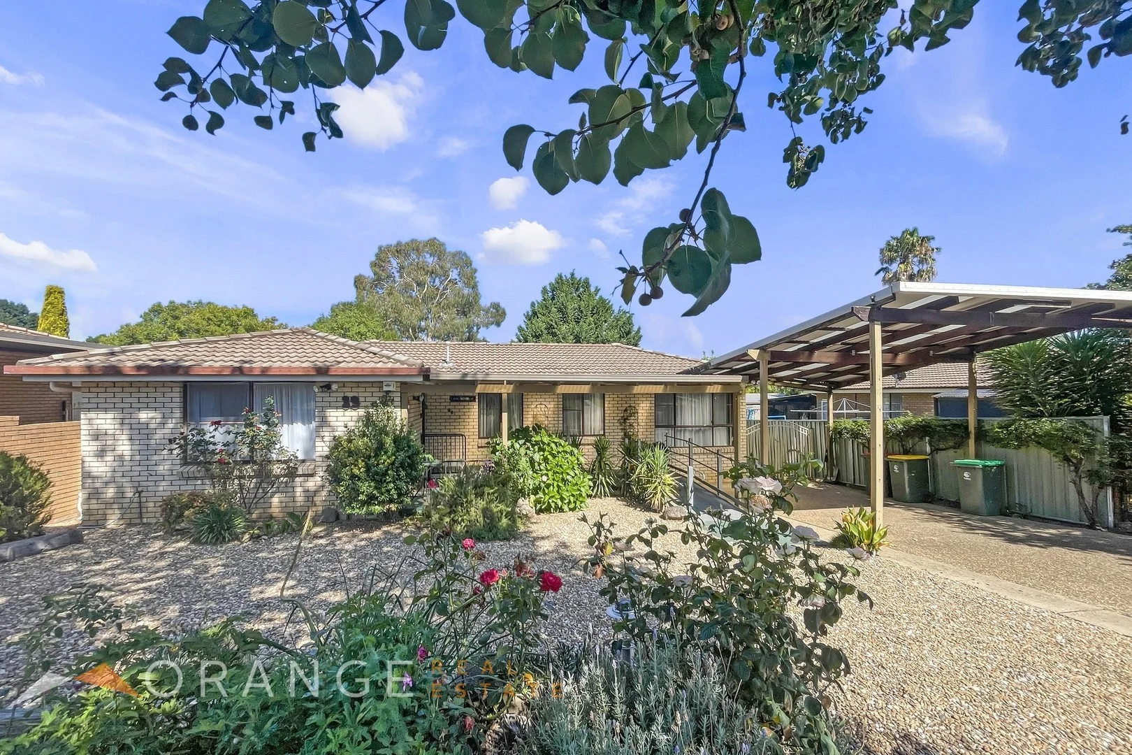
39 Seymour Street
Orange, NSW 2800
Neighbourhood & everyday essentials
Explore around Orange, from school days to weekends.
Area figures
- schools in Orange
- 16
Find schools, playgrounds and children’s classes. Browse by age to plan school days and weekends.
Area figures
- residents (ABS, June 2024)
- 44,610
- children aged 0–14
- 9,301
- schools
- 19
- parks & libraries
- 27
- kids’ activity providers listed
- 10
Most-listed activities: Tennis, Swimming, AFL
Population figures: Australian Bureau of Statistics
Explore local libraries, community spaces, schools and council programs across the wider area.
Parks, playgrounds & public spaces
Mt Lindsay Rotary Park
Wolsley St, Orange, New South Wales, 2800
230 m straight-line distance
Bowen Park
Park St, Orange, New South Wales, 2800
461 m straight-line distance
Bowen Reserve
Jilba St, Orange, New South Wales, 2800
766 m straight-line distance
Memorial Park
Bathurst Rd, Orange, New South Wales, 2800
1.5 km straight-line distance
Things to do near this home
Explore nearby play centres and family attractions from the directory. Check ages, entry prices and opening hours with the venue.
Find more ideas by age, budget and indoor or outdoor setting on Things to do. Dated events are in What’s on. See what’s on
Discover local guides & family ideas
Read local family guides and practical articles as you explore life around this home.
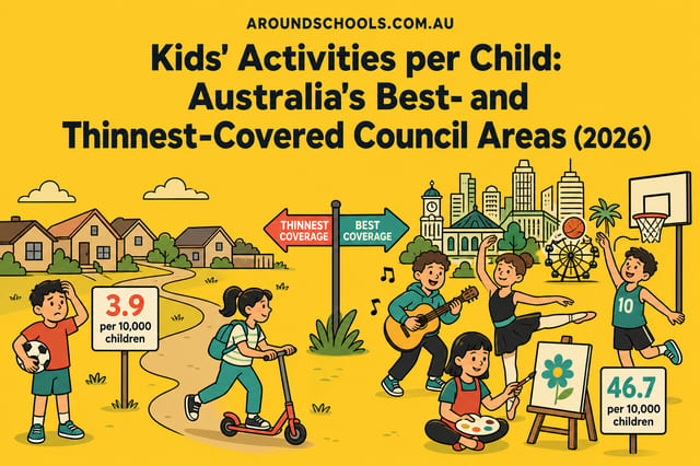
Kids' Activities per Child: Australia's Best- and Thinnest-Covered Council Areas (2026)
Across Australia's big council areas, the AroundSchools directory lists a median of about 10 kids' activity providers for every 10,000 children — but in Melbourne's Wyndham it is 3.9, and in the City…
Read more →
Most Livable Suburbs in New South Wales for Families (2026)
Sydney lists more kids' activities in our directory than any other suburb in NSW. This page ranks NSW suburbs by how much a family moving there could actually do with their kids, then adds what else…
Read more →Everyday essentials & getting around
Open the map to choose a destination and check journey times from this address. Walking routes, step-free access and travel times have not been verified.
Flood & development checks
Property-specific flood risk and announced developments have not been verified. Search this address in the official maps and ask the council for current flood information.
Source: AroundSchools directory. Distances are straight-line distances, not walking routes. Confirm facilities on the linked detail pages. Directory update dates are not supplied for this summary.
Property Details
648 m²
House
RESIDENTIAL
What's Nearby

Mt Lindsay Rotary Park
Wolsley St, Orange
Mt Lindsay Lookout
Mount Lindsay Dr, Orange
Bowen Park
Park St, Orange
Bowen Reserve
Jilba St, Orange

Fitness Perfection
March St, Orange

Central West Libraries
Byng St, Orange
Orange Library
Byng St, Orange

Orange Indoor Tennis
Palmer St, Orange

ORANGE HOCKEY ASSOCIATION
Orange
Nearby Schools

Orange East Public School
45 Spring St, Orange NSW 2800

Bowen Public School
Park St, Orange NSW 2800

St Mary's Catholic Primary School - Orange
Cnr Park And Byng Streets, Orange NSW 2800 Australia

OneSchool Global NSW - Orange
East Orange NSW 2800
Kinross Wolaroi School
59 Bathurst Road, Orange NSW 2800 Australia

Canobolas Rural Technology High School
Icely Rd, Orange NSW 2800
Nearby schools do not imply enrolment eligibility. Confirm catchments, year levels and childcare availability directly with the provider.
Nearby Properties
Recently sold nearby
Homes that have sold close to this address. We don’t show sale prices.
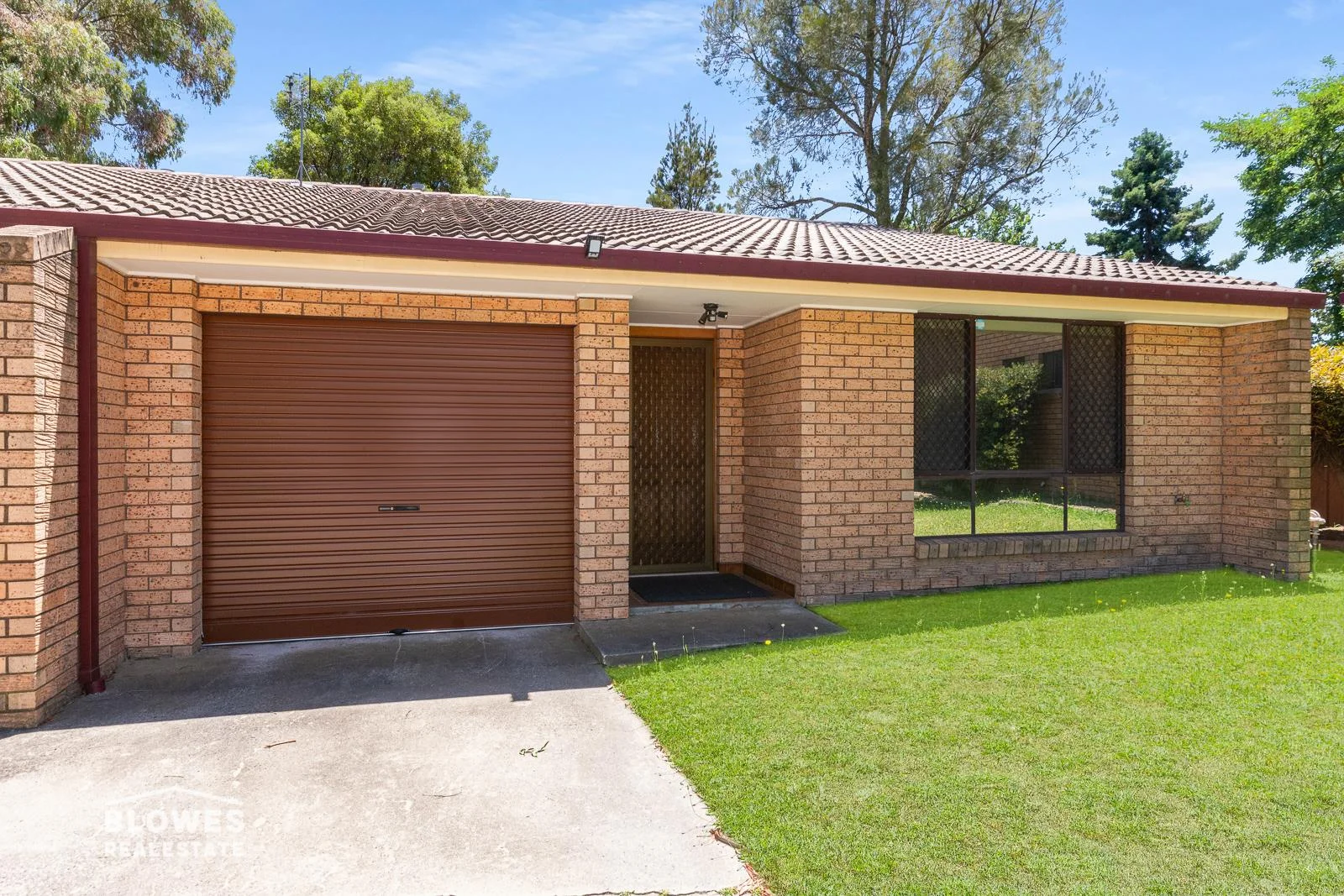
Orange, NSW 2800
Property Type: Apartment / Unit / Flat
Listing Type: Residential
Status: Active
Summary: WELL KEPT UNIT WITH ALL CONTENTS!
Description: This generous two bedroom unit has been looked after meticulously by the owner, and would be a great purchase for someone who needs a place to live and also needs the furniture and inventory that comes with the property. The unit features 2 good size bedrooms, both with built in robes, the central bathroom has a shower and bath, and seperate toilet. The large north facing living/dining area is just of the kitchen, and the extra long single garage with auto door, has internal entry into the unit. Great secure rear yard at approximately 85sqm. • Well maintained unit, close to shops and restaurants • Public transport 7 days a week only a short walk away • Would be excellent first home or a good rental • Comes with everything, furniture, electrical etc • Interested, contact me for an inventory - Walk in walk out (contact for inventory) - Nothing to spend, excellent condition - Generous size rooms
Agent: Chris Tyack - chris@blowesre.com.au - 02 6362 1233
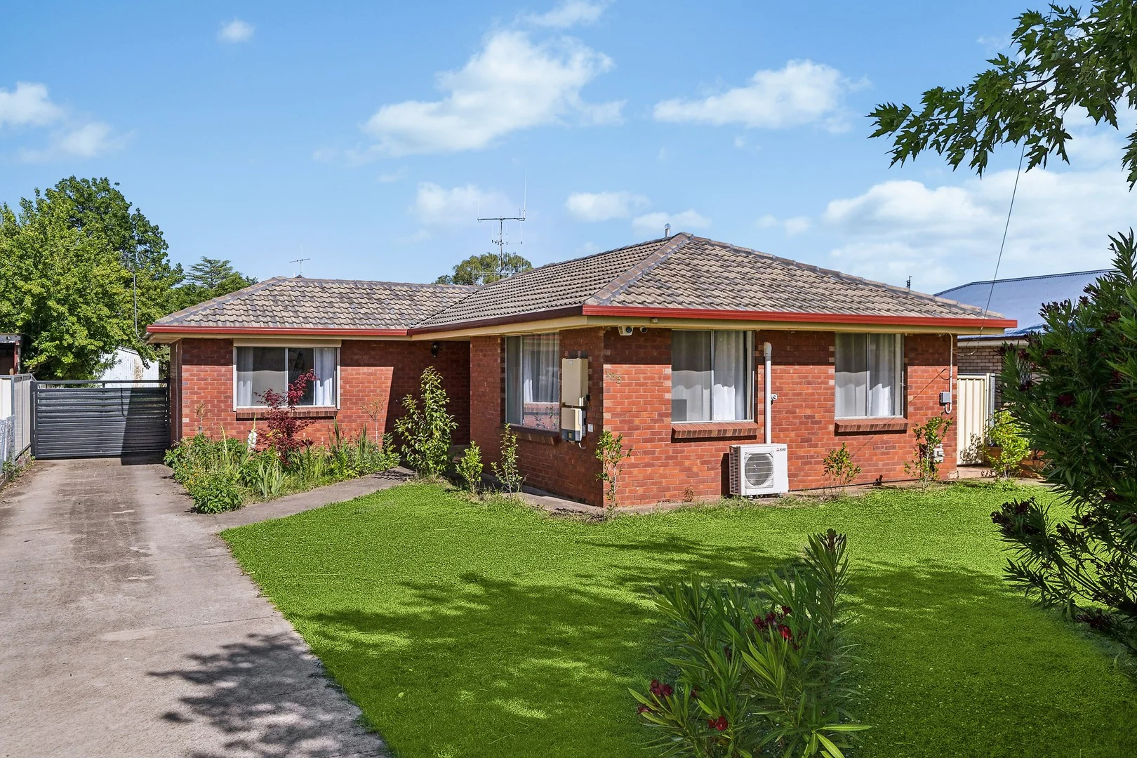
Orange, NSW 2800
Land Size: 781 m²
Property Type: House
Listing Type: Residential
Status: Active
Summary: Welcome Home Space, Style & Location
Description: Perfectly positioned just minutes from town, this charming three-bedroom home offers the ideal blend of space, comfort, and convenience on a generous 781m² block. Step inside and feel instantly at home. The thoughtfully designed layout features air-conditioned living spaces, ensuring year-round comfort, while the beautifully appointed kitchen is the heart of the home - stylish, functional, and perfect for everyday living. Flowing seamlessly from the living area is a covered sunroom, an inviting space to relax regardless of the season. Outside, there's room to move and more. The expansive yard offers plenty of space for kids, pets, or future improvements, while the double shed provides excellent storage, workshop space, or secure parking for vehicles and toys. Whether you're a first-home buyer, growing family, downsizer, or savvy investor, this property ticks all the boxes with its convenient location, generous block size, and practical features. DISCLAIMER All information (including but not limited to the property areas, floor size, price, address and general property description, opinions and/or articles) on the McGrath website is provided for general information and/or educative purposes only. The content does not constitute professional advice (be it of a legal, financial or taxation nature) and should not be relied upon as such.
Agent: Jack Aumuller - JackAumuller@mcgrath.com.au - 02 7903 0753
Agent: Rachel Smith - rachelsmith@mcgrath.com.au - 02 7903 0753
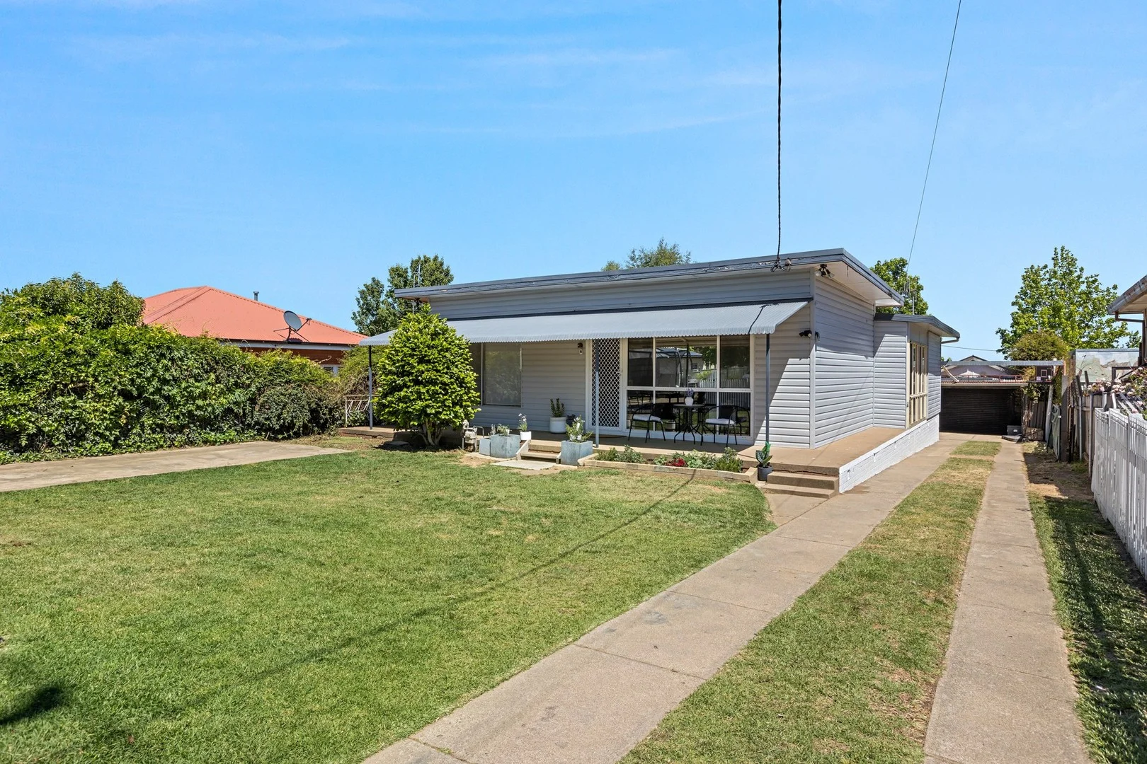
Orange, NSW 2800
Land Size: 613 m²
Property Type: House
Listing Type: Residential
Status: Active
Summary: Moments from Kinross, Packed with Upgrades
Description: SOLD OFF MARKET BY TOM FIGUERO - - Key Investor Facts - - Council Rates - $667 per quarter (approx) Estimated Rental Potential - $540 - $560 per week (approx) Building and Pest Inspection - Available on request Year Built - 1960 (approx) Behind the picket fence, 65 Cox Avenue offers a fresh and comfortable home in a quiet East Orange position just behind Kinross Wolaroi School. A long list of recent upgrades means you can move straight in, while still having room to add your own touches over time. The layout revolves around an open-plan living, kitchen and dining area, complemented by a north-facing sunroom that brings in beautiful natural light. There's also a handy study nook - ideal for homework, admin or a compact work-from-home station. The updated kitchen includes stone benchtops, a breakfast bar, generous prep space, excellent storage and a dishwasher. Climate control is well catered for with ducted gas heating plus two split-system air conditioners - one in the main living zone and the other positioned in the hallway to service the bedrooms. There are three bedrooms, with the master notably generous and featuring a walk-in robe fitted with on-trend drawer and hanging storage, along with a built-in desk perfect for working from home or a make-up station, the other two bedrooms also feature built in robes. The bathroom was replaced within the last year and now includes floor-to-ceiling tiles, a shower-over-bath with a feature niche, floating vanity and a mirrored shaving cabinet with extra storage. Fresh paint and carpet throughout enhance the overall presentation. The level backyard is a great size with plenty of usability, and side access runs the full length of the home to a single steel shed. At the front, the dual-driveway setup is a real advantage, providing easy off-street parking for multiple vehicles - perfect for a van, boat or trailer. A 5 kW rooftop solar array adds ongoing energy efficiency. A strong option for first-home buyers, families and investors, this home combines comfort, upgrades and convenience in a popular East Orange pocket. - - Property Highlights - - - Quiet East Orange location behind Kinross Wolaroi School - Fresh internal paint and carpet - Open-plan living, kitchen and dining + north-facing sunroom - Updated kitchen with stone benchtops, breakfast bar, excellent storage and dishwasher - Ducted gas heating + two split-system air conditioners - Three bedrooms, generous master with fitted walk-in robe and built-in desk - Fully renewed bathroom with floor-to-ceiling tiles and shower-over-bath with feature niche - 5 kW rooftop solar array - Level backyard with side access to a single steel shed - the shed also features a workshop. - Dual-driveway frontage with off-street parking for multiple vehicles (ideal for van/boat/trailer) - Picket-fenced front yard and wide street presence - Scope to add further improvements and value over time *Disclaimer** - All boundaries and point of interest markers within this advertising are to be used only as a guide. - All information contained herein is gathered from sources we deem to be reliable. However, we cannot guarantee its accuracy and interested persons should rely on their own enquiries.
Agent: Tom Figuero - tom.figuero@belleproperty.com - 02 6362 6566
Agent: Josh Mastronardi - josh.mastronardi@belleproperty.com - 02 6362 6566
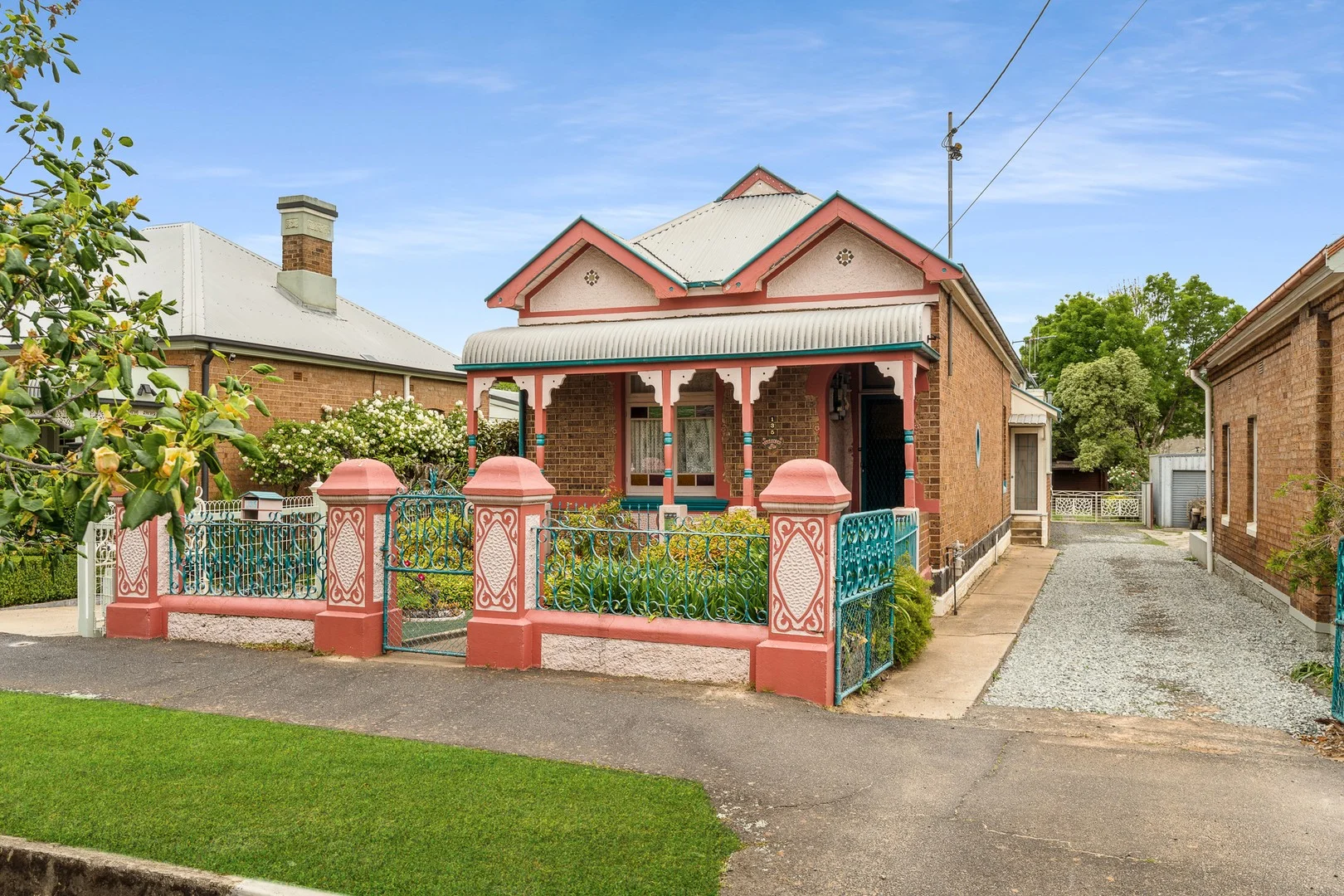
Orange, NSW 2800
Land Size: 594 m²
Property Type: House
Listing Type: Residential
Status: Active
Summary: Welcome to - 135 Edward Street, Orange
Description: This solid double brick home in sought-after East Orange is full of potential and waiting for someone to bring their dream home to life. With its charming street appeal and classic character, it's a property that captures the best of old-world charm and comfortable family living. Inside, you'll find three generous bedrooms, soaring high ceilings, and stunning ornate fireplaces that add timeless elegance throughout. There's a separate lounge and dining room, plus a spacious family room providing extra space for relaxed living. The home is kept cozy with gas heating for year-round comfort. Outside, enjoy the convenience of rear yard access, a single garage or shed, and a carport, along with a lovely outdoor patio perfect for entertaining or quiet evenings. Situated in a popular pocket of East Orange, just a short stroll to the CBD, this is a wonderful opportunity not to be missed. Contact our team today to arrange a viewing or to obtain a floor plan. Disclaimer We have obtained all information on this property from sources we believe to be reliable; however, we cannot guarantee its accuracy. All interested parties should make and rely upon their own investigations in order to determine whether or not this information is in fact accurate.
Agent: Anthony Cook - anthony@johncook.com.au - 02 6361 0133
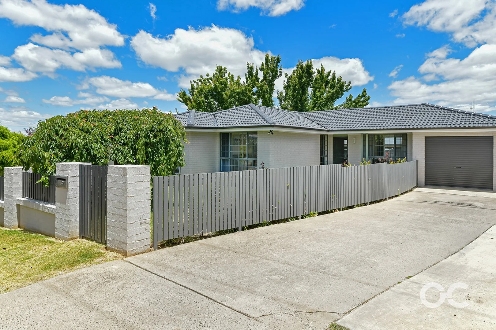
Orange, NSW 2800
Land Size: 406 m²
Property Type: House
Listing Type: Residential
Status: Active
Summary: Effortless Living on a Low-Maintenance Block
Description: Perfectly combining comfort, style, and everyday convenience, this beautifully updated three-bedroom home presents an easy-care lifestyle in a lovely, established setting. Surrounded by stunning mature trees and well-kept gardens, the home opens to a bright and airy open-plan design, highlighted by a stylishly renovated kitchen, generous living and dining spaces, and fresh paint with updated flooring that brings a modern, welcoming feel throughout. All three bedrooms are well-sized and include built-in wardrobes, while the practical three-way bathroom enhances functionality for both families and guests. Outdoors, the covered alfresco area and extended concrete patio create a seamless space for entertaining or relaxing in any season. With a single-car garage and low-maintenance grounds, this property is perfectly suited to investors seeking solid returns, downsizers wanting a relaxed lifestyle, or first home buyers looking for a move-in-ready opportunity in a lovely Orange location. Low maintenance 406 square meter block Spacious open plan kitchen living and dining Beautifully renovated kitchen Three spacious bedrooms all with built in wardrobes Updated floorcoverings, carpet & paint throughout Modernised three-way bathroom for added convenience Additional storage throughout Gas unit for heating Undercover alfresco area Beautiful established trees and gardens Estimated rental return: $550 - $570 per week Rates per quarter: $637 Information published by Our City Real Estate on its website and in its advertising and marketing materials is obtained from sources the Agency deems trustworthy and reliable. While we make every effort to obtain and use accurate information, we take no responsibility for any inaccuracies within that information and will not be liable for any losses incurred through its use. We recommend that interested people source their own information before making decisions.
Agent: Lan Snowden - lan@ourcityrealestate.com.au - 02 5326 5700
Agent: Libby Wilder - libby@ourcityrealestate.com.au - 02 5326 5700
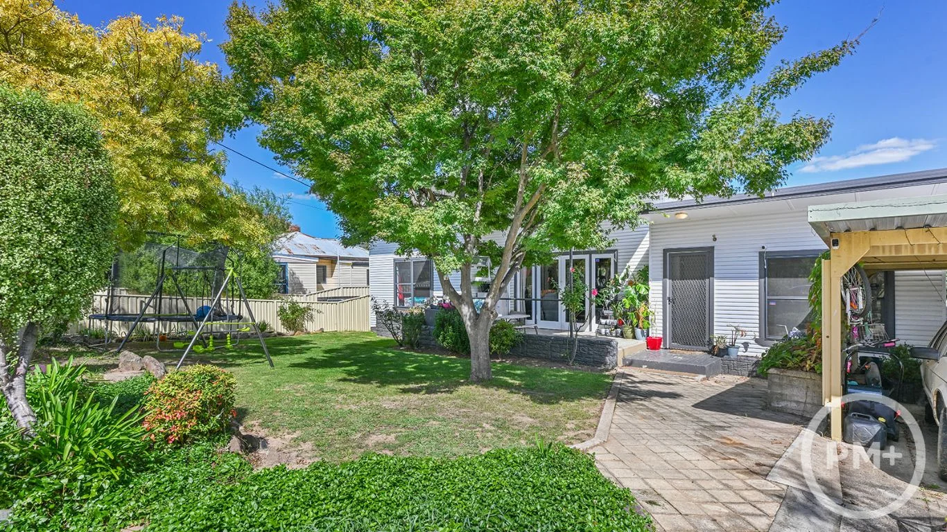
Orange, NSW 2800
Land Size: 561.6 m²
Property Type: House
Listing Type: Residential
Status: Active
Summary: So Much to Love!
Description: This home offers an opportunity for both first home buyers or astute investors. Ideal if you're embarking on your first home ownership journey, or with fantastic Tenants already in place, this purchase could represent a seamless addition to your property portfolio. Offering; 3 x bedrooms with built-in wardrobes 2 x separate living areas 2 x full bathrooms Airy and light filled kitchen and dining area North facing main living area Private front patio & garden area Rear timber deck with views to Mt Canobolas Character features like polished timber floorboards, french doors & high ceilings Creature comforts include slow combustion wood heating, reverse cycle air-conditioning & spa bath Very well presented and maintained, in need of little improvement, weekends can be spent doing what you love, while making the most of this convenient and increasingly popular neighbourhood. Call us today on (02) 6361 4155 to arrange your inspection.
Agent: John Brennan - enquiries@orangepropertyplus.com.au - 0263614155
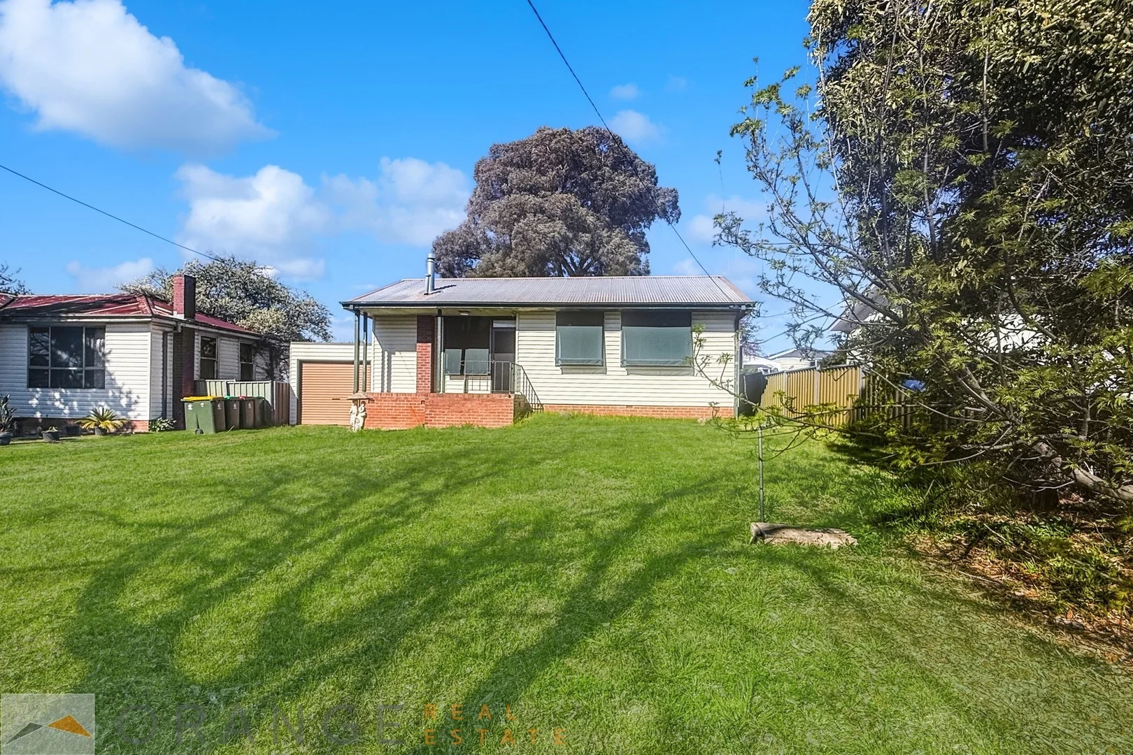
Orange, NSW 2800
Land Size: 574 m²
Property Type: House
Listing Type: Residential
Status: Active
Summary: NOT JUST A HOUSE, IT'S A HOME
Description: Step into the perfect blend of charm and convenience with this delightful three-bedroom home, a perfect start for first-time buyers or astute investors alike. Nestled in a serene neighbourhood, this property is just a short walk from the reputable Bletchington Primary School, making it ideal for young families or those planning for the future. Upon entering, you are greeted by the warm embrace of high ceilings and polished floorboards that invite you into the lounge room. Adjoined by a dining area, the adjoining compact kitchen is a model of efficiency, boasting an electric oven and ample cupboard space to cater to all your cooking needs. Each bedroom is generous in size, with built-in robes providing generous storage solutions. Ensuring year-round comfort, two reverse cycle air conditioners are thoughtfully placed; one in the master bedroom for peaceful slumbers and the other in the living area for a pleasant ambience throughout the home. The outside space offers an extra-large garden shed, ideal for those who appreciate additional storage or a potential workshop. The convenience of drive-through access to the backyard through a roller door is not to be overlooked, enhancing the functionality of the generous 574 square metre land size. Adding to the property's appeal is the presence of a long-term tenant for investors seeking immediate returns. Don't let this opportunity pass you by this is a must-see for those looking to step onto the property ladder or expand their investment portfolio. Act quickly to secure a home that promises a blend of lifestyle and potential.
Agent: Scott Quirk - scott@orangerealestate.com.au - 0476333076
Agent: Gina Noonan - gina@orangerealestate.com.au
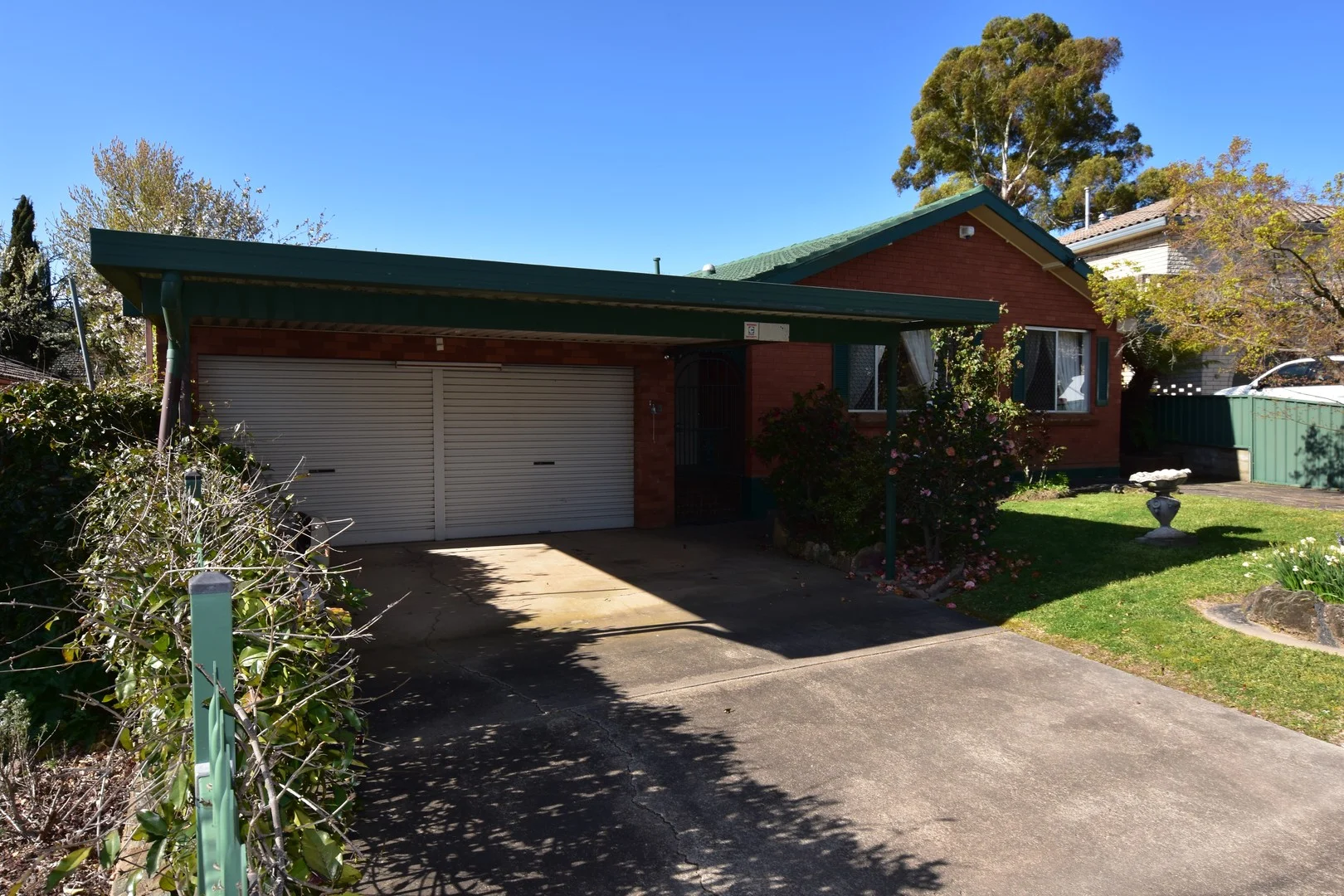
Orange, NSW 2800
Land Size: 627 m²
Property Type: House
Listing Type: Residential
Status: Active
Summary: Hidden Treasure, a Real Surprise with so much on Offer & many Extra Features.
Description: This brick veneer & tile roof home, is located in a lovely quiet cul de sac in East Orange with an established leafy, private garden setting. You will be close to local schools, the Anzac Park sports complex, local shops & cafes & the Dudley Private Hospital. You are in for a real surprise, where once inside you'll be able to take in all of the space on offer, including an entry foyer with a study nook. The internal hallway has double built-in linen/storage cupboards & provides access to the living rooms, including a loungeroom, a separate dining room, a family room & updated kitchen with a gas stove & adjoining meals area. Yes there is plenty of space here & you have plenty of room choices, to suit your individual room requirements. You'll find 3 bedrooms, main with built-in robes & an updated bathroom with a shower recess & a separate toilet. The laundry has easy access to a covered pergola & back yard, where you'll love a great sunny north aspect. The home has the ideal boys shed, with a large 3 car garage/workshop & second toilet, plus a garage door providing access to the back yard. A double carport provides extra undercover car accommodation & the fenced front yard includes another secure off street concrete, car park space. Rarely will the boy's in your family, be provided with all of this man's space. The home is naturally warm & very inviting, with a sunny north aspect to the living rooms. You'll be comfortable with a gas heater & an air conditioner. This property is an excellent first home with unlimited potential to change & utilize the many rooms, for your own use & you can use your flair & inspiration, to paint & update in your own time. There's plenty of opportunity & potential with this home.
Agent: James Eddy - james.eddy@orange.rh.com.au - 02) 6362-1366
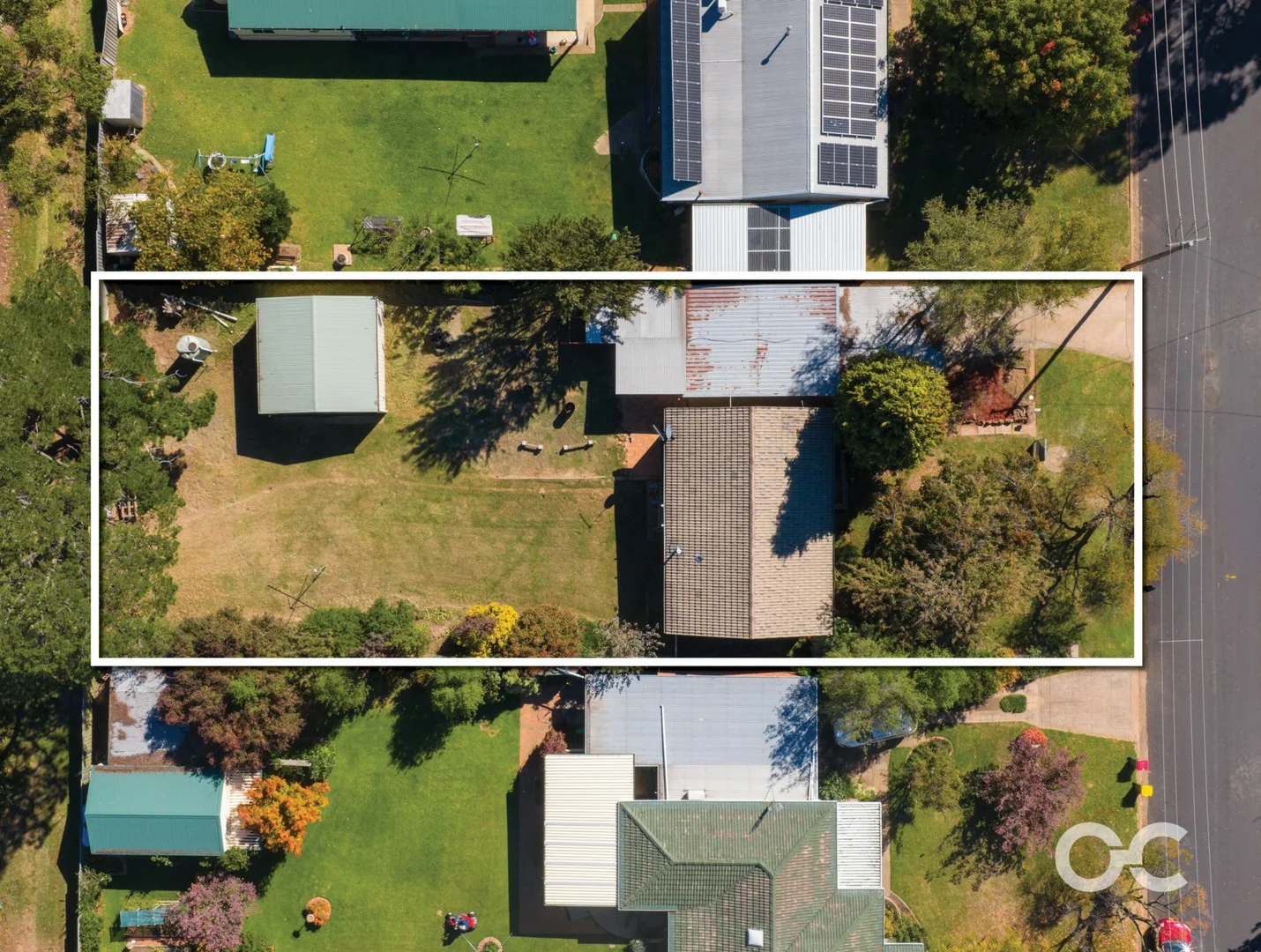
Orange, NSW 2800
Land Size: 1011 m²
Property Type: House
Listing Type: Residential
Status: Active
Summary: Big Block, Big Opportunity
Description: Positioned on a generous 1,011sqm parcel in a well-established pocket of Orange, this three-bedroom home presents an outstanding opportunity for homeowners, investors, or developers alike. Offering comfortable living now with exciting future potential, the property lends itself to subdivision or dual occupancy (STCA), making it a smart addition to any portfolio. Inside, the home features a practical layout with three well-proportioned bedrooms, a central bathroom, and a light-filled living area complemented by reverse cycle heating and cooling for year-round comfort. The functional kitchen and dining space provide a great foundation to enjoy as-is or enhance over time. Outdoors is where this property truly shines, with the expansive block offering endless possibilities. Two separate double garages provide exceptional storage, workshop space, or secure parking for multiple vehicles, trailers, or equipment. Whether you're looking to move in, lease out, or unlock the development potential, this is a rare chance to secure a sizeable block in a sought-after location. Key Features: Three spacious bedrooms Central bathroom with practical layout Reverse cycle heating and cooling Expansive 1,011sqm block Potential for subdivision or dual occupancy (STCA) Two separate double garages plus carport (accommodating up to six vehicles) Excellent investment or development opportunity Potential rental return: $480 per week Rates: $685 per quarter Unlock the potential and secure your future on Elsie Street. Information published by Our City Real Estate on its website and in its advertising and marketing materials is obtained from sources the Agency deems trustworthy and reliable. While we make every effort to obtain and use accurate information, we take no responsibility for any inaccuracies within that information and will not be liable for any losses incurred through its use. We recommend that interested people source their own information before making decisions.
Agent: James Taylor - james@ourcityrealestate.com.au - 02 5326 5700