42 Playford Road
Killarney Vale, NSW 2261
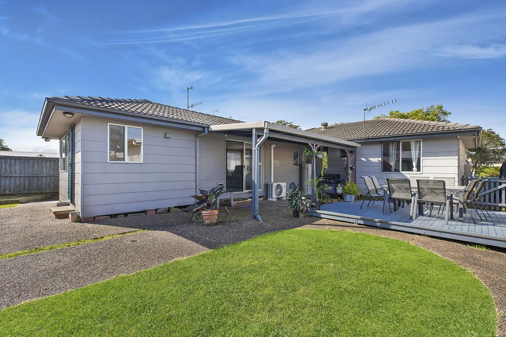
Neighbourhood & everyday essentials
Explore around Killarney Vale, from school days to weekends.
Find schools, playgrounds and children’s classes. Browse by age to plan school days and weekends.
Area figures
- residents (ABS, June 2024)
- 354,803
- children aged 0–14
- 63,020
- schools
- 109
- parks & libraries
- 126
- kids’ activity providers listed
- 109
Most-listed activities: AFL, Tennis, Female AFL
Population figures: Australian Bureau of Statistics
Explore local libraries, community spaces, schools and council programs across the wider area.
Parks, playgrounds & public spaces
Bateau Bay Library
Bay Village Rd, Bateau Bay, New South Wales, 2261
1.2 km straight-line distance
Bateau Bay Park - Cresthaven Ave Entrance
Cresthaven Ave, Bateau Bay, New South Wales, 2261
1.7 km straight-line distance
Saltwater Creek Reserve
The Entrance Rd, Long Jetty, New South Wales, 2261
1.8 km straight-line distance
Bateau Bay Park
Ventura Ave, Bateau Bay, New South Wales, 2261
1.9 km straight-line distance
Saltwater Creek Reserve: Toilets, Playground, Parking
Things to do near this home
Explore nearby play centres and family attractions from the directory. Check ages, entry prices and opening hours with the venue.
Find more ideas by age, budget and indoor or outdoor setting on Things to do. Dated events are in What’s on. See what’s on
Discover local guides & family ideas
Read local family guides and practical articles as you explore life around this home.

Kids' Activities per Child: Australia's Best- and Thinnest-Covered Council Areas (2026)
Across Australia's big council areas, the AroundSchools directory lists a median of about 10 kids' activity providers for every 10,000 children — but in Melbourne's Wyndham it is 3.9, and in the City…
Read more →
Most Livable Suburbs in New South Wales for Families (2026)
Sydney lists more kids' activities in our directory than any other suburb in NSW. This page ranks NSW suburbs by how much a family moving there could actually do with their kids, then adds what else…
Read more →Everyday essentials & getting around
Open the map to choose a destination and check journey times from this address. Walking routes, step-free access and travel times have not been verified.
Flood & development checks
Property-specific flood risk and announced developments have not been verified. Search this address in the official maps and ask the council for current flood information.
Source: AroundSchools directory. Distances are straight-line distances, not walking routes. Confirm facilities on the linked detail pages. Directory update dates are not supplied for this summary.
Property Details
658 m²
House
RESIDENTIAL
Upcoming Events Nearby

Fri, 25 Sept · Toukley
Lego club at Toukley Library
Ages 8–12
Sat, 24 Oct · Brookvale
Brookvale Halloween Festival 2026
Wed, 31 Dec · Brookvale
Free Trial - AAGI | 1st Jan to 23rd Dec-2026
Ages 1–18
Wed, 31 Dec · Brookvale
Birthday Parties - AAGI | 1st Jan to 20th Dec-2026
Ages 2–18
Thu, 15 Oct · Speers Point
Digitales: Storytime and art - Oct 15, Nov 19, Dec 10
Ages 2–5
What's Nearby

Iris Lodge Alpacas
33 Dunks Lane , JIlliby

Kip McGrath - Bateau Bay
Suite 5, 3 Farrar Way, Killarney Vale

Sir Joseph Banks Oval
Bateau Bay

Bateau Bay Library
Bay Village Rd, Bateau Bay

Bateau Bay Ten Pin Bowl
Bay Village

The Entrance Leagues Club
Bay Village Rd, Bateau Bay
Bateau Bay Park - Cresthaven Ave Entrance
Cresthaven Ave, Bateau Bay
Saltwater Creek Reserve
The Entrance Rd, Long Jetty
Bateau Bay Park
Ventura Ave, Bateau Bay
Nearby Schools

The Central Coast Montessori Primary School
10-12 Debra Anne Dr, Bateau Bay NSW 2261, Australia

Brooke Avenue Public School
Brooke Ave, KILLARNEY VALE NSW 2261

Killarney Vale Public School
Hendricks Rd, Killarney Vale NSW 2261

Our Lady of the Rosary Catholic School
Shelly Beach Road, Shelly Beach NSW 2261 Australia

St John Fisher Catholic Primary School
Hicks Lane, Tumbi Umbi NSW 2261 Australia

Bateau Bay Public School
2A Waratah Street, BATEAU BAY NSW 2261
Nearby schools do not imply enrolment eligibility. Confirm catchments, year levels and childcare availability directly with the provider.
Nearby Properties
Recently sold nearby
Homes that have sold close to this address. We don’t show sale prices.
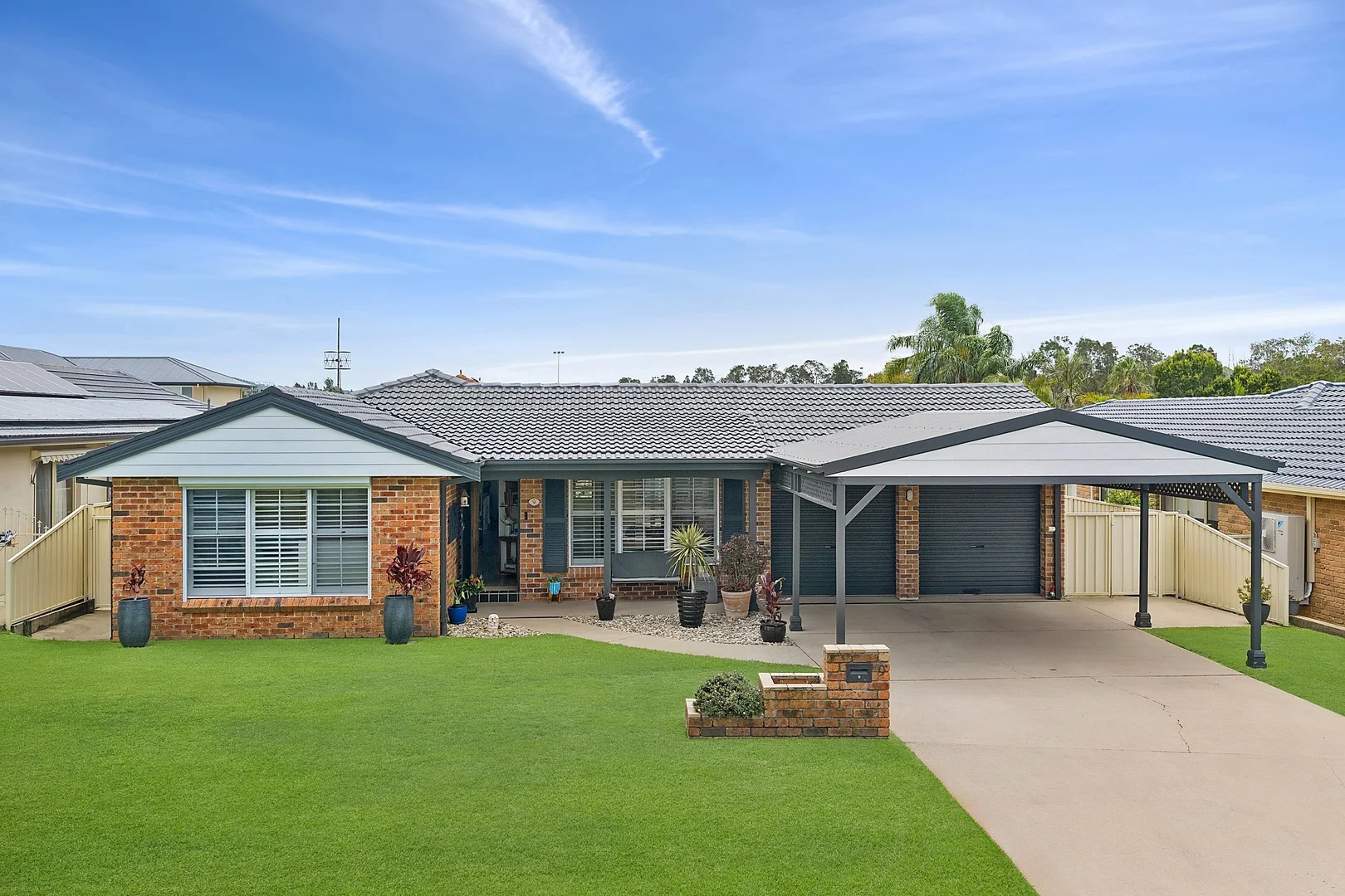
Bateau Bay, NSW 2261
Land Size: 501 m²
Property Type: House
Listing Type: Residential
Status: Active
Summary: Beautiful single level home designed with multiple living and dining zones
Description: Positioned within a peaceful, tightly-held cul-de-sac in sought-after Bateau Bay, this beautifully presented single level home delivers an exceptional standard of family living with a refined yet relaxed coastal feel. Designed with space, comfort and effortless entertaining in mind, the home offers multiple living zones and a seamless indoor/outdoor connection to a private alfresco and sparkling pool; creating the perfect environment for families to grow and unwind. - Elegant open plan living and dining zones bathed in natural light - Well considered single level design with separate lounge and family retreat - Expansive covered alfresco flowing to a sparkling in-ground pool - Contemporary kitchen with quality appliances, generous bench space and storage - Privately positioned master suite with ensuite and mirrored built-in robe - Three additional bedrooms, each appointed with built-in robes - Stylish family bathroom with separate bath and shower, functional internal laundry - Air conditioning, ceiling fans and plantation shutters, solar panels - Double lock-up garage plus double carport for off street parking and storage - Moments to beaches, coastal walks, quality schools, cafés and local shopping precincts KEY DETAILS: Council Rates $1,745pa Water Rates $1,185pa
Agent: Melanie Sommers - melaniesommers@mcgrath.com.au - 43318011
Agent: Scott Falconer - scottfalconer@mcgrath.com.au - 4331 8014
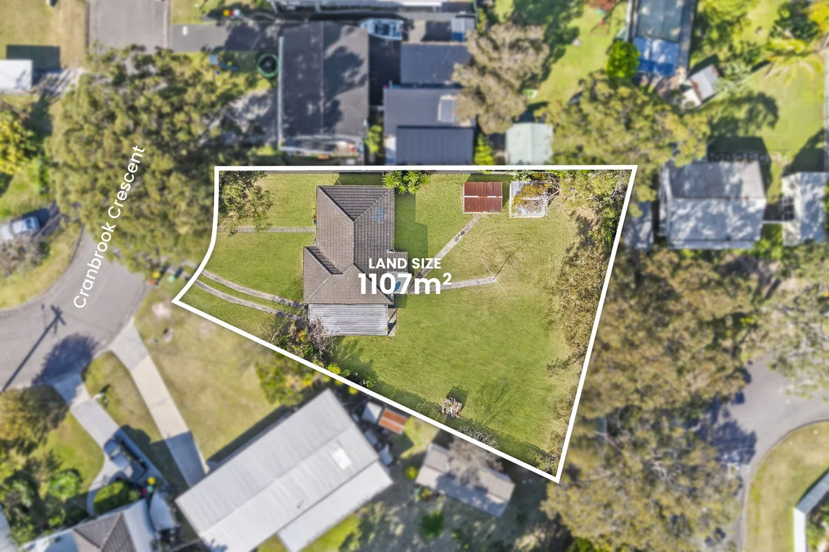
Killarney Vale, NSW 2261
Land Size: 1107 m²
Property Type: House
Listing Type: Residential
Status: Active
Summary: Lakeside Blank Canvas!
Description: Occupying an expansive 1,107 sq/m level block (R2 Zoning) in a desirable Killarney Vale Lakeside location soaking up a sunny aspect towards the lake. The existing dwelling could be ideal for the brave renovator or would make for the ideal knock down rebuild site (subject to council approval). Featuring; One living area, three-bedroom layout. Mostly demolished kitchen area. Bathroom with separate toilet. External laundry. Carport. Expansive grounds on ultra rare 1107 sq/m land. Blank canvas opportunity. The Location: 2 kms m to Killarney Vale Public School. 5.1 kms to Tuggerah Lakes Secondary College Berkeley Vale Campus. 1.5 kms to Coles Killarney Vale. 230 m to Tuggerah Lake and Cycleway. 2.0 kms to Tuggerah Lakes Secondary College. 3.8 kms to Shelly Beach Golf Club and Shelly Beach. 4.4 kms to Bay Village Square. Approximately 10 kms to Tuggerah Station, Westfeild Tuggerah and M1 Motorway. Parcels of land in Killarney Vale of this size are rare; and it has been a prized family holding for in excess of 30 years. For further information contact Justin or Belinda today! Council Rates: $2,037.90 per annum. Water Rates: $262.21 per quarter. Disclaimer: All information contained herein is gathered from sources we consider to be reliable, however we cannot guarantee or give any warranty about the information provided. All images, border/s, property boundaries and floor plans are indicative of the property and for illustrative purposes only. Any development potential stated herein is suggestive only and may be subject to relevant approvals, as such it is not to be relied upon. All distances and measurements are approximate. Interested parties must solely rely on their own enquiries.
Agent: Justin Bond - justin.bond@ljhooker.com.au - 43891722
Agent: Belinda Bond - belinda.bond@ljhooker.com.au - 43 891722
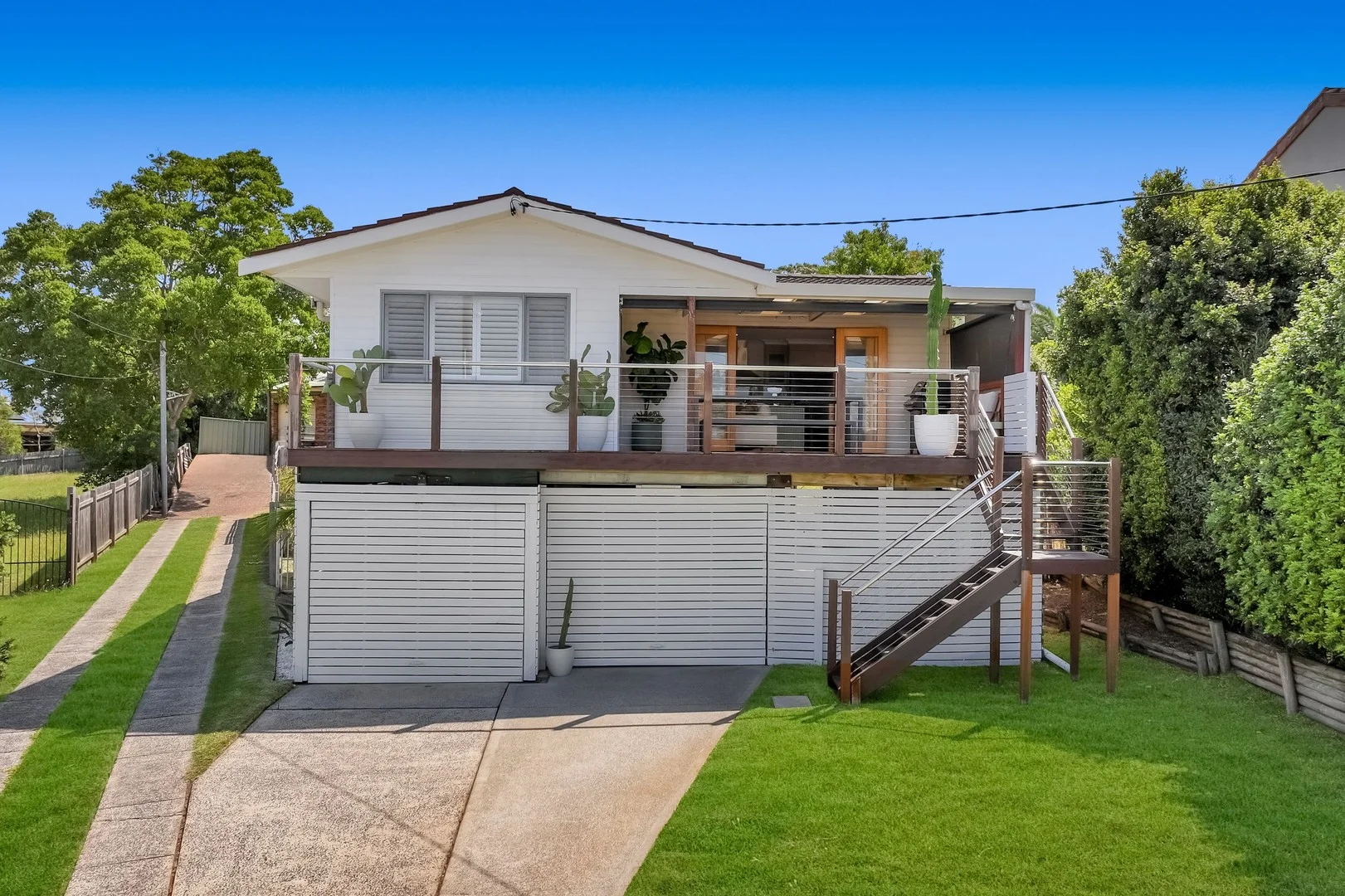
Bateau Bay, NSW 2261
Land Size: 461 m²
Property Type: House
Listing Type: Residential
Status: Active
Summary: Elevated Coastal Living with Space, Style & Versatility
Description: Welcome to 43A Margherita Avenue, Bateau Bay a beautifully presented home offering the perfect balance of space, comfort and coastal lifestyle, ideal for young families, investors and first home buyers ready to step into the market. Set across two levels, this four-bedroom home features timber floors throughout and a thoughtfully designed layout that grows with you. The renovated kitchen with quality chef-style appliances is the heart of the home and flows to the undercover deck, making everyday living and entertaining effortless. Downstairs is versatile with a rumpus room providing valuable extra space with a kids' playroom, second living area and/or work-from-home zone. With two bathrooms and a lock-up carport, the home delivers everyday practicality. Positioned in an elevated location, the home captures coastal breezes and a sense of privacy, while remaining close to local shops, golf course, beaches, schools, cafes and transport, with easy access to the M1 Motorway for commuting. Other features include: - Fully fenced & low maintenance backyard - North East aspect - Gas cooking & hot water. - Split system air conditioner - Lockable storage - Ceiling fans throughout bedrooms and more! LAND SIZE: Approx. 461sqm COUNCIL RATES: $1,803.28/annum. WATER RATES: $296.27/quarter RENTAL RETURN: Estimated $800-$850/week.
Agent: Alana Gargaro - alana@residentialhqcc.com.au
Tumbi Umbi, NSW 2261
Land Size: 658 m²
Property Type: House
Listing Type: Residential
Status: Active
Summary: Contact Agent
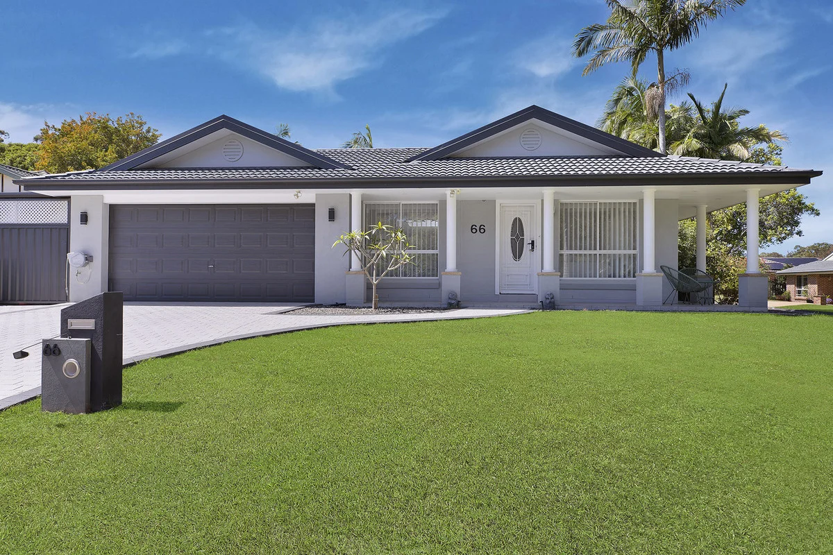
Description: Perfectly positioned in the highly sought-after suburb of Tumbi Umbi, this beautifully presented, single-level family home offers space, style, and serenity. Located just minutes from some of the Central Coast's finest beaches, lifestyle hubs, and with convenient access to the freeway connecting Sydney and Newcastle, this is a property that ticks every box. Set on a generous 658sqm corner block with scenic bushland views, this stunning home is ideal for families, downsizers, or anyone seeking a peaceful lifestyle with all the modern comforts. Key features: *Single-level living in a friendly, quiet neighbourhood *Four spacious bedrooms, including master with ensuite *Light-filled open plan living areas designed for modern family living *Gourmet kitchen with quality appliances and ample storage *Double lock-up garage plus off-street parking for a boat or small caravan *Stylish main bathroom servicing the additional bedrooms *Large covered entertaining area overlooking the sleek in-ground pool and private surrounds *Peaceful corner block with tranquil bushland outlook *Ideal for mature-aged downsizers with plenty of space and easy living *Ducted air conditioning, ceiling fans, gas fireplace, solar system, and attached workshop This property is more than just a home it's a lifestyle. Whether you're entertaining guests by the pool, enjoying the peaceful natural surroundings, or exploring nearby beaches, you'll love everything this exceptional home has to offer. Please contact Craig today for more information or to arrange a private inspection. Disclaimer: All information contained herein is gathered from sources we consider to be reliable, however we cannot guarantee or give any warranty about the information provided. All images, border/s, property boundaries and floor plans are indicative of the property and for illustrative purposes only. Any development potential stated herein is suggestive only and may be subject to relevant approvals, as such it is not to be relied upon. All distances and measurements are approximate. Interested parties must solely rely on their own enquiries.
Agent: Craig Trehearne - craig.trehearne@ljhooker.com.au - 43 891722
Shelly Beach, NSW 2261
Land Size: 601 m²
Property Type: House
Listing Type: Residential
Status: Active
Summary: Coastal Comfort and Convenience, Moments from the Beach and Golf Course
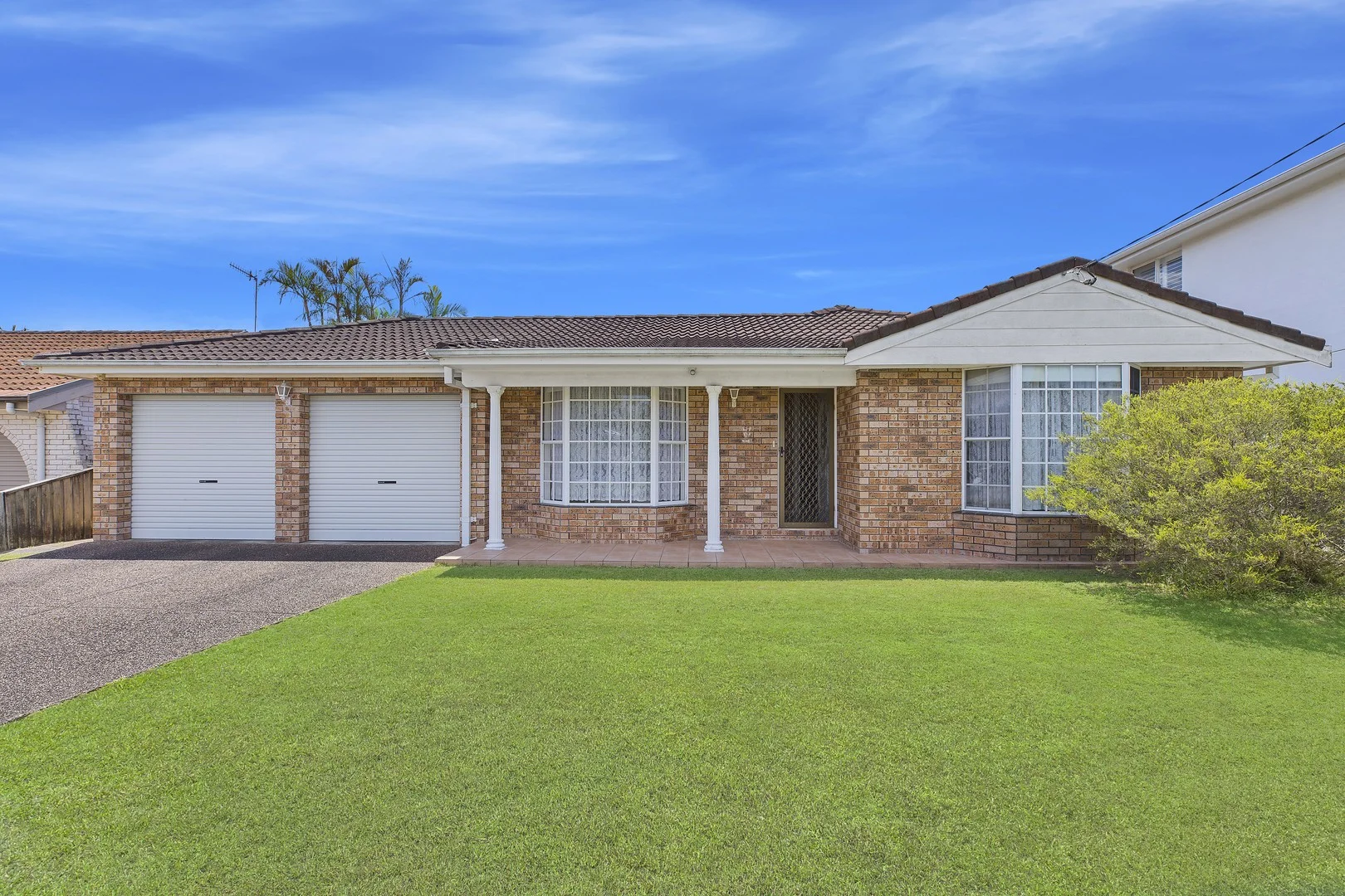
Description: Peacefully positioned in a highly sought-after cul-de-sac, this charming single-level brick and tile home offers the ideal blend of lifestyle and convenience-just moments from the beach, golf course, popular cafés, clubs, schools, and shopping. Boasting a sun-drenched north-facing rear aspect, the home features a well-designed floor plan with spacious light-filled living areas that capture refreshing sea breezes. Enjoy effortless entertaining in the large private outdoor area, overlooking the fully fenced yard on an approximately 601m² block-perfect for families or relaxed coastal living. This well-presented residence presents an exceptional opportunity for buyers seeking comfort, convenience, and a desirable beachside lifestyle in a prime location. - Spacious lounge and dining areas, with split system air conditioning for year round comfort, plus a sun-filled family room at the rear of the house - Three good sized bedrooms, all with built-in wardrobes - Two bathrooms, including ensuite to the main bedroom - Large timber kitchen with dishwasher, breakfast bar and loads of storage - Private covered outdoor area with a beautiful north facing aspect, overlooking the fully fenced yard, perfect for entertaining or relaxing whilst the kids and pets play - Double garage with drive-thru yard access, plus an additional carport, perfect for the boat - Superb lifestyle location, conveniently just moments to the beach, golf course, popular cafes, clubs, schools, and shopping Disclaimer: All information contained herein is gathered from sources we consider to be reliable, however we cannot guarantee or give any warranty about the information provided. All images, border/s, property boundaries and floor plans are indicative of the property and for illustrative purposes only. Any development potential stated herein is suggestive only and may be subject to relevant approvals, as such it is not to be relied upon. All distances and measurements are approximate. Interested parties must solely rely on their own enquiries.
Agent: Paul Witney - paul.witney@raywhite.com - 02 43344333
Agent: Penny Hancock - penny.hancock@raywhite.com - 02 4334 4333
Bateau Bay, NSW 2261
Land Size: 369.9 m²
Property Type: House
Listing Type: Residential
Status: Active
Summary: Another Sold by Peter Moran and Scott Falzon!
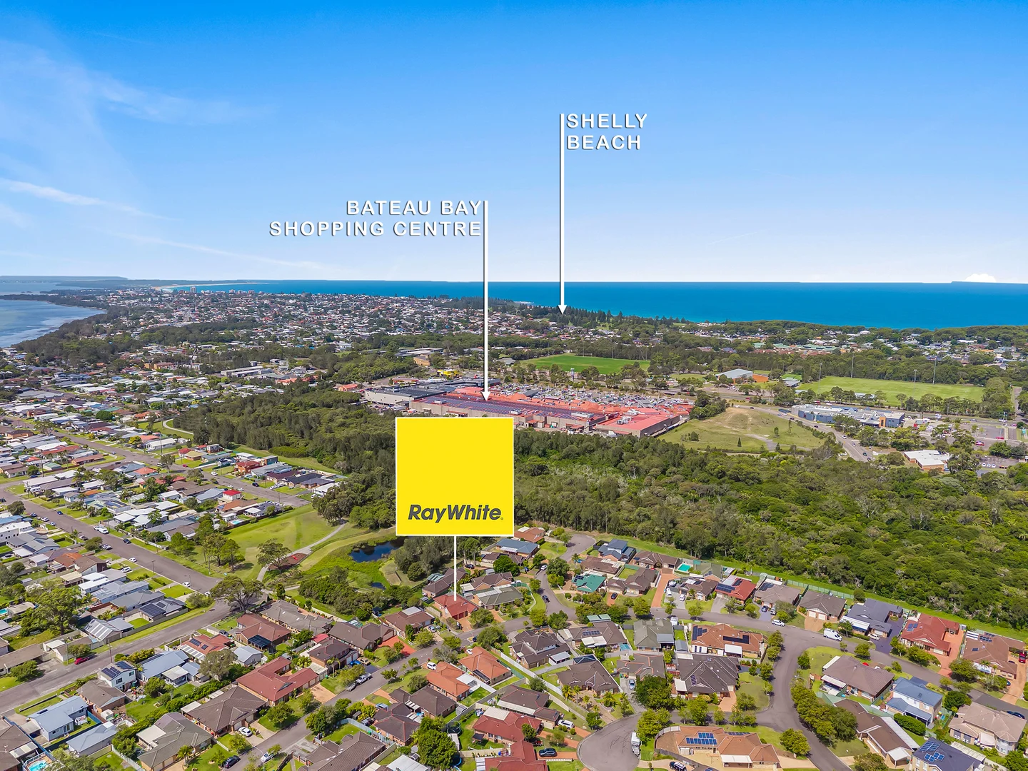
Description: Property Overview - Beautiful Home This neat single-level home offers the perfect combination of comfort, convenience, and low-maintenance living. Located in a highly sought-after, quiet neighbourhood, it's just a short stroll to essential amenities, making it ideal for retirees, first home buyers, singles, or investors. Features You'll Love Bright and airy open-plan living area Freshly carpeted throughout Two reverse-cycle air conditioning units (main lounge and main bedroom) Handy two-way bathroom with separate toilet Spacious north-facing covered entertaining area Large double garage with internal access and drive-through access - perfect for a small boat or trailer Low-maintenance yard for easy care living Location Highlights 10-minute walk to Bateau Bay Charter Square Shopping Centre Close to medical facilities, The Entrance Leagues Club, primary and pre-schools Bus stop nearby for easy transport 30-second stroll to park and open space for kids 15 to 20 minute walk to Bateau Bay Beach Why This Home Stands Out Perfect for a new family, retired couple, or single person Situated in a quiet, highly desirable neighbourhood Move-in ready - start enjoying your new home immediately Don't miss this opportunity! Contact us today to arrange your inspection. DISCLAIMER: This advertisement contains information provided by third parties. While all care is taken to ensure otherwise, Ray White Long Jetty | The Entrance does not make any representation as to the accuracy of the information contained in the advertisement, does not accept any responsibility or liability and, recommends that any client make their own investigations and enquiries. All images are indicative of the property only.
Agent: Peter Moran - peter.moran@raywhite.com - 02 4360 4360
Agent: Scott Falzon - scott.falzon@raywhite.com - 02 4360 4360
Bateau Bay, NSW 2261
Land Size: 556 m²
Property Type: House
Listing Type: Residential
Status: Active
Summary: SOLD by Mark Anderson 0416 144 286
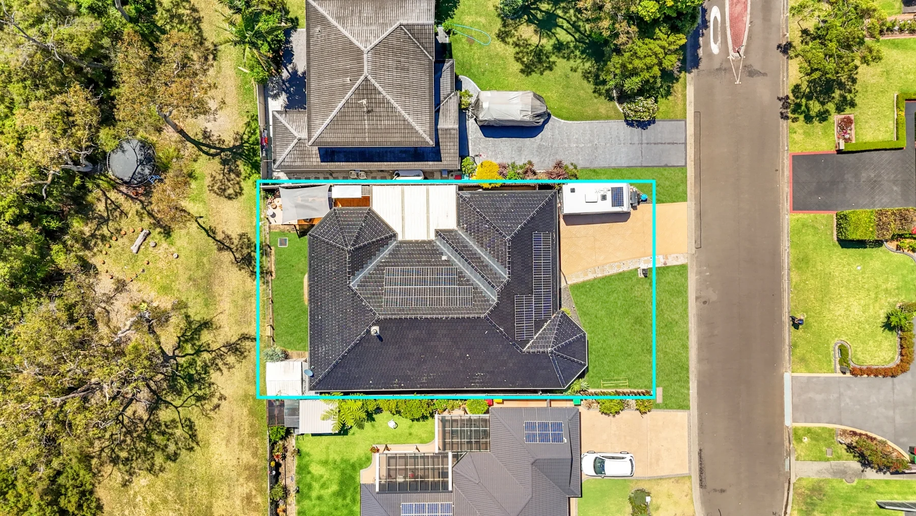
Description: Coastal Bushland Family Retreat Tucked away on a whisper-quiet street and embraced by untouched Australian coastal bushland, this expansive family home radiates warmth, calm and an unmistakable sense of sanctuary. Soaring ceilings and thoughtfully designed spaces create an atmosphere that feels both grand and deeply inviting, while natural gas, a slow-combustion fireplace and ducted air conditioning keep the home cosy and comfortable through every season. At its heart, a beautifully open family zone blends seamlessly with a gourmet kitchenperfect for slow mornings, busy weeknights and everything in between. The elegant formal lounge and dining spaces offer room to celebrate, reconnect and unwind, giving the home a rare versatility for families of all sizes. The master suite is a true retreat, featuring an ensuite, walk-in robe and a romantic bay window that welcomes soft morning light. Three additional bedrooms with built-ins ensure everyone has their own peaceful space. Outside, the low-maintenance gardens and covered entertaining area invite long lunches, sunset drinks and those quiet moments where you can simply listen to nature and breathe. Backing directly onto tranquil bushland, this home feels worlds awayyet still close to everything that matters. To view this property in person contact Mark direct on 0416144286 Email us today for further detailed property information. If you don't receive a response within 5 minutes, please check your junk mail! DISCLAIMER: The information in this advertisement has been provided by third parties. While Mark Anderson Property strives to ensure its accuracy, we do not guarantee or warrant its completeness. We accept no liability for errors, omissions, or misstatements and encourage prospective buyers to conduct their own independent investigations. All images are for illustrative purposes only.
Agent: Mark Anderson - mark@maproperty.com.au - 0416144286
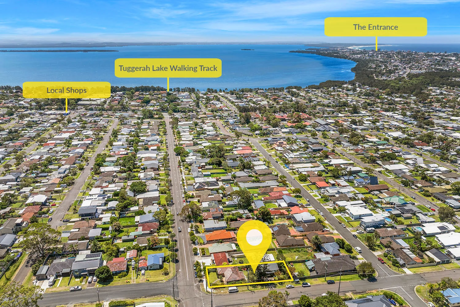
Killarney Vale, NSW 2261
Land Size: 739.8 m²
Property Type: House
Listing Type: Residential
Status: Active
Summary: Another Sold by Peter Moran and Linda Hall!
Description: This approved dual occupancy property is a fantastic opportunity for investors seeking an excellent return, or families wanting potential multi-generational living options. The property comprises a main three bedroom home currently rented for $560 per week, and a modern two bedroom granny flat leased for $480 per week, both with excellent tenants and long term possibilities. What sets this apart from others is the spaciousness of the dwelling set out. The property occupies a large approx 740sqm corner block whereby the house and the granny flat feel completely separated via dual street access, providing individual entry points, plenty of yard space and privacy between both buildings. The main house is deceivingly large inside, featuring timber floors and a light and airy ambience, whilst the granny comes with a large fully secure yard plus carport. Conveniently located within a ten minute walk to the local primary school, shops and cafes, five minutes drive to the beach, and approx 15 minutes drive to the M1 motorway or Tuggerah Train Station. This is one of the best dual occupancy set ups and investments you will find, so don't miss this one. DISCLAIMER: This advertisement contains information provided by third parties. While all care is taken to ensure otherwise, Ray White Long Jetty | The Entrance does not make any representation as to the accuracy of the information contained in the advertisement, does not accept any responsibility or liability and, recommends that any client make their own investigations and enquiries. All images are indicative of the property only.
Agent: Peter Moran - peter.moran@raywhite.com - 02 4360 4360
Agent: Linda Hall - linda.hall@raywhite.com - 02 4360 4360
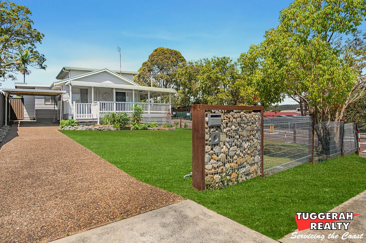
Killarney Vale, NSW 2261
Land Size: 613 m²
Property Type: House
Listing Type: Residential
Status: Active
Summary: Coastal Charm Meets Family Comfort on a Prime Corner Block
Description: Welcome to your dream home a spacious, sun-drenched coastal-inspired haven nestled on a generous corner block that invites nostalgic childhood memories. With a lush, grassed front yard ideal for play and relaxation, this property offers the ultimate blend of lifestyle and functionality. Inside, you'll find a recently renovated white kitchen that blends modern style with functionality, flowing seamlessly into open plan living and dining areas adorned with warm floorboards. At the rear of the home, a second lounge area features built-in storage and can easily be transformed into a fourth bedroom or a peaceful parents' retreat, with a third bedroom conveniently located just off this space. The bathroom has been beautifully updated and features a luxurious spa bath, perfect for unwinding after a long day. A second toilet in the laundry adds practicality for busy households. Upstairs, two additional bedrooms are enhanced by brand new carpet, ceiling fans, exposed beams, and built-in robes. The master bedroom boasts a unique elevated sleeping area, creating a subtle separation between rest and relaxation zones. Step outside to discover a covered entertainment area perfect for weekend barbecues, a sparkling inground pool that promises endless summer fun, and a brand-new shed for all your storage needs. This home offers a relaxed coastal lifestyle with thoughtful updates and versatile spaces, making it the perfect place to grow, entertain, and enjoy. Location highlights: Killarney Vale Public School directly across the road Killarney Vale Shops (Coles, cafes, medical services) approx. 500m Tuggerah Lake Foreshore walking and cycling track approx. 800m Bateau Bay Square Shopping Centre approx. 2.5km Toowoon Bay Beach approx. 3km The Entrance Beach and town centre approx. 3.5km Shelly Beach approx. 4km Shelly Beach Golf Club approx. 4km Don't miss this opportunity to secure a versatile, stylish home in a sought-after coastal location. Enquire today to arrange your inspection and experience the best of Central Coast living. Disclaimer: All information about the property has been provided to Tuggerah realty by third parties. Parties looking should make and rely on their own enquiries in relation to the property. We have obtained all information in this document from sources we believe to be reliable; however, we cannot guarantee its accuracy. Prospective purchasers are advised to carry out their own investigations Disclaimer: This advertisement contains information provided by third parties. While all care is taken to ensure otherwise, Tuggerah Realty, does not make any representation as to the accuracy of any of the information contained in the advertisement, does not accept any responsibility or liability and recommends that any client make their own investigations and enquiries. All images are indicative of the property only.
Agent: Glenn Harrison - glenn@tuggerahrealty.com.au - +61 2 4352 1950
Agent: Holly Harrison - sales@tuggerahrealty.com.au - +61 2 4352 1950