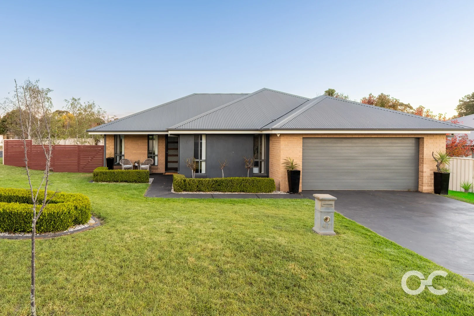
47 Melaleuca Way
Orange, NSW 2800
Neighbourhood & everyday essentials
Explore around Orange, from school days to weekends.
Area figures
- schools in Orange
- 16
Find schools, playgrounds and children’s classes. Browse by age to plan school days and weekends.
Area figures
- residents (ABS, June 2024)
- 44,610
- children aged 0–14
- 9,301
- schools
- 19
- parks & libraries
- 27
- kids’ activity providers listed
- 10
Most-listed activities: Tennis, Swimming, AFL
Population figures: Australian Bureau of Statistics
Explore local libraries, community spaces, schools and council programs across the wider area.
Parks, playgrounds & public spaces
Beech Crescent Park
Beech Cres, Orange, New South Wales, 2800
235 m straight-line distance
Withington Park
Kengdelt Pl, Orange, New South Wales, 2800
454 m straight-line distance
Agland Park
Barrett Ct, Orange, New South Wales, 2800
721 m straight-line distance
Calare Park
Wentworth Ln, Orange, New South Wales, 2800
879 m straight-line distance
Things to do near this home
Explore nearby play centres and family attractions from the directory. Check ages, entry prices and opening hours with the venue.
Find more ideas by age, budget and indoor or outdoor setting on Things to do. Dated events are in What’s on. See what’s on
Discover local guides & family ideas
Read local family guides and practical articles as you explore life around this home.

Kids' Activities per Child: Australia's Best- and Thinnest-Covered Council Areas (2026)
Across Australia's big council areas, the AroundSchools directory lists a median of about 10 kids' activity providers for every 10,000 children — but in Melbourne's Wyndham it is 3.9, and in the City…
Read more →
Most Livable Suburbs in New South Wales for Families (2026)
Sydney lists more kids' activities in our directory than any other suburb in NSW. This page ranks NSW suburbs by how much a family moving there could actually do with their kids, then adds what else…
Read more →Everyday essentials & getting around
Open the map to choose a destination and check journey times from this address. Walking routes, step-free access and travel times have not been verified.
Flood & development checks
Property-specific flood risk and announced developments have not been verified. Search this address in the official maps and ask the council for current flood information.
Source: AroundSchools directory. Distances are straight-line distances, not walking routes. Confirm facilities on the linked detail pages. Directory update dates are not supplied for this summary.
Property Details
758 m²
House
RESIDENTIAL
What's Nearby

Withington Park
Kengdelt Pl, Orange

Central West Gymnastics
Barrett Ct, Orange
Ken River Park
Woodward St, Orange
Elephant Park
Woodward St, Orange
Norton Park
Rifle Range Rd, Orange

Orange Aquatic Centre
Hill St, Orange
Cook Park
Summer St, Orange
Waraninta Park
Gardiner Rd, Orange

Orange Ex-Services' Club Tennis Complex
Kite St, Orange
Nearby Schools

Canobolas Public School
Canobolas Rd, Orange NSW 2800

Orange Christian School
500 Cecil Road, Orange NSW 2800 Australia

Calare Public School
Calare Public School, ORANGE NSW 2800

Orange High School
Woodward St, Orange NSW 2800

Anson Street School
Orange NSW 2800

Borenore Public School
1243 The Escort Way, BORENORE NSW 2800
Nearby schools do not imply enrolment eligibility. Confirm catchments, year levels and childcare availability directly with the provider.
Nearby Properties
Recently sold nearby
Homes that have sold close to this address. We don’t show sale prices.
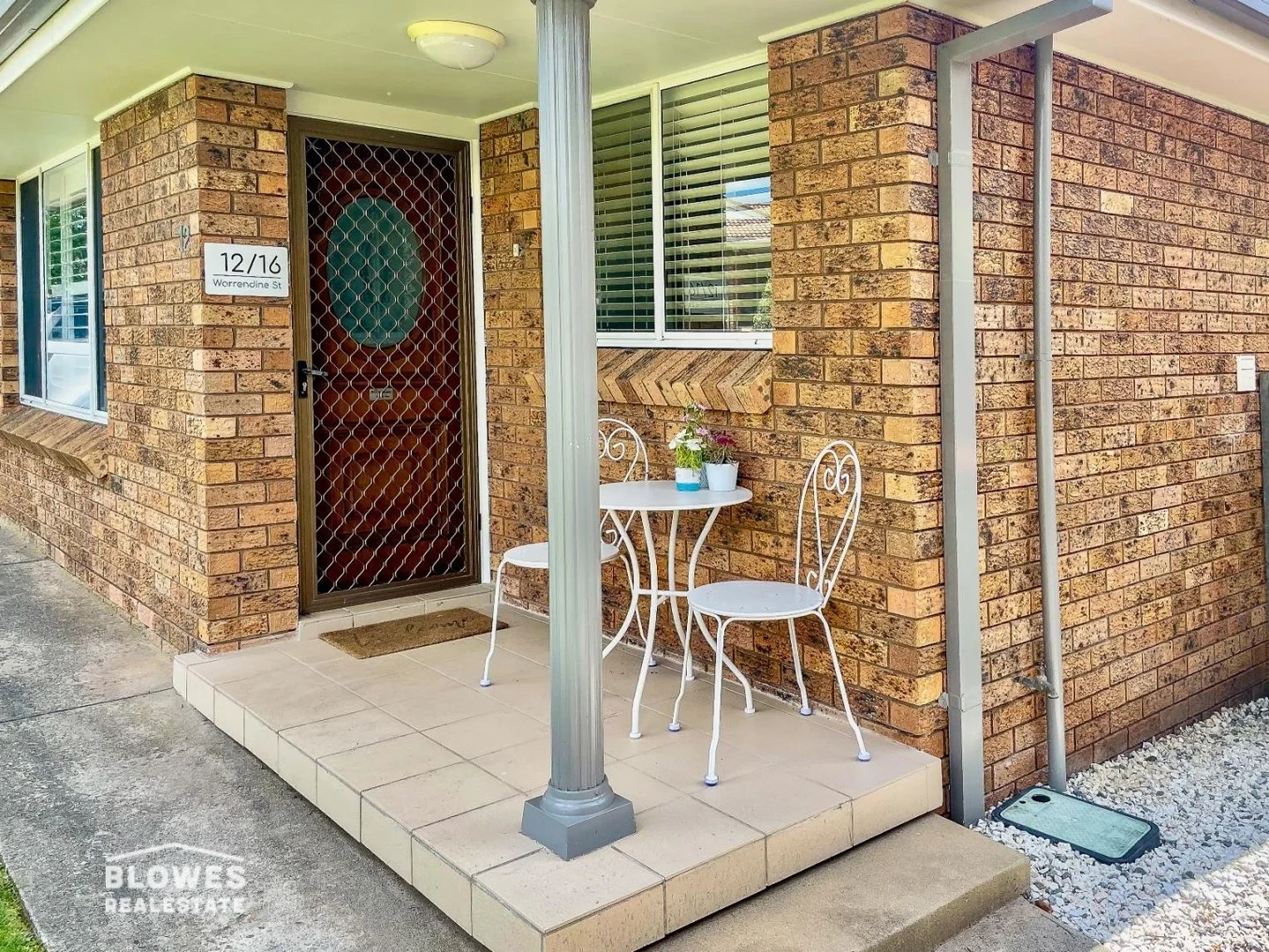
Orange, NSW 2800
Property Type: Apartment / Unit / Flat
Listing Type: Residential
Status: Active
Summary: INVESTORS, BETTER BE QUICK FOR THIS ONE!
Description: What a great location, walking distance to town and across the road from Orange Aquatic Centre, Orange City Bowling Club and more. The unit has 2.5 bedrooms and along with the main bathroom it also has an en-suite of the master bedroom. There are ceiling fans in the bedrooms and living room, and a reverse cycle A/C in the living area. As you can see from the photos of the property, it is in excellent condition, and currently tenanted with a good return until February 2026. FEATURES: - Paint and floor coverings in good condition - Great kitchen with modern appliances - Large built in robe in master bedroom plus en-suite - Plantation shutters in the lounge room - Good size 2nd bedroom plus 3rd bedroom or office behind the garage - Single lock up garage with internal access LOCATION: - Orange Aquatic Centre - Orange City Bowling Club - Cook Park, Elephant Park - Walk to the CBD
Agent: Chris Tyack - chris@blowesre.com.au - 02 6362 1233
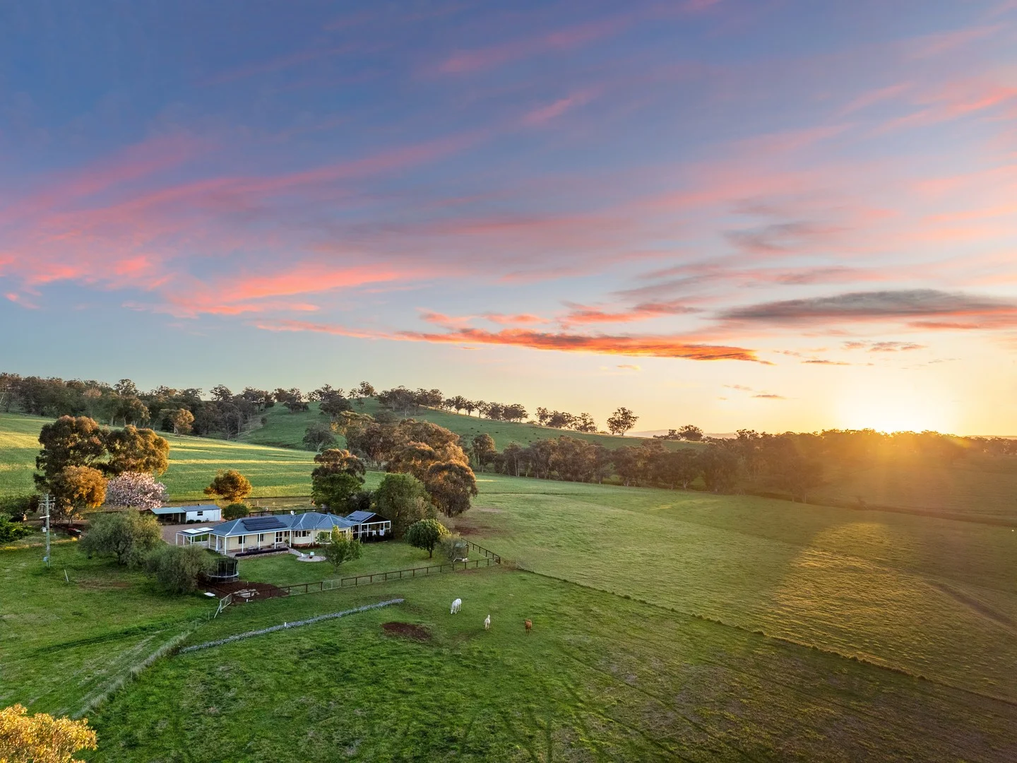
Orange, NSW 2800
Land Size: 61300 m²
Property Type: Rural
Listing Type: Residential
Status: Active
Summary: "Muirfield" - Modern Country Luxury for the Whole Family
Description: Set on 15 acres of gently rolling countryside, "Muirfield" delivers the perfect balance of modern design and rural tranquillity. The beautifully renovated family home combines style, space and practicality, with landscaped gardens and thoughtful details throughout. Inside, the heart of the home is the designer kitchen, featuring a 900 mm Falcon Professional Series oven, engineered stone benchtops, and an integrated Bosch dishwasher. Perfect for family gatherings and relaxed entertaining, the open-plan living and dining areas flow seamlessly to the outdoor entertaining spaces, enhanced by spotted gum floors that add warmth and timeless style throughout. With ducted air conditioning, a 10kW solar system, and a sun-drenched north-facing aspect, the home offers effortless comfort and energy efficiency year-round. Four spacious bedrooms, including a master suite with a walk-in robe and ensuite, provide plenty of room for every family member to unwind. A separate study (or fifth bedroom) supported by reliable Starlink internet provides the perfect work-from-home setup or homework zone, and the dedicated children's play areas within the landscaped gardens offer endless opportunities for outdoor adventure and imaginative play. Beyond the home, the property delivers all the benefits of a true country lifestyle without compromise. There are three newly fenced paddocks and a holding yard, all with their own water supply, a large multipurpose shed with stables and a hot-water wash bay, a separate tack room, brand-new hardwood post-and-rail fencing, 135,000 L of water storage, and a dam. Whether you're a hobby farmer, an equestrian family, or simply seeking space to breathe, this property has it all. Nestled within the tightly held Bowan Park district, "Muirfield" offers a rare blend of seclusion and connection to community. Unwind on the terrace, watch the sun fall across the paddocks, and enjoy the ease of country living at its most comfortable. Property Highlights: Master suite with walk-in robe and ensuite featuring a marble vanity benchtop, underfloor heating, and heated towel rails Three additional bedrooms with built-ins, plus separate study (or fifth bedroom) Generous main bathroom with underfloor heating and heated towel rails Open-plan kitchen and dining with 900mm Falcon oven with induction cooktop, engineered stone benchtops, and integrated Bosch dishwasher Spacious living room filled with natural light and views across the property Laundry with ample storage and third toilet LG ducted reverse-cycle and zoned air conditioning plus ceiling fans in all bedrooms North-facing aspect and 10kW solar system for year-round energy efficiency Landscaped grounds by Sally Bourne with two entertaining areas, raised garden beds, and dedicated children's play spaces Three paddocks and a holding yard with water supply Large multipurpose shed with power, stables, hot water wash bay and tack room Double garage with power plus double carport 135,000L water storage, dam Starlink internet professionally installed FAST FACTS: Property Built: 1994 Land Size: 6.13 Ha (15 acres) House Size: 213 sqm Rates: $672.19 yearly School Zones: Cudal Public School and Molong Central School DISCLAIMER All information (including but not limited to the property areas, floor size, price, address and general property description, opinions and/or articles) on the McGrath website is provided for general information and/or educative purposes only. The content does not constitute professional advice (be it of a legal, financial or taxation nature) and should not be relied upon as such.
Agent: Josh Fitzgerald - JoshFitzgerald@mcgrath.com.au - 02 7903 0753
Agent: Team Fitzgerald - teamfitzgerald@mcgrath.com.au - 02 7903 0753
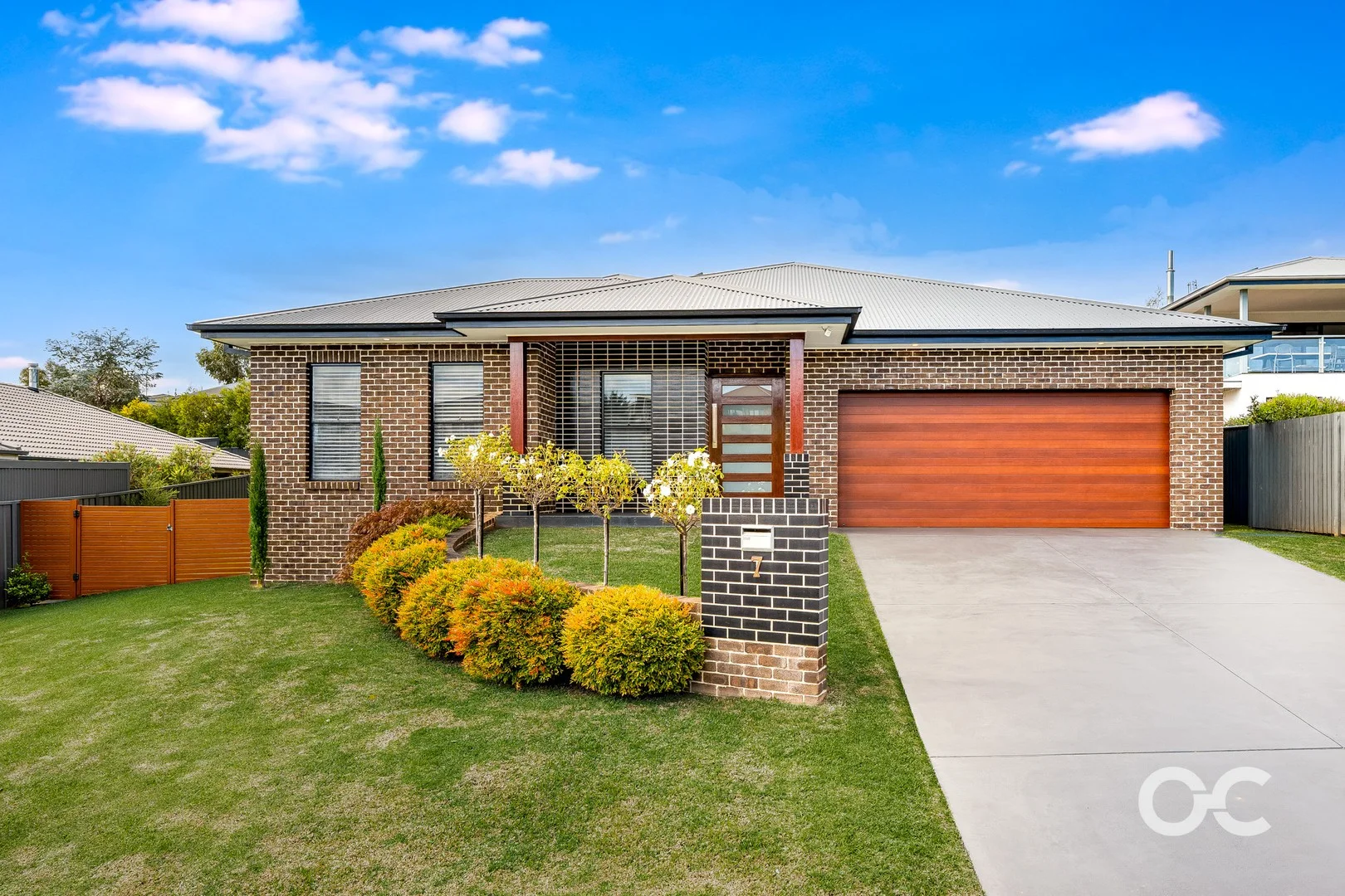
Orange, NSW 2800
Land Size: 900 m²
Property Type: House
Listing Type: Residential
Status: Active
Summary: Impressive Family Home with Established Gardens, Spacious Living and Outdoor Entertaining
Description: Set on an impressive 900sqm parcel in the ever-popular Wentworth Estate, 7 Isaac Drive is more than just a home - it's a private retreat where space, light and lifestyle come together beautifully. From the moment you step inside, soaring ceilings and sun-drenched interiors create an immediate sense of openness, while the thoughtfully designed layout offers both connection and quiet retreat. At the heart of the home, the open-plan kitchen, living and dining zone flows effortlessly, complemented by a separate family room and dedicated home office. The master suite is a true sanctuary with its walk-in wardrobe and ensuite, while the remaining bedrooms are generously sized and equipped with built in wardrobes. The backyard is a real highlight, with established gardens, a generous lawn and plenty of space to enjoy. The covered alfresco area, complete with ceiling fan, enjoys a lovely outlook over the established gardens and manicured lawn - ideal for effortless entertaining. Features: - Master bedroom complete with walk in wardrobe and enuite with underfloor heating - Three additional bedrooms all with built in wardrobes - Modern three way bathroom - Open plan kitchen living and dining - Spacious kitchen with grand island bench plus butlers pantry - Separate family room - Home office - Additional third toilet/powder room - High ceilings - Ducted heating and cooling plus woodfire - Abundance of natural light - Lots of storage throughout - 6.5 KW solar system - Optic fibre internet connection - Large outdoor alfresco area with ceiling fan - Spacious 900sqm block with rear yard access - Beautiful well maintained established gardens and lawn - Conveniently located within walking distance to the Ploughmans Wetlands and The Wentworth Orange - Estimated rental return: $750 - $790 per week - Rates per quarter: $761 Information published by Our City Real Estate on its website and in its advertising and marketing materials is obtained from sources the Agency deems trustworthy and reliable. While we make every effort to obtain and use accurate information, we take no responsibility for any inaccuracies within that information and will not be liable for any losses incurred through its use. We recommend that interested people source their own information before making decisions.
Agent: Lan Snowden - lan@ourcityrealestate.com.au - 02 5326 5700
Agent: Libby Wilder - libby@ourcityrealestate.com.au - 02 5326 5700
Agent: Adam Harrison - adam@ourcityrealestate.com.au
Orange, NSW 2800
Land Size: 689 m²
Property Type: House
Listing Type: Residential
Status: Active
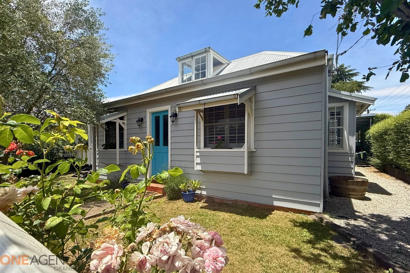
Summary: Perfectly Positioned, Fully Renovated & Full of Character
Description: Nestled just a few blocks from the CBD, this beautifully renovated home at 78 Cecil Road offers an exceptional lifestyle for buyers seeking timeless charm paired with modern luxury. Set in one of Orange's most convenient pockets, you'll enjoy the ease of walking to shops, cafés and the serene surrounds of Elephant Park, complete with walking trails, playgrounds and leafy picnic spots. WHAT WE LOVE Step inside and be greeted by expansive, light-filled interiors designed for effortless living and entertaining. The spacious open-plan living area flows seamlessly to a sun-drenched north-facing deck-ideal for long lunches, family BBQs or simply soaking up the afternoon warmth. At the heart of the home sits the fully renovated kitchen, complete with sleek modern finishes and a 900mm five-burner gas stove, perfect for those who love to cook. Offering four generous bedrooms-including two with built-in robes-the home's accommodation is complemented by a stunning federation-inspired bathroom. Finished with pressed metal ceilings, a marble-top double vanity and a classic claw-foot bath, it's the perfect blend of elegance and history. A versatile loft space provides a fantastic retreat for the kids or an ideal study zone, and the second bathroom at the rear adds excellent practicality for families or guests. Character features such as stained-glass windows are showcased throughout, adding soul and uniqueness to this charming boutique home. WHAT YOU'LL LOVE - Two living areas - Reverse-cycle split system air conditioning in the living area - Ducted gas heating throughout - Laundry with 2nd bathroom - Two carportsand 7m x 5m shed - Established gardens with fruit trees and raised garden beds - Quiet, convenient location close to parks and the CBD - Generous corner block with room for a granny flat (stca) Currently leased to quality tenants at $700 per week (fixed term until April 2026) Council Rates: $699 per quarter Beautifully presented, wonderfully located, and thoughtfully updated-this is the perfect place to call home or a fantastic investment opportunity in one of Orange's most sought-after pockets. Information published by One Agency Orange on its website and in its advertising and marketing materials is obtained from sources the Agency deems trustworthy and reliable. While we make every effort to obtain and use accurate information we take no responsibility for any inaccuracies within that information and will not be liable for any losses incurred through its use. We recommend that interested people source their own information before making decisions.
Agent: Bianca Sciuto - biancasciuto@oneagency.com.au
Orange, NSW 2800
Land Size: 692 m²
Property Type: House
Listing Type: Residential
Status: Active
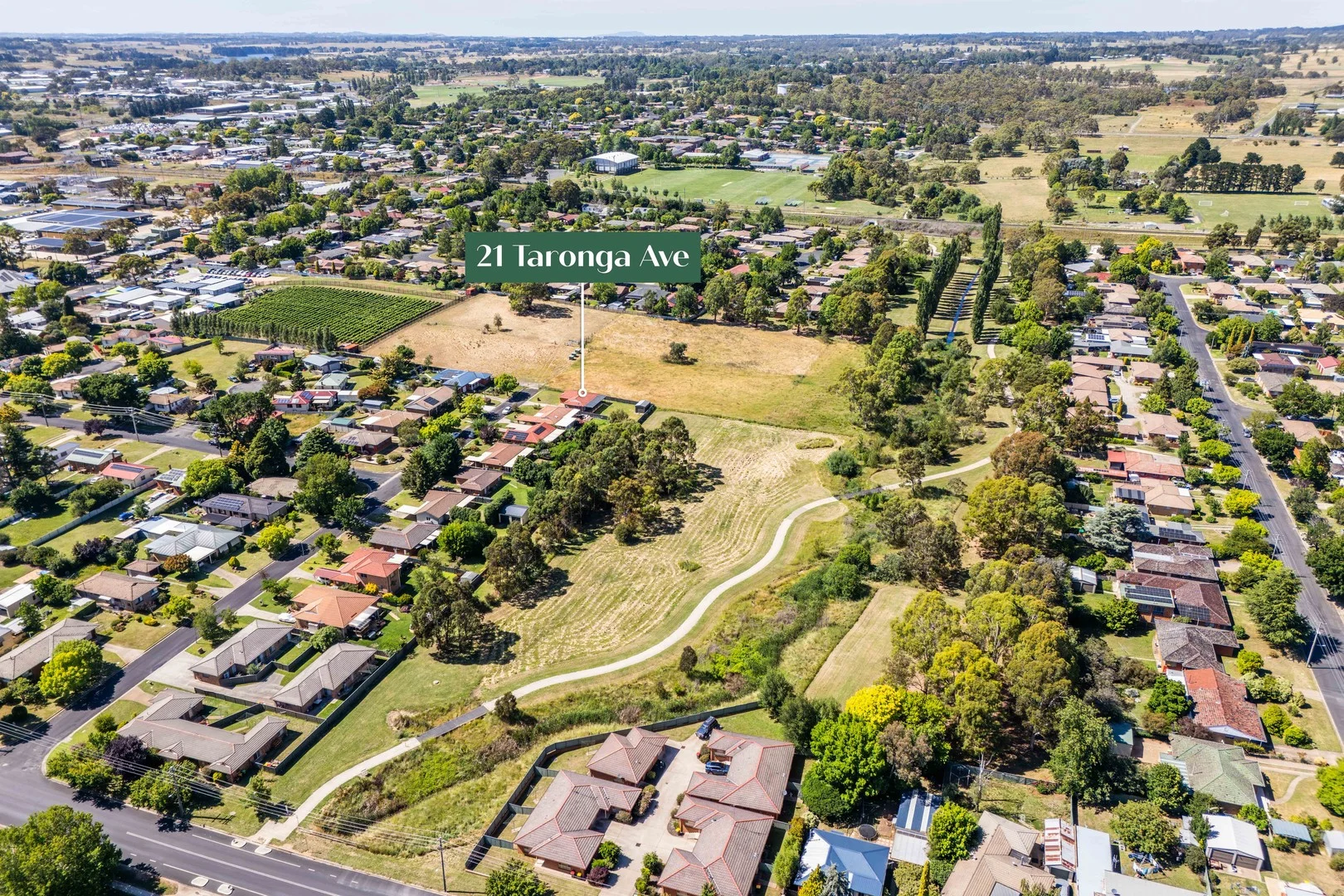
Summary: Parkside Privacy in South Orange
Description: Please Note: Due to the strong level of interest in this property, the vendors have requested that all best and final offers be submitted by Tuesday, 3:00pm 6th January 2026. If you would like to make an offer, please contact the agent to receive the required documentation and a clear explanation of the process. Positioned in a quiet South Orange pocket and backing directly onto Nelson Park, 21 Taronga Avenue, Orange offers a highly appealing combination of privacy, natural light and outstanding outdoor space. With no rear neighbours and the Anson Street School Agriculture Department facility adjoining to the left, the home enjoys an open setting with minimal residential density - a rare find this close to town. Ideal for downsizers, first-home buyers and investors, the home is compact, solid and functional, offering comfortable living with excellent scope for cosmetic updates to add value over time. Inside, the efficient floorplan features three bedrooms, all with built-in robes, and excellent storage throughout including a large linen cupboard. Bedroom one comfortably accommodates a queen-size bed, bedroom two suits a queen or double, while bedroom three is ideal as a single bedroom or, for those not requiring three bedrooms, a bright and practical home office. The central bathroom includes a separate bath and shower, while the functional kitchen and dining area is equipped with a gas cooktop, electric oven and good storage. The adjoining living area is filled with natural light and the home is serviced throughout by ducted reverse-cycle air conditioning, providing year-round comfort. Set on a generous 692m² block, the property's standout feature is the large covered outdoor patio, creating an excellent extension of the living space and overlooking the fully fenced backyard and adjoining parkland - ideal for entertaining, relaxing or family use. A rear gate provides direct access to Nelson Park, a popular green corridor offering open space, walking tracks and recreation facilities. From here, sealed footpaths connect all the way into the Orange CBD, making it ideal for walking, bike riding and kids heading out to play. The home also falls within one of Orange's most highly regarded school catchments, including Orange Public School and Orange High School, adding further long-term appeal. Practicality is enhanced by a drive-through single lock-up garage with access to the rear yard, along with a separate single-bay shed positioned at the rear of the block - ideal for additional storage, a workshop or hobby space. With an estimated rental return of $500$520 per week, a generous landholding, direct park access and clear value-add potential, 21 Taronga Avenue presents a compelling opportunity to secure a solid home with exceptional outdoor appeal in a tightly held South Orange location. Points of Interest & Lifestyle Highlights: - Direct rear access to Nelson Park via private back gate - 450m to kids' play equipment within Nelson Park - 300m to Machin Dog Park - 750m walk to Cecil's Café via park footpaths - 950m to Orange Aquatic Centre - 950m to Orange City Bowling Club - 950m to Orange Velodrome - 1.8km to Orange CBD Key Features: - Solid home with excellent scope for cosmetic improvement - Generous 692m² block - Large covered outdoor patio - Three bedrooms with built-in robes - Light-filled living and dining areas - Whole-home ducted reverse-cycle air conditioning - Central bathroom with separate bath and shower - Fully fenced backyard with rear gate to Nelson Park - Drive-through single lock-up garage - Separate single-bay shed at rear of block **Disclaimer** - All boundaries and point of interest markers within this advertising are to be used only as a guide. - Photography contains virtual styling. - All information contained herein is gathered from sources we deem to be reliable. However, we cannot guarantee its accuracy and interested persons should rely on their own enquiries.
Agent: Tom Figuero - tom.figuero@belleproperty.com - 02 6362 6566
Agent: Josh Mastronardi - josh.mastronardi@belleproperty.com - 02 6362 6566
Orange, NSW 2800
Land Size: 620 m²
Property Type: House
Listing Type: Residential
Status: Active
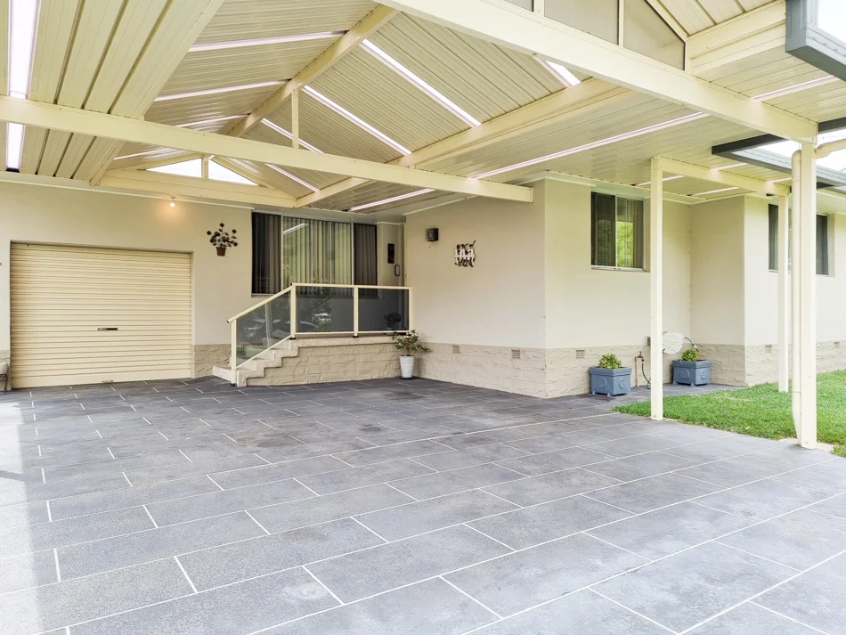
Summary: Spacious Family Home with Endless Possibilities
Description: Welcome to 24 Woodward Street, Orange a beautifully designed 5-bedroom home offering comfort, space, and versatility in a peaceful location. All five bedrooms are generously sized and feature built-in robes, ensuring ample storage. The home boasts two bathrooms, including one with a relaxing spa bath, perfect for unwinding after a long day. With both formal and casual living areas, there's plenty of room for the whole family to spread out. The well-appointed kitchen features extensive bench space, a dishwasher, and an adjoining dining area with a skylight, creating a bright and inviting atmosphere. Stay comfortable year-round with ducted gas heating and reverse-cycle air conditioning. The laundry provides plenty of storage, and a large hallway storage area adds to the home's practicality. A true standout of this property is the large shed, complete with a sink and toiletideal for hobbies, additional storage, or even a home business. Expansive undercover entertaining area, seamlessly connecting the house to the shedperfect for gatherings. Low-maintenance, peaceful backyard, offering a private retreat Nestled at the southern end of Woodward Street, this home is just moments from parks, schools, and offers easy access to the CBD. Don't miss this fantastic opportunitycontact us today to arrange an inspection! Rates approx. $2680 p.a
Orange, NSW 2800
Land Size: 973 m²
Property Type: House
Listing Type: Residential
Status: Active
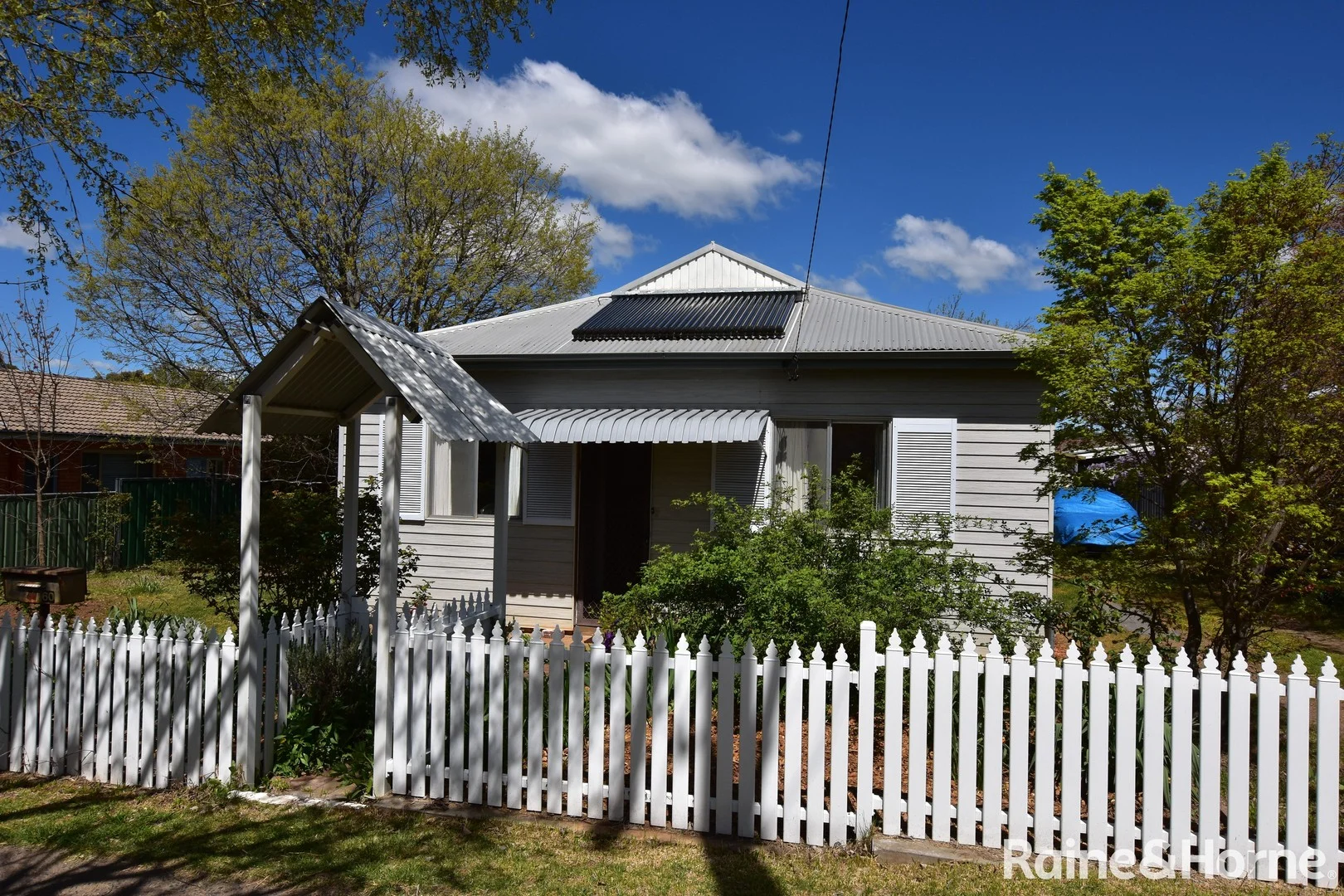
Summary: Spacious Four Bedroom Home on a Large Land Holding with Subdivision or Redevelopment Potential STCA.
Description: This charming home sits behind a picket fence in a highly regarded area of Warrendine, so close to the centre of town. You are two blocks walk to the Orange Aquatic Centre & City Bowling Club & can enjoy the local pathways with a walk to town & you are close to so many other city facilities. You are handy to any number of nearby schools, as well as being in the Orange Public & Orange High School catchment. The home has updated exterior cladding, new guttering & solar hot water. The interior offers plenty of space to realise your dreams & includes an updated timber kitchen, with two pantries, an electric stove & dishwasher & a renovated bathroom with a separate toilet. The loungeroom has a split system air conditioner & the separate dining room has a gas heater & the rest of the home is in original condition, allowing you to improve & update, with a fresh coat of paint & improvements at a time, to suit your own needs. The large land holding is 973 square metres & feels like your very own park & you can have vehicle access or driveways, either side of the home into the back yard. This would offer space to build a second home or a granny flat or Subdivision or total Redevelopment potential, all subject to council approval. The yard is fully fenced & very private & over many years, has been a great playground for kids to run & play. The yard includes a studio, a single garage, a concrete slab for a car port, a vegetable patch, a sand pit & a water tank for the garden. There are many possible outcomes including development/investment potential, STCA or simply having a home, where you can update & renovate, to have the home of your dreams in a top West Orange location.
Agent: James Eddy - james.eddy@orange.rh.com.au - 02) 6362-1366
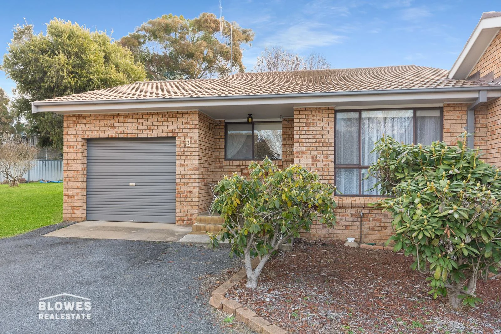
Orange, NSW 2800
Property Type: Apartment / Unit / Flat
Listing Type: Residential
Status: Active
Summary: GREAT TWO BEDDER IN EXCELLENT LOCATION!
Description: Living in a cul-de-sac is great because you have a lot less traffic; but a tidy two bedroom unit in great part of town in a cul-de-sac is even better. This unit is ready to move into and would suit anyone looking for a peaceful lifestyle within a small unit complex just of Wentworth lane. There are two good size bedrooms both with built in robes, updated modern bathroom tiled floor to ceiling, large north facing living/lounge room, dining room, and a great galley style kitchen with stone bench tops, dishwasher and near new oven/cooktop. Other great features include: • Extra long single garage, so room for storage • Lawned common with trees adjoins the property • Great investment potential (approx $450 to $470PW) • 750m walk to Elephant Park, 2.45klm drive to CBD • 171sqm block, covered outdoor alfresco, secure yard - Great location and in excellent condition - South/West Orange location - Three minute walk to Calare school - Quiet location
Agent: Chris Tyack - chris@blowesre.com.au - 02 6362 1233
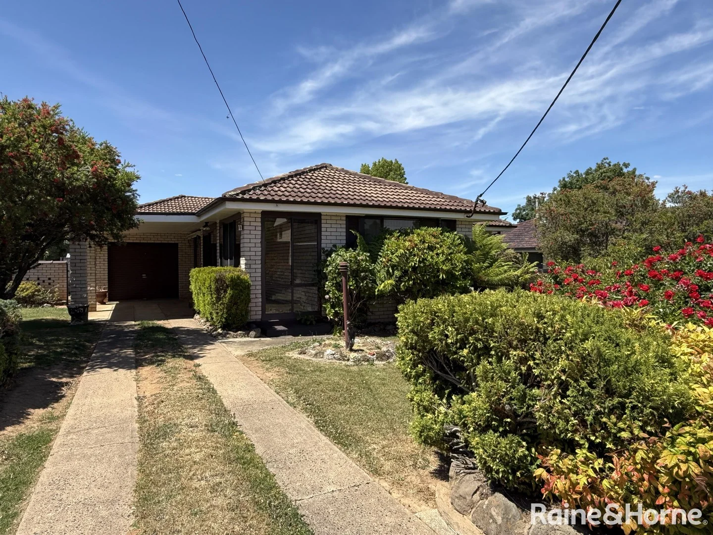
Orange, NSW 2800
Land Size: 556.4 m²
Property Type: House
Listing Type: Residential
Status: Active
Summary: In A Quiet, South Orange Neighbourhood with a Northern Aspect to its rear yard
Description: It's Centrally Located in Close Proximity to all inner-city facilities, the Aquatic Centre, Bowling Club, James Sheahan High School & the Christian School. Due for a makeover & in need of some works, this home is a blank canvass, so you can move in & undertake any works, at your own pace. It comprises a flexible floor plan, with additional living areas. An enclosed entry alcove, creates an extra sitting nook, or study. Leading off this, is the tiled hallway, which opens onto a large separate living room. There's an adjoining meals area, plus updated kitchen, which includes an electric stove, breakfast bench & an abundance of cupboards. Located off the meals area, is a separate north facing sunroom, which soaks up the all-day sun & overlooks the private rear garden. All bedrooms are spacious with built-in wardrobes. The bathroom requires some works & is complete with a bathtub, shower recess & vanity, whilst the toilet is separate. The home is complete with a split system air-conditioner & electric heating & there is a ducted natural gas heating system, which is not fully operational. The garage provides both internal access & access to the rear yard. It's set on an established & sunny, private courtyard style rear garden, with a pergola/BBQ area, additional storage sheds & the gardens could easily be transformed, as they have many established plants & shrubs. This home has unlimited potential, both inside & out, just waiting for a new owner to make it, their own. For the Investor with a makeover, to the bathroom & new paint & carpet it would rent in the vicinity of $ 560-00 per week. It's a spacious home, located in a highly regarded & well held neighbourhood, close to the centre of town & all amenities.
Agent: Roger Eddy - roger.eddy@orange.rh.com.au - 02 6362 1366