69 Matcham Road
Matcham, NSW 2250
Neighbourhood & everyday essentials
Explore around Matcham, from school days to weekends.
Find schools, playgrounds and children’s classes. Browse by age to plan school days and weekends.
Area figures
- residents (ABS, June 2024)
- 354,803
- children aged 0–14
- 63,020
- schools
- 109
- parks & libraries
- 126
- kids’ activity providers listed
- 109
Most-listed activities: AFL, Tennis, Female AFL
Population figures: Australian Bureau of Statistics
Explore local libraries, community spaces, schools and council programs across the wider area.
Parks, playgrounds & public spaces
Fernries Reserve
Oak Rd, Matcham, New South Wales, 2250
2.0 km straight-line distance
Terrigal Park
Charles Kay Dr, Terrigal, New South Wales, 2260
2.2 km straight-line distance
Duffys Reserve
Terrigal Dr, Terrigal, New South Wales, 2260
2.3 km straight-line distance
Terrigal Rotary Park
Terrigal Dr, Terrigal, New South Wales, 2260
2.7 km straight-line distance
Duffys Reserve: Sports courts / fields, Parking
Things to do near this home
Explore nearby play centres and family attractions from the directory. Check ages, entry prices and opening hours with the venue.
Find more ideas by age, budget and indoor or outdoor setting on Things to do. Dated events are in What’s on. See what’s on
Discover local guides & family ideas
Read local family guides and practical articles as you explore life around this home.

Kids' Activities per Child: Australia's Best- and Thinnest-Covered Council Areas (2026)
Across Australia's big council areas, the AroundSchools directory lists a median of about 10 kids' activity providers for every 10,000 children — but in Melbourne's Wyndham it is 3.9, and in the City…
Read more →
Most Livable Suburbs in New South Wales for Families (2026)
Sydney lists more kids' activities in our directory than any other suburb in NSW. This page ranks NSW suburbs by how much a family moving there could actually do with their kids, then adds what else…
Read more →Everyday essentials & getting around
Open the map to choose a destination and check journey times from this address. Walking routes, step-free access and travel times have not been verified.
Flood & development checks
Property-specific flood risk and announced developments have not been verified. Search this address in the official maps and ask the council for current flood information.
Source: AroundSchools directory. Distances are straight-line distances, not walking routes. Confirm facilities on the linked detail pages. Directory update dates are not supplied for this summary.
Property Details
12140.56926 m²
RURAL
RESIDENTIAL
Upcoming Events Nearby

Fri, 25 Sept · Toukley
Lego club at Toukley Library
Ages 8–12
Sat, 24 Oct · Brookvale
Brookvale Halloween Festival 2026
Wed, 31 Dec · Brookvale
Birthday Parties - AAGI | 1st Jan to 20th Dec-2026
Ages 2–18
Wed, 31 Dec · Brookvale
Free Trial - AAGI | 1st Jan to 23rd Dec-2026
Ages 1–18
Mon, 16 Mar · Willoughby
Pottery class - Silky Shapes Studio | 17-Mar to 19-Dec-2026 🫙
Ages 10–85
Thu, 22 Oct · Lane Cove
50 Years of Delvena Refuge
What's Nearby

Des Johns Aquatic & Fitness
Serpentine Rd, Terrigal

Paul Oval
Milina Rd, Holgate

Breakers Country Club
Wamberal
Brendan Franklin Oval
Beaufort Rd, Terrigal
Fernries Reserve
Oak Rd, Matcham
Terrigal Park
Charles Kay Dr, Terrigal
Duffys Reserve
Terrigal Dr, Terrigal

Gracie Jiu Jitsu Central Coast
Chetwynd Rd, Erina

Gosford Gymnastics
Gooriwa Rd, Holgate
Nearby Schools

Erina Heights Public School
Serpentine Rd, Erina Heights NSW 2260

Our Lady Star of the Sea Catholic Primary School
165 Serpentine Road, Terrigal NSW 2260 Australia

Central Coast Grammar School
1 Arundel Road, Erina Heights NSW 2260 Australia

Holgate Public School
RMB 5255 Wattle Tree Rd, Holgate NSW 2250

Aspect Central Coast School
Terrigal NSW 2260

Terrigal High School
Charles Kay Drive, Terrigal NSW 2260
Nearby schools do not imply enrolment eligibility. Confirm catchments, year levels and childcare availability directly with the provider.
Nearby Properties
Recently sold nearby
Homes that have sold close to this address. We don’t show sale prices.
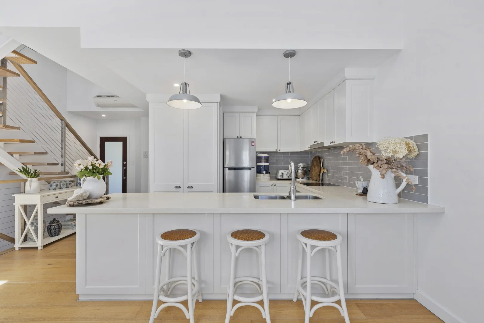
Wamberal, NSW 2260
Property Type: Townhouse
Listing Type: Residential
Status: Active
Summary: Refined Coastal Living In A Secure Boutique Complex
Description: Located within a peaceful and secure boutique complex comprising a limited number of residences, this beautifully designed townhouse delivers sophisticated coastal living in one of Wamberal's most tightly held addresses. Light-filled open-plan living is enhanced by soaring vaulted ceilings, creating an inviting sense of space ideal for both everyday relaxation and effortless entertaining. Spread across three thoughtfully zoned levels, the home offers three generous bedrooms, two bathrooms, an entertainers' kitchen and a flexible floorplan that balances privacy with connection. Whether you're seeking a permanent sea change, a smart investment or a low-maintenance, lock-and-leave weekender, this exceptional residence delivers a lifestyle of ease and leisure in a prime location - just minutes from Wamberal Beach, local shops, cafés, transport and everyday amenities. Key features: - 3 generous bedrooms all with built-in robes. Main bedroom on entry level with ensuite and direct access to a private courtyard. 2 additional light-filled bedrooms upstairs with built-ins - 2 bathrooms main bathroom boasts large freestanding bathtub - Modern kitchen complete with stone benchtops, Smeg oven and induction cooktop, Fisher & Paykel dishwasher - Internal European laundry and integrated storage throughout - North-east facing entertainer's balcony - the perfect place to enjoy your morning coffee or sunset drinks with a coastal breeze - Split system air conditioning and security intercom - Oversized double garage with generous utility space - ideal for a workshop, home gym, storage or additional living area. Additional visitor parking spot right out the front - Short 7-minute drive to Wamberal Beach. 12-minute drive to Erina Fair shopping centre and 30 minutes to the M1 Freeway to Sydney or Newcastle
Agent: Michael Ahearn - michael.ahearn@ljhooker.com.au - 02 4385 8444
Agent: Matthew Farrugia - matthew.farrugia@ljhooker.com.au - 02 4385 8444
Matcham, NSW 2250
Property Type: Acreage / Semi-Rural
Listing Type: Residential
Status: Active
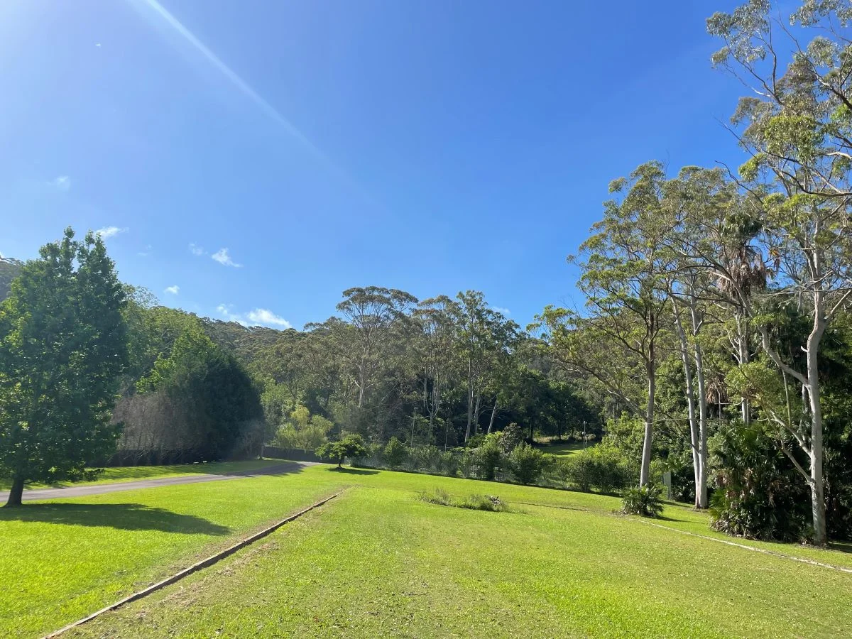
Summary: Prestige Vacant Acres
Description: Nestled in a great location in Oak Road yet within close proximity to Central Coast Grammar School, Firescreek Boutique Winery, Shops, Cafes and the Coasts stunning beaches 191 Oak Road Matcham (Lot 1 & Lot 3, DP 1108607) Lot 1 is approx 4.12ha & Lot 3 is approx 1.07ha which equates to almost 13 acres of land and arguably 1 of the last remaining prestige rural blocks left in Matcham Holdings of size and scope are extremely rare and you'll find that you are only limited by your imagination with what can be done here The property is ready and waiting for you to bring your dream to life Contacted Rod Pitstock on 0409244235 for further information or to arrange an inspection (white boundary line is a rough guideline only)
Agent: Rod Pitstock - rodney.pitstock@optusnet.com.au - 0243855700
Matcham, NSW 2250
Land Size: 3041 m²
Property Type: Acreage / Semi-Rural
Listing Type: Residential
Status: Active
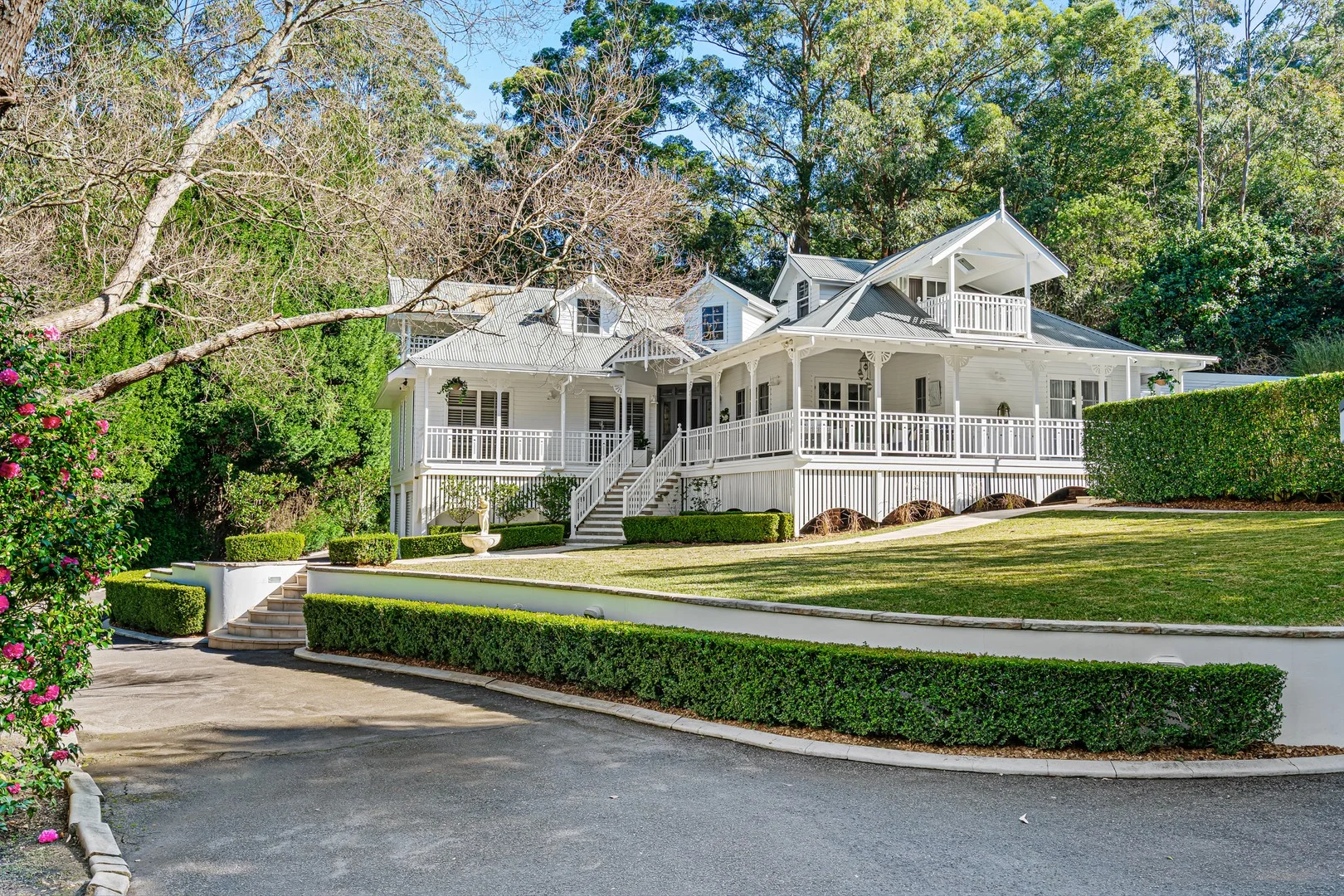
Summary: The most captivating home you'll see all year
Description: Set amid estate-like gardens and boasting the graceful lines of a heritage Queenslander, this has to be one of the most captivating homes to come to market this year; bathed in north sun, it's an exquisite fusion of sleek, contemporary finishes paired with the strength and beauty of classic architectural themes. Effortlessly bridging the divide between indoors and out, its deep, shady verandahs span the front of the residence; the luminous, open plan design flows to vast entertaining terraces, sparkling pool and child-friendly lawns in back. Beautifully designed and renovated in 2018, this gorgeous estate and its separate guest house are both stunning it's a character-rich, storybook home created for the way we live now. Exquisite design with open plan living, media room + study nook Sparkling pool, sun drenched terraces, deep verandahs High ornate ceilings, wood fireplace, French doors, Blackbutt floors Fully self-contained guest house and a separate home office with AC Vogue award winning, designer kitchen features Carrera marble island Master with luxurious ensuite; many bedrooms with private terraces Pizza oven, heated floors, R/C air, boatshed, garage w/int access North aspect; 3,041sqm parcel, glorious, well-manicured gardens
Agent: Cathy Baker - cathy.baker@belleproperty.com - 02 4360 1717
Agent: Luke Hutton - luke.hutton@belleproperty.com
Holgate, NSW 2250
Land Size: 11331.197976 m²
Property Type: Rural
Listing Type: Residential
Status: Active
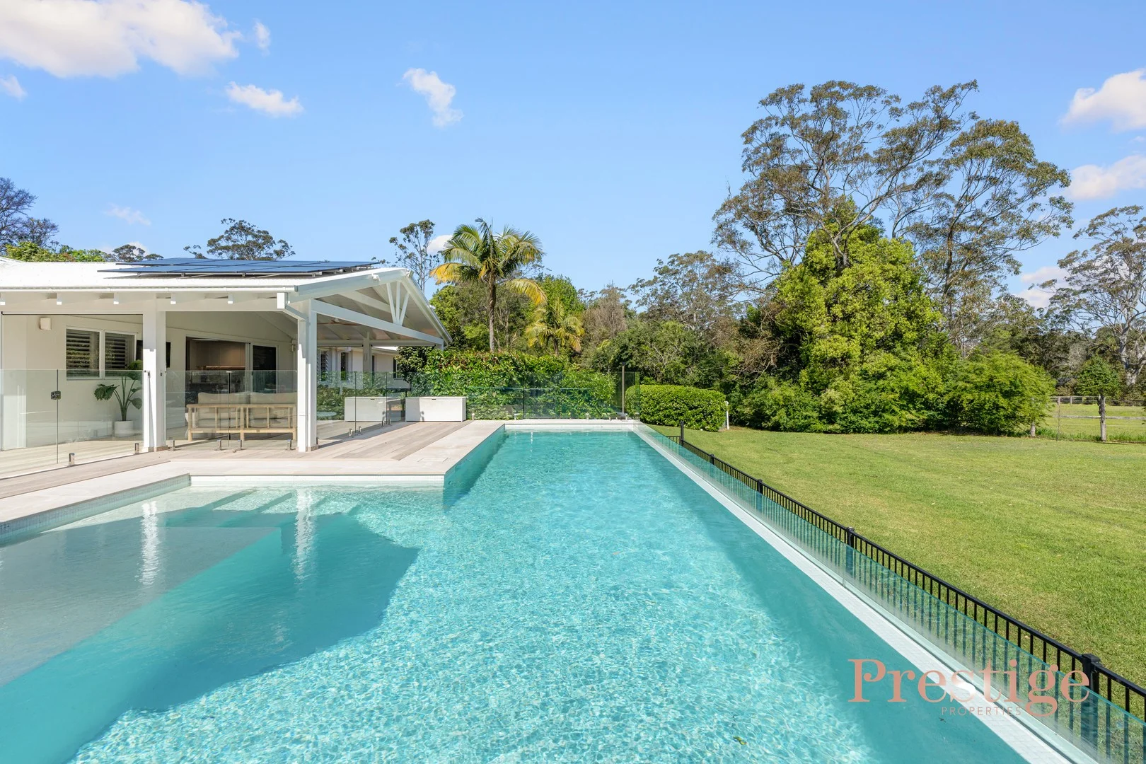
Summary: A Hamptons-Style, Single-Level Acreage with Guest Wing & Pool
Description: Set on approx. 2.8 acres of level, manicured grounds, this single-level Hamptons-inspired estate has been masterfully renovated to deliver scale, sophistication and effortless resort-style living. From the moment you arrive, the home radiates understated luxury, blending timeless design with modern functionality in one of Holgate's most exclusive settings. Defined by light and proportion, the interiors reveal multiple living zones designed for both family connection and large-scale entertaining. Wide oak floors, a French cast-iron Chazelles wood burner and a striking stone fireplace bring warmth and character, while full-height glass doors frame garden views and flood the home with natural light. At the heart, a bespoke kitchen with premium appliances, a walk-in pantry and custom cabinetry flows seamlessly to the dining and lounge areas, extending outdoors. The alfresco domain is a true showpiece, with a soaring cathedral-ceiling pavilion, expansive Millboard decking and a 12.5m heated magnesium pool forming a private, resort-inspired retreat. Accommodation is intelligently zoned: three family bedrooms and a master retreat with luxury ensuite and private patio access, plus a fully self-contained two-bedroom guest wing with separate driveway entry ideal for extended family, multi-generational living, a home office or holiday accommodation. Framed by landscaped gardens and established trees, the property achieves a rare harmony of privacy and convenience just minutes to Central Coast Grammar, Holgate Public School, boutique wineries, vibrant cafés and Erina Fair. A sanctuary of prestige and scale, it represents a lifestyle opportunity rarely offered in this tightly held enclave. Features include: - Approx. 2.8 acres of level, manicured grounds with a gated entry and tree-lined driveway creating a resort-style sense of arrival. - Hamptons-inspired interiors with wide oak floors, bespoke cabinetry, plantation shutters, Roman blinds and custom linen curtains. - A generously sized open-plan living and dining room, anchored by a French cast-iron Chazelles wood burner and stone fireplace. - Bespoke kitchen with skylit entertainer's island, granite sink, brass tapware, Spanish porcelain splashback, NEFF multifunction oven and steam oven, Siemens induction cooktop, walk-in pantry and extensive storage in the main residence. - Master retreat of approx. 32sqm with walk-in robe, dressing room, private patio access and a luxury ensuite featuring underfloor heating, heated towel rails and a frameless walk-in shower. - Three additional family bedrooms with built-in robes and ceiling fans, positioned around a central bathroom with a freestanding tub, plus a guest powder room. - Self-contained guest wing of approx. 110sqm with its own driveway, open-plan living/dining, kitchen, two bedrooms, bathroom and laundry ideal for extended family or multi-generational living. - Cathedral-ceiling entertaining pavilion with V-groove lining and ceiling fans, extending onto over 150sqm of Millboard decking. - 12.5m heated magnesium pool with wide swim ledge, in-pool umbrella insert and frameless glass fencing, complemented by an adjoining spa. - Firepit entertaining terrace with built-in seating and festoon lighting for atmospheric evenings. - Multiple patios extending from bedrooms and living zones, creating private garden retreats. - Secure oversized double garage with internal access, additional driveway parking and connection to a dedicated mudroom. - Full laundry, built-in linen press and extensive storage throughout. - Solar panels, ducted air conditioning, ceiling fans in all bedrooms and the alfresco pavilion, high-speed NBN and CCTV security system. - Two 24,000L water tanks, 3-phase power, a septic system and Termimesh termite protection ensuring robust acreage infrastructure. - Conveniently located just minutes to Central Coast Grammar, Holgate Public School, boutique wineries, vibrant cafés, Erina Fair and the region's best beaches. - Council rates: $3,151 (approx). pa. For more details, contact Adrienn Stenner on 0414 729 453 or Daniella Szakacs on 0404 065 098. If you make an online enquiry and do not receive a response within 5 minutes, please check your junk or spam folder. If it has not arrived, please contact the agents directly. DISCLAIMER: The information in this advertisement has been provided by third parties. While Prestige Properties Central Coast strives to ensure its accuracy, we do not guarantee or warrant its completeness. We accept no liability for errors, omissions, or misstatements and encourage prospective buyers to conduct their own independent investigations. All images are for illustrative purposes only.
Agent: Adrienn Stenner - adrienn@prestigeproperties.com.au - 02 4385 6423
Agent: Daniella Szakacs - daniella.szakacs@prestigeproperties.com.au - 02 4385 6423
Terrigal, NSW 2260
Property Type: Villa
Listing Type: Residential
Status: Active
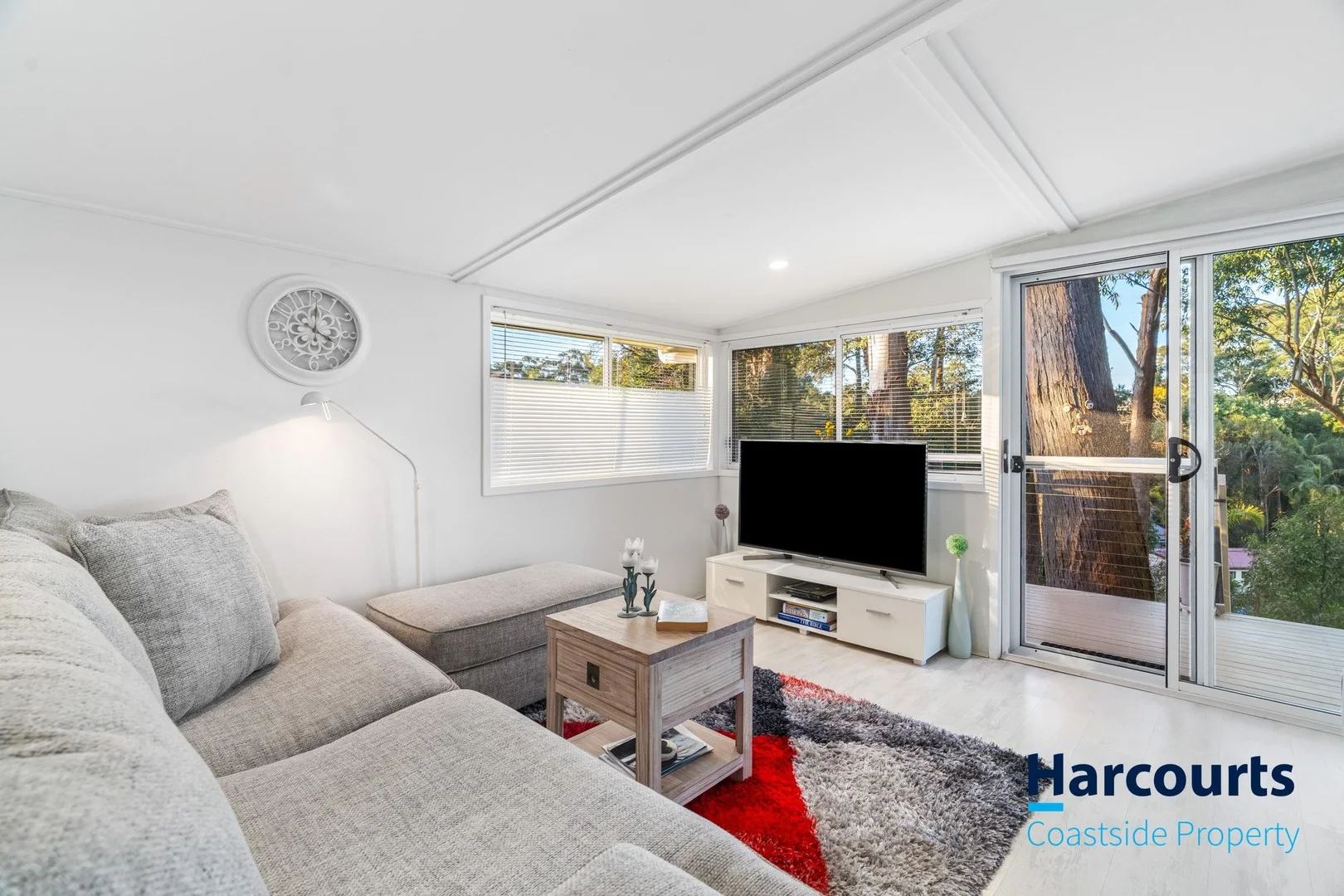
Summary: The Ultimate Tree House with Picturesque Valley Views !!!
Description: Nestled in the highly desirable enclave of The Bungalows at Terrigal. This charming home offers a harmonious blend of comfort, convenience, and lifestyle. Perfect for downsizers, retirees, or those seeking a peaceful coastal retreat, the property is situated mere minutes from the vibrant Terrigal Beach and boasts thoughtfully designed indoor and outdoor spaces. Key Features • Master Bedroom: The bedroom is generously sized with toilet and shower. • Open plan living and dining: Filled with natural light, these spaces feature warm, welcoming interiors ideal for relaxation and entertaining. • Well-appointed kitchen: Spacious bench areas and ample storage make cooking and organizing a breeze. • Additional toilet: Complemented by a separate toilet conveniently positioned within the laundry. • Veranda: Perfect for enjoying your morning coffee or unwinding in the fresh air. • Carport: Provides off-street parking for your vehicle. • Backyard and garden shed: Ideal for storage, gardening. • Air conditioning and fan: Ensures year-round comfort, regardless of the season. About The Bungalows at Terrigal This well-maintained lifestyle village is celebrated for its serene, community-centric atmosphere. Designed with convenience in mind, The Bungalows offer easy access to local shops, medical facilities, and transportation links. Just seven minutes away lies the iconic Terrigal Beach, allowing residents to enjoy the tranquillity of village life while remaining close to the energy of a coastal hub. Why Choose This Home? Whether you're looking to downsize, embrace retirement in a peaceful setting, or simply find a convenient and quiet place to call home, this property represents a unique opportunity. The combination of thoughtful design, prime location, and community-focused living ensures that this home ticks all the boxes for those seeking a balanced lifestyle. Don't miss out on the chance to secure your place in this sought-after community! Contact Sapna Gupta today and arrange a private viewing on 0497 723 972
Agent: Sapna Gupta - sapna.gupta@harcourts.com.au - 024367777
Wamberal, NSW 2260
Land Size: 9793.3925364 m²
Property Type: Rural
Listing Type: Residential
Status: Active
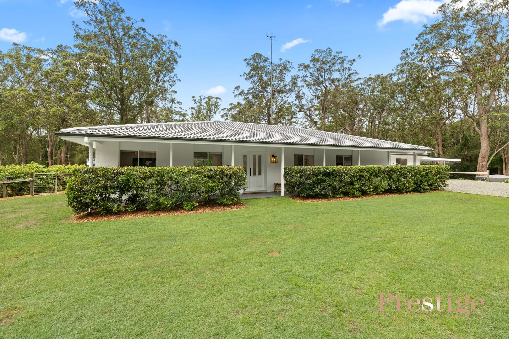
Summary: SOLD by Adrienn Stenner & Daniella Szakacs
Description: Set on approximately 2.42 acres of level, usable land, this single-level home delivers relaxed family living with a practical layout, modern comfort and a superb connection to the outdoors. Privately positioned in a sought-after pocket of Wamberal, it combines light-filled interiors with expansive green surrounds, offering the perfect environment for families seeking space, lifestyle and convenience. Framed by leafy gardens and open lawns, the home's inviting facade and verandah set the tone for relaxed family living. Freshly presented throughout, the home features four bedrooms, including a main with ensuite, plus two separate living zones providing flexibility for both relaxation and play. The sleek kitchen with stainless-steel appliances flows easily to the dining area and covered alfresco terrace, creating an ideal space for year-round entertaining. Outside, wide lawns stretch toward bushland borders and established trees, creating a serene sense of privacy. The property also includes stables, a carport and ample room for additional vehicles, boat or caravan parking, while the fully fenced grounds offer plenty of space for children and pets to explore. Located just moments from Wamberal Beach, local schools and shops, this property represents an outstanding opportunity to secure an acreage lifestyle with modern ease. Features include: - Expansive 2.42-acre parcel of flat, fully usable land surrounded by established trees and greenery. - Single-level design ideal for family living, offering a seamless flow between indoor and outdoor spaces. - Spacious open-plan kitchen, dining and living area featuring quality stainless-steel appliances and ample storage connecting to the outdoor entertaining terrace. - Two generous living zones, providing flexibility for both family relaxation and children's play. - Four bedrooms, each fitted with built-in wardrobes and ceiling fans; master suite with ensuite and walk-in robe. - Modern bathrooms, including a recently updated ensuite with full-height tiling and contemporary finishes. - Covered outdoor entertaining area overlooking level lawns perfect for gatherings or watching children play. - Private and peaceful setting, just moments from Wamberal Beach (approx. 5km), Erina Fair (4km), Terrigal Esplanade (6km) and local schools. - Further features include: ducted air conditioning, stables and fenced area, carport plus ample additional parking space. An opportunity to secure an exceptional blend of space, lifestyle and convenience in one of Wamberal's most desirable acreage pockets. For more details, contact Adrienn Stenner on 0414 729 453 or Daniella Szakacs on 0404 065 098. If you make an online enquiry and do not receive a response within 5 minutes, please check your junk or spam folder. If it has not arrived, please contact the agents directly. DISCLAIMER: The information in this advertisement has been provided by third parties. While Prestige Properties Central Coast strives to ensure its accuracy, we do not guarantee or warrant its completeness. We accept no liability for errors, omissions, or misstatements and encourage prospective buyers to conduct their own independent investigations. All images are for illustrative purposes only.
Agent: Adrienn Stenner - adrienn@prestigeproperties.com.au - 02 4385 6423
Agent: Daniella Szakacs - daniella.szakacs@prestigeproperties.com.au - 02 4385 6423
Terrigal, NSW 2260
Property Type: House
Listing Type: Residential
Status: Active
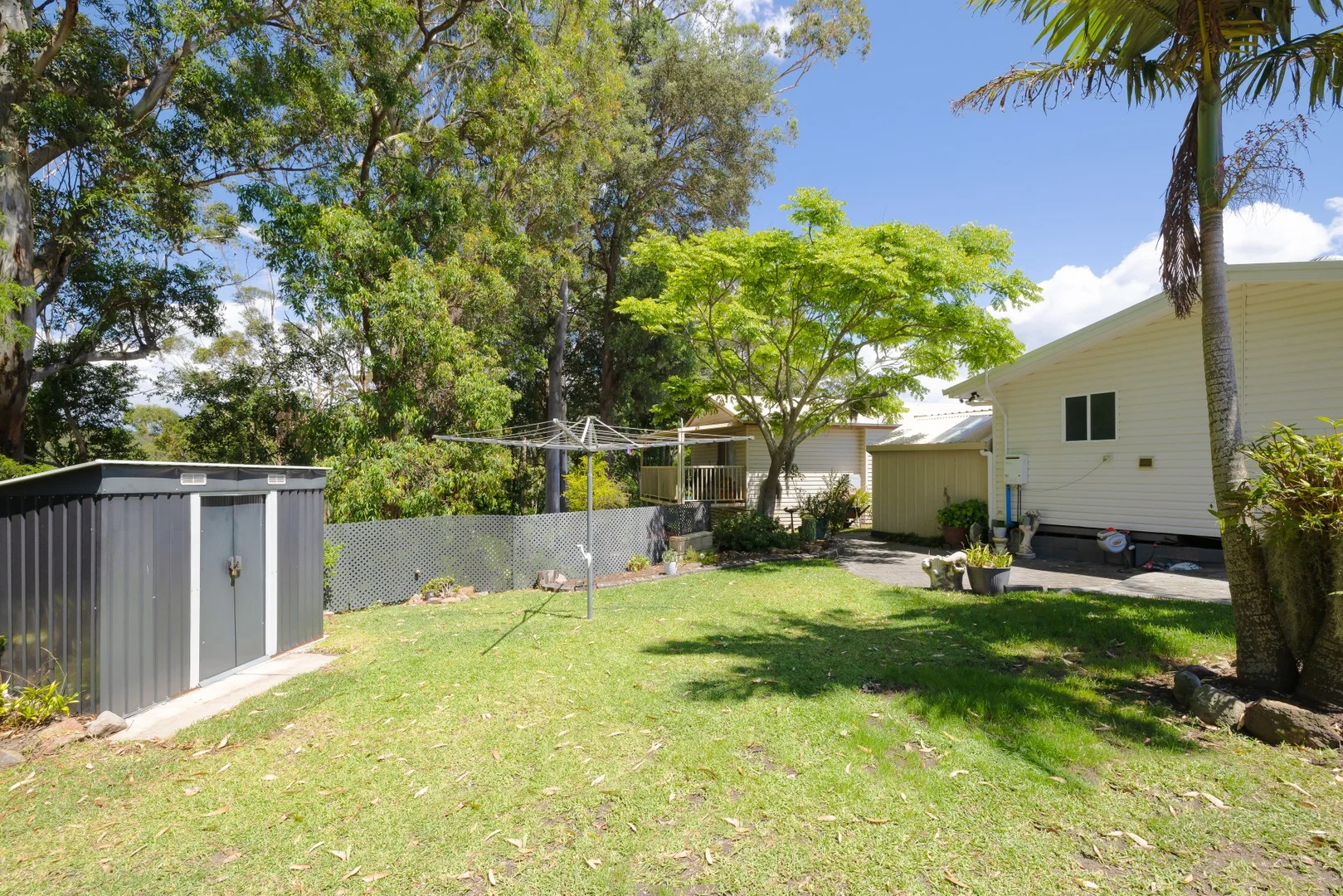
Summary: Nestled within the peaceful and sought-after The Bungalows community
Description: 2 Bed | 1 Bath | 1 Carport | Land-Lease Living This immaculately presented two-bedroom home offers relaxed coastal living surrounded by greenery. Set on one of the larger sites in the village, the property provides both privacy and space with a generous yard, sunny patio and two garden sheds. Home Highlights Light-filled open-plan living and dining area with timber-look flooring and neutral tones throughout Modern kitchen with ample bench space, large window, and generous storage options Two spacious bedrooms main with walk-in robe, second with built-in robe Freshly renovated bathroom with walk-in shower, full tiling, and quality fixtures Separate laundry with adjoining second WC for convenience Private covered verandah perfect for morning coffee or evening relaxation Single carport plus two outdoor sheds offering excellent storage Expansive paved entertaining patio and level lawn framed by established trees Location & Lifestyle Set in a quiet pocket of The Bungalows, this home enjoys a leafy backdrop and a welcoming community atmosphere. Residents love the friendly neighbourhood, low-maintenance lifestyle, and proximity to Terrigal Beach, local shops, and medical facilities. Approximate weekly site fee: $168 per week No council rates or stamp duty apply simply enjoy the benefits of land-lease living in a prime coastal location. DISCLAIMER The information provided on this website is for general purposes only and should not be taken as professional advice. All property details, pricing, and statements are illustrative and subject to change. Actual outcomes may vary due to market conditions, council approvals, planning requirements, policy changes, or other external factors. No warranty or representation that any property information, projection, or estimate displayed will be achieved or remain accurate. Interested parties should rely on their own enquiries.
Agent: Chris Garnsey - chris_garnsey@hotmail.com - 0424 650 687
Matcham, NSW 2250
Land Size: 10000 m²
Property Type: Vacant Land
Listing Type: Residential
Status: Active
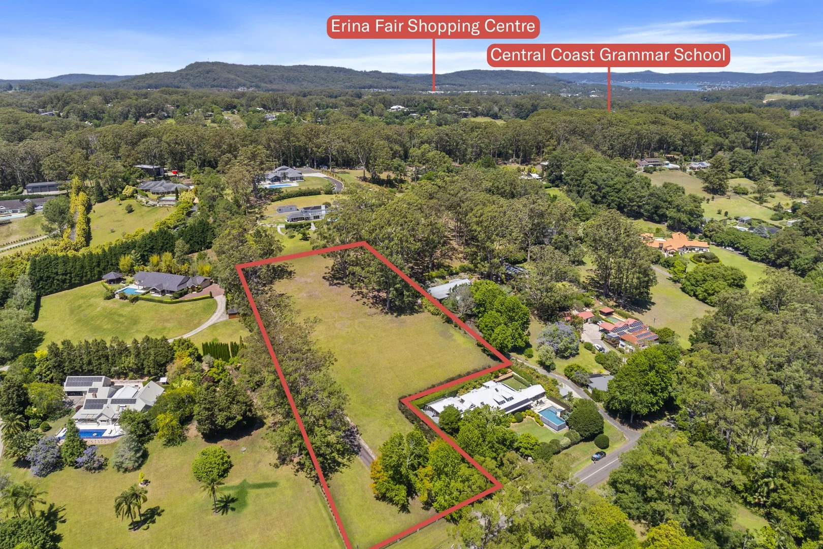
Summary: Build your dream lifestyle on one of Matcham's rare elevated acreages, complete with DA approval for a stunning architectural residence.
Description: Set high on the ridge with beautiful natural surrounds, this vacant parcel offers a rare opportunity to secure premium land in one of the Central Coast's most tightly held acreage pockets. Positioned for privacy, sun and outlook, this is a block designed for those who value space, serenity and a high-quality build without the uncertainty of the approval process. The hard work has already been done. With a DA-approved modern home ready to bring to life, you can step straight into planning your build and begin creating the lifestyle Matcham is famous for - expansive living, peaceful bushland edges, and a genuine sense of exclusivity. This is a property that speaks to both owner-builders and those engaging high-end architects or custom builders looking to fast-track construction on a premium site. Whether you want to design a contemporary retreat, a family estate or an entertainer's sanctuary, this land offers the canvas, the elevation and the approvals to make it happen. Opportunities like this, fully approved, elevated, and positioned in blue-chip Matcham, rarely come to market. Key Highlights at a Glance: - Elevated vacant block in one of Matcham's most prestigious acreage enclaves - DA approval already in place for a contemporary architect-designed home - Peaceful outlooks across surrounding treetops and natural bushland - Wide frontage, generous building envelope and excellent site orientation - Ideal for those seeking privacy, space and the freedom to create a high-end residence - Minutes to Erina Fair, Terrigal Beach, elite schools and transport links A rare chance to secure land in a suburb where opportunities to build are extremely limited DA Summary: The approved design includes: - A modern family home with multiple living zones - Strong indooroutdoor connection with generous glazing and outdoor areas - Thoughtful orientation to maximise natural light and privacy - Well-considered placement of the dwelling within the elevated site - Compliance with all major planning controls already resolved. - The ability to commence builder engagement immediately - no DA delays - This gives buyers a massive advantage: you can start building sooner, avoid the approval wait, and use the DA as-is or make minor amendments with council more easily now that a full approval is in place.
Agent: Paul Hills - paulhills@theagency.com.au - 0421 742 752
Agent: Shad Hassen - shad@theagency.com.au - 0418 700 300
Terrigal, NSW 2260
Land Size: 665 m²
Property Type: House
Listing Type: Residential
Status: Active
Summary: Dual occupancy with exceptional income potential
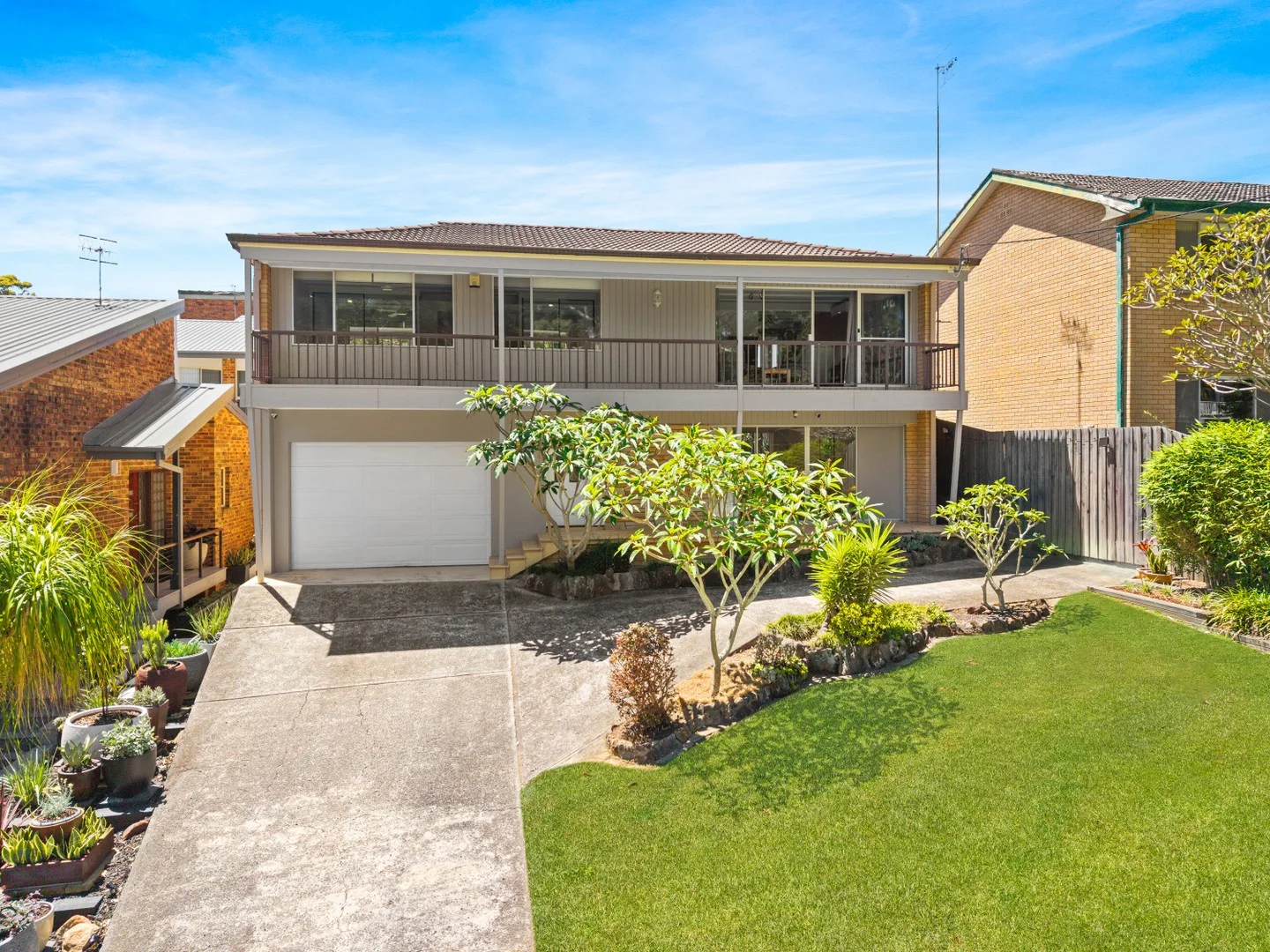
Description: Positioned in one of Terrigal's most convenient and tightly held pockets, this dual-dwelling property offers a rare chance to secure not just a home, but a high-performing investment in one of the Central Coast's most desirable beachside suburbs. With schools, cafés, beaches and Terrigal's bustling town centre only minutes away, the lifestyle and rental appeal here is undeniable. Set on a generous 650sqm block, the property includes a three-bedroom main residence and a separately metered, council-approved two-bedroom granny flat-perfect for generating immediate rental income or creating flexible multi-generational living. The main home includes three bedrooms with built-ins, a large downstairs rumpus, a main bathroom plus powder room, and a covered balcony ideal for entertaining, which also offers excellent scope for expansion, with potential to convert the space below into a parents' retreat featuring a main bedroom and ensuite. The original kitchen presents an exciting opportunity to renovate and instantly add value. The modern, well-appointed granny flat features two spacious bedrooms, a combined bathroom and laundry, and a fully equipped kitchen-ready to rent from day one. Whether you choose to live in one and lease the other, rent both for dual income, or live in the granny flat while you renovate the main home, this property offers endless potential to maximise returns in a blue-chip location. - 650sqm block with dual occupancy: two-storey main home and council-approved granny flat - Main residence has 3 generous bedrooms all with built-in robes - Main bathroom plus powder room downstairs for added convenience - Original kitchen and appliances-ideal for updating and adding value - Large covered front balcony and east-facing rear deck with ocean glimpses - Split-system a/c and ceiling fans in bedrooms - Granny flat boasts 2 generous bedrooms with built-in robes, combined bathroom laundry and fully-equipped kitchen - Low-maintenance tropical gardens with scope to enhance - 1.5-car drive-through garage with integrated storage, plus additional off-street parking - Additional 2-car off-street parking - Convenient coastal location, just 5 minutes to Terrigal Beach and town centre and 8 minutes to Erina Fair shopping centre
Agent: Tim Andrews - tim.andrews@ljhooker.com.au - 02 4385 8444
Agent: Charlie Betar - charlie.betar@ljhooker.com.au