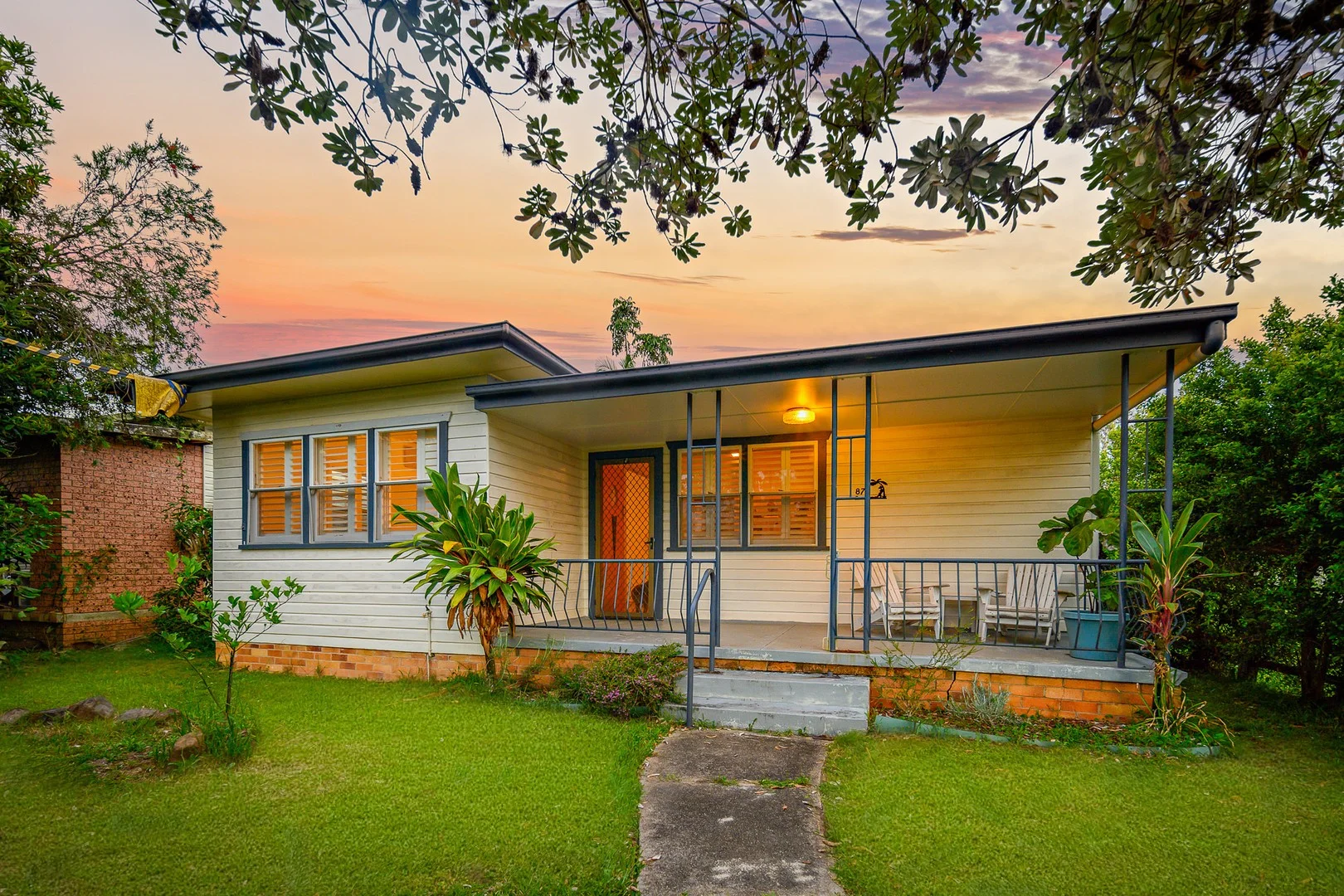
87 Prince St
Mullumbimby, NSW 2482
Neighbourhood & everyday essentials
Explore around Mullumbimby, from school days to weekends.
Area figures
- schools in Mullumbimby
- 5
Find schools, playgrounds and children’s classes. Browse by age to plan school days and weekends.
Area figures
- residents (ABS, June 2024)
- 37,826
- children aged 0–14
- 6,014
- schools
- 18
- parks & libraries
- 23
- kids’ activity providers listed
- 12
Most-listed activities: Circus, Tennis, Tutoring
Population figures: Australian Bureau of Statistics
Explore local libraries, community spaces, schools and council programs across the wider area.
Parks, playgrounds & public spaces
Stan Robinson Park
Argyle St, Mullumbimby, New South Wales, 2482
418 m straight-line distance
Richmond-Tweed Regional Library
Station St, Mullumbimby, New South Wales, 2482
562 m straight-line distance
Mullumbimby Heritage Park
Murwillumbah Rd, Mullumbimby, New South Wales, 2482
730 m straight-line distance
National Parks & Wildlife Service
Casuarina St, Mullumbimby, New South Wales, 2482
809 m straight-line distance
Things to do near this home
Explore nearby play centres and family attractions from the directory. Check ages, entry prices and opening hours with the venue.
Find more ideas by age, budget and indoor or outdoor setting on Things to do. Dated events are in What’s on. See what’s on
Discover local guides & family ideas
Read local family guides and practical articles as you explore life around this home.

Kids' Activities per Child: Australia's Best- and Thinnest-Covered Council Areas (2026)
Across Australia's big council areas, the AroundSchools directory lists a median of about 10 kids' activity providers for every 10,000 children — but in Melbourne's Wyndham it is 3.9, and in the City…
Read more →
Most Livable Suburbs in New South Wales for Families (2026)
Sydney lists more kids' activities in our directory than any other suburb in NSW. This page ranks NSW suburbs by how much a family moving there could actually do with their kids, then adds what else…
Read more →Everyday essentials & getting around
Open the map to choose a destination and check journey times from this address. Walking routes, step-free access and travel times have not been verified.
Flood & development checks
Property-specific flood risk and announced developments have not been verified. Search this address in the official maps and ask the council for current flood information.
Source: AroundSchools directory. Distances are straight-line distances, not walking routes. Confirm facilities on the linked detail pages. Directory update dates are not supplied for this summary.
Property Details
446 m²
House
RESIDENTIAL
What's Nearby

Spaghetti Circus
Mullumbimby Showground, 62 Main Arm Rd, Mullumbimby

Circus Arts Byron Bay
17 Centennial Cct, , Byron Bay

Richmond-Tweed Regional Library
Station St, Mullumbimby

Shotokan Karate-do
Gordon St, Mullumbimby

Mullumbimby Tennis Club
Oleander St, Mullumbimby

Tallowood Ridge Estate
Parakeet Pl, Mullumbimby

Brunswick Health & Recreation Centre
Teven St, Brunswick Heads
Pilgrim Memorial Reserve
Old Pacific Hwy S, Brunswick Heads
Brunswick He Boathar Reserve
Old Pacific Hwy, Brunswick Heads
Nearby Schools

Mullumbimby Public School
Morrison Ave, Mullumbimby NSW 2482

St John's Primary School - Mullumbimby
11 Murwillumbah Road, Mullumbimby NSW 2482 Australia

Mullumbimby High School
9 Jubilee Ave, Mullumbimby NSW 2482

Hinterland Christian College
114 Main Arm Rd, Mullumbimby NSW 2482, Australia

Brunswick Heads Public School
Fingal St, Brunswick Heads NSW 2483

Shearwater, the Mullumbimby Steiner School
349 Left Bank Road, Mullumbimby NSW 2482 Australia
Nearby schools do not imply enrolment eligibility. Confirm catchments, year levels and childcare availability directly with the provider.
Nearby Properties
Recently sold nearby
Homes that have sold close to this address. We don’t show sale prices.
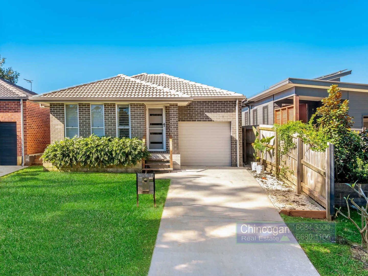
Mullumbimby, NSW 2482
Land Size: 310 m²
Property Type: House
Listing Type: Residential
Status: Active
Summary: Now Available for Immediate Purchase
Description: This appealing near-new home is situated in a highly regarded Mullumbimby location, central and quiet is now available for purchase with vacant possession. Designed with modern principles of 5-star energy efficiency, this home offers exceptional comfort and low running costs. Light filled open plan living area seamlessly flows onto a spacious patio, creating a serene ambiance for the living zones. The master retreat is a wonderful feature, along with the heart of home kitchen and bespoke bathrooms. With generously sized bedrooms and ample storage throughout this property boasts a smart spacious layout, and is in excellent condition, making it an exceptional find Mullumbimby. The leafy low maintenance private grounds are situated on a fully raised lot, ensuring complete peace of mind for your future. Enjoy the many charms Mullumbimby has to offer, with cafes, shops markets, and the renowned markets just around the corner, all while relishing the tranquility and security of home ownership in this peaceful setting. Now available for the first time with vacant possession, this flood free home is terrific value in this prime position.
Agent: Adam Mangleson - adam@chincogan.com.au - 02 6684 3300
Agent: Chad Mangleson - chad@chincogan.com.au - 02 6684 3300
Mullumbimby, NSW 2482
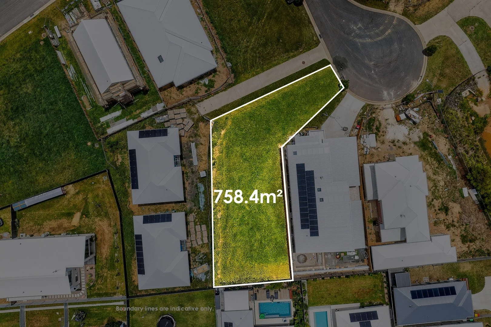
Land Size: 758.4 m²
Property Type: Vacant Land
Listing Type: Residential
Status: Active
Summary: A Head Start on Building in Tallowood Ridge
Description: Set in a quiet cul-de-sac and surrounded by quality, established homes, this slightly elevated, block provides an excellent foundation for a thoughtfully designed family residence, with flexibility to accommodate multi-generational living. Importantly, the current owner has already progressed full architectural house plans with G.J. Gardner Homes, which are awaiting Complying Development Certificate (CDC) approval. This places the next owner in a strong position to move forward with confidence toward building a contemporary home in one of the Byron Shire's most liveable communities. Positioned within the tightly held Tallowood Ridge Estate, 6 Goshawk Lane, Mullumbimby offers a rare opportunity to secure a generous 758.4sqm parcel of land with extensive groundwork already completed - saving valuable time, cost and complexity before construction even begins. Property Highlights - Generous 758.4sqm block within the Tallowood Ridge Estate - Architectural house plans completed with G.J. Gardner Homes, featuring: - Four bedrooms -Three bathrooms - A practical, family-focused layout - Plans progressed to CDC stage and awaiting Complying Development approval - Potential for a granny flat (STCA), offering flexibility for extended family or future income - Extensive preparatory work already completed, including: - Soil testing - Flood compliance - Full architectural documentation - All services in place with underground connections - Fibre to the Premises (FTTP) NBN - Level to gently sloping land - Quiet cul-de-sac setting surrounded by established homes Location & Lifestyle Tallowood Ridge is prized for its balance of space, community and convenience. From this peaceful setting, you're just minutes from the vibrant heart of Mullumbimby and within easy reach of the Byron Shire's most sought-after lifestyle destinations. - Approx. 5 minutes to Mullumbimby's cafes, shops and farmers market - Close to local schools, including Shearwater Steiner School - Easy access to Brunswick Heads and Byron Bay - Walking trails, green spaces and Mount Chincogan nearby With generous proportions and a significant head start already in place, 6 Goshawk Lane is an outstanding opportunity to secure land with real momentum behind it-allowing you to focus on the exciting part: bringing your new home to life. For further information, contact Victoria Fitzgibbon on 0409 997 789 at Byron Shire Real Estate. Property Code: 1484
Agent: Victoria Fitzgibbon - victoria@byronshirerealestate.com.au - 02 6685 1754
Mullumbimby, NSW 2482
Land Size: 887 m²
Property Type: House
Listing Type: Residential
Status: Active
Summary: Quintessential Mullumbimby family home
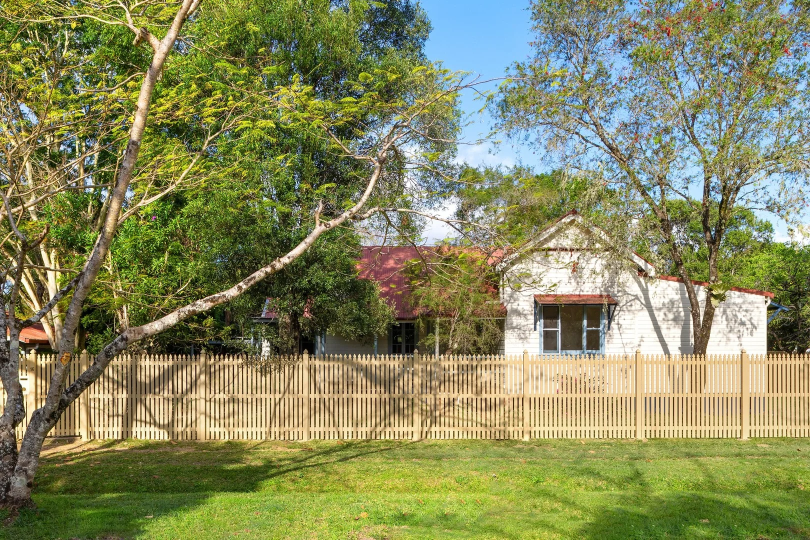
Description: Situated in one of the most desirable and tightly held locations in Mullumbimby and offering wonderful neighbour separation, this three bedroom timber home is nestled on a large level corner block (887sqm) with wide council verges, so rarely available. The home oozes character and old world charm, with excellent natural light, polished floorboards, 3+ metre high timber-lined ceilings and walls, and an ornate pressed metal ceiling in the living room. A spacious separate dining room, perfect for entertaining, leads to both the living room and a large outside covered deck with easy access to a level fenced garden and lawn. The master bedroom has the bonus of an adjoining sitting/dressing room with built in wardrobes. The exceptional location is very convenient - only a short, level stroll to the town centre, with two primary schools and Mullumbimby High School also within walking distance. This is the first time this special property has been offered for sale in 24 years, and it is now reluctantly being made available for a new owner to comfortably enjoy from day one, or to implement some personal improvements to enhance this classic home to the next level without fear of overcapitalising. - Privacy and neighbour separation, limited local traffic - Period home with classic features including very high ceilings - Comfortable family home with multiple living and work areas - Level usable land, perfect for the keen gardener or active family - Workspace is separate from the house, ideal as home office - Be sure to inspect as soon as possible, as this property will sell
Agent: Duncan Lorimer - duncan@lorimerestateagents.com.au
Mullumbimby, NSW 2482
Land Size: 677 m²
Property Type: House
Listing Type: Residential
Status: Active
Summary: Creatively inspired home
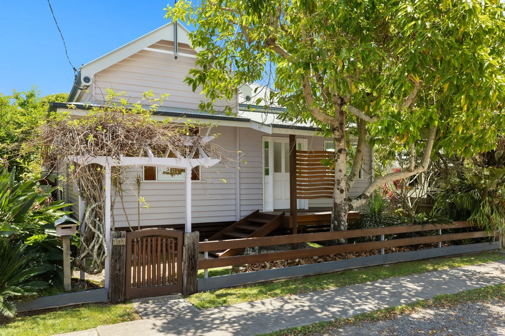
Description: With abundant natural light combined with high timber lined ceilings and walls, this charming home has a contemporary twist. The original home was built in 1914 (approximately) as a railway workers cottage with an extension and major renovations taking place in the late 1990's, by the then owner who was a shipwright. Enjoy an excellent floor plan with many quality timber features ensuring this is more than just a house; it is offering a definite lifestyle, and all wonderfully positioned being only a 300 metre level walk to the heart of Mullumbimby town centre. Multiple living areas create an atmosphere of space ensuring a comfortable lifestyle and flexibility depending on your needs. A practical kitchen boasting generous bench space and an amazing amount of storage, open plan to a welcoming casual living area with a slow combustion wood heater and air conditioning, all with the benefits of ample natural light, interesting soaring ceilings, and great air flow, opening to the large covered deck for extended living and entertaining. Bedrooms are generous with beautiful, polished timber floorboards and high ceilings, all with built in robes. The master bedroom overlooks a tropical back garden and opens to a very inviting and useable covered deck. The bathroom is appealing with full bath and separate shower recess, plus separate toilet. Other features include a free-standing artist studio or office, and in addition to this, a large creative workshop space with its own bathroom and rear lane access, plus parking for two cars. This property should suit a broad range of potential buyers such as a young family, downsizers or even an investor, it will not disappoint. - Rear lane access to parking and large creative workshop - Tropical back garden with fenced vegie patch and chicken coop - Sophistication with older style character and a modern flair - Separate artist studio or office space away from the house - Immaculate presentation, ready to enjoy - Level stroll to Mullumbimby town centre - Offering a "lifestyle" package so hard to find
Agent: Duncan Lorimer - duncan@lorimerestateagents.com.au
Mullumbimby, NSW 2482
Land Size: 437100 m²
Property Type: Rural
Listing Type: Residential
Status: Active
Summary: Hinterland Acreage with Sweeping Views to Cape Byron
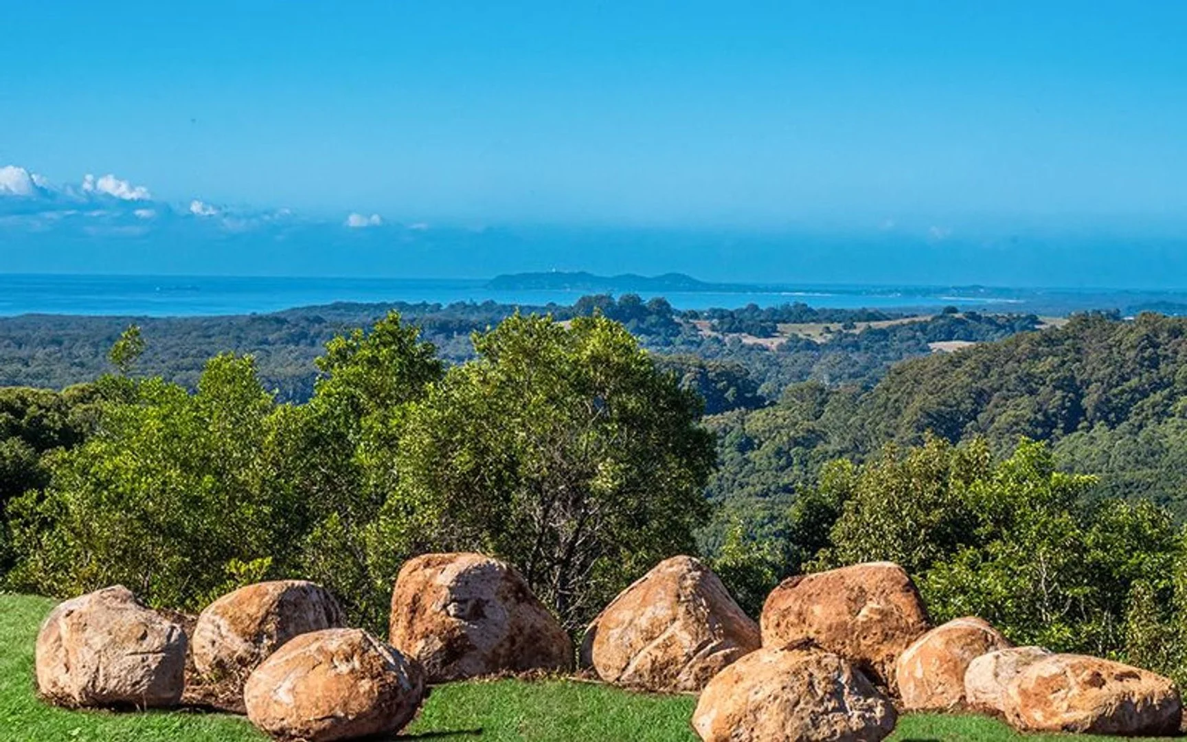
Description: 108 Acres of Pure Hinterland Magic with Ocean Views Set across approx. 108 acres in the foothills of Mt Chincogan, this exceptional rural property offers sweeping views from the Cape Byron Lighthouse right through to Wollumbin (Mt Warning). Positioned within the crater of the long-extinct Mt Chincogan, it enjoys a unique natural amphitheatre setting private, peaceful, and visually spectacular. Just 8 minutes from Mullumbimby and 25 minutes from Byron Bay, this property offers rare scale, outstanding water security, and enormous potential for future development (STCA). The existing shed home is surprisingly spacious, featuring 5 bedrooms, generous living areas, and modern upgrades, including a brand-new 18.4kW solar battery system with SkyBox storage and new air conditioning throughout. Comfortable, practical, and fully off-grid, it provides an ideal base while you build. Features include: 43.7 ha / 108 acres of pristine hinterland with stunning ocean and mountain views Elevated vantage points offering 270° views from Wategos to Mt Warning Perfect north-easterly aspect for all-day sunlight and sea breezes Excellent water security with a brand-new spring-fed dam and multiple natural springs Several elevated building sites ideal for your dream home (STCA) Fully serviced, comfortable shed home: 5 bedrooms, spacious living, new solar + battery, new A/C Great potential for hobby farming, permaculture or livestock Peaceful, private, self-sufficient living in a spectacular natural setting Location: 8 mins to Mullumbimby 12 mins to Ocean Shores 15 mins to Brunswick Heads 25 mins to Byron Bay 3040 mins to Ballina or Coolangatta Airports A rare slice of hinterland paradise offering space, sustainability, and unmatched views with the versatility to build, grow, create, or develop a lifestyle retreat of extraordinary scale (STCA).
Agent: Ku Darroch - ku@byronbaysales.com.au - 0411 809 819
Agent: Riley Buckland - riley@byronbaysales.com.au
Mullumbimby, NSW 2482
Land Size: 736 m²
Property Type: House
Listing Type: Residential
Status: Active
Summary: A Timeless Charmer
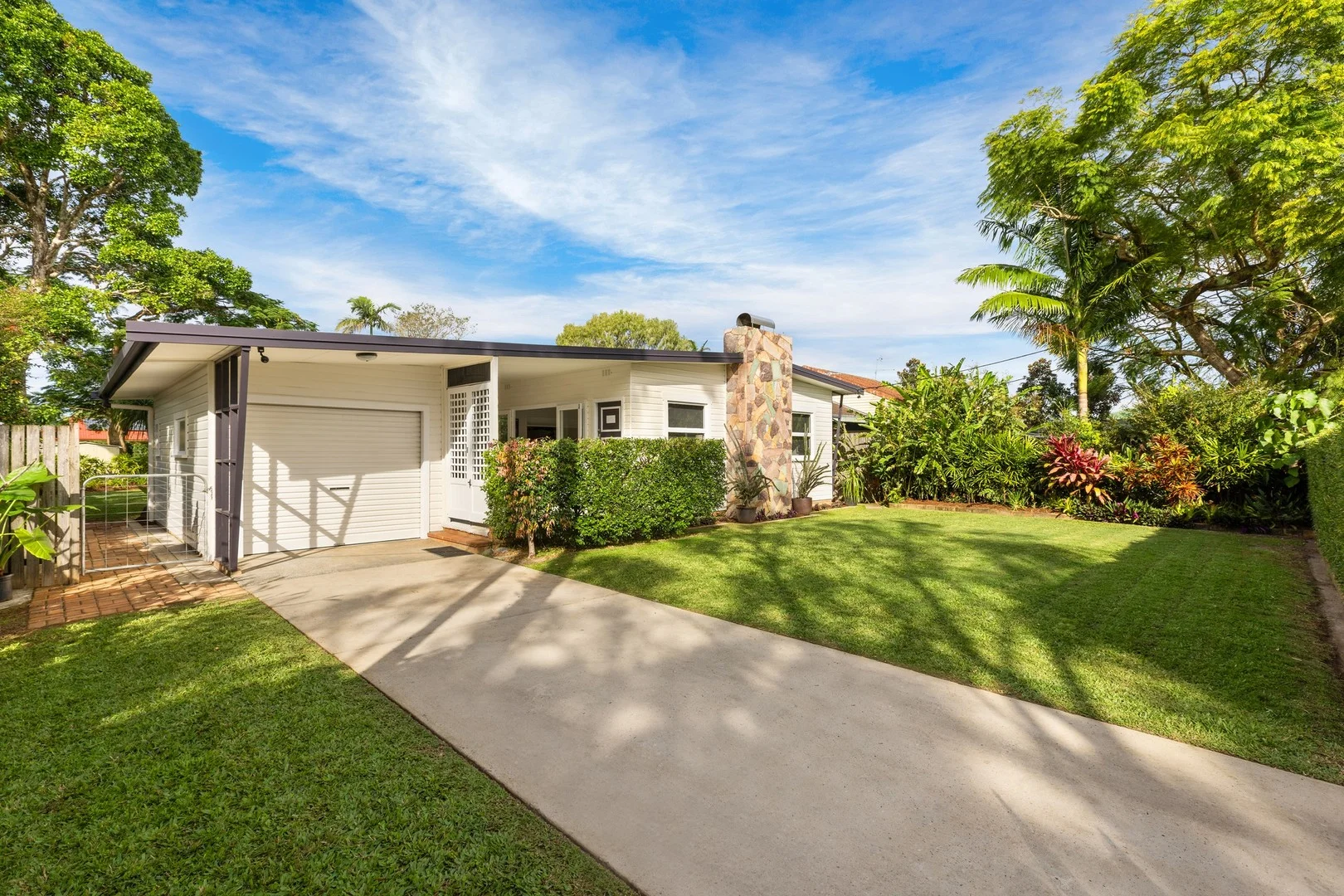
Description: As stunning today as it was upon construction in 1958, 36 Dalley St Mullumbimby is an all-original Mid-Century Modern timber character home situated in one of the most desirable locations in the heart of town. This unique custom-designed home exudes timeless charm and enduring appeal. This flood free home has been meticulously maintained, and retains virtually all original features and showcases the exceptional craftsmanship of its era. Positioned on a generous 736m2 allotment, the home is set behind a privacy hedge, with mature, established gardens beautifully framing the house and grounds. The forward-thinking floorplan emphasizes an indoor/outdoor lifestyle, with a full-length semi-enclosed breezeway as a standout feature, seamlessly connected to the living areas through oversized glass doors and windows. The spacious open-plan lounge and dining area boasts a working central stone-tiled fireplace, high ceilings, ornate cornices, timber windows, and floors. A retro kitchen with a servery also connects to the living space, with a split door providing access to the breezeway entertaining area. The central bathroom further highlights the quality of this home. Accessed via a long central hallway, there are three bedrooms and a sunroom to capture abundant sunlight while offering a picturesque garden outlook with a north-east aspect. The home filled with natural light far exceeding most others, complemented by numerous windows and excellent cross-ventilation. A separate single garage includes a second toilet and workshop space, which could easily be converted into a studio or guest accommodation (STCA). Additional features include a garden shed, rear lane frontage, a recently replaced roof with insulation, a newly painted exterior, and air conditioning. This home is ready to be cherished and enjoyed.
Agent: Adam Mangleson - adam@chincogan.com.au - 02 6684 3300
Agent: Chad Mangleson - chad@chincogan.com.au - 02 6684 3300
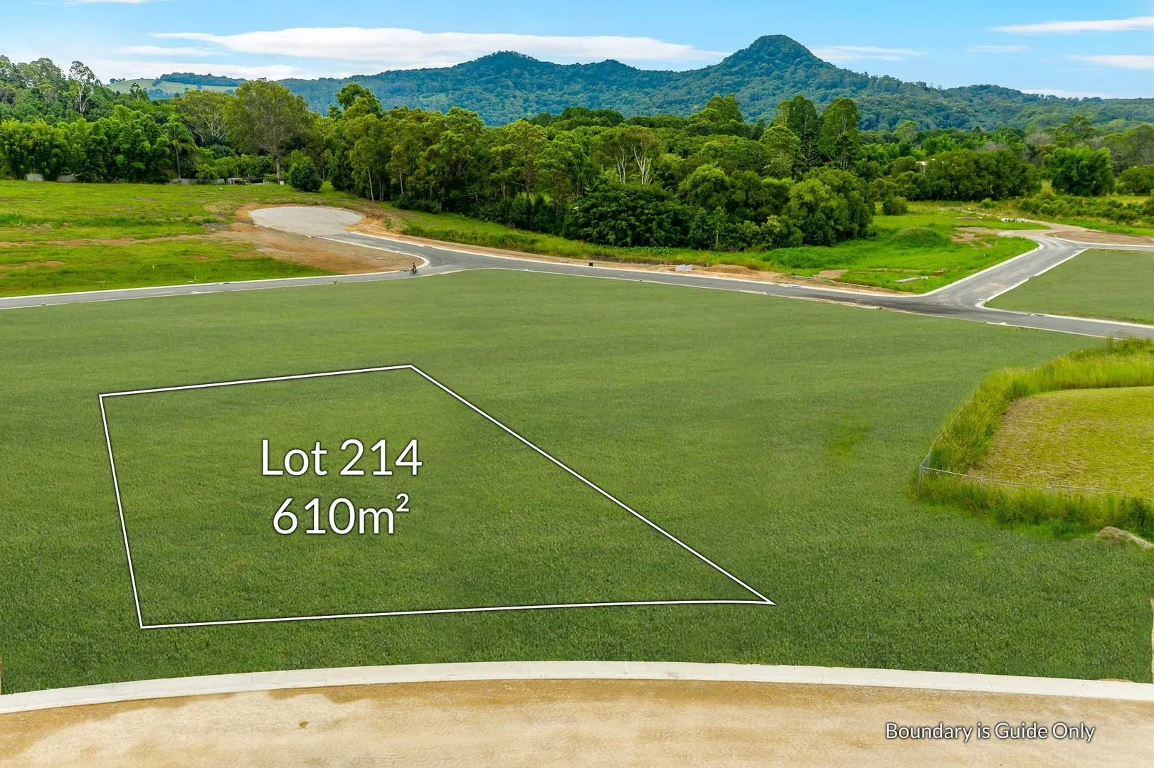
Mullumbimby, NSW 2482
Land Size: 610 m²
Property Type: Vacant Land
Listing Type: Residential
Status: Active
Summary: Elevated Vacant Lot
Description: Nearing completion, as part of the super desirable Tallowood Ridge Mullumbimby penultimate stage, this near level vacant lot offers a north facing yard and wide 18m+ frontage allowing for a multitude of home designs and styles to comfortably fit on this elevated fully serviced lot. No restrictions on which builder or what style of home you need to build allowing you to create your own dream home. Land of this quality is also much more affordable to build upon than you may think and often home buyers can create far better value than buying existing properties with this wonderful lot. Delayed settlement available and worry-free purchase for home buyers or investors with secondary dwelling also permissible. Contact now for further details.
Agent: Adam Mangleson - adam@chincogan.com.au - 02 6684 3300
Agent: Chad Mangleson - chad@chincogan.com.au - 02 6684 3300
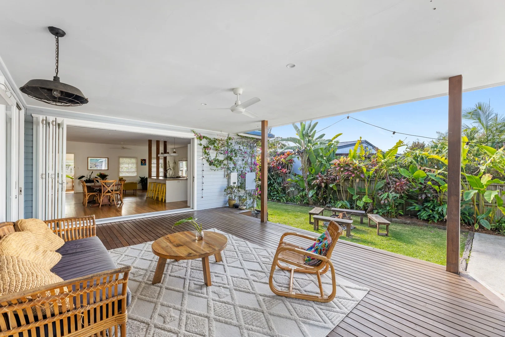
Mullumbimby, NSW 2482
Land Size: 613 m²
Property Type: House
Listing Type: Residential
Status: Active
Summary: Classic Mullum Home with Separate Studio/Office
Description: - Main home not flood affected in 2022 weather event. Full of character and style, this classic Mullumbimby residence has been lovingly renovated to create a home that feels both warm and inviting. Light-filled interiors, tasteful finishes and a relaxed vibe make it the perfect place for family living and easy entertaining. The open plan living and dining space is the heart of the home, with high ceilings, exposed timber beams and polished hardwood floors adding to its timeless appeal. Bi-fold doors open wide to a covered deck, extending the living area outdoors and overlooking the leafy established gardens, a beautiful setting for family gatherings or quiet afternoons at home. The kitchen combines charm and functionality with handcrafted cabinetry, quality appliances, a striking tiled splashback and feature lighting. Three generous bedrooms provide comfort, all with built-ins, while the main enjoys an ensuite, walk in robe and direct access to the deck. A family bathroom with bathtub services the other bedrooms, alongside a well-designed laundry and a handy mudroom at the entry, ideal for busy families. The separate large home office at the rear of the property is a real bonus, offering space for creative pursuits or guest accommodation. Outdoors, the home continues to shine. The fully fenced block offers established tropical gardens, fruit trees and generous lawns, with rear lane access for added convenience. Children and pets can play safely, while the lush setting creates a peaceful retreat. From the front deck, take in sunsets and views of Mount Chincogan and enjoy the winter sun. Located just a short stroll to town,10 minutes to Brunswick Heads and 25 minutes to Byron Bay, this home offers the perfect blend of lifestyle, location, character and comfort. Key Features - Beautifully renovated with warmth and style - Light-filled open plan living with high ceilings & polished hardwood floors - Bi-fold doors opening to large covered entertaining deck - Kitchen with timber cabinetry, quality appliances and feature tiling - Three bedrooms with built-ins, main with ensuite & deck access - Family bathroom with bath + additional toilet in laundry - Mudroom at entry, perfect for families - Large versatile home office space at rear - Fully fenced block with rear lane access - Established tropical gardens, fruit trees & safe play spaces - Front and back hardwood covered decks for year-round enjoyment - Solar hot water + 6.63kW solar power - Air conditioning in main bedroom - Main home not flood affected in 2022 weather event. Call Gary and Todd to inspect this beautifully maintained and presented home! Property Code: 1449
Agent: Gary Brazenor - gary@byronshirerealestate.com.au - 02 6685 1754
Agent: Todd Buckland - todd@byronshirerealestate.com.au - 02 6685 1754
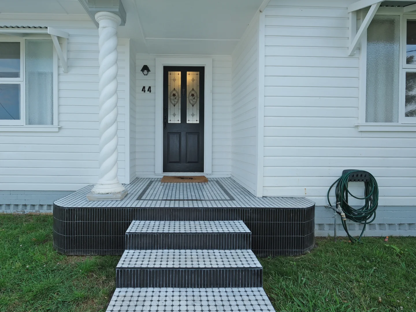
Mullumbimby, NSW 2482
Land Size: 664 m²
Property Type: House
Listing Type: Residential
Status: Active
Summary: Make An Offer - Seller moving interstate. Accepting first reasonable offer.
Description: Phone Enquiry ID: 233242 Effortless Living Fully Renovated, Walk to Shops & Cafes, Only 8 Mins To The Beach Step inside this beautifully renovated cottage, where timeless charm meets modern luxury on a generous, flat 664m² block. Every detail has been considered, from the brand new kitchen and bathrooms to soft, ambient lighting that transforms the home in the evenings. Absolutely stunning chandeliers at the entrance and dining room add an abundance of elegance, while spacious bedrooms and split system air conditioning throughout ensure year round comfort for all. Designed for both style and convenience, this home features six foot fences on either side and no rear neighbours, creating privacy while maintaining a north facing aspect. The sun drenched, flat lawns provide plenty of space for children to play or pets to roam and the open plan living effortlessly flows to a spacious entertainer's deck. Perfect for dining, relaxing or hosting friends. With plenty of room for a pool or studio. STCA. Located just 600m from Mullumbimby's best shops, cafés and restaurants, you can enjoy walking to dinner and stroll home again. Families will love being only 350m from the local primary school, while weekends are made easy with Brunswick Heads Beach just a 7 minute drive away. Low maintenance gardens, a firepit for winter gatherings and bespoke luxury finishes throughout, make this home truly move in ready, with no expense spared and nothing more to do. Live the Mullumbimby lifestyle in a home where luxury, convenience, charm and space for play, harmoniously combine. Elegant marble entrance creating an immediate sense of luxury and style. North facing rear entertainer's deck with serene views across lush green pastures. Fully fenced front and rear yards. Private, secure and perfect for children or pets. Space for a pool, studio or secondary dwelling (STCA) offering endless potential. Bespoke, high end finishes throughout, showcasing quality craftsmanship in every detail. Comprehensively renovated. Move straight in and enjoy from day one without spending another cent. Lock up garage for one vehicle. Plus additional off street parking for two more vehicles in the long driveway. Garden shed for easy outdoor storage. Split system air conditioning throughout for year round comfort. 600m stroll to Woolworths, Santos and IGA. 600m stroll to The Banya Bathhouse, plus Mullumbimby's vibrant café and dining precinct. Walk to dinner and walk home again. 7 minutes drive to Brunswick Heads Beach and 15 minutes drive to Byron Bay. Optional designer furniture package available to complete the home's refined aesthetic. Private viewings are available outside of scheduled open times. Please connect to arrange your personal tour of this beautiful home. Don't miss this rare opportunity to call timeless elegance your own, while the owner is eager to secure a sale.
Agent: buymyplace . - nocommission@buymyplace.com.au - 0488842044