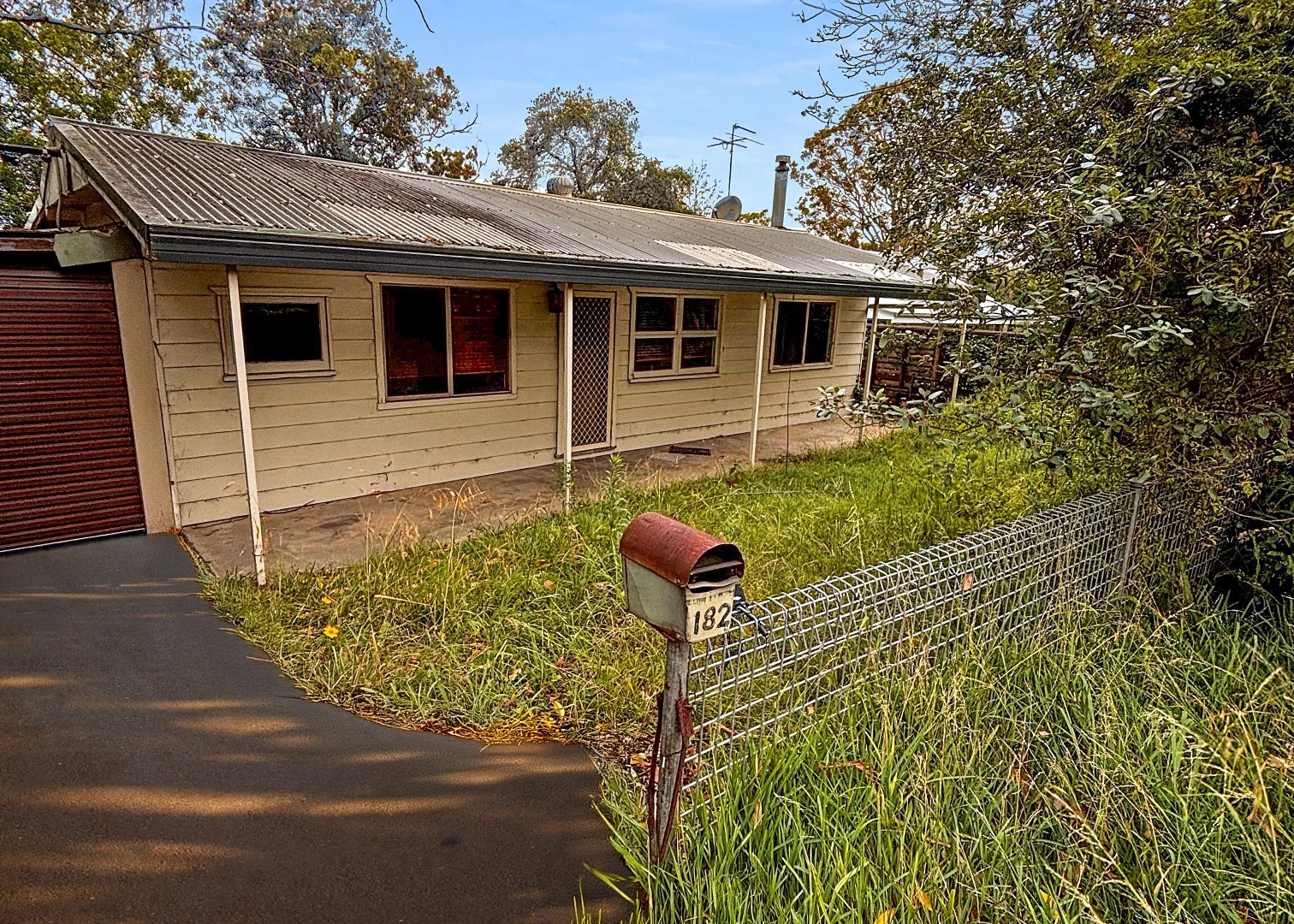
182 Railway Parade
Warrimoo, NSW 2774
Neighbourhood & everyday essentials
Explore around Warrimoo, from school days to weekends.
Area figures
- schools in Warrimoo
- 3
Find schools, playgrounds and children’s classes. Browse by age to plan school days and weekends.
Area figures
- residents (ABS, June 2024)
- 78,891
- children aged 0–14
- 13,251
- schools
- 37
- parks & libraries
- 76
- kids’ activity providers listed
- 33
Most-listed activities: Adventure & Camping, Art Centre, Karate
Population figures: Australian Bureau of Statistics
Explore local libraries, community spaces, schools and council programs across the wider area.
Parks, playgrounds & public spaces
Cross St Natural Reserve
Cross St, Warrimoo, New South Wales, 2774
1.5 km straight-line distance
Blaxland Library
Blaxland, New South Wales, 2774
1.9 km straight-line distance
Cripple Creek Reserve
Dixon Rd, Blaxland, New South Wales, 2774
1.9 km straight-line distance
Robertswood Park
Robertswood Ave, Blaxland, New South Wales, 2774
2.3 km straight-line distance
Robertswood Park: Playground, Picnic tables
Things to do near this home
Explore nearby play centres and family attractions from the directory. Check ages, entry prices and opening hours with the venue.
Find more ideas by age, budget and indoor or outdoor setting on Things to do. Dated events are in What’s on. See what’s on
Discover local guides & family ideas
Read local family guides and practical articles as you explore life around this home.

Kids' Activities per Child: Australia's Best- and Thinnest-Covered Council Areas (2026)
Across Australia's big council areas, the AroundSchools directory lists a median of about 10 kids' activity providers for every 10,000 children — but in Melbourne's Wyndham it is 3.9, and in the City…
Read more →
Most Livable Suburbs in New South Wales for Families (2026)
Sydney lists more kids' activities in our directory than any other suburb in NSW. This page ranks NSW suburbs by how much a family moving there could actually do with their kids, then adds what else…
Read more →Everyday essentials & getting around
Open the map to choose a destination and check journey times from this address. Walking routes, step-free access and travel times have not been verified.
Flood & development checks
Property-specific flood risk and announced developments have not been verified. Search this address in the official maps and ask the council for current flood information.
Source: AroundSchools directory. Distances are straight-line distances, not walking routes. Confirm facilities on the linked detail pages. Directory update dates are not supplied for this summary.
Property Details
1126 m²
House
RESIDENTIAL
Upcoming Events Nearby

Sat, 28 Nov · Penrith
Write Out West Family Fun Day
Wed, 25 Nov · Penrith
Dharug Story Time with Jasmine Seymour and Penrith City Library’s Children’s Team
Ages 2–5
Wed, 4 Nov · Penrith
Robotics @ Penrith City Library - Wednesday 4, 11 November 2026
Ages 8–14
Sat, 24 Oct · Penrith
Child Car Seat Safety Checks
Mon, 26 Oct · Blacktown
Consent & Sexting: UNSW Youth Legal Workshop
Ages 16+
Thu, 22 Oct · Stanhope Gardens
Young Leaders & Speakers (Ages 13-18)
Ages 13–18
What's Nearby

Blue Mountains Taekwondo
Florabella St, Warrimoo

Warrimoo Girl Guide Hall
Warrimoo

Star Structures
Boynton St, Blaxland

Glenbrook Ballet Theatre
Blaxland

Life First Aid Courses
Blaxland

Blaxland Library
Blaxland
Blue Mountain Katoomba New South Wales
Blaxland
Cripple Creek Reserve
Dixon Rd, Blaxland

Blaxland Football Club
St Johns Rd, Blaxland
Nearby Schools

Warrimoo Public School
16-30 Florabella St, Warrimoo NSW 2774, Australia

Blaxland Public School
Baden Place, Blaxland NSW 2774

Wycliffe Christian School
133 Rickard Rd, Warrimoo NSW 2774, Australia

Wycliffe Hope School
Warrimoo NSW 2774

Mount Riverview Public School
Rusden Rd, MOUNT RIVERVIEW NSW 2774

Blaxland East Public School
53-85 Old Bathurst Road, BLAXLAND EAST NSW 2774
Nearby schools do not imply enrolment eligibility. Confirm catchments, year levels and childcare availability directly with the provider.
Nearby Properties
Recently sold nearby
Homes that have sold close to this address. We don’t show sale prices.
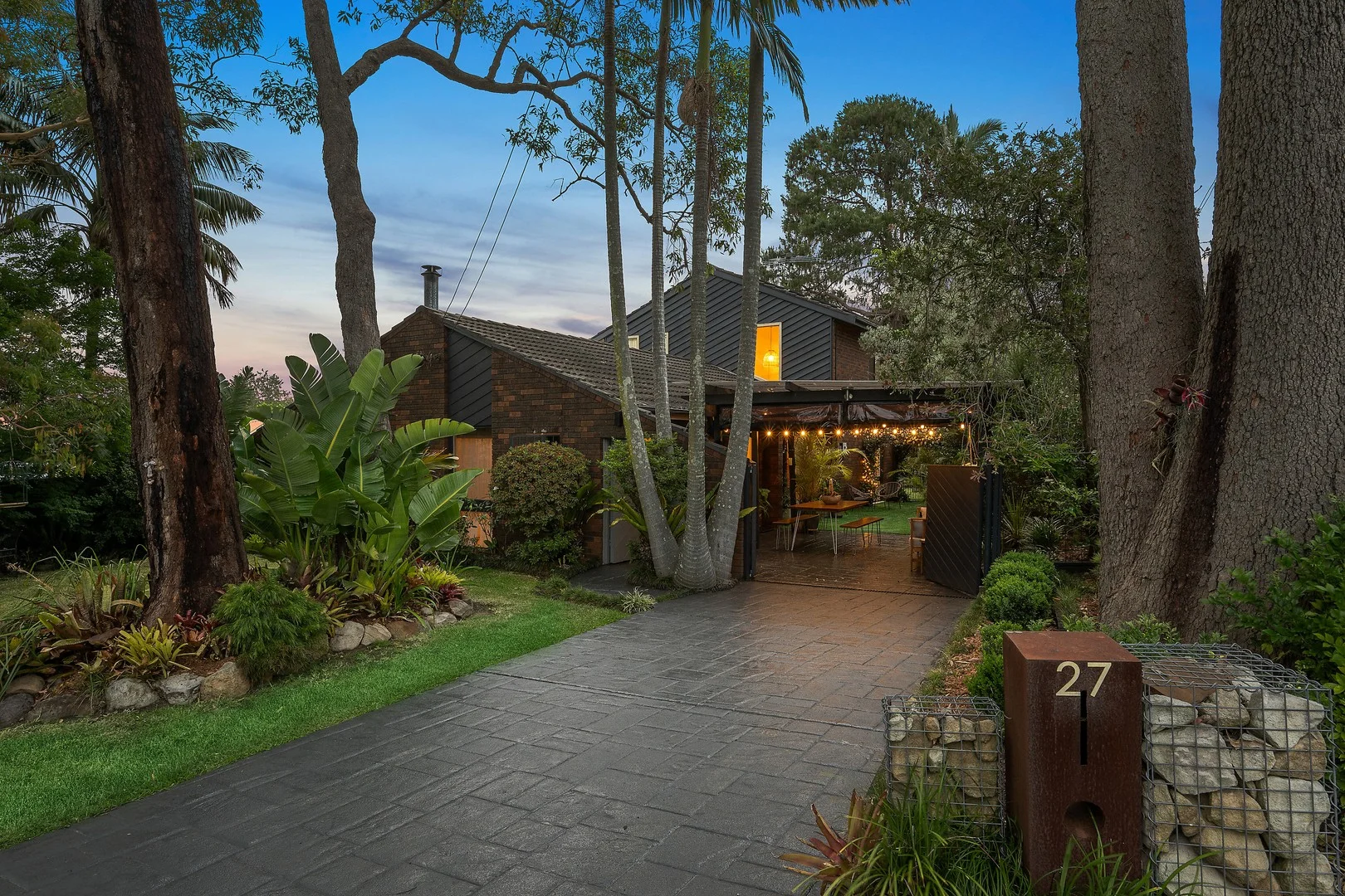
Blaxland, NSW 2774
Land Size: 557 m²
Property Type: House
Listing Type: Residential
Status: Active
Summary: Beautifully presented family home in a peaceful, convenient setting
Description: Immaculate in presentation and full of warmth, this four-bedroom home combines exceptional quality with a superb position close to East Blaxland shops and school. Quietly tucked away in a sought-after pocket, it offers multiple living areas, seamless indooroutdoor flow and a layout designed for both family connection and privacy. Across two levels, the home includes two bedrooms and two bathrooms downstairs-both renovated with stylish finishes, including a deep tub in the main-plus two additional bedrooms upstairs serviced by a third, well-maintained bathroom. The updated kitchen adjoins a cosy meals area and a new wood fireplace adds modern character and comfort. Outside, lush greenery and thoughtful details create a welcoming atmosphere, from the festoon lighting to the covered sitting and entertaining areas that blend beautifully with the home's indoor spaces. The backyard is fully enclosed and includes three covered storage areas or sheds, while the single carport doubles as a charming outdoor entertaining zone. - Spectacular presentation in a peaceful yet convenient location - Four bedrooms split over two levels for privacy and flexibility - Three bathrooms; two beautifully renovated, one well maintained - Updated kitchen with adjoining meals area and leafy outlook - Brand new, stylish wood fireplace adds warmth and charm - Multiple living areas with seamless indooroutdoor connection - Covered entertaining areas with festoon lighting and greenery - Enclosed backyard with three covered storage sheds - Single carport currently used as a sheltered entertaining space - Short walk to East Blaxland shops and local school
Agent: Kenneth Harris - kennethharris@mcgrath.com.au - 02 4739 9882
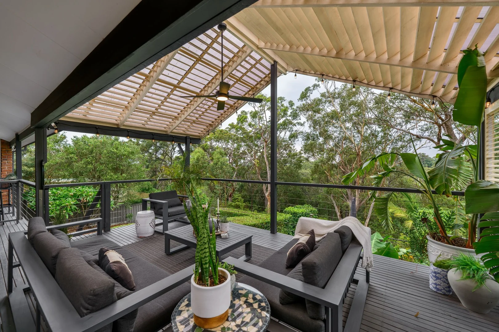
Blaxland, NSW 2774
Land Size: 751 m²
Property Type: House
Listing Type: Residential
Status: Active
Summary: UNDER CONTRACT
Description: KEY FEATURES BLOCK SIZE: 751m2 (approx) BEDROOMS: 4 BATHROOMS: 2 plus a powder room (4 toilets in total) LIVING AREAS: 2 internal & multiple external GARAGING: 2 car accomodation OTHER FEATURES: Ducted air conditioning, split system air conditioning, ceiling fans, gas connections, slow combustion fireplace, 8.8 kW solar with Tesla backup battery, plantation shutters & butlers pantry. Quality Miele appliances in the kitchen including induction cooktop, oven, steam oven & dishwasher. L shaped front deck, large gabled roof outdoor alfresco space, levelled grass lawn, workshop & immaculate established garden surrounds. RATES & CHARGES COUNCIL RATES: $625.00 per quarter (approx) WATER CHARGES: $250.00 per quarter including personal usage (approx) LOCATION 350 metres (approx) to Blaxland East Public School 500 metres (approx) to Little Echidna Early Learning Centre 3 kms (approx) to Blaxland High School 5.6 kms (approx) to Nepean High School 1.6 kms (approx) to Blaxland Station 5.3 kms (approx) to Emu Plains Station 8 kms (approx) to Penrith CBD 29 kms (approx) to Western Sydney International Airport (due to open in 2026) WHAT WE LOVE MOST! This convenient yet peaceful location, is second to none! Walk to the local school & shops. We love the serene bush back drop, abundance of space, storage & privacy. We love the eye-catching renovations, private & generous outdoor entertaining spaces plus the homely feel you receive as soon as you enter the front door. THE VIBE: Well loved & spacious! Disclaimer: We have been furnished with the above information, however, Merrick Property Group gives no guarantees or undertakings concerning the accuracy, completeness or up-to-date nature of the information provided. All interested parties are responsible for their own independent enquiries in order to determine whether or not this information is in fact accurate.
Agent: Paul Merrick - paul@merrickpropertygroup.com.au - 0247600812
Agent: Ty Hickson - ty@merrickpropertygroup.com.au - 0451 429 496
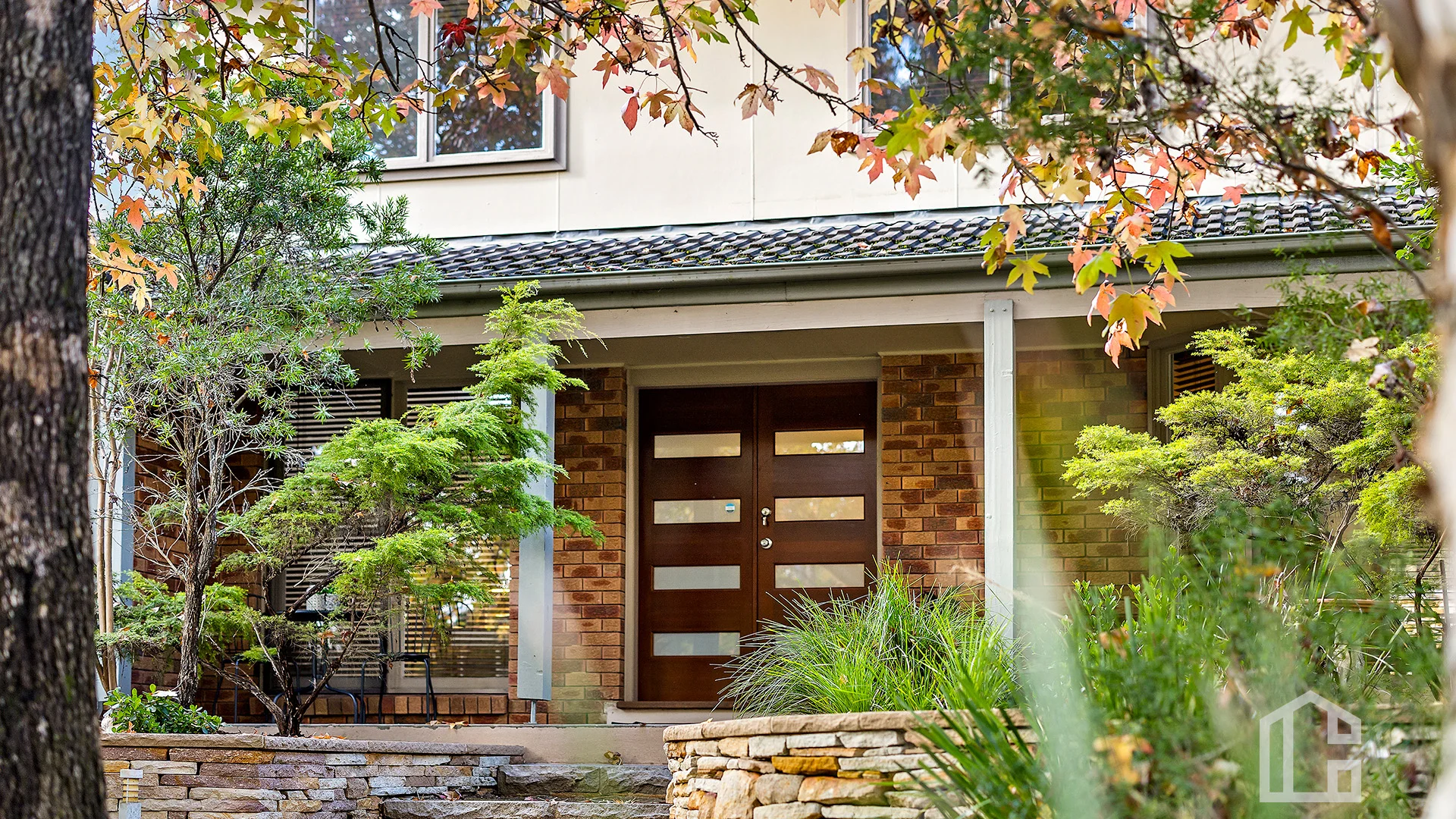
Blaxland, NSW 2774
Land Size: 703 m²
Property Type: House
Listing Type: Residential
Status: Active
Summary: Live The Mountain Life!
Description: LOCATION Nestled in the picturesque Blue Mountains, this gorgeous family home offers the convenience of Blaxland Village and the suburban tranquility of Mount Riverview, both only minutes' drive away. Enjoy easy access to local amenities such as quaint cafes, boutique shops, and essential services. With its proximity to the stunning Blue Mountains National Park, Reserve Street is a gateway to breathtaking bushwalking trails and scenic lookouts, including the iconic Blaxland Lookout. STYLE This beautiful family home with its neutral tones, sleek floors, and abundant natural light. The modern kitchen is a stylish centerpiece, featuring clean lines and stainless-steel appliances. This home offers a blend of modern comfort with the beauty of nature. LAYOUT Situated on the high side of the road you will notice the leafy surroundings and privacy whilst entering in this family home. Two storey home with a study, main living, dinning and galley style kitchen with ample cupboard space and dishwasher. Kitchen bi-fold windows opening onto the rear yard ideal for entertainers, covered entertaining area with a private terraced yard. Internal laundry/downstairs toilet and garage access all on the lower level. Heading upstairs 4 good size bedrooms, walk in robe and ceiling fan to master. Modern bathroom with separate bath and shower. Split system air conditioning in the lounge room, perfect for both summer and winter and ducted air conditioner throughout. FEATURES open plan kitchen with stainless appliances bi-fold windows, dishwasher, ducted air conditioning, 1x split system air conditioner, 3x toilets, main bathroom (separate bath and shower) ensuite to master, internal laundry, internal garage access, stenciled concrete covered entertaining area, private terraced rear yard. Disclaimer: All information contained herein is gathered from sources we believe to be reliable. However, we cannot guarantee its accuracy & interested persons should rely on their own inquiries. Disclaimer: All information contained herein is gathered from sources we believe to be reliable. However, we cannot guarantee its accuracy and interested persons should rely on their own inquiries.
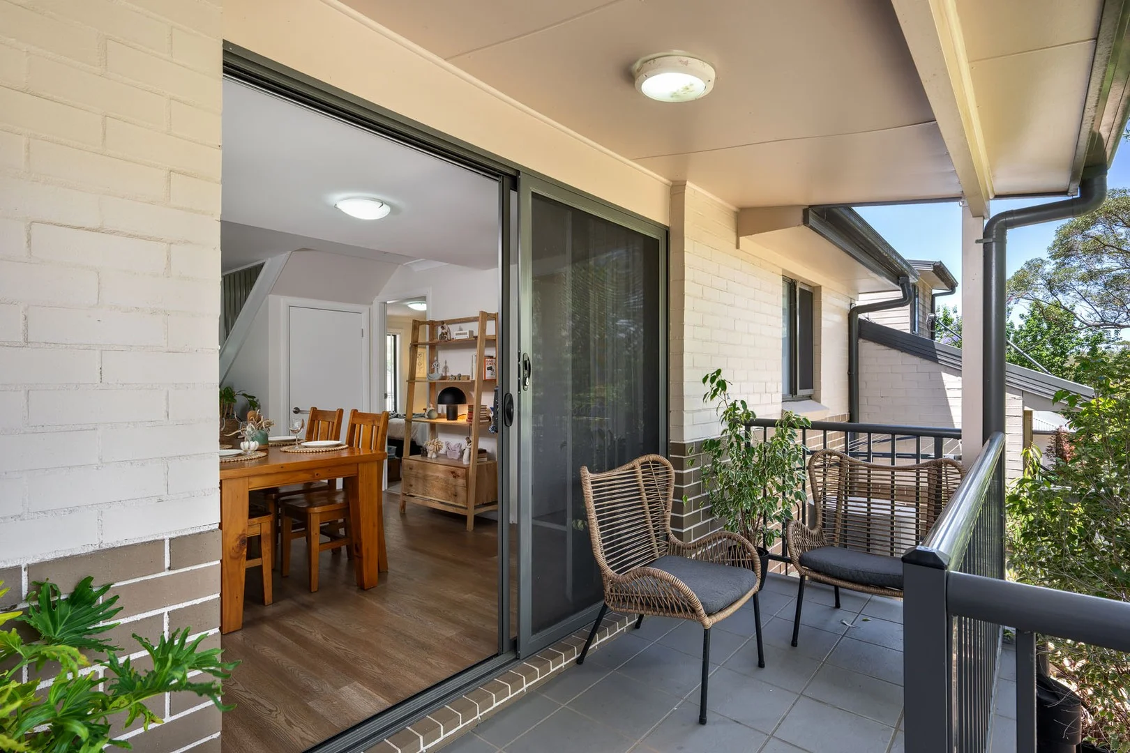
Blaxland, NSW 2774
Property Type: Townhouse
Listing Type: Residential
Status: Active
Summary: UNDER CONTRACT
Description: KEY FEATURES BEDROOMS: 3 (including built ins to all bedrooms) BATHROOMS: 2 LIVING AREAS: 1 GARAGING: 1 car garage OTHER FEATURES: Split system air conditioning, open plan feel, front & back verandahs, internal laundry, great storage throughout, private rear courtyard perfect for entertaining & enjoy time in the sun. Easy access to the single lock up garage. RATES & CHARGES COUNCIL RATES: $378.00 per quarter (approx) WATER CHARGES: $250.00 per quarter including personal usage (approx) STRATA FEES: $1,100.00 per quarter (approx) LOCATION 1.3 kms (approx) to Blaxland IGA & Shops 1.5 kms (approx) to Blaxland Station 2.5 kms (approx) to Glenbrook Village 1.4 kms (approx) to Glenbrook Swim Centre 12.5 kms (approx) to Penrith CBD 54 kms (approx) to Parramatta CBD 30 kms (approx) to Western Sydney International Airport (due to open in 2026) WHAT WE LOVE MOST! Located within a small complex, offering a great floor plan & within a stones throw to Blaxland shops & station. We love the private outdoor living space & the convenient location. THE VIBE: Spacious, welcoming & easy care! Disclaimer: We have been furnished with the above information, however, Merrick Property Group gives no guarantees or undertakings concerning the accuracy, completeness or up-to-date nature of the information provided. All interested parties are responsible for their own independent enquiries in order to determine whether or not this information is in fact accurate.
Agent: Paul Merrick - paul@merrickpropertygroup.com.au - 0247600812
Agent: Ty Hickson - ty@merrickpropertygroup.com.au - 0451 429 496
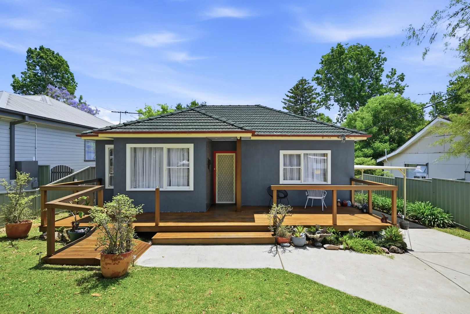
Blaxland, NSW 2774
Land Size: 600 m²
Property Type: House
Listing Type: Residential
Status: Active
Summary: Fully Loaded Opportunity Move In, Renovate, Detonate or Invest!
Description: Santa's come early with this incredible opportunity! Set on a 600sqm block in a highly sought-after neighbourhood, this property is bursting with potential. Whether you're looking to move straight in, renovate and add value, detonate and rebuild your dream home, or explore a granny flat addition (STCA), the possibilities are endless. 600sqm block with excellent scope for improvement Ideal for first home buyers, downsizers or savvy investors Family-friendly street in a popular, convenient location Outstanding potential to create your dream home or dual income(STCA) Properties like this are rare - and this one won't last long. Move fast and make it yours! Mitch Paxton Lic No: 20478544 DISCLAIMER: Whilst we deem this information to be reliable the agent cannot guarantee its accuracy and accepts no responsibility for such. Interested persons should rely on their own enquiries.
Agent: Daniel Hulston - daniel.hulston@aitkenre.com.au - 02 4739 1111
Agent: Mitch Paxton - mitch.paxton@aitkenre.com.au - 02 4739 1111
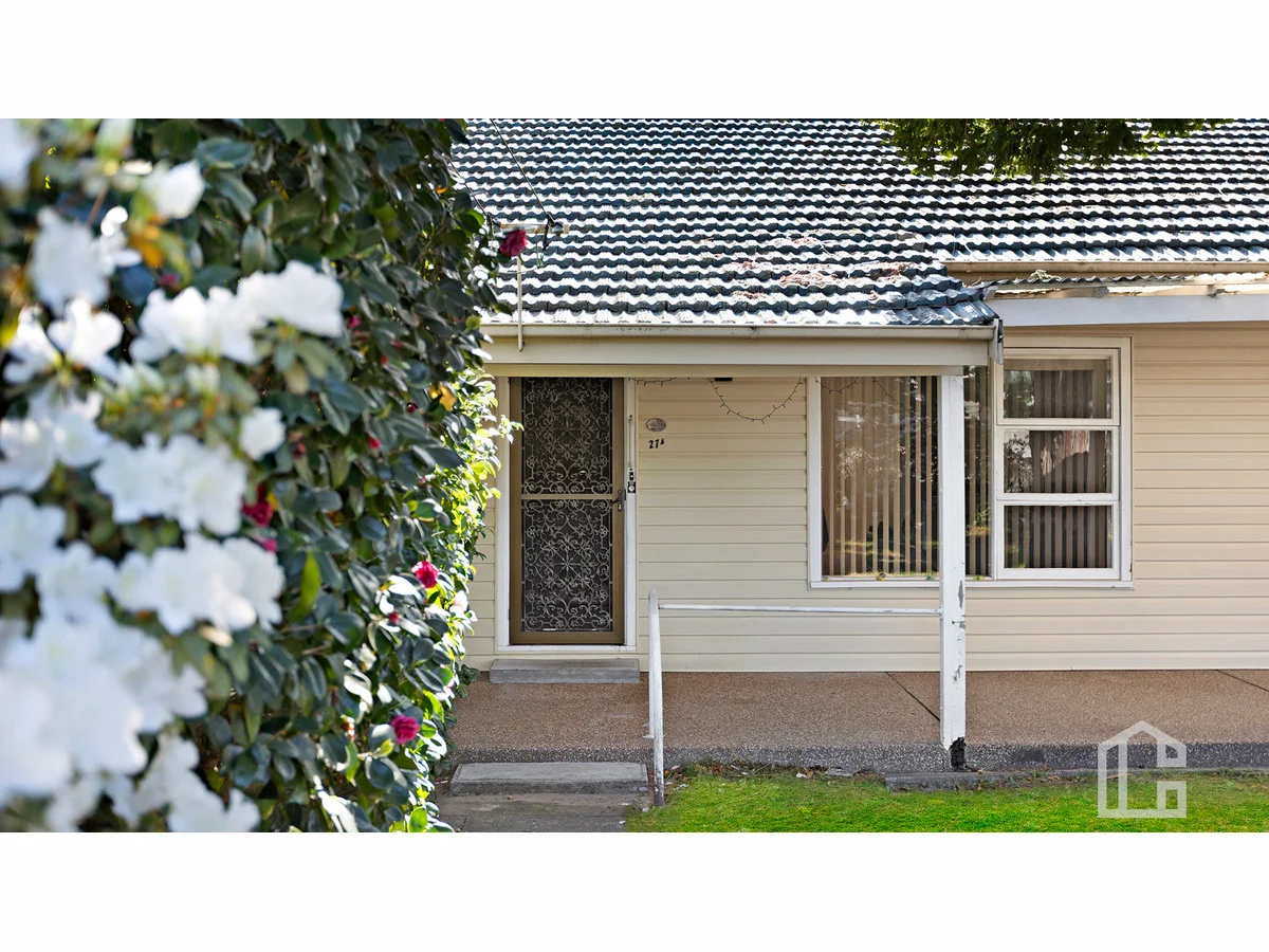
Blaxland, NSW 2774
Land Size: 695.6 m²
Property Type: House
Listing Type: Residential
Status: Active
Summary: R2 Zoned in the Heart of Blaxland
Description: LOCATION: Positioned on a gently sloping allotment of approx. 695 sqm, zoned R2. Convenient location with easy access to Blaxland rail offering accessibility lift and trouble free pedestrian access to Blaxland shops. STYLE: Single level, clad garden cottage with tile roof, built circa 1960. LAYOUT: Entry foyer, open plan dining and living, 2 bedrooms of ample size, 2nd large living room or 3rd bedroom overlooking backyard, study nook/sunroom FEATURES: Reverse cycle air-conditioningt, ceiling fan, original kitchen and bathroom, high ceilings, built in robes, uitility room, 2nd toilet, gently sloping yard and single lock up garage. Disclaimer: All information contained herein is gathered from sources we believe to be reliable. However, we cannot guarantee its accuracy & interested persons should rely on their own inquiries. Disclaimer: All information contained herein is gathered from sources we believe to be reliable. However, we cannot guarantee its accuracy and interested persons should rely on their own inquiries. Distances checked via Google Maps.
Agent: Tennille Haddock - thaddock@chapmanrealestate.com.au - 02 4739 4311
Agent: Sharon Lampert - slampert@chapmanrealestate.com.au - 02 4739 4311
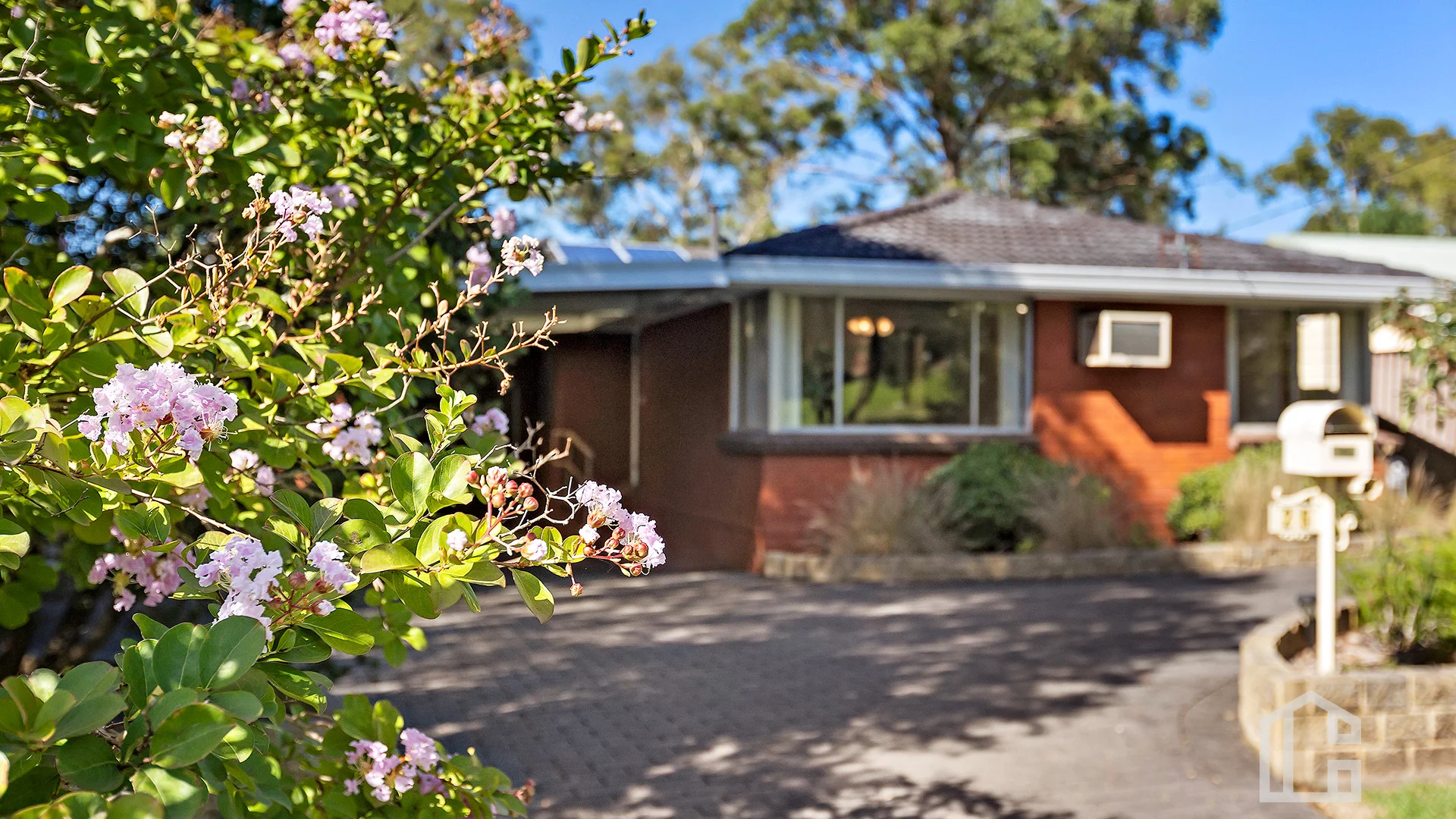
Blaxland, NSW 2774
Land Size: 760 m²
Property Type: House
Listing Type: Residential
Status: Active
Summary: A Warm, Well-Kept Home in a Peaceful Parkside Setting.
Description: Location Set on a flat, clear block in a tightly held and highly regarded street, this home enjoys a wonderful outlook backing directly onto Lennox Park and the local tennis courts. The position offers a peaceful, open feel with green views and excellent privacy, while still being close to local amenities, transport, schools and village conveniences. Style A single-story red brick and tile home, well maintained and presented in immaculate condition. Solid, timeless and low-maintenance, this property will appeal to families, downsizers and buyers seeking comfort with flexibility. Layout The home features a combined lounge and dining area, offering a spacious and practical central living zone. Accommodation includes well-sized bedrooms, all with excellent natural light and ceiling fans. A renovated main bathroom services the home, complemented by an additional toilet with its own powder room, providing extra convenience for families and guests. Features Just listed, this beautifully presented home offers spacious bedrooms, a freshly painted combined lounge and dining area with new carpets, air conditioning, ceiling fans throughout, and a cosy gas fireplace. The immaculate kitchen features a gas cooktop and stove and flows effortlessly into the living space. A renovated bathroom, separate powder room with an additional toilet, oversized single garage, double carport, and an attached utility room ideal as a studio, study or additional family space complete this exceptional offering. Backing onto parklands and set on one of the area's most sought-after streets, this is a home that combines comfort, flexibility and lifestyle. Disclaimer: All information contained herein is gathered from sources we believe to be reliable. However, we cannot guarantee its accuracy and interested persons should rely on their own inquiries. Distances checked via Google Maps.
Agent: Felipe Martin - fmartin@chapmanrealestate.com.au
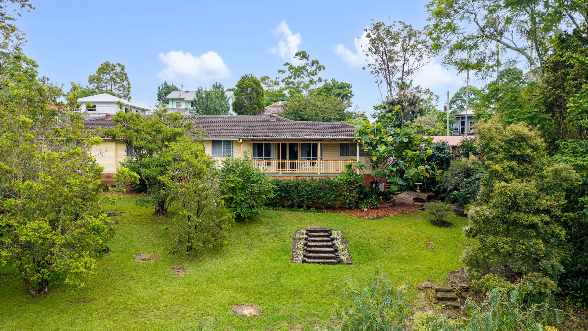
Warrimoo, NSW 2774
Land Size: 6696 m²
Property Type: House
Listing Type: Residential
Status: Active
Summary: Multi Generational Living | Lifestyle and Land in the Heart of Warrimoo
Description: Tucked away in a peaceful and private pocket of Warrimoo, this beautifully maintained home offers space, serenity and a rare opportunity to secure an expansive 6,696m² block in the heart of the Lower Mountains. Set back from the road and surrounded by established gardens and bushland, the home immediately feels like a retreat. Inside, the single level layout provides comfort and practicality, with five bedrooms and two bathrooms thoughtfully arranged to suit growing families or those simply wanting extra room to spread out. The home has been immaculately cared for over the years, offering a warm and welcoming atmosphere from the moment you step inside. Outdoors is where this property truly shines. The generous backyard and natural bush setting create a wonderful sense of privacy and freedom ideal for children to explore, for entertaining family and friends, or simply enjoying the peaceful surrounds. It's a block that offers space, flexibility and long-term lifestyle value. Positioned just moments from Warrimoo Train Station and within easy reach of local shops and schools, this is a home that combines convenience with the relaxed charm the Lower Mountains is known for. Whether you're searching for space for the family, room to grow, or a private escape with city access close by, this is a property that offers both lifestyle and opportunity. Ideal for multi-generational living Expansive 6,696m² block Five bedrooms, two bathrooms, two living spaces Single-level layout Air conditioning Garage accommodation with additional driveway parking Set back from the road for added privacy Established gardens and bushland surrounds Close to Warrimoo Train Station, local shops and schools Agent Daniel Jennings 0415 673 906 Lochlan Attard 0401 360 071 Disclaimer: The above information has been furnished to us by the vendor. We have not verified whether or not that information is accurate, and do not have any belief one way or the other in its accuracy. We do not accept any responsibility to any person for its accuracy and do no more than pass it on. All interested parties should make and rely upon their own inquiries in order to determine whether or not this information is, in fact, accurate. Some images may have been digitally styled for marketing purposes only.
Agent: Daniel Jennings - daniel@dukesestateagents.com.au - 02 4739 9933
Agent: Lochlan Attard - lochlan.a@dukesestateagents.com.au - 02 4739 9933
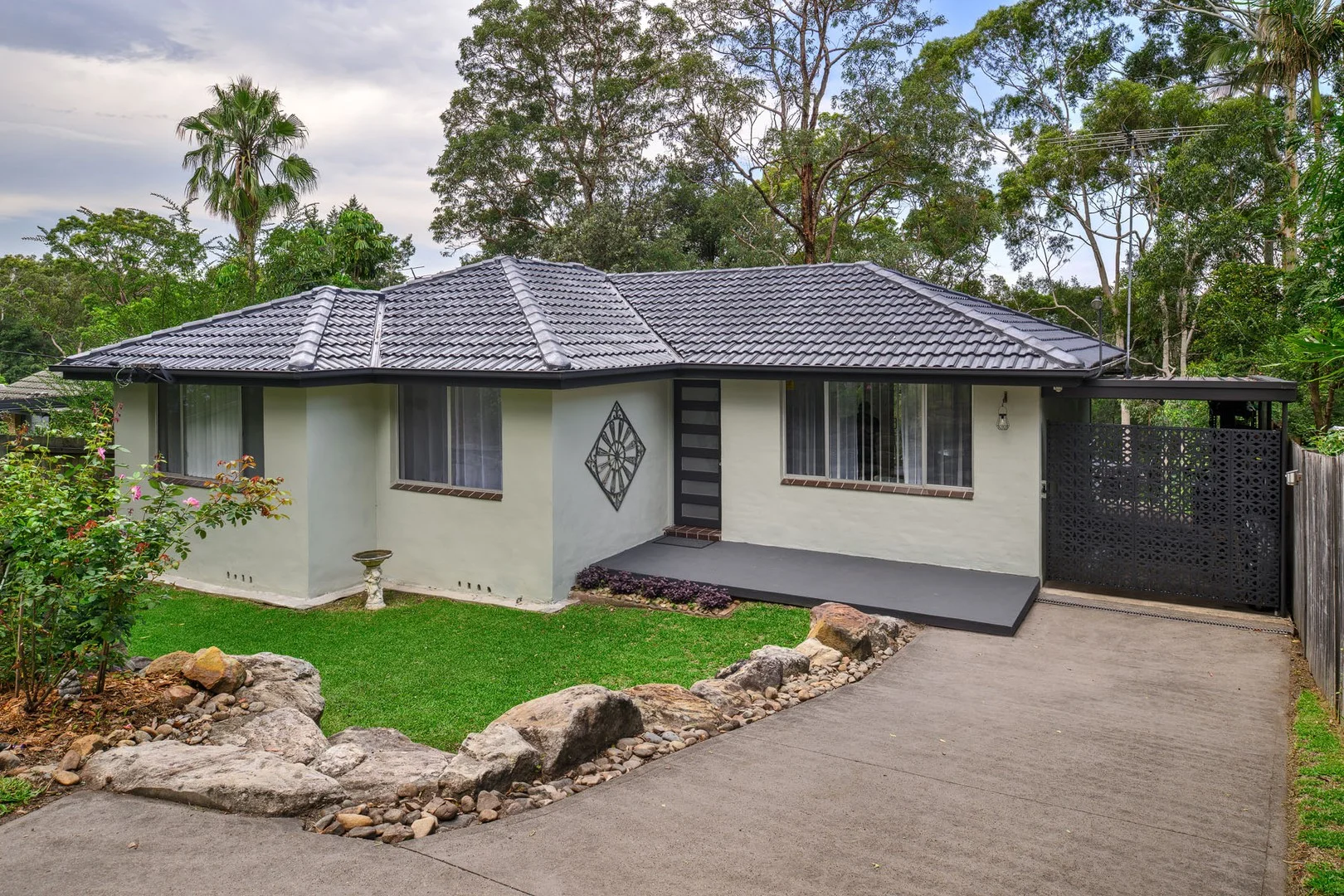
Warrimoo, NSW 2774
Land Size: 809 m²
Property Type: House
Listing Type: Residential
Status: Active
Summary: UNDER CONTRACT
Description: KEY FEATURES BLOCK SIZE: 809m2 (approx) BEDROOMS: 3 - all with built in robes BATHROOMS: 1 LIVING AREAS: 1 internal plus an undercover verandah GARAGING: Single carport plus further off street parking OTHER FEATURES: Split system air conditioning, ceiling fans, recently painted internally & timber floors restored. The kitchen comprises a large gas cooktop, electric oven & range hood, island bench & appliances cupboard. Internal laundry, open plan lounge & dining which seamlessly flow out to the verandah & overlooks the fully fenced backyard. Under house storage, pizza oven & a great private entertainers space for enjoying quality family time. Located on a parallel service road, adjacent to the Great Western Highway. RATES & CHARGES COUNCIL RATES: $547.00 per quarter (approx) WATER CHARGES: $230.00 per quarter not including personal usage (approx) LOCATION 2 kms (approx) to Warrimoo Public School 2.2 kms (approx) to Blue Mountains Grammar - Valley Heights 3 kms (approx) to Wycliffe Christian School 6.3 kms (approx) to Blaxland High School 1.6 kms (approx) to Warrimoo Station 4.4 kms (approx) to Blaxland IGA & shops 5.2 kms (approx) to Springwood CBD 14 kms (approx) to Penrith CBD 35 kms (approx) to Western Sydney International Airport (due to open in 2026) WHAT WE LOVE MOST! This property is a great first step into home ownership! There is plenty of room to entertain & the backyard can easily host kids play equipment, chooks & veggie patches. The floor plan is practical & its convenient to connect to the Great Western Highway for your trips up or down the Mountain. The gorgeous bush back drop is a highlight! THE VIBE: Functional, relaxed & offers a great place to unwind after a long day. Disclaimer: We have been furnished with the above information, however, Merrick Property Group gives no guarantees or undertakings concerning the accuracy, completeness or up-to-date nature of the information provided. All interested parties are responsible for their own independent enquiries in order to determine whether or not this information is in fact accurate.
Agent: Paul Merrick - paul@merrickpropertygroup.com.au - 0247600812
Agent: Ty Hickson - ty@merrickpropertygroup.com.au - 0451 429 496