19 Northcote Street
Coledale, NSW 2515
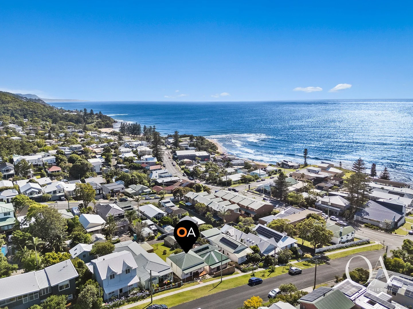
Neighbourhood & everyday essentials
Explore around Coledale, from school days to weekends.
Find schools, playgrounds and children’s classes. Browse by age to plan school days and weekends.
Area figures
- residents (ABS, June 2024)
- 221,894
- children aged 0–14
- 37,670
- schools
- 86
- parks & libraries
- 137
- kids’ activity providers listed
- 71
Most-listed activities: Swimming, Karate, Tennis
Population figures: Australian Bureau of Statistics
Explore local libraries, community spaces, schools and council programs across the wider area.
Parks, playgrounds & public spaces
St. James Park
Cliff St, Coledale, New South Wales, 2515
155 m straight-line distance
Coledale Beach Park
Lawrence Hargrave Dr, Coledale, New South Wales, 2515
256 m straight-line distance
Austinmer Boat Harbour Park
Headland Ave, Austinmer, New South Wales, 2515
1.1 km straight-line distance
Mike Dwyer Reserve
Lawrence Hargrave Dr, Wombarra, New South Wales, 2515
1.2 km straight-line distance
Things to do near this home
Explore nearby play centres and family attractions from the directory. Check ages, entry prices and opening hours with the venue.
Find more ideas by age, budget and indoor or outdoor setting on Things to do. Dated events are in What’s on. See what’s on
Discover local guides & family ideas
Read local family guides and practical articles as you explore life around this home.
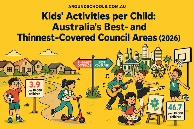
Kids' Activities per Child: Australia's Best- and Thinnest-Covered Council Areas (2026)
Across Australia's big council areas, the AroundSchools directory lists a median of about 10 kids' activity providers for every 10,000 children — but in Melbourne's Wyndham it is 3.9, and in the City…
Read more →
Most Livable Suburbs in New South Wales for Families (2026)
Sydney lists more kids' activities in our directory than any other suburb in NSW. This page ranks NSW suburbs by how much a family moving there could actually do with their kids, then adds what else…
Read more →Everyday essentials & getting around
Open the map to choose a destination and check journey times from this address. Walking routes, step-free access and travel times have not been verified.
Flood & development checks
Property-specific flood risk and announced developments have not been verified. Search this address in the official maps and ask the council for current flood information.
Source: AroundSchools directory. Distances are straight-line distances, not walking routes. Confirm facilities on the linked detail pages. Directory update dates are not supplied for this summary.
Property Details
409 m²
House
RESIDENTIAL
Upcoming Events Nearby

Thu, 1 Oct · South Hurstville.
Term 4: Ukulele for Kids (8-12 years)
Ages 8–12
Sun, 1 Nov · Hurstville.
Hurstville Museum & Gallery: Open Day
Fri, 20 Nov · Kogarah
Healthy and Active Families
Ages 6+
Sun, 1 Nov · Kogarah
Kogarah Christmas Carol
Tue, 13 Oct · Dulwich Hill
Storytime at ETC Library - Weekly Tuesdays from Oct 13 until Dec 15
Ages 3–5
Thu, 26 Nov · Burwood
FREE Kids STEAM Club (9 to 12 year olds) - Burwood Council | Monthly Activity till November
Ages 9–12
What's Nearby

St. James Park
Cliff St, Coledale

Coledale Soccer Fields
Cliff St, Coledale
Coledale Beach Park
Lawrence Hargrave Dr, Coledale
Austinmer Boat Harbour Park
Headland Ave, Austinmer
Mike Dwyer Reserve
Lawrence Hargrave Dr, Wombarra
Austinmer Park
Little Austinmer Ln, Austinmer
Glastonbury Gardens
Lawrence Hargrave Dr, Austinmer
Allen Park
Railway Ave, Austinmer
Sublime Point Cafe
Sublime Point Lkot, Maddens Plains
Nearby Schools

Coledale Public School
Lawrence Hargrave Drive, Coledale NSW 2515

Austinmer Public School
90 Lawrence Hargrave Drive, Austinmer NSW 2515

Scarborough Public School
Lawrence Hargrave Drive, Scarborough NSW 2515

Thirroul Public School
Roxburgh Ave, Thirroul NSW 2515

St Michael's Catholic Primary School - Thirroul
Station Street, Thirroul NSW 2515 Australia

Bulli Public School
Haig Rd, Bulli NSW 2516
Nearby schools do not imply enrolment eligibility. Confirm catchments, year levels and childcare availability directly with the provider.
Nearby Properties
Recently sold nearby
Homes that have sold close to this address. We don’t show sale prices.
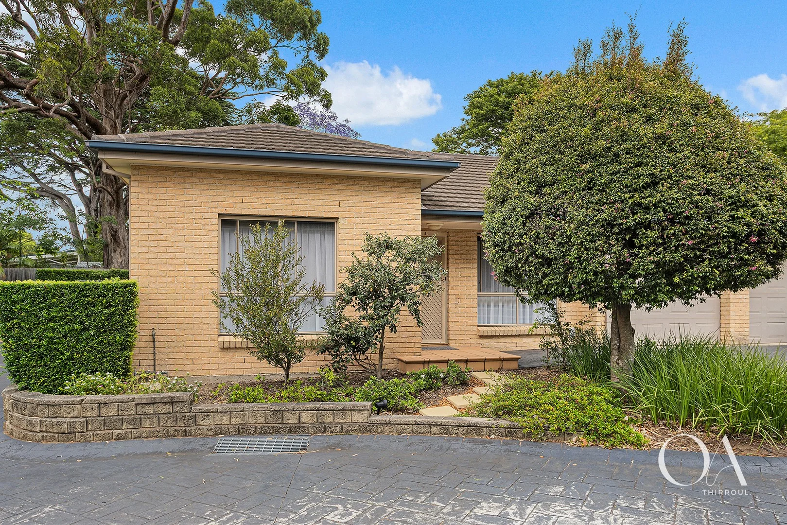
Thirroul, NSW 2515
Property Type: Villa
Listing Type: Residential
Status: Active
Summary: Sold Off Market
Description:
Agent: Andrew Hedley - andrewhedley@oneagency.com.au
Agent: Kane Downie - kanedownie@oneagency.com.au
Thirroul, NSW 2515
Land Size: 421 m²
Property Type: House
Listing Type: Residential
Status: Active
Summary: Charming. Convenient. Carefree.
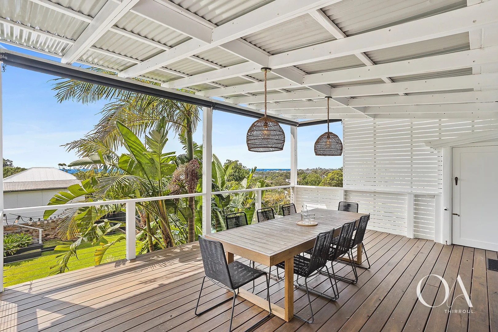
Description: Sold Off Market. Originally a workers' cottage dating back to the early 1930s, this beautifully renovated semi-detached home captures stellar ocean views from its elevated vantage, and is just a short stroll from the cosmopolitan delights of Thirroul Village and the transport hub that is Thirroul railway station. Featuring an expansive covered alfresco entertaining space overlooking the sunny rear yard, step inside and discover elegant solid timber flooring and generous ceiling height throughout, a tastefully remodelled bathroom and kitchen including high end Bosch induction cooktop, and 2 ample bedrooms, main including built-in robe and adjoining study/sunroom. Occupying a sun-blessed corner allotment with a long northern boundary and thriving established landscaping, Thirroul Public School is just 400m from home, Ryan's Hotel, cafes, Community Centre, and Library are all only 450m away, and express train travel to Sydney or Wollongong is accessed in a mere 600m. - Comprehensively renovated Torrens Title Semi enjoying stellar sea views - Elevated corner allotment with a long northern boundary welcoming light - Epic fully fenced grassed yard with verdant gardens and outdoor shower - Garage accessed from Virginia Terrace invites self-cont studio conversion - Open plan living connects to expansive covered outdoor entertaining area - Stylish stone kitchen features dishwasher, Bosch cooking, ample storage - 2 generous bedrooms, main including robe and adjoining sunroom/study - Polished modern bathroom with bath, rain shower, matte black tapware - Solid timber flooring, elegant plantation shutters, blockout roller blinds - Renovated ground floor laundry includes built-in cabinetry and tub - 6.6kW rooftop solar system, air conditioning, under house storage - 400m to School, 450m to shopping/dining/services, 600m to Train station
Agent: Andrew Hedley - andrewhedley@oneagency.com.au
Agent: Kane Downie - kanedownie@oneagency.com.au
Wombarra, NSW 2515
Land Size: 1094 m²
Property Type: House
Listing Type: Residential
Status: Active
Summary: Outstanding Oceanside Opportunity
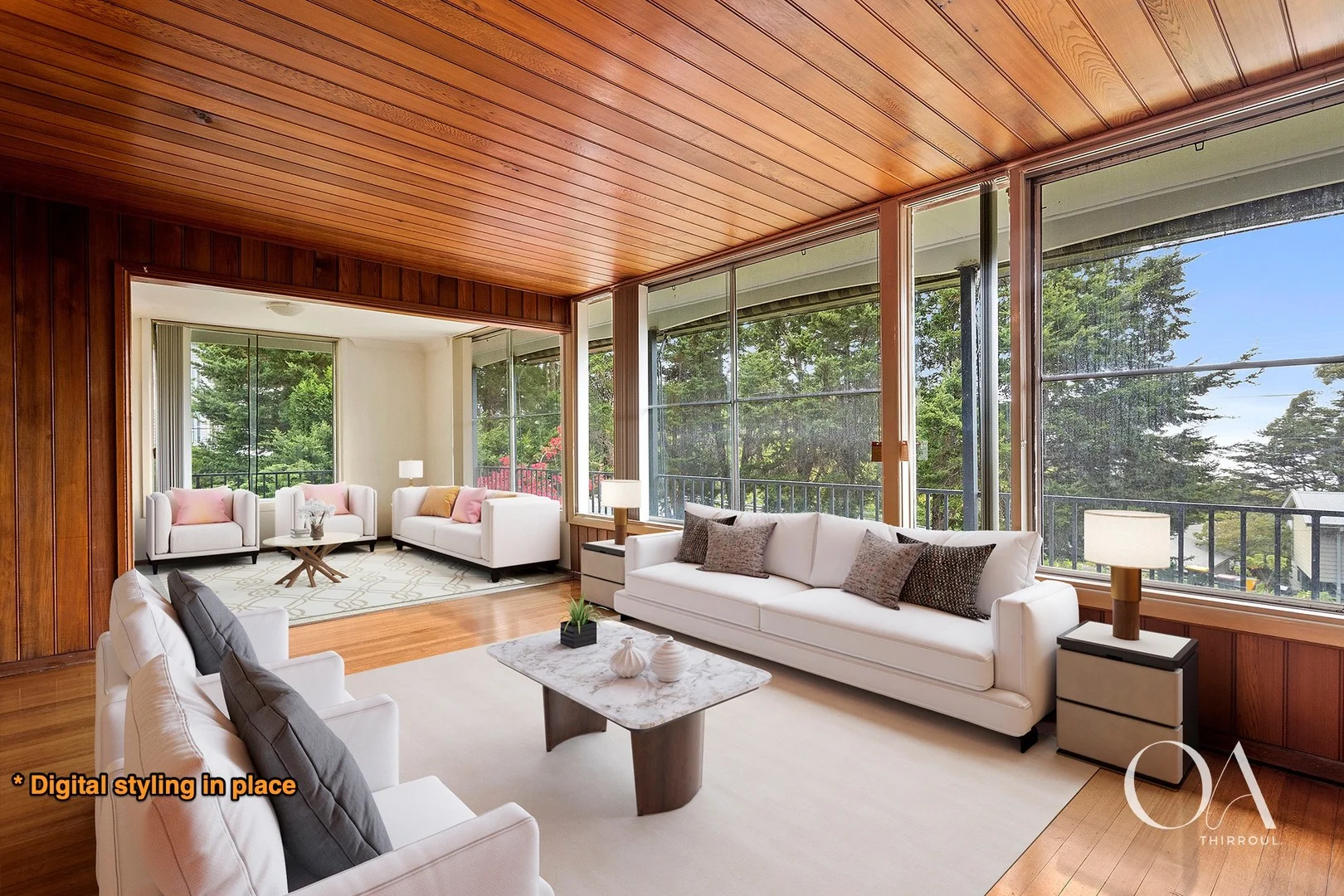
Description: Whether it be drawing an income from the detached flat and ground floor self-contained studio, accommodating extended family and guests, or redeveloping to create the ultimate coastal retreat, this expansive seaside home on a phenomenal 1094sqm corner allotment represents a wealth of possibilities for the future. Capturing sparkling ocean views from wide picture windows, elegant solid timber flooring connects kitchen/dining and generous living spaces, carpeted bedrooms feature unique original built-in wardrobes, a renovated family bathroom includes luxurious clawfoot tub, and established trees screen a verdant garden from the street. Occupying a privileged position in an extraordinarily beautiful landscape, both Northbound and Southbound bus stops are at your door, Jim Allen Oval sporting field is only 350m away, stunning Scarborough Beach is just 450m from home, Wombarra train station is accessed in 500m, and the iconic Scarborough Hotel is reached in 600m. - North and East facing 1094sqm corner allotment a short stroll to the beach - Subdivision and multiple occupancy development opportunities (STCA) - Spacious family home enjoys ocean views and abundant natural light - Wide enclosed verandah allows private all-weather outdoor entertaining - Kitchen features new solid timber benchtops and handy walk-in pantry - Skylit living area with hardwearing timber floor embraces ocean views - 3 ample carpeted bedrooms, 2 with built-in wardrobes, 1 with ensuite - Federation-style family bathroom includes pedestal basin and clawfoot tub - Downstairs self-contained studio with private entry, kitchenette, bathroom - Remote-access double garage features storage room and internal entry - Separate 1 bedroom flat includes kitchen, living area, bathroom, laundry, Parking space, and adjacent wilderness wonderland. - Bus at the door, 350m to Park, 450m to Beach, 500m to Train station
Agent: Kane Downie - kanedownie@oneagency.com.au
Agent: Andrew Hedley - andrewhedley@oneagency.com.au
Thirroul, NSW 2515
Property Type: Apartment / Unit / Flat
Listing Type: Residential
Status: Active
Summary: A Beachside Retreat Like No Other!
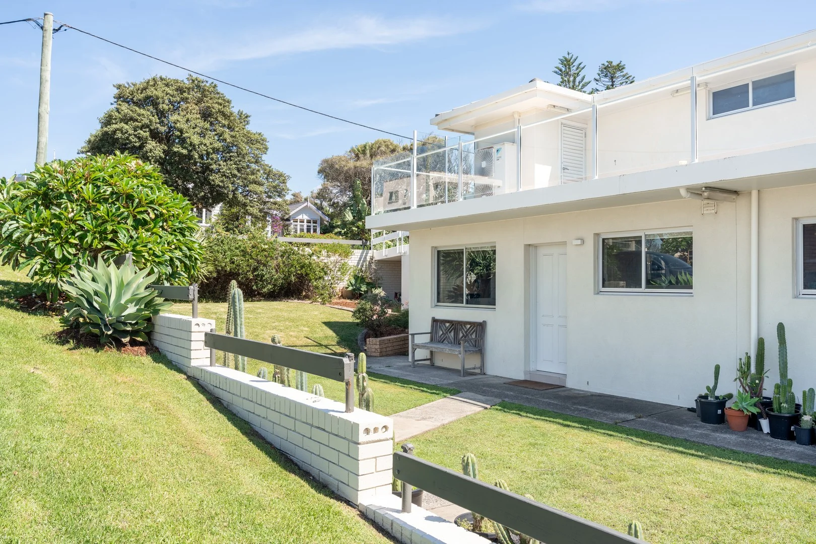
Description: Don't miss this rare opportunity to secure your very own slice of Thirroul coastal paradise. Set in an inspiring beachside location with breathtaking ocean and sand views that rival multimillion-dollar residences, this 2-bedroom, 2-bathroom apartment offers the perfect blend of comfort, space, and coastal charm. Ideally positioned in the most desirable & sought-after area, you'll enjoy a relaxed, outdoor lifestyle while remaining conveniently close to Sydney. • Wake up to uninterrupted ocean and beach vistas, watching the waves crash and the sun rise over the horizon - the perfect start to any day. • Two spacious bedrooms, including a master with an ensuite, provide plenty of room to unwind. The open-plan living area is ideal for lounging or entertaining guests. • Enjoy cooking in your modernized kitchen, complete with stone countertops and an oversized island - the sound of the ocean makes meal prep a true pleasure. • Step outside to a large, sun-drenched grassed area - perfect for kids to play, entertaining friends, or simply soaking in the sun and coastal breeze. • Additional external storage space is available, providing extra room for all your belongings, surfboards, or outdoor gear. • With the iconic Thirroul Beach, bike track, and swimming pool at your doorstep, embrace an active outdoor lifestyle while keeping an eye on the surf as you work from home. • Explore the vibrant local scene, with cafes, restaurants, shops, and the train station all just a short stroll away. • Double brick construction provides enhanced insulation and energy efficiency, while air conditioning adds an extra layer of comfort year-round. • The proximity to the Sublime Point hike and the bike path connecting Thirroul to Wollongong offers easy access to outdoor adventures. This property presents a fantastic investment opportunity with an estimated rental return of $700 per week and the potential for lucrative Airbnb income. Your new home includes a car space, with plenty of additional parking right out front. Experience the benefits of living in a boutique complex of just seven apartments, with low strata fees of $585 per quarter. Whether you're looking to embrace the beachside lifestyle or make a smart investment in the perfect property, this stunning Thirroul home offers the ideal location at the right time in the property cycle. Make it yours today!
Agent: Justin Sydenham - justin.sydenham@raywhite.com
Thirroul, NSW 2515
Property Type: House
Listing Type: Residential
Status: Active
Summary: Where morning sun and sea views define home.
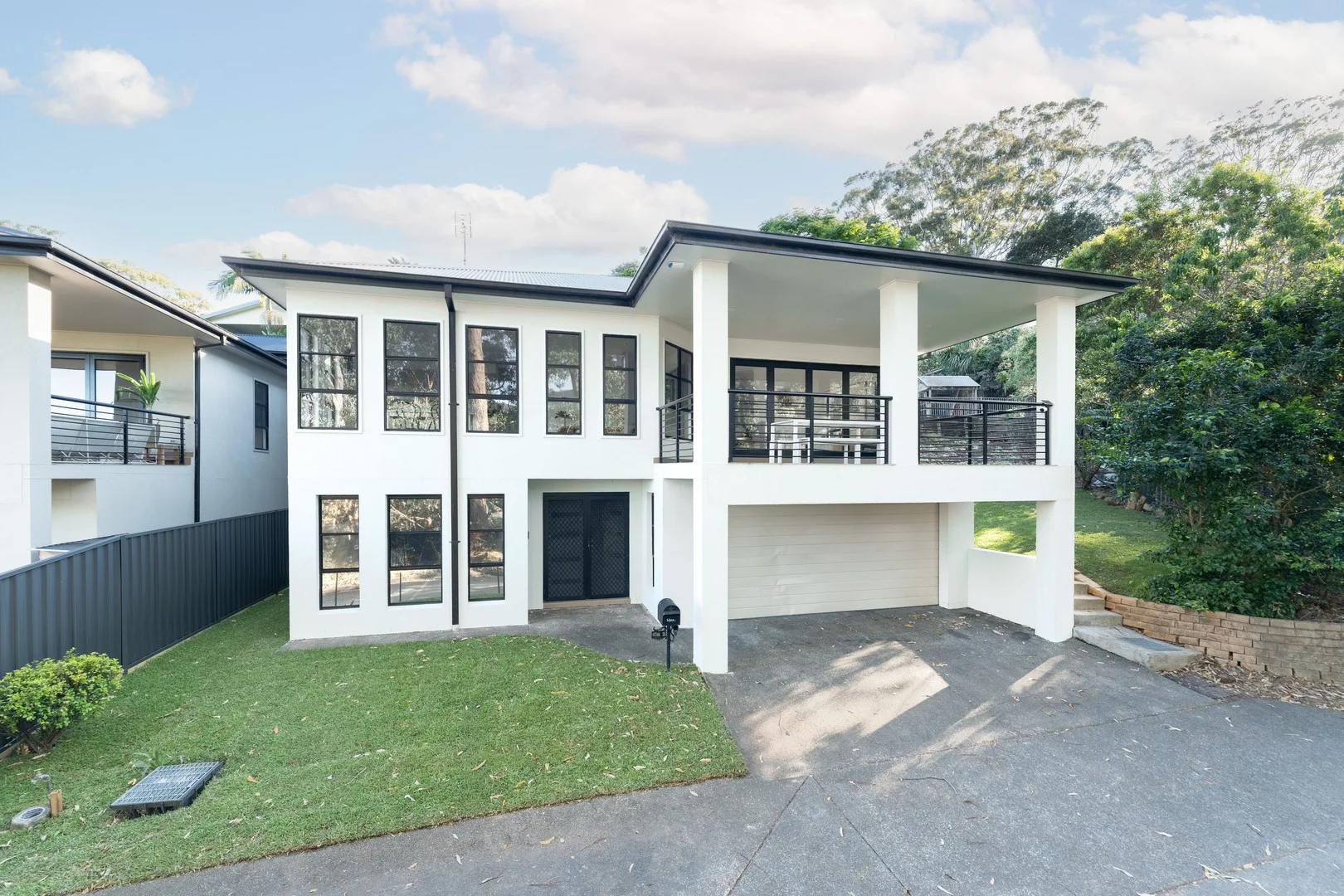
Description: Set high in a quiet, leafy pocket just moments from Thirroul Village, this master-built coastal residence combines enduring quality with fresh contemporary style. Solidly constructed and recently refurbished throughout, it captures natural light, sea breezes, and a sense of calm in every room. Wake each day to the warmth of the rising sun spilling across the ocean and into your open-plan living space - the perfect backdrop for relaxed coastal living. Upstairs offers three generous bedrooms, including a master suite with double-door entry providing northerly light, and a beautifully renewed ensuite. A versatile fourth bedroom on the lower level with its own bathroom is ideal for guests, a home office, or a private retreat. A choice of 3 bathrooms, the main featuring a separate vanity on entry and toilet, along with a room for the bath & shower. The spacious living and dining area flows seamlessly to a large covered entertaining deck with elevated ocean and bushland views, while the brand-new kitchen blends elegance with practicality - abundant space, premium finishes, and a stunning sea outlook. Complete with a remote double garage with internal access, elevated low-maintenance block, and a sun-drenched north-facing aspect, this home offers exceptional value for its calibre and location. A timeless, solid build - refreshed for modern coastal living, and priced to make your Thirroul dream a reality
Agent: Justin Sydenham - justin.sydenham@raywhite.com
Austinmer, NSW 2515
Property Type: Villa
Listing Type: Residential
Status: Active
Summary: The Garden Party
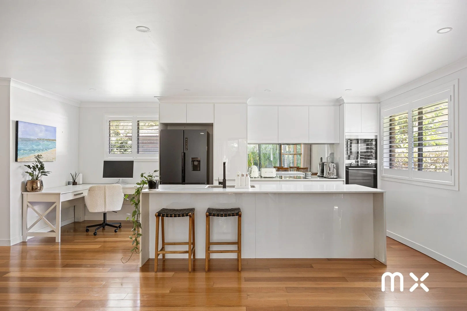
Description: stylish | refreshed | functional Beautifully updated and thoughtfully improved, this light filled home delivers modern comfort with a practical, family friendly layout. Set within an exclusive complex of just two villas, the residence enjoys a sense of privacy and low density living. With recent renovations throughout and a strong focus on everyday ease, the residence blends contemporary finishes with warm textures, generous storage and seamless indoor/outdoor living, making it an ideal choice for those seeking a move-in ready lifestyle. what you will love > open-plan kitchen, living & dining, a hub for everyday family life, designed for flexibility and effortless entertaining > sleek modern kitchen with stone benchtops, AEG electric cooktop, oven and microwave, offering style and functionality for daily cooking and hosting > large-format windows in the living area dressed with sheer linen curtains, allowing abundant natural light while maintaining privacy > timber floorboards paired with newly installed carpet (2025), delivering a warm, modern feel underfoot throughout the home > beautifully renovated bathroom (2025) featuring floating vanity and generous open shower with rainfall and handheld showerheads for a spa-like experience > plantation shutters and ceiling fans thoughtfully placed to enhance airflow, comfort and year-round liveability > daikin split-system air conditioning servicing the main kitchen, living zone & the upstairs room for tailored climate control > generous bedrooms with built-in wardrobes and fresh carpet (2025) providing comfort > wide hallways with excellent storage options, ensuring the home remains organised, practical and clutter-free > landscaped gardens designed for low maintenance while creating a peaceful, private setting ideal for everyday enjoyment > recently completed deck (2025) extending the living space outdoors and offering a relaxed area for entertaining or unwinding > parking for two vehicles, including a secure lock-up garage and additional driveway space for everyday convenience > council = $2,599 pa, water = $817 pa Whilst every effort has been made to ensure the accuracy and thoroughness of the information provided to you in our marketing material, we cannot guarantee the accuracy of the information provided by our vendors, and as such, and McNeice X makes no statement, representation or warranty, and assumes no legal liability in relation to the accuracy of the information provided. Interested parties should conduct their own due diligence in relation to each property they are considering purchasing. All photographs, maps and images are representative only, for marketing purposes.
Agent: David Hyslop - davidhyslop@mcneice.com.au - 02 4284 8536
Agent: Matthew Stipcevic - matthews@mcneice.com.au - 02 4284 8536
Thirroul, NSW 2515
Land Size: 669 m²
Property Type: House
Listing Type: Residential
Status: Active
Summary: Peaceful. Private. Coastal Living or Transformation
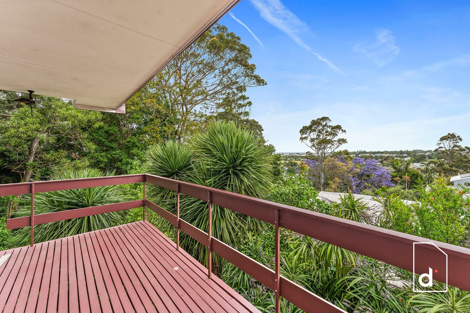
Description: Nestled into the lush escarpment foothills, this quietly positioned home offers a private sanctuary above the vibrant beachside village of Thirroul. Surrounded by established greenery with sweeping treetop and district views, this is a rare chance to secure a home that feels a world away - yet sits moments from the coast. Split-Level Living Clever design enhances comfort and privacy, with the upper floor dedicated to peaceful sleeping quarters and the lower living zones encouraging connection amongst family and friends. IndoorOutdoor Flow Light-filled lounge with cosy wood fireplace opens through sliding doors to an expansive view deck - a tranquil setting to welcome the sunrise or enjoy cool ocean breezes at dusk. Leafy Elevated Outlook Breathtaking vistas stretch across tree canopies, escarpment ridgelines, and distant ocean horizons, creating a calming retreat immersed in nature. Solid Original Bones Clean, functional interiors with three bedrooms, full bathroom + separate WC, and a retro kitchen provide immediate liveability with limitless potential. A Canvas for Creation Solid double-brick construction offers an exceptional foundation to reimagine and transform into a contemporary coastal haven over time. Secure Parking & Storage Oversized tandem garage with workshop space, plus a separate laundry room for added practicality. THE LOCATION + LIFESTYLE This peaceful setting is one of Thirroul's best-kept secrets - a leafy pocket offering unmatched serenity while remaining incredibly connected to the village and coastline below. Cafés and bakeries for morning coffee. Thirroul Beach and cycleways for weekend adventures. Express trains to Sydney for effortless commuting. Boutique shopping, community spirit, and a lifestyle people wait years to secure. Just an 8-minute (approx) walk to the train station and just over an hour to Sydney or the airport - no car needed! Work from home or commute with ease, then unwind with a 15-minute (approx) stroll to the beach and the free saltwater pool. At 7 Mason Street, you'll feel like you're living in a treetop escape - yet everything you need sits just a short stroll or drive away. A home with soul, potential, and a dream-worthy backdrop, this is your opportunity to transform a tranquil retreat into the coastal haven you've always imagined. ***Disclaimer*** The property photos and descriptions are provided for general information purposes only. While care has been taken to ensure their accuracy, variations may exist. Prospective buyers are encouraged to conduct their own inspections and seek independent advice to confirm all details.
Agent: Adam McMahon - info@dignam.com.au - 02 4267 5377
Agent: Lachlan James - info@dignam.com.au - 0242675377
Coledale, NSW 2515
Property Type: House
Listing Type: Residential
Status: Active
Summary: Experience an unrivalled level of lifestyle, quality & finish!
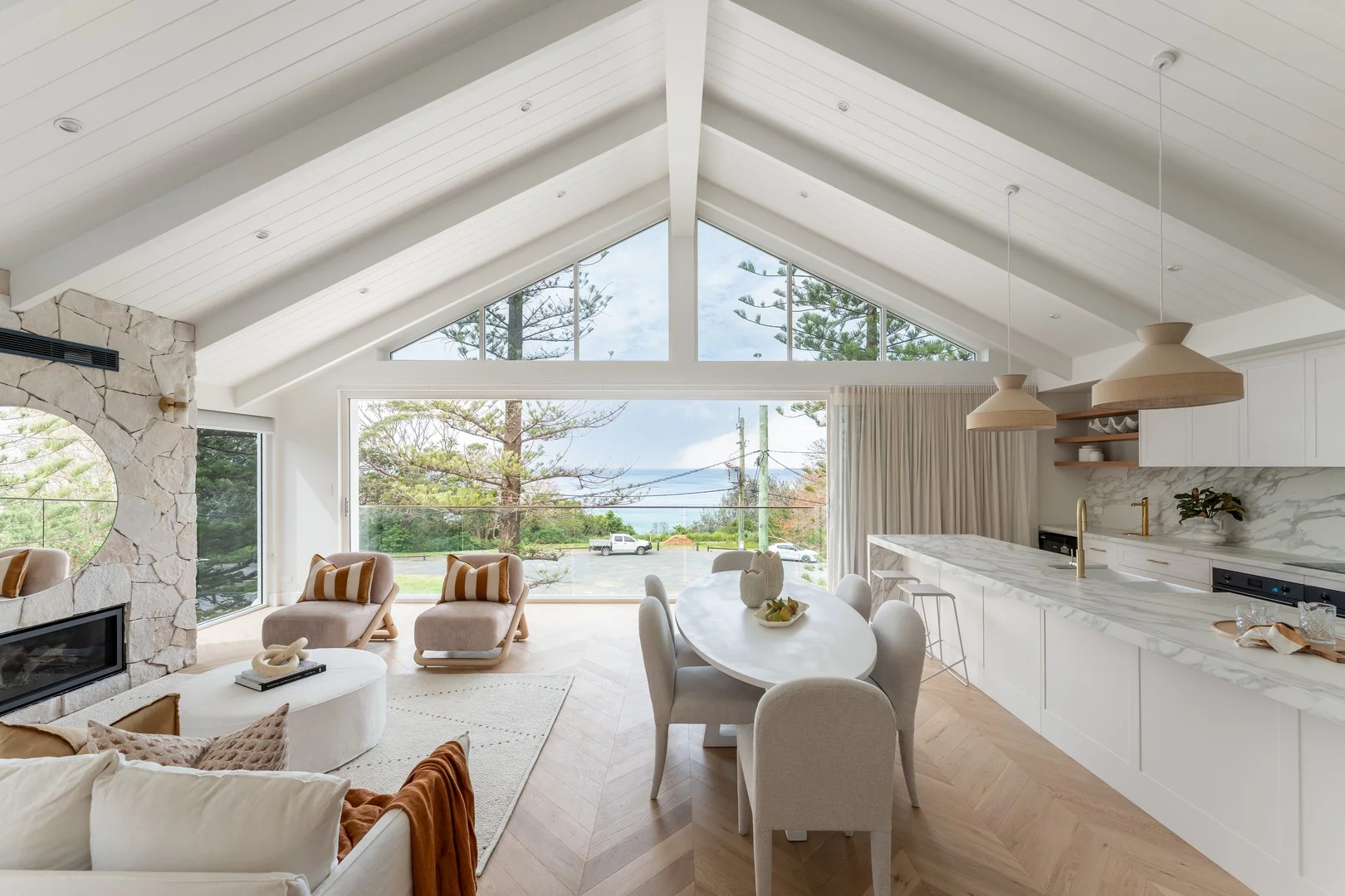
Description: Welcome to a residence that transcends the ordinary. Perched directly opposite the golden sands and rolling whitewash of iconic Sharkies Beach, this Mediterranean-inspired masterpiece by Genesis redefines luxury coastal living. Here, your weekends are spent drifting between ocean dips and sun-soaked relaxation, all from the comfort of a home that celebrates design, soul, and effortless elegance. Crafted with Genesis' signature precision and passion for innovative architecture, this is more than a home-it's a sanctuary. Whether you're seeking space for a growing family, an idyllic retreat for entertaining, or a flexible dual-living solution, this coastal haven delivers it all with unmistakable style. Brand new 5-bedroom, 5-bathroom showpiece capturing uninterrupted views of the Pacific Ocean and beloved Sharkies Beach Versatile floorplan ideal for families or dual living - full sized home upstairs with three bedrooms. ensuite bathrooms. Featuring the most spectacular master suite with walk in robe & exotic bathroom & private access to the pool deck & BBQ area. Breathtaking upper-level living zone featuring vaulted ceilings, commercial full-length double glazed glass dressed with elegant full length curtains. There's wide light filled hallways, and seamless flow to a north-facing Palm Springs-inspired pool deck with polished concrete podiums, built-in BBQ and a mosaic-tiled heated pool or oversized spa for year-round enjoyment Gourmet kitchen of grand proportion, centred around a 60mm waterfall-edge breakfast bar and fitted with a Smeg 900 induction cooktop, two pyrolytic ovens, additional combi oven with warmer, and a Liebherr fully integrated double fridge plus wine fridge. A full butler's pantry with extensive storage and double sink completes the entertainer's dream Lower level living equally refined, boasting a sculptural kitchen more artwork than utility, ocean views, and direct access to the sun-drenched garden terrace & front garden Oversized gas fireplace encased within a striking sandstone wall, adding warmth and ambience to the main living space Private side entry framed by a brushed-gold hot/cold outdoor shower, leading to a statement front door and impressive entry foyer Double-height entry void with joinery bench seating & cloak cupboard, concealed shoe storage and level access to the lower living and bedrooms. Premium finishes throughout including Chevron Oak flooring, central ducted heating & cooling, and under-floor heating in both master bathrooms A home designed with abundant light, warmth, and cinematic luxury-every space inspires comfort, creativity and connection Enjoy the sun, sand, surf & community feel of Sharkies Beach directly across the road. A real lifestyle convenience with Coledale's eateries & shops as well as the Iconic headlands Hotel only minutes walk along the coastline.
Agent: Justin Sydenham - justin.sydenham@raywhite.com
Agent: Larissa Gameiro - salesthirroul@raywhite.com
Thirroul, NSW 2515
Property Type: Townhouse
Listing Type: Residential
Status: Active
Summary: Idyllic setting in sought after location
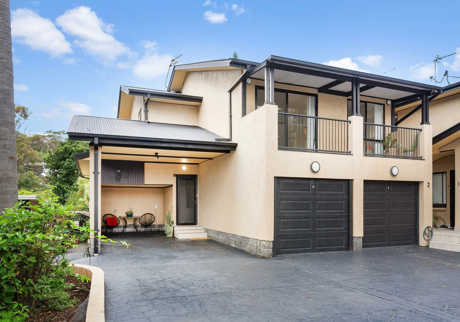
Description: The perfect lifestyle awaits in this oversized town home located just steps away from Thirroul Beach. Grab a coffee from a great coffee shop around the corner on your way to work in the morning, or stay for a chat with the locals to exchange the latest surfing tips. Walk to Thirroul village hub with fabulous eateries, wine bars and Anita's Theatre with live shows and entertainment. For the commuters, Thirroul train station has an express service to Sydney, with 1 hour and 10 minutes ride to Sydney CBD. First time offered for sale, in a small complex of three, this property is perfectly located for convenience and superior lifestyle. Other features:- Approximately 135 metres to the beach Walk in robes in all bedrooms Three balconies with escarpment views Single remote controlled garage + carport Private parking spot along the street in front of the complex Gas cooking, heating and hot water Affordable outgoings Level walk to everything Strata levies: $805.00 per quarter Council rates: $502.53 per quarter Water rates: $169.03 per quarter
Agent: Barbara Wright - barbara.wright@seacliffproperty.com.au