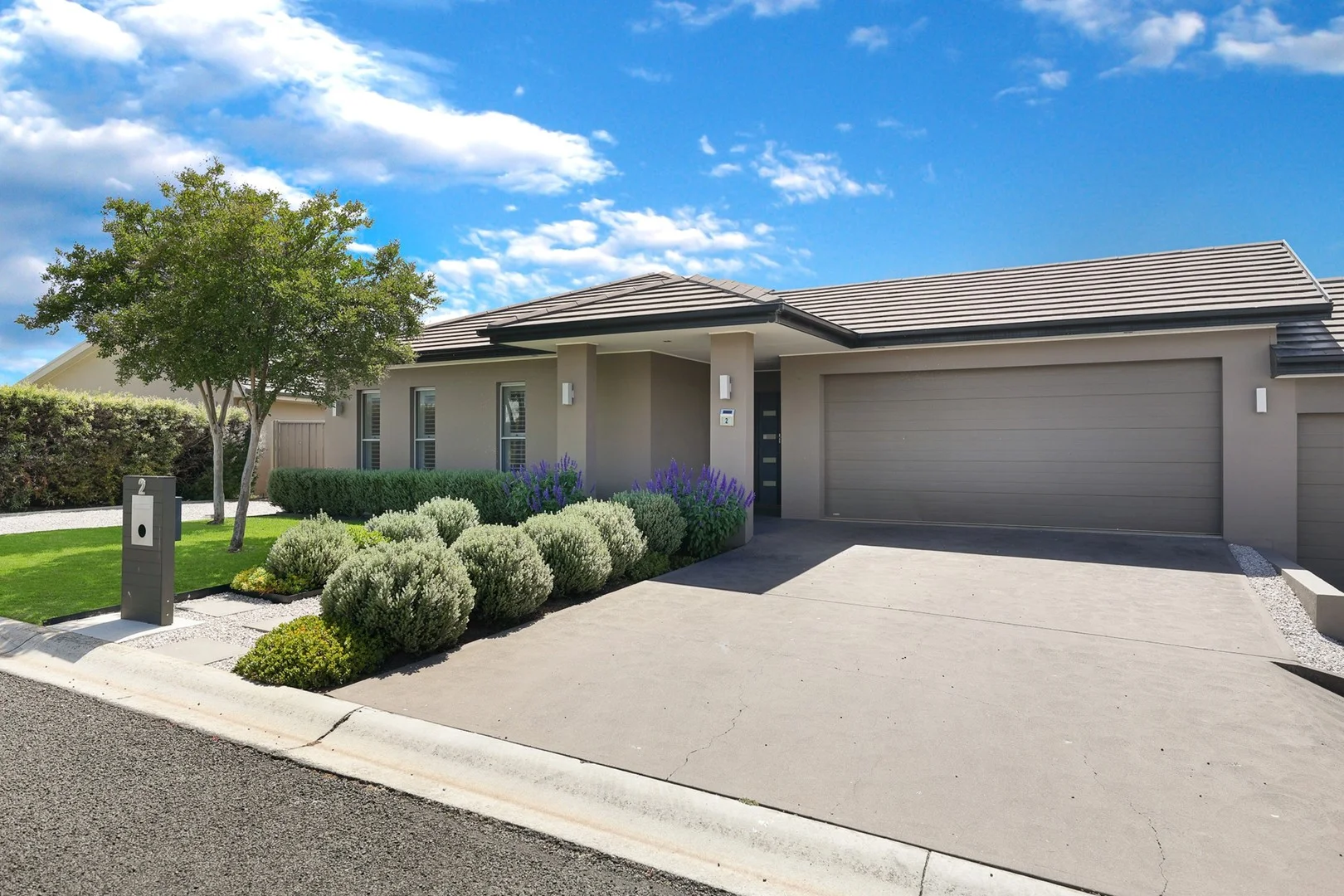
2 Wanda Crescent
Mudgee, NSW 2850
Neighbourhood & everyday essentials
Explore around Mudgee, from school days to weekends.
Area figures
- schools in Mudgee
- 4
Find schools, playgrounds and children’s classes. Browse by age to plan school days and weekends.
Area figures
- residents (ABS, June 2024)
- 26,214
- children aged 0–14
- 5,260
- schools
- 13
- parks & libraries
- 36
- kids’ activity providers listed
- 4
Most-listed activities: Gymnastics, Karate, Tennis
Population figures: Australian Bureau of Statistics
Explore local libraries, community spaces, schools and council programs across the wider area.
Parks, playgrounds & public spaces
Doug Gudgeon Drive Park
Doug Gudgeon Dr, Mudgee, New South Wales, 2850
442 m straight-line distance
Cahill Park
Lawson St S, Mudgee, New South Wales, 2850
1.4 km straight-line distance
Mudgee Park
Nicholson St, Mudgee, New South Wales, 2850
1.9 km straight-line distance
Avisford Nature Reserve
Mount Misery Rd, Mudgee, New South Wales, 2850
2.7 km straight-line distance
Cahill Park: Sports courts / fields
Things to do near this home
Explore nearby play centres and family attractions from the directory. Check ages, entry prices and opening hours with the venue.
Find more ideas by age, budget and indoor or outdoor setting on Things to do. Dated events are in What’s on. See what’s on
Discover local guides & family ideas
Read local family guides and practical articles as you explore life around this home.
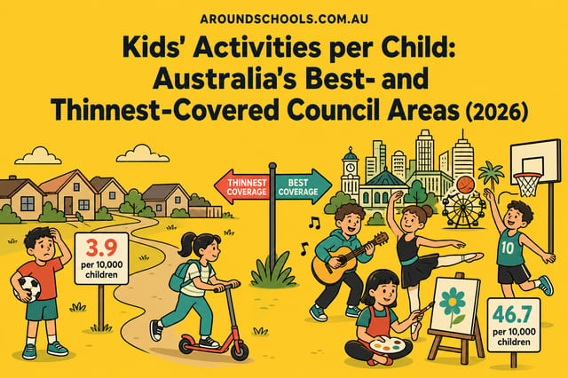
Kids' Activities per Child: Australia's Best- and Thinnest-Covered Council Areas (2026)
Across Australia's big council areas, the AroundSchools directory lists a median of about 10 kids' activity providers for every 10,000 children — but in Melbourne's Wyndham it is 3.9, and in the City…
Read more →
Most Livable Suburbs in New South Wales for Families (2026)
Sydney lists more kids' activities in our directory than any other suburb in NSW. This page ranks NSW suburbs by how much a family moving there could actually do with their kids, then adds what else…
Read more →Everyday essentials & getting around
Open the map to choose a destination and check journey times from this address. Walking routes, step-free access and travel times have not been verified.
Flood & development checks
Property-specific flood risk and announced developments have not been verified. Search this address in the official maps and ask the council for current flood information.
Source: AroundSchools directory. Distances are straight-line distances, not walking routes. Confirm facilities on the linked detail pages. Directory update dates are not supplied for this summary.
Property Details
444 m²
House
RESIDENTIAL
What's Nearby




Nearby Schools

Cudgegong Valley Public School
Madeira Rd, Mudgee NSW 2850

St Matthews Catholic School - Mudgee
Lewis Street, Mudgee NSW 2850 Australia

Mudgee High School
41 Douro St, Mudgee NSW 2850

Mudgee Public School
Perry St, Mudgee NSW 2850

Hargraves Public School
Merinda St, Hargraves NSW 2850

Lue Public School
Swanston St, Lue NSW 2850
Nearby schools do not imply enrolment eligibility. Confirm catchments, year levels and childcare availability directly with the provider.
Nearby Properties
Recently sold nearby
Homes that have sold close to this address. We don’t show sale prices.
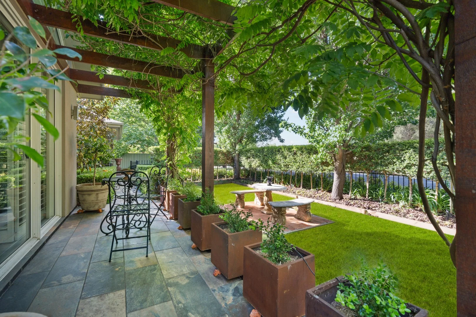
Mudgee, NSW 2850
Land Size: 1433 m²
Property Type: House
Listing Type: Residential
Status: Active
Summary: Prestige Living In Leafy East Mudgee
Description: Positioned in sought after east Mudgee, this craftsman built residence exudes elegance and style and enjoys leafy seclusion and privacy, screened behind mature hedges and trees on a level 1433sqm allotment. Cleverly designed with a focus on comfort and energy efficiency, this home bathes in an abundance of natural light and benefits from a versatile floorplan of generous proportions. * Craftsman built to the highest standards with attention to detail inside and out * Multiple dining, family and living zones overlooking decks, courtyard and gardens * Custom design kitchen with first class appliances, stone tops and abundant storage * King sized master suite with walk-in dressing room, new carpet, generous ensuite, heated towel rail * Two further king sized bedrooms with excellent storage plus fourth bedroom/home office * Well appointed main bathroom, heated towel rail; Large laundry with ample built in cabinetry * Hydronic underfloor heating and ducted reverse cycle air conditioning, gas fireplace, ceiling fans * High 2.7m ceilings, feature raked ceiling in north facing sitting room * Extensive hallway storage and linen press * Covered entertaining area plus additional private courtyard ideal for alfresco dining * Double lock up garage with internal access * 12m x 6m Colorbond shed (2.7m high) with skillion roof and 2 secure car spaces * Newly installed 15.3kW roof solar system with 27kWh battery * Brick and Hebel construction with custom orb Zincalume roofing. Composite decking for all-weather durability * FTN internet connection * Security system with cameras, alarms, deadlocks, window locks and external sensor lighting * Landscaped gardens with established lawns, specimen trees and low maintenance design * Shade house, glasshouse, raised garden beds and garden shed * 38L/min approx. bore with automated irrigation servicing established gardens * 2700L of rain water storage with filtration system and optional house or garden connection * Outstanding sustainability features including double glazed windows and premium insulation throughout * Within easy walking distance of the Mudgee CBD A meticulously maintained and thoughtfully designed home offering privacy, sustainability and space in a blue chip Mudgee setting. To arrange a private inspection, contact Damian Kearns at The Agency Mudgee on 0428 144 905
Agent: Damian Kearns - damiankearns@theagency.com.au - 0428 144 905
Mudgee, NSW 2850
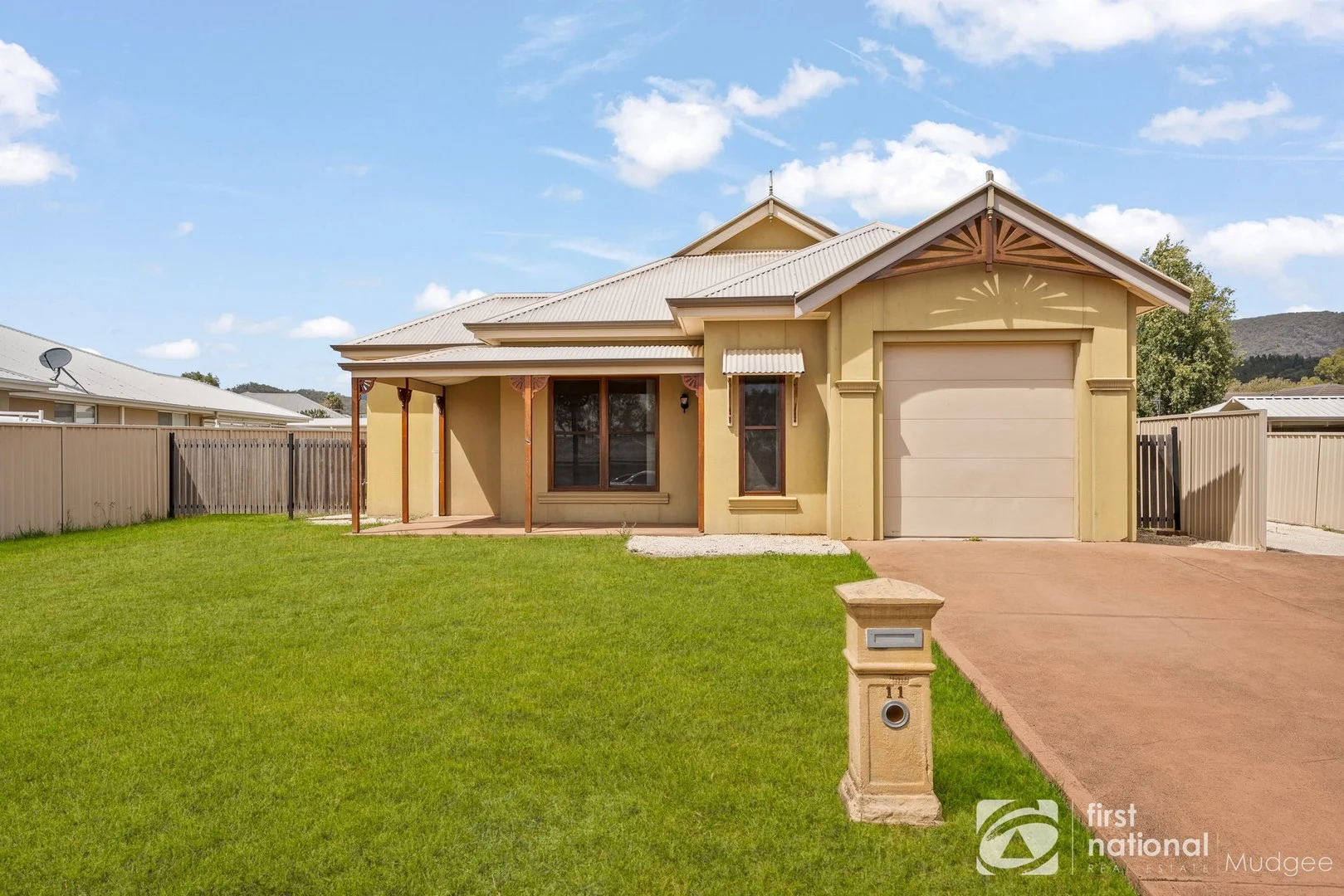
Land Size: 511 m²
Property Type: House
Listing Type: Residential
Status: Active
Summary: CHARM FROM THE STREET, SPACE WITHIN
Description: FIRST IMPRESSIONS FROM THE AGENT From its charming street presence to its surprisingly spacious interior, this quality-built home is a true surprise package. With decorative timber details, ornate ceilings and generous proportions throughout, it offers warmth, character and comfort in equal measure. FIRST CHOICE FEATURES - Charming front facade with decorative timber features and inviting front porch - Open plan living and dining areas framed by timber windows - Well-appointed kitchen with gas cooktop, breakfast bar and excellent storage including a deep pantry - Generously sized bedrooms all with built-in robes, master with ensuite - Picture rails and ornate ceilings adding character and charm - Excellent storage throughout the home - Split system air conditioning for year-round comfort - Covered outdoor alfresco area ideal for relaxed entertaining - Single lock-up garage with internal access and electric door - Easy-care, level 512sqm block with garden shed WHY THE OWNER PUT THE PROPERTY FIRST The owners loved how this home combined character with practicality. Its generous room sizes, excellent storage and easy layout made it comfortable to live in and appealing to a wide range of buyers or tenants. Whether as a long-term rental, a first home or a downsizer's choice, it's been a reliable, low-fuss property with enduring appeal. Contact Marnie Robbins on 0423 618 693 to arrange your inspection. DISCLAIMER: The above information has been furnished to us by the Vendor. We have not verified whether or not that information is accurate and do not have any belief one way or another in its accuracy. We do not accept any responsibility to any person for its accuracy and do no more than pass it on. All interested parties should make and rely upon their own enquiries in order to determine whether or not this information is in fact accurate.
Agent: Marnie Robbins - marnie.robbins@fnmudgee.com.au - 0263723000
Mudgee, NSW 2850
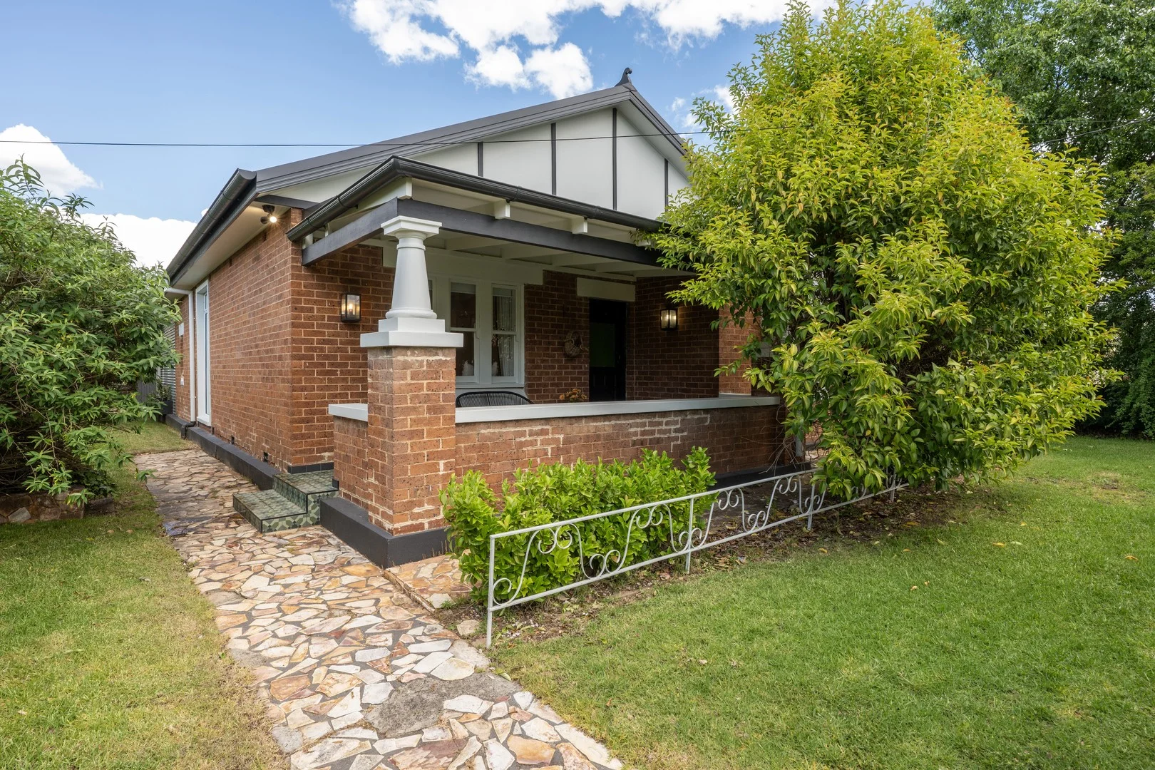
Land Size: 867 m²
Property Type: House
Listing Type: Residential
Status: Active
Summary: Charming Mudgee Cottage Renovated & Ready
Description: Rich in character and thoughtfully renovated, this charming brick cottage perfectly balances timeless appeal with modern comfort. Just steps from the heart of downtown Mudgee, the home has been designed for effortless living and entertaining, with open-plan spaces flowing seamlessly to a private alfresco and a beautifully landscaped backyard, ideal for gatherings or quiet relaxation. Currently operating as an Airbnb, it offers a rare combination of lifestyle sophistication and strong investment potential. Whether you're raising a family, downsizing with ease, or seeking a turnkey short-stay property, this home presents an exceptional opportunity in one of Mudgee's most sought-after locations. - Fully renovated to perfection with high-end finishes and quality craftsmanship throughout - Three well-proportioned bedrooms, including a luxurious master retreat with walk-in robe and elegant ensuite - Open-plan living with raked ceilings and skylights, filling the space with natural light - Showpiece kitchen with stone benchtops, large walk-in pantry and outdoor servery window - Cosy woodfire and ducted air conditioning for year-round comfort and ambience - Dedicated study nook, perfect for remote work or study - Luxurious main bathroom with floor-to-ceiling tiles, floating vanity & large soaker tub - Remote gate access for privacy and security - Garden shed and irrigation across an established 867m² block - Ideal for families, entertaining, or short-stay accommodation - Currently operating as an Airbnb - Short walk to hospital, cafés, restaurants, parks, and the CBD
Agent: Adam Woods - adamwoods@mcgrath.com.au - 6372 2584
Mudgee, NSW 2850
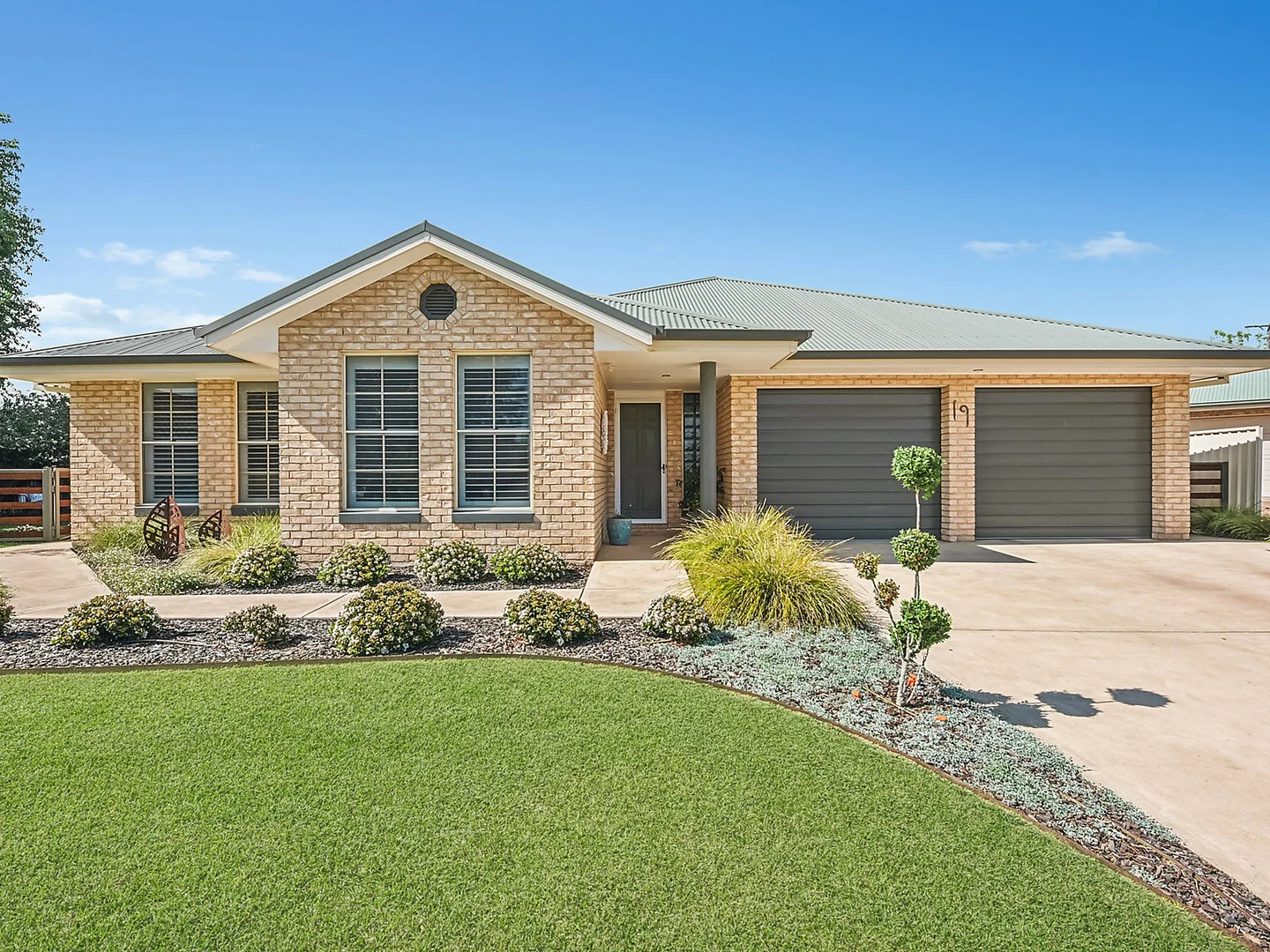
Land Size: 944 m²
Property Type: House
Listing Type: Residential
Status: Active
Summary: Stylish Living and Exceptional Comfort in Leafy East Mudgee
Description: Tucked away in a quiet cul-de-sac in sought-after East Mudgee, 19 Julia Court presents the perfect fusion of contemporary living, timeless comfort, and elegant outdoor entertaining. This beautifully renovated four-bedroom residence offers a relaxed and easy-care lifestyle, thoughtfully designed for families, downsizers, short term Airbnb investors, or anyone seeking space, style, and serenity. From the moment you arrive, you'll be captivated by the home's pristine street appeal, manicured front gardens, and elegant façade. Set on a generous 944m² block, the home boasts a flexible, light-filled floorplan with expansive living areas, large bedrooms, and seamless indoor-outdoor flow. Surrounded by lush, landscaped gardens and peaceful leafy surrounds, this is a true haven sitting on the fringe of Mudgee's CBD with walking distance to parks, schools and the Cudgegong River. Property Features: - Light-filled family home offering high ceilings and quality finishes throughout - Four oversized bedrooms, including a master suite with walk-in robe, built-in wardrobe, ceiling fan and ensuite - Three additional king-sized bedrooms, all with built-in robes - Spacious formal lounge and dining room with a sunny northerly aspect - Light-filled open plan living and meals area off the well-appointed kitchen - Modern kitchen featuring SMEG appliances and a large walk-in pantry - Ducted reverse-cycle air conditioning, ceiling fans and underfloor heating for year-round comfort - Plantation shutters throughout add style and privacy - Covered all-weather outdoor entertaining area overlooking established gardens - Relaxing four-person spa bath set in a tranquil garden setting - Double lock-up garage with internal access and additional storage - Trendy garden shed/cubby house, ideal for kids or creative outdoor use - Beautifully maintained 944m² block with ornamental shade trees and flowering plants - Quiet, family-friendly cul-de-sac close to parks, schools, and all Mudgee amenities This home combines the charm of a tranquil garden retreat with the functionality of a spacious family residence all in one of Mudgee's most desirable neighbourhoods. Homes in this location are rarely offered to market. Don't miss your chance to inspect today. Contact Edwina Smith today to arrange your private viewing on 0429 328 086. Disclaimer: The material and information contained within this marketing material is for general information purposes only. All information contained herein has been gathered from sources we deem to be reliable. However, we cannot guarantee it's accuracy. You should not rely upon this information and material as a basis for making any formal decisions. We recommend all interested parties make further enquiries to verify the information contained herein.
Agent: Edwina Smith - edwinasmith@spmudgee.com.au - 0429 328 086
Mudgee, NSW 2850
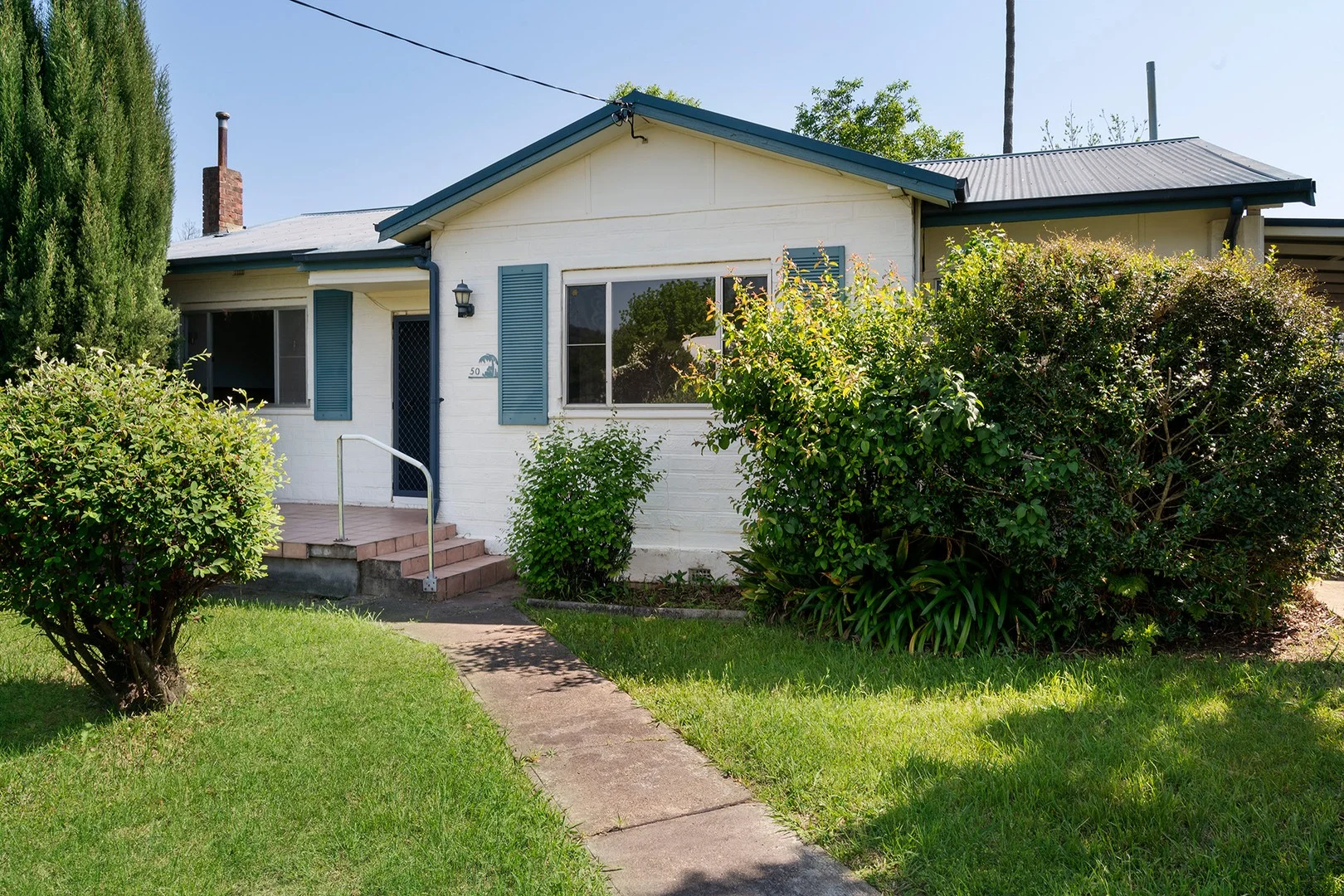
Land Size: 954 m²
Property Type: House
Listing Type: Residential
Status: Active
Summary: CHARMING EARLY 1900'S COTTAGE
Description: Nestled just 3.5 blocks from Mudgee's CBD this delightful early 1900's cottage perfectly blends original character with functional living. Brimming with natural light and timeless features this is a home filled with charm and opportunity. - Three bedrooms, two with built in robes and ceiling fans. - Two sun-filled enclosed verandah's perfect for a study, loungeroom or a creative space. - Original kitchen with ample storage, featuring an original slow combustion stove and electric stove. - Original bathroom maintaining classic cottage character. - Cozy loungeroom with original oil heater. - Split system in kitchen for comfort all year round. - Established gardens with lots of fruit tree's. - Side yard access for added convenience. - Rental potential of $430 - $470 per week. With its generous outdoor spaces and proximity to Mudgee's CBD this home offers a relaxed lifestyle with endless potential to renovate, restore or simply enjoy! Contact David Goldring on 0426 251 981 or Jessika Weatherall on 0488 386 493 to arrange your private inspection today!
Agent: David Goldring - david@thepropertyshop.com.au - 02 6372 2222
Agent: Jessika Weatherall - jess@thepropertyshop.com.au - 02 6372 2222
Mudgee, NSW 2850
Land Size: 1016 m²
Property Type: House
Listing Type: Residential
Status: Active
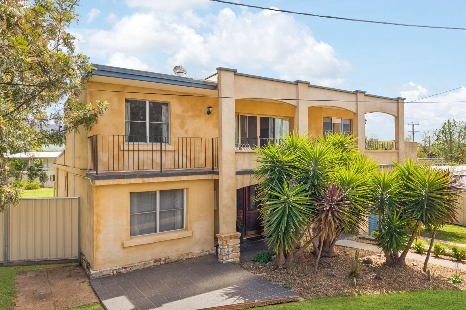
Summary: Substantial Home. Excellent Shed. Large Block.
Description: Set in a peaceful and private location just a short stroll from the golf course, schools and the hospital in Mudgee South, this spacious home occupies a generous 1016m² block. Here you will find multiple living areas, great outdoor entertaining and impressive shedding - perfect for growing families. * Light filled lounge room with wood fire overlooking the rear yard * Separate dining area adjacent to the kitchen * Upstairs family or rumpus room opening onto a balcony * Four good size bedrooms with built-in wardrobes * Master bedroom with ensuite bathroom * Bathroom upstairs plus third bathroom combined with laundry downstairs * Air conditioning and ceiling fans throughout * Generous undercover entertaining deck * 15m x 6m approx. shed with three phase power and studio area * Lock up garage and workshop area; could be converted to additional living or bedroom space * Vehicle access on both sides of the home * Easy care backyard, fully fenced and ample room for additional shedding or pool * Tremendous value for money with the amount of space and improvements on offer To arrange an inspection, contact Damian Kearns at The Agency Mudgee on 0428 144 905
Agent: Damian Kearns - damiankearns@theagency.com.au - 0428 144 905
Mudgee, NSW 2850
Property Type: Apartment / Unit / Flat
Listing Type: Residential
Status: Active
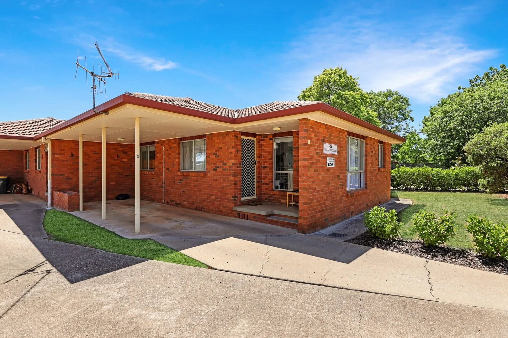
Summary: Renovated and ready to move in!
Description: Perfectly positioned just moments from Mudgee's vibrant CBD, this beautifully renovated two-bedroom unit delivers the ideal blend of style, comfort and convenience. Whether you're a first-home buyer, savvy investor or downsizer seeking a carefree lifestyle, this inviting property offers an exceptional opportunity in one of Mudgee's most desirable locations. Step inside and instantly feel the warmth of the thoughtfully updated interiors. Fresh finishes, modern flooring and soft neutral tones create a bright, welcoming atmosphere. The open-plan living and dining area flows effortlessly into the renovated kitchen with excellent storage and a clean, modern designperfect for everyday living or easy entertaining. Both bedrooms are well proportioned, each fitted with built-in storage and enjoying plenty of natural light. The refreshed bathroom continues the home's modern theme with sleek fixtures and a practical layout. A private outdoor courtyard provides a low-maintenance space to relax, unwind or enjoy your morning coffee in the sunshine. Adding to the appeal is a single carport and the unbeatable convenience of being within walking distance to shops, cafés, parks and Mudgee's thriving town centre. Everything you need is quite literally on your doorstep. Features you'll love: - Stylishly renovated throughout with modern finishes - Two generous bedrooms, both with built-in wardrobes - Light-filled open-plan living and dining - Modern kitchen with good storage and modern fittings - Bright, contemporary bathroom complete with a bathtub, offering comfort and convenience - Private, low-maintenance courtyard for outdoor relaxation - Secure single carport with easy access - Short, level walk to Mudgee CBD, cafés, supermarkets and amenities - Ideal for first-home buyers, investors or downsizers seeking convenience A rare opportunity to secure a beautifully presented, move-in ready home in a tightly held central pocket. Properties of this calibre so close to town and fully updated are hard to come by. For further information or to arrange an inspection please contact Edwina Smith on 0429 328 086. DISCLAIMER: The above information has been furnished to us by the Vendor. We have not verified whether or not that information is accurate and do not have any belief one way or another in its accuracy. We do not accept any responsibility to any person for its accuracy and do no more than pass it on. All interested parties should make and rely upon their own enquiries in order to determine whether or not this information is in fact accurate.
Agent: Edwina Smith - edwinasmith@spmudgee.com.au - 0429 328 086
Mudgee, NSW 2850
Land Size: 1050 m²
Property Type: House
Listing Type: Residential
Status: Active
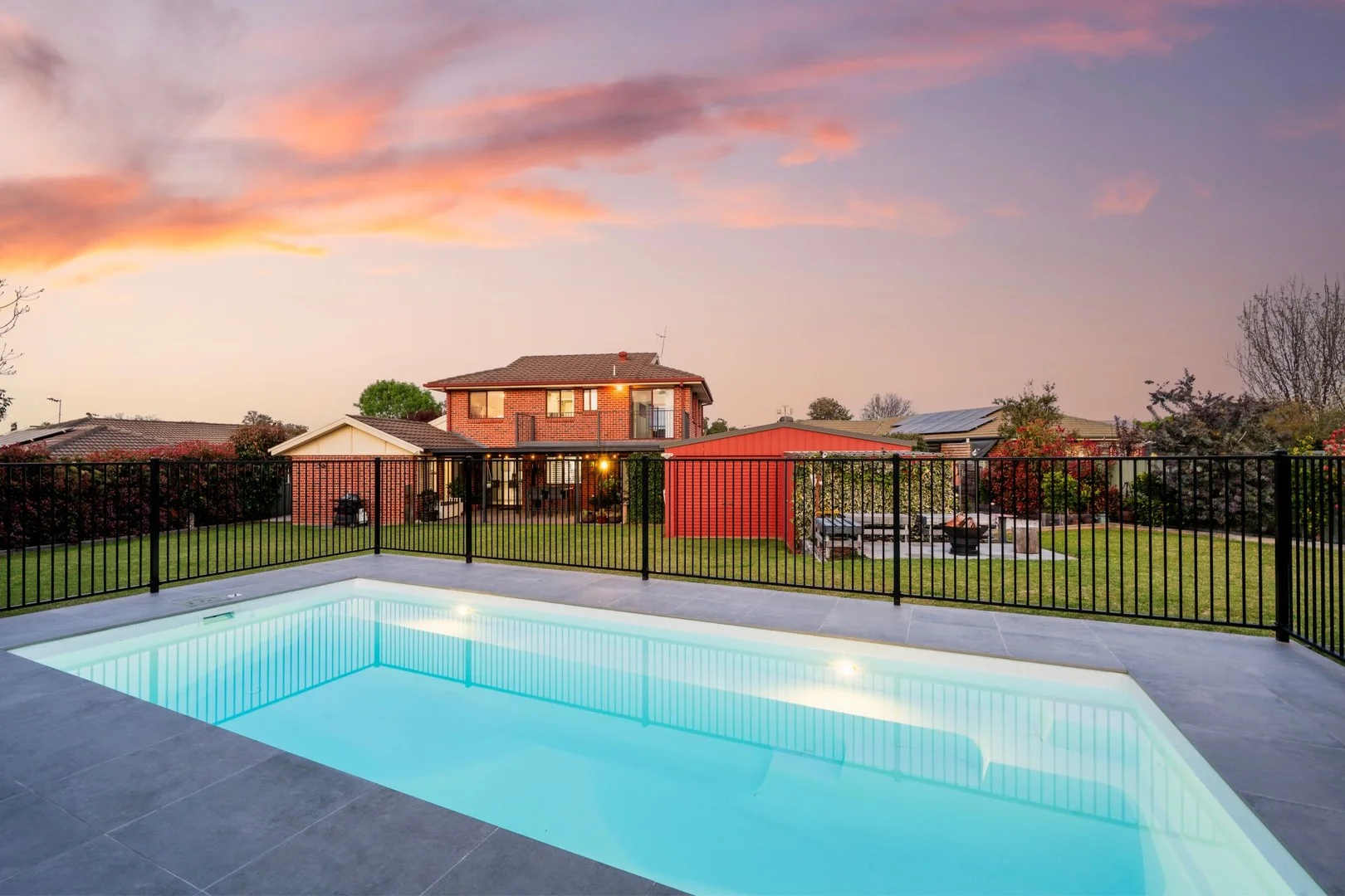
Summary: Dream Family Living
Description: Tucked away in a quiet South Mudgee cul-de-sac, this impressive two-storey brick home delivers the perfect blend of space, comfort, and lifestyle. Set on a generous 1,050sqm block with established gardens, sparkling pool, and excellent shedding, it's a property designed for families who want it all. - 4 generously sized bedrooms, each with built-in wardrobes - Master retreat with walk-in robe, ensuite and private courtyard - Flexible floorplan with three living areas to suit any lifestyle - Spacious kitchen overlooking the backyard and entertaining space - Character-filled three-way bathroom with mosaic tiling and separate WC - Light-filled interiors with large windows throughout - Year-round comfort with underfloor heating, reverse cycle A/C & ceiling fans - Established gardens and mature trees offering shade, privacy and charm - Sparkling inground swimming pool, perfect for summer days - Outstanding shedding 7x8m double garage plus 8x8m powered workshop/storage shed
Agent: Adam Woods - adamwoods@mcgrath.com.au - 6372 2584
Agent: Jessica Martens - jessicamartens@mcgrath.com.au - 6272 2584
Mudgee, NSW 2850
Land Size: 401 m²
Property Type: House
Listing Type: Residential
Status: Active
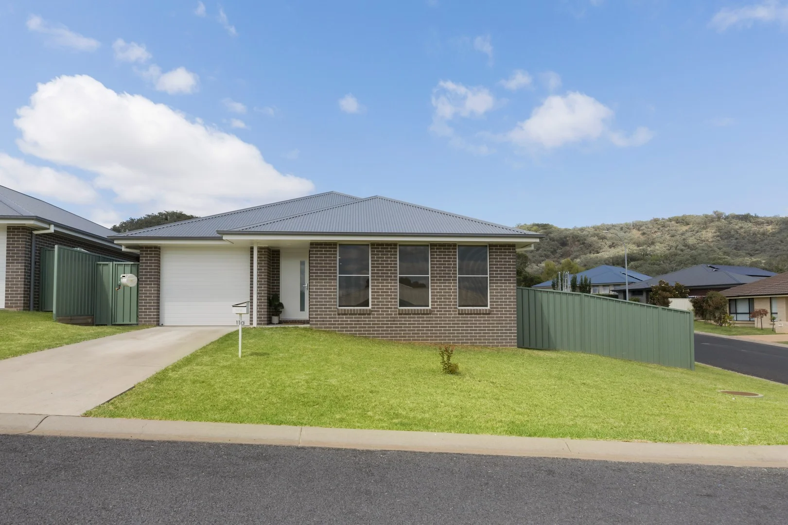
Summary: Modern Home in South Mudgee Perfect for Comfort & Convenience!
Description: Whether you're searching for your dream home, a smart investment, or a low-maintenance lifestyle, this well-built, freestanding home in South Mudgee is the perfect opportunity to elevate your living experience. - Spacious, north-facing open-plan living & dining designed to create a bright, welcomingatmosphere perfect for both relaxation and entertaining. - Well-appointed master suite with a walk-in robe, private ensuite, and split system air conditioning, ensuring maximum comfort and privacy at all times. - Two generous additional bedrooms with built-in wardrobes, offering plenty of space for the whole family or guests. - All-season comfort with split system air conditioning, keeping you cozy in winter and cool in summer. - Sleek, modern kitchen featuring stone benchtops, quality appliances and plenty of storage, perfect for home chefs. - Outdoor entertaining area a peaceful space where you can unwind, entertain, or enjoy your morning coffee in tranquillity. - Single garage with extra storage plus additional off-street parking, providing ultimate convenience and peace of mind. Located in a family-friendly, sought-after neighbourhood, just minutes from parks, schools, and Mudgee's vibrant town centre, this home is a true must-see! Don't let this incredible opportunity slip away contact Edwina Smith today to book your inspection!
Agent: Edwina Smith - edwinasmith@spmudgee.com.au - 0429 328 086