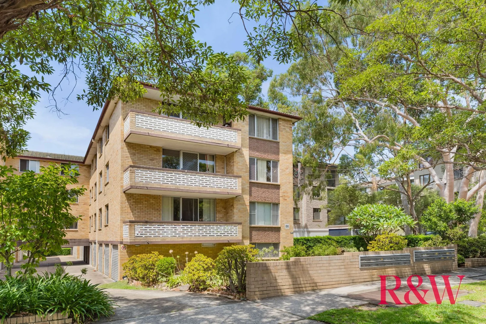
21/84-86 ALBERT ROAD
Strathfield, NSW 2135
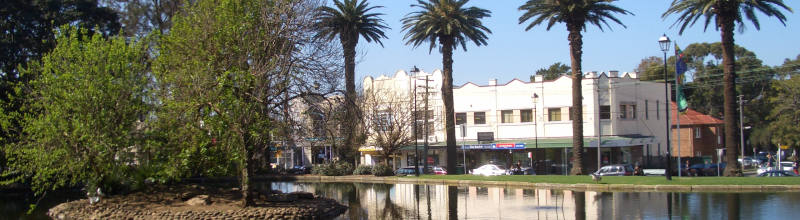
Neighbourhood & everyday essentials
Explore around Strathfield, from school days to weekends.
Find schools, playgrounds and children’s classes. Browse by age to plan school days and weekends.
Area figures
- residents (ABS, June 2024)
- 43,346
- children aged 0–14
- 4,528
- schools
- 11
- parks & libraries
- 9
- kids’ activity providers listed
- 17
Most-listed activities: Tennis, Gymnastics, Maths
Population figures: Australian Bureau of Statistics
Explore local libraries, community spaces, schools and council programs across the wider area.
Parks, playgrounds & public spaces
Laker Reserve Community Garden, Strathfield
Elva St, Strathfield, New South Wales, 2135
266 m straight-line distance
Veech Library
Albert Rd, Strathfield, New South Wales, 2135
540 m straight-line distance
Strathfield Library
Rochester St, Homebush, New South Wales, 2140
607 m straight-line distance
Fitzgerald Park
Broughton Rd, Strathfield, New South Wales, 2135
686 m straight-line distance
Things to do near this home
Explore nearby play centres and family attractions from the directory. Check ages, entry prices and opening hours with the venue.

Browse things to do with kids in Sydney
Find more ideas by age, budget and indoor or outdoor setting on Things to do. Dated events are in What’s on. See what’s on
Discover local guides & family ideas
Read local family guides and practical articles as you explore life around this home.
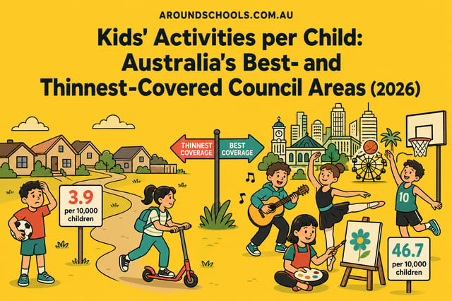
Kids' Activities per Child: Australia's Best- and Thinnest-Covered Council Areas (2026)
Across Australia's big council areas, the AroundSchools directory lists a median of about 10 kids' activity providers for every 10,000 children — but in Melbourne's Wyndham it is 3.9, and in the City…
Read more →
Most Livable Suburbs in New South Wales for Families (2026)
Sydney lists more kids' activities in our directory than any other suburb in NSW. This page ranks NSW suburbs by how much a family moving there could actually do with their kids, then adds what else…
Read more →Everyday essentials & getting around
Open the map to choose a destination and check journey times from this address. Walking routes, step-free access and travel times have not been verified.
Flood & development checks
Property-specific flood risk and announced developments have not been verified. Search this address in the official maps and ask the council for current flood information.
Source: AroundSchools directory. Distances are straight-line distances, not walking routes. Confirm facilities on the linked detail pages. Directory update dates are not supplied for this summary.
Property Details
Apartment / Unit / Flat
RESIDENTIAL
Upcoming Events Nearby

Thu, 26 Nov · Burwood
FREE Kids STEAM Club (9 to 12 year olds) - Burwood Council | Monthly Activity till November
Ages 9–12
Tue, 13 Oct · Dulwich Hill
Storytime at ETC Library - Weekly Tuesdays from Oct 13 until Dec 15
Ages 3–5
Thu, 22 Oct · Lane Cove
50 Years of Delvena Refuge
Sun, 1 Nov · Hurstville.
Hurstville Museum & Gallery: Open Day
Fri, 23 Oct · Carlingford
Globalart Carlingford Open Day
Ages 4–15
Sun, 1 Nov · Kogarah
Kogarah Christmas Carol
What's Nearby

EnterMission Burwood
Suite 201 Level 2/1-17 Elsie St , Burwood

Allegro Childrens Music
104 Lucas Road, Burwood

Emily Chu - Piano Lessons
43 Rawson St, Lidcombe

A Face Painting Dream
76/27 Bennelong Parkway , Wentworth Point

Face Focus Entertainment
27 Bennelong Pkwy, Wentworth Point

AJ Magic
., Sydney

Bonjour Babies (Summer Hill Public School NSW)
Moonbie St, Summer Hill

Kids French Club in Summer Hill
Moonbie Street, Summer Hill

dance @ nikki webster
227 Catherine St, Leichhardt
Nearby Schools

Meriden School
10-28 Redmyre Road, Strathfield NSW 2135 Australia

St Martha’s Catholic Primary School - Strathfield
88 Churchill Avenue, Strathfield NSW 2135 Australia
Strathfield Girls High School
Albert Rd, Strathfield NSW 2135

Santa Sabina College
59-63 The Boulevarde, Strathfield NSW 2135 Australia

Homebush Public School
Rochester St, Homebush NSW 2140

MLC School
7 Rowley Street, Burwood NSW 2134 Australia
Nearby schools do not imply enrolment eligibility. Confirm catchments, year levels and childcare availability directly with the provider.
Nearby Properties
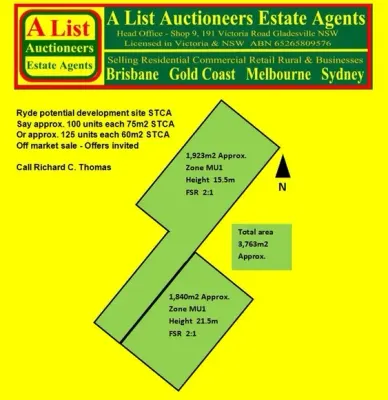
Address withheld
Ryde, NSW 2112
$36,000,000 – $39,500,000
A List Auctioneers Estate Agents
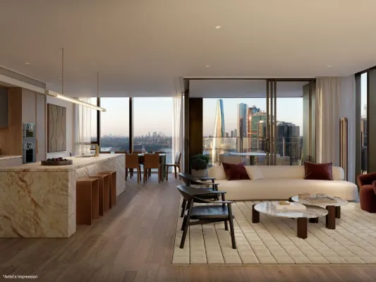
4005/8 Darling Drive
Sydney, NSW 2000
$12,980,000
Mirvac Residential NSW
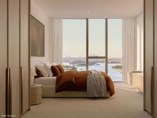
4003/8 Darling Drive
Sydney, NSW 2000
$8,630,000
Mirvac Residential NSW
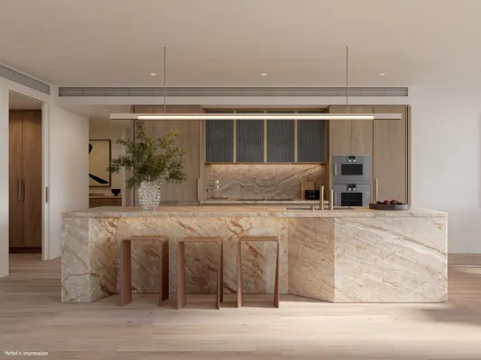
2608/8 Darling Drive
Sydney, NSW 2000
$6,225,000
Mirvac Residential NSW
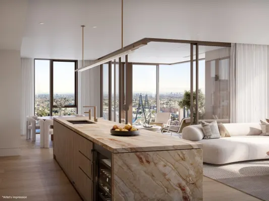
4002/8 Darling Drive
Sydney, NSW 2000
$9,020,000
Mirvac Residential NSW
Address withheld
Macquarie Park, NSW 2113
$1,525,000
A List Auctioneers Estate Agents
Recently sold nearby
Homes that have sold close to this address. We don’t show sale prices.
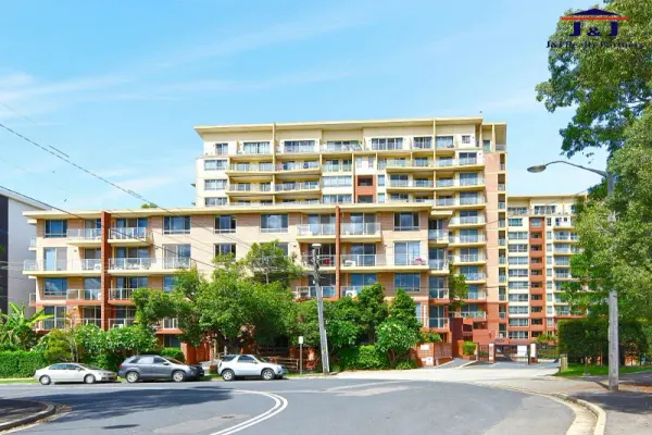
Homebush, NSW 2140
Land Size: 114 m²
Property Type: Apartment / Unit / Flat
Listing Type: Residential
Status: Active
Summary: Resort-Style Living in the Heart of Homebush | Crown Development
Description: Step into this sun-drenched, fourth-floor apartment nestled in the sought-after Crown Complex, where comfort meets convenience. Boasting modern interiors and access to resort-style facilities, this is the perfect home for professionals, couples, or young families alike. Just a short stroll to Homebush Station, local schools, shops, and the vibrant Bakehouse Quarter renowned for its dining and lifestyle options. Features include: Expansive master bedroom features an admirable ensuite Two spacious carpet bedrooms, both with built-in robes and balcony access Spacious open-plan living and dining area with floor boards Sleek full bathroom combined bathtub and shower Airy proportions and leafy outlook allowing an abundance of natural lights to stream in through large balcony doors. Chef's delight kitchen completed with stone, natural gas cooking, Quality appliances and ample storage space. Enjoy year-around entertaining on tranquil covered balcony seamlessly flow off the living and bedrooms, perfect for an entertainment Air conditioning & internal laundry Lift access, security parking, resort style pool, gym and playground Only a minute walk to Homebush train station, village shops and school Size: 114 sqm (84+16+14), Lease contract till Dec 2025 Strata: $1,302 Council: $466 Water: $176 all p/q
Agent: Sonia Kim - soniakim@jjrealty.com.au - 0297463344
Agent: J and J Realty Partners Strathfield - info@jjrealty.com.au - 0297463344
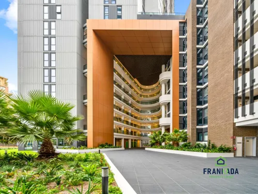
Homebush, NSW 2140
Property Type: Apartment / Unit / Flat
Listing Type: Residential
Status: Active
Summary: Cosy 1 Bedroom Apartment Possessing Superb Lifestyle and Convenience
Description: Ideally located amidst the bustling backdrop of Homebush, this comfortable 1 bedroom apartment embodies a dynamic lifestyle. Homeowners can revel in the suburban lifestyle being footsteps away from local cafes, restaurants and gyms, whilst a leisurely stroll allows residents to enjoy the plethora of dining, shopping and entertainment options on offer at Strathfield Plaza. With buses accessing Rhodes, Sydney Olympic Park and Strathfield just a 2 minute walk from the apartment, a 6 minute walk also arrives at Homebush Station, ensuring that residents have a multitude of transport options to access all parts of Sydney. Within its spacious interior, the integrated living and dining room flows onto a covered balcony, whilst sleek stone countertops accentuate a full kitchen complement, complete with in-built appliances. The classy bedroom also offers a walk-in wardrobe and balcony access, allowing residents to enjoy many serene sunrises or sunsets from the comfort of their own room. Coupled with ducted air conditioning and internal laundry and dryer, this cosy apartment is ideal for busy professionals and savvy investors alike. Features: Integrated living/dining area flows seamlessly onto covered balcony Sleek stone kitchen countertops complete with in-built oven and dishwasher Carpeted bathroom with walk-in wardrobe and balcony access Tiled bathroom with modern fittings Ducted Air Conditioning Internal laundry and dryer Catchment area of Strathfield Girls (Ranked 9th amongst comprehensive schools in 2024 HSC) 2 minutes drive to Great Western Hwy, M4 and Parramatta Rd 2 minutes walk to bus services accessing Rhodes, Sydney Olympic Park, Strathfield and Burwood 6-7 minute walk to Homebush Station Footsteps to local gyms, cafes and restaurants Stroll to plethora of dining, shopping and entertainment options at Strathfield Plaza Disclaimer: Raine & Horne Ryde has no reason to doubt the accuracy of the property information provided. We request that at all times you inspect the property and make & rely upon your enquiries.
Agent: Gordon Shaoguo He - gordon.he@ryde.rh.com.au - 0478023521
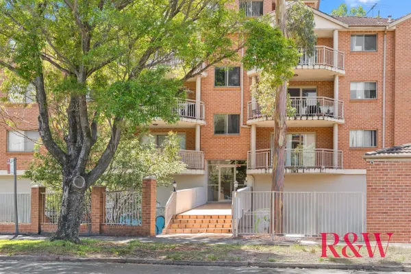
Strathfield, NSW 2135
Property Type: Apartment / Unit / Flat
Listing Type: Residential
Status: Active
Summary: HUGE APARTMENT, GREAT LOCATION
Description: This oversized apartment is positioned in the heart of Strathfield within a very short distance to train station, shops, restaurants and cafes. Set within a well maintained security complex of full brick and concrete construction. Presenting a rare opportunity to buy such a large apartment so close to Strathfield Train Station and town centre. This is an opportunity to buy more than just a home, providing lifestyle, comfort, convenience and connectivity. A few of the features on offer include: • 2 large bedrooms, both with built in wardrobes • Huge open plan lounge and dining areas • Main bedroom with large fully tiled en-suite • Bright kitchen with breakfast bar and gas cooking • Huge fully tiled main bathroom • Separate internal laundry • Sunny large balcony access from the living areas • Freshly painted and new carpet throughout • Large lock Up Garage • Total area an impressive 124m2 approx • Simply move in and enjoy or invest • Great floor plan and layout • Boutique complex of only 15 apartments Making a great opportunity to invest or move in and enjoy the convenience. Near to the area's popular schools and parks. Strata approx $1,117pq; water approx $176pq; council approx $446pq. DISCLAIMER: While Richardson & Wrench Strathfield have taken all care in preparing this information and used their best endeavours to ensure that the information contained therein is true and accurate but accept no responsibility and disclaim all liability in respect of any errors, inaccuracies or misstatements contained herein. Richardson & Wrench Strathfield urge prospective purchasers to make their own inquiries to verify the information contained herein.
Agent: Paul Galassi - paul@rwstrathfield.com.au - 02 9745 2733
Agent: Adrian Galassi - adrian@rwstrathfield.com.au - 02 9745 2733
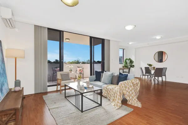
Strathfield, NSW 2135
Property Type: Apartment / Unit / Flat
Listing Type: Residential
Status: Active
Summary: ACHIEVED THE TOP PRICE IN THE BUILDING- ANOTHER SUCCESS BY LISA LEE
Description: Elevate your lifestyle in one of Strathfield's most sought-after locations. Positioned on the 5th floor of a secure complex, this beautifully presented apartment boasts a desirable north-east aspect, quality finishes, and unbeatable convenience. Located directly opposite Strathfield Plaza and just a 2-minute walk to the train station and bus stop, everything you need is right at your doorstep – shopping, dining, top schools, and rapid access to the CBD. Property Highlights: * Sun-drenched north-east facing aspect with abundant natural light * Two generously sized bedrooms with built-in wardrobes * Oversized open-plan living and dining area with timber floorboards * Expansive, private balcony ideal for morning coffee and relaxed entertaining * Modern gas kitchen featuring stone bench tops and stainless steel appliances * Two spacious bathrooms, plus internal laundry * Secure lock-up garage * Full-brick construction with lift access, video intercom & well-maintained complex This is an ideal opportunity for first home buyers and investors alike, offering the perfect blend of lifestyle, location, and long-term value. For more information or to arrange an inspection, contact Lisa Lee on 0452 474 989.
Agent: Lisa Lee - lisa.lee@century21.com.au - 9874 8888
Strathfield, NSW 2135
Property Type: Apartment / Unit / Flat
Listing Type: Residential
Status: Active
Summary: SOLD
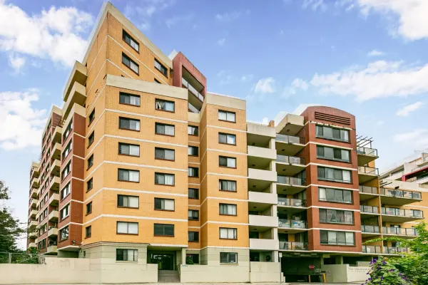
Description: 7th Floor North West Facing 2 Bedroom Apartment - First Home or Investment This well presented 2 bedroom spacious apartment with district views is the perfect place to come home to. Property boasts Spacious combined lounge and dining area Chefs kitchen with gas cooking, dishwasher and plenty of storage 2 double sized bedrooms main with built in wardrobe Separate bath and shower Wooden floors Air conditioning Secure basement parking Within easy walking distance to Strathfield station, local schools and shopping makes this property worth inspecting. For further information or to inspect, please contact Eugene Ganke from Century 21 Burwood on 0404 010 555
Agent: Eugene Ganke - eugene.ganke@century21.com.au
Agent: Khya Sumarto - khya.sumarto@century21.com.au
Strathfield, NSW 2135
Property Type: Apartment / Unit / Flat
Listing Type: Residential
Status: Active
Summary: Inspection Cancelled Under Contract
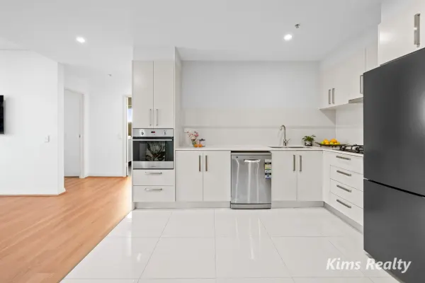
Description: Experience elevated living in this generously proportioned two-bedroom apartment, perfectly positioned in one of Strathfield's most sought-after locations. Situated on Level 9 at the rear of a boutique complex, located moments away from Strathfield Station, elite schools, parks, and Strathfield Plaza. Property Features: - Spacious open plan living/dining area with abundant natural light - Seamless indoor/outdoor flow via floor-to-ceiling glass doors to balcony - Floor-to-ceiling glass sliding doors open to a sun-drenched balcony with wide district outlooks - Two generously sized bedrooms with built-in wardrobes, master with ensuite - Stylish main bathroom with floor-to-ceiling tiles - Dedicated study/home office adjacent to kitchen - Modern stone kitchen with stainless steel gas appliances - Internal laundry, split system air-conditioning - Secure basement car space with convenient lift access to Level B2 - In the heart Strathfield CBD, just minutes' walk to all amenities - Steps to Strathfield Plaza, parks, schools, and The Boulevard - Easy access to elite private & public schools including Strathfield Girls, St Patrick's and Meriden - Walk to vibrant local cafes and eateries, schools and parklands A great opportunity to buy a modern, move-in ready apartment in one of the Inner West's most popular suburbs. Perfect for living in or as a smart investment for the future. Total area 106m² Strata Levy $983 p/q (approx.) Water $180 p/q (approx.) Council rate $477 p/q (approx.) Rental Return $900 p/w (approx.) (Note: Entrance to Inspections are on Raw Square)
Agent: Lin Xu - lin@kimsrealty.com.au - 0433180224
Agent: Stephen Cho - stephen@kimsrealty.com.au - 02 9718 8333
Homebush, NSW 2140
Property Type: Apartment / Unit / Flat
Listing Type: Residential
Status: Active
Summary: Contemporary Apartment Living in the Heart of Homebush
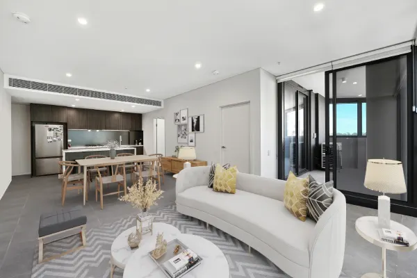
Description: Positioned on the 7th floor, this near-new apartment completed in 2024 offers a well-considered two-bedroom plus study layout designed for comfortable modern living. The light-filled open-plan living and dining area flows to a generous balcony, creating an inviting space for everyday living. Quality finishes, practical inclusions and access to resident gym facilities further enhance the appeal, all within a secure building in the heart of Homebush. Features include: - Spacious open-plan living and dining area opening to a generously sized balcony - Modern kitchen with stainless steel appliances, gas cooking and Caesarstone benchtops - Two well-proportioned bedrooms with built-in wardrobes, main with ensuite and balcony access from the second bedroom - Stylish main bathroom complemented by a separate internal laundry - Oversized secure car space with storage cage in a security building - Convenient location moments to Homebush and Strathfield stations, shops, cafés, Bakehouse Quarter, Aldi and DFO Homebush, with direct rail access to Sydney CBD in approximately 30 minutes For more details please contact Koji Amaike on 0422 101 068 or Emma Byrnes on 0478 751 778. Disclaimer: This information has been obtained from our vendors/third party/sources we deem to be reliable. We make no representation as to its accuracy. All images and photographs are indicative only and we are merely passing the information on. Any interested parties should satisfy themselves as to the accuracy, dimensions, reliability, currency and completeness of each illustration, description and reference.
Agent: Koji Amaike - koji.amaike@novarealtygroup.com.au - 02 9901 4248
Agent: Emma Byrnes - emma.byrnes@novarealtygroup.com.au - 02 9901 4248
Strathfield, NSW 2135
Property Type: Apartment / Unit / Flat
Listing Type: Residential
Status: Active
Summary: SPACIOUS TOP FLOOR APARTMENT
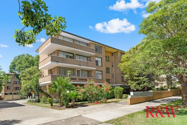
Description: A great opportunity to buy an original apartment close to Strathfield Train Station and Centre. Positioned on the top floor within a well maintained complex with leafy surrounds and in ground swimming pool. Filled with natural light throughout with a peaceful outlook. A few of the features this property has to offer include: • 2 double bedrooms • Spacious lounge and dining room • Bright separate kitchen • Large bathroom • Internal laundry • Balcony • Lock up garage Only a short distance to all of the area's popular primary and high schools. Located near to Strathfield train station, shops, restaurants, cafes and parks. The apartment is original in condition and requires work. DISCLAIMER: While Richardson & Wrench Strathfield have taken all care in preparing this information and used their best endeavours to ensure that the information contained therein is true and accurate but accept no responsibility and disclaim all liability in respect of any errors, inaccuracies or misstatements contained herein. Richardson & Wrench Strathfield urge prospective purchasers to make their own inquiries to verify the information contained herein.
Agent: Paul Galassi - paul@rwstrathfield.com.au - 02 9745 2733
Agent: Adrian Galassi - adrian@rwstrathfield.com.au - 02 9745 2733
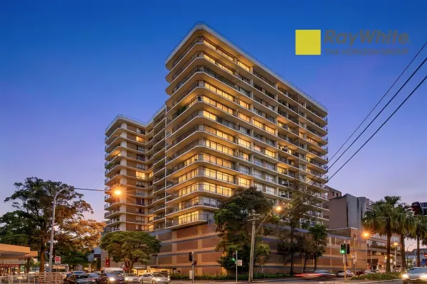
Strathfield, NSW 2135
Property Type: Apartment / Unit / Flat
Listing Type: Residential
Status: Active
Summary: Penthouse-Level Luxury | Recently Renovated | 2 Bed | 1 Bath | 2 Car
Description: Experience elevated living in this recently renovated penthouse-level apartment situated on the top floor of the highly desirable building at 30-34 Churchill Avenue, Strathfield. Featuring 2 bedrooms, 1 bathroom and 2 secure car spaces, this residence combines refreshed interiors, abundant natural light and unmatched urban convenience. Key Features • Penthouse-level position with impressive district and potential city skyline views • Recently renovated throughout - updated finishes and move-in ready condition • Bright open-plan living and dining opening onto a full-length entertainer's balcony • Two generous bedrooms with built-in wardrobes • Modern kitchen with stone benchtops and quality appliances • Secure building with intercom and lift access • Two secure car spaces - exceptionally rare for a 2-bedroom unit in this location • Access to building facilities including a swimming pool and gym, adding comfort and lifestyle convenience • Moments to Strathfield Station, Strathfield Plaza, cafés, restaurants and top schools This beautifully upgraded penthouse-level apartment delivers the perfect blend of style, convenience and value. A rare offering in one of Inner West's most connected suburbs. Contact us today for inspections at Edwin Wang:0413089339 or Joe DU 0434626400. * We do not guarantee or give any warranty on the accuracy of the information and/or statements provided. Interested parties must rely on their own inquiries.
Agent: Edwin Wang - zhen.wang@raywhite.com
Agent: Joe Du - joe.du@raywhite.com