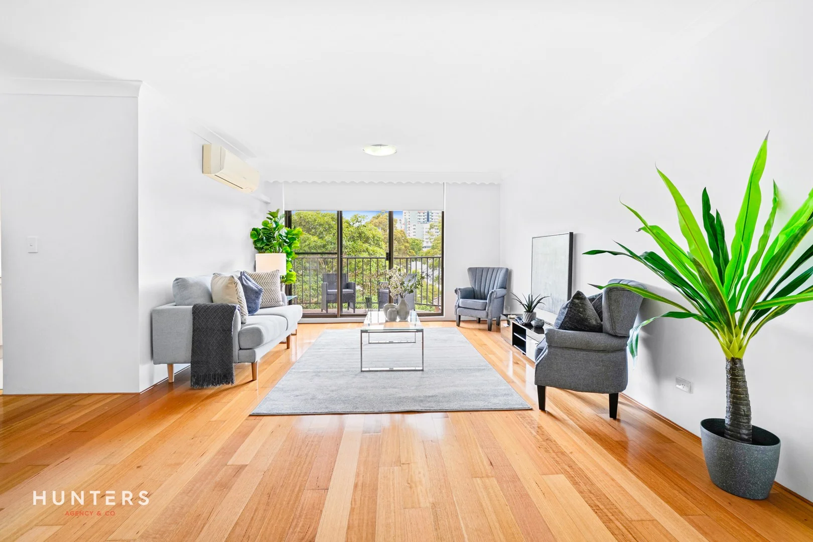
20/101 Wentworth Road
Strathfield, NSW 2135
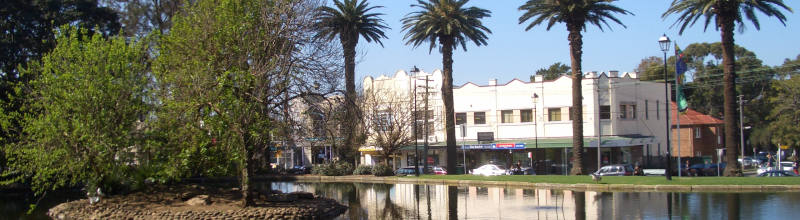
Neighbourhood & everyday essentials
Explore around Strathfield, from school days to weekends.
Find schools, playgrounds and children’s classes. Browse by age to plan school days and weekends.
Area figures
- residents (ABS, June 2024)
- 43,346
- children aged 0–14
- 4,528
- schools
- 11
- parks & libraries
- 9
- kids’ activity providers listed
- 17
Most-listed activities: Tennis, Gymnastics, Maths
Population figures: Australian Bureau of Statistics
Explore local libraries, community spaces, schools and council programs across the wider area.
Parks, playgrounds & public spaces
Burwood Library
Conder St, Burwood, New South Wales, 2134
326 m straight-line distance
Nurragingy Reserve, Doonside
Railway Pde, Burwood, New South Wales, 2134
869 m straight-line distance
Laker Reserve Community Garden, Strathfield
Elva St, Strathfield, New South Wales, 2135
945 m straight-line distance
Veech Library
Albert Rd, Strathfield, New South Wales, 2135
1.2 km straight-line distance
Things to do near this home
Explore nearby play centres and family attractions from the directory. Check ages, entry prices and opening hours with the venue.

Browse things to do with kids in Sydney
Find more ideas by age, budget and indoor or outdoor setting on Things to do. Dated events are in What’s on. See what’s on
Discover local guides & family ideas
Read local family guides and practical articles as you explore life around this home.
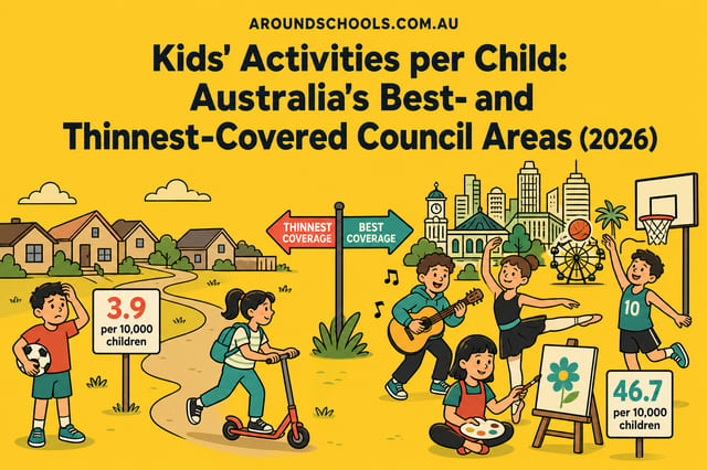
Kids' Activities per Child: Australia's Best- and Thinnest-Covered Council Areas (2026)
Across Australia's big council areas, the AroundSchools directory lists a median of about 10 kids' activity providers for every 10,000 children — but in Melbourne's Wyndham it is 3.9, and in the City…
Read more →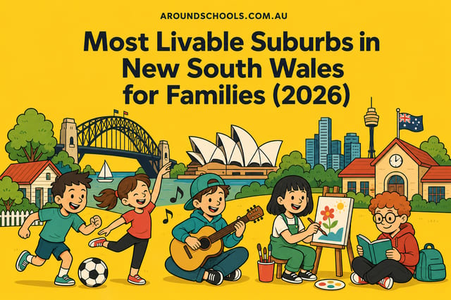
Most Livable Suburbs in New South Wales for Families (2026)
Sydney lists more kids' activities in our directory than any other suburb in NSW. This page ranks NSW suburbs by how much a family moving there could actually do with their kids, then adds what else…
Read more →Everyday essentials & getting around
Open the map to choose a destination and check journey times from this address. Walking routes, step-free access and travel times have not been verified.
Flood & development checks
Property-specific flood risk and announced developments have not been verified. Search this address in the official maps and ask the council for current flood information.
Source: AroundSchools directory. Distances are straight-line distances, not walking routes. Confirm facilities on the linked detail pages. Directory update dates are not supplied for this summary.
Property Details
Apartment / Unit / Flat
RESIDENTIAL
Upcoming Events Nearby

Thu, 26 Nov · Burwood
FREE Kids STEAM Club (9 to 12 year olds) - Burwood Council | Monthly Activity till November
Ages 9–12
Tue, 13 Oct · Dulwich Hill
Storytime at ETC Library - Weekly Tuesdays from Oct 13 until Dec 15
Ages 3–5
Sun, 1 Nov · Hurstville.
Hurstville Museum & Gallery: Open Day
Thu, 22 Oct · Lane Cove
50 Years of Delvena Refuge
Sun, 1 Nov · Kogarah
Kogarah Christmas Carol
Fri, 20 Nov · Kogarah
Healthy and Active Families
Ages 6+
What's Nearby

EnterMission Burwood
Suite 201 Level 2/1-17 Elsie St , Burwood

Allegro Childrens Music
104 Lucas Road, Burwood

Bonjour Babies (Summer Hill Public School NSW)
Moonbie St, Summer Hill

Kids French Club in Summer Hill
Moonbie Street, Summer Hill

Emily Chu - Piano Lessons
43 Rawson St, Lidcombe

Face Focus Entertainment
27 Bennelong Pkwy, Wentworth Point

A Face Painting Dream
76/27 Bennelong Parkway , Wentworth Point

AJ Magic
., Sydney

Kids French Club in Earlwood
396 Homer Street, Earlwood
Nearby Schools

Santa Sabina College
59-63 The Boulevarde, Strathfield NSW 2135 Australia
Burwood Public School
1-3 Conder Street, BURWOOD NSW 2134

Meriden School
10-28 Redmyre Road, Strathfield NSW 2135 Australia

MLC School
7 Rowley Street, Burwood NSW 2134 Australia

Trinity Grammar Preparatory School
125 The Boulevarde, Strathfield NSW 2135 Australia

Southern Cross Catholic College
17 Comer Street, Burwood NSW 2134 Australia
Nearby schools do not imply enrolment eligibility. Confirm catchments, year levels and childcare availability directly with the provider.
Nearby Properties
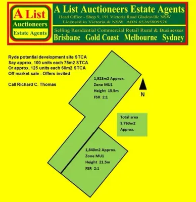
Address withheld
Ryde, NSW 2112
$36,000,000 – $39,500,000
A List Auctioneers Estate Agents
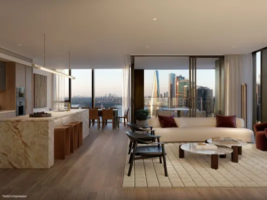
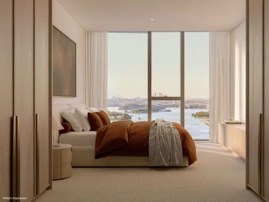
4005/8 Darling Drive
Sydney, NSW 2000
$12,980,000
Mirvac Residential NSW
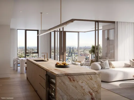
4003/8 Darling Drive
Sydney, NSW 2000
$8,630,000
Mirvac Residential NSW
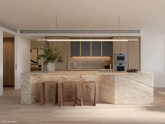
4002/8 Darling Drive
Sydney, NSW 2000
$9,020,000
Mirvac Residential NSW
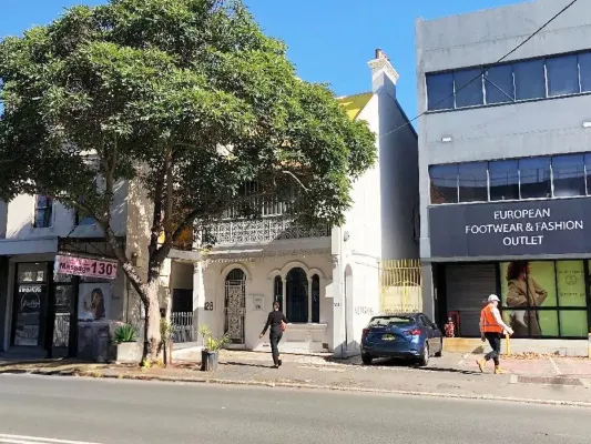
2608/8 Darling Drive
Sydney, NSW 2000
$6,225,000
Mirvac Residential NSW
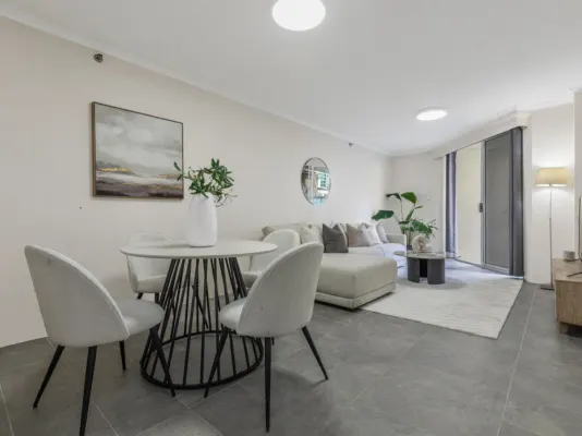
6/569-581 George Street
Sydney, NSW 2000
$640,000 – $675,000
Oak Property Partners Pty Ltd
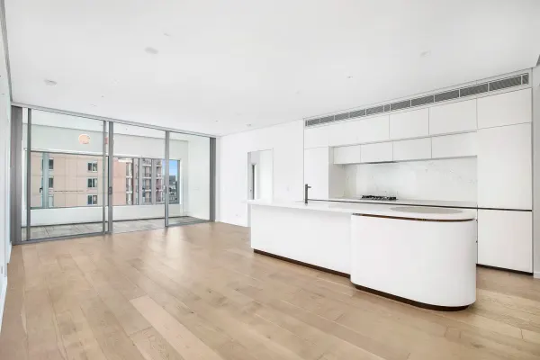
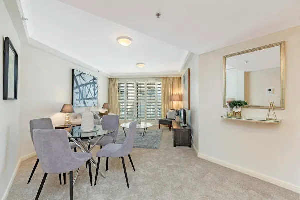
Recently sold nearby
Homes that have sold close to this address. We don’t show sale prices.

Burwood, NSW 2134
Land Size: 936 m²
Property Type: House
Listing Type: Residential
Status: Active
Summary: Development site for sale
Description: Spread over a combined land size of 936 sqm (approx.) with incredible street frontage and two liveable dwellings, this is one of those rare opportunities set to provide property prosperity for future generations. - R1 zoning - Height of Building:14m - FSR: 2:1 Located in one of BURWOOD's most desirable pockets, this home offers supreme conveniencewalking distance to elite schools (Burwood public school,MLC), Burwood train stations, and Burwood's vibrant shopping and China town dining precinct.This is a rare opportunity to secure a premium lifestyle property with outstanding potential.
Agent: Simon Liang - burwoodnorth@hotmail.com - 0433070338
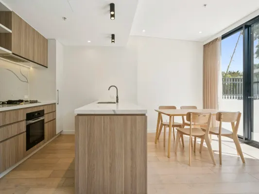
Burwood, NSW 2134
Property Type: Apartment / Unit / Flat
Listing Type: Residential
Status: Active
Summary: Spacious & Top quality 2-Bedroom Apartment in Prime Burwood Location with a Courtyard !
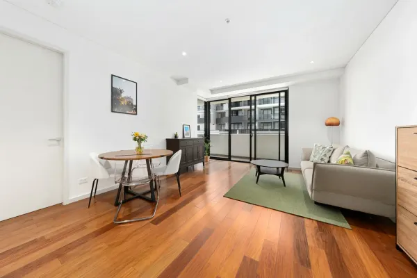
Description: Immersed in the vibrant heart of Burwood, Adela is quietly positioned within a leafy enclave, offering a rare sense of tranquillity just moments from the bustling town centre. Showcasing striking contemporary architecture, this impeccably appointed apartment delivers an exceptional blend of style, comfort, and convenience. Property Features: * 2 spacious bedrooms with built-in wardrobes * 2 modern bathrooms (including an ensuite with a window) * Open-plan living and dining area * Contemporary kitchen with quality appliances * Private courtyard/balcony * Secure car space * Internal laundry * Secure building with intercom access Location Highlights: * Walking distance to Burwood Station with 3-4 minutes * Close to Westfield Burwood, shops, cafés, and restaurants with 3-4 minutes * Easy access to schools, parks, and public transport Ideal for owner-occupiers or investors seeking a low-maintenance property in a highly sought-after location.
Agent: Li (sammi) Fan - sammifan@stonerealestate.com.au - 0283865218
Burwood, NSW 2134
Land Size: 107 m²
Property Type: Apartment / Unit / Flat
Listing Type: Residential
Status: Active
Summary: Unbeatable Location, Effortless Modern Living
Description: Welcome to this stunning two-bedroom plus study apartment set on the second floor of Tower B in the prestigious "Burwood Grand" complex. Positioned directly beside Burwood Plaza and Emerald Square, just 400 metres from Burwood Train Station, this luxurious residence delivers exceptional convenience and a lifestyle of comfort and sophistication. Step inside to a spacious, intelligently designed floor plan featuring two generously sized bedrooms, both with built-in wardrobes, a well-proportioned study area, and two sleek, contemporary bathrooms finished with quality European fixtures. The designer kitchen showcases stone benchtops and premium Miele appliances, seamlessly connecting to the open-plan living and dining area, which flows onto a large entertainer's balcony, perfect for relaxing or hosting guests. Additional highlights include ducted air conditioning, quality timber flooring throughout, internal laundry, and secure basement parking. Enjoy an unbeatable location just moments from Burwood train station, Burwood Plaza, Westfield Shopping Centre, Burwood Library, Burwood Park, vibrant cafes, restaurants, and some of the area's most sought-after schools. This is an outstanding opportunity to secure a premium apartment in the very heart of Burwood, offering ultimate convenience and strong rental appeal.
Agent: Rong You - rong@ljhburwood.com.au - 9745 3999

Burwood, NSW 2134
Property Type: House
Listing Type: Residential
Status: Active
Summary: Development site for sale
Description: 39-41 Conder st Burwood, 1355sqm, FSR: 2:1, 14m height limit, R1 high desity zoning
Agent: Simon Liang - burwoodnorth@hotmail.com - 0433070338
Burwood, NSW 2134
Property Type: Apartment / Unit / Flat
Listing Type: Residential
Status: Active
Summary: SOLD
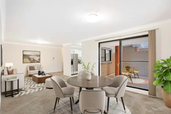
Description: Experience an unmatched contemporary lifestyle in this spacious 2 bedroom, 2 bathroom unit in the vibrant heart of Burwood. Designed for modern urban living, the 138 sqm space strikes the perfect balance between style and convenience, right where dynamic city life meets relaxed home comfort. The chef's kitchen is a highlight, boasting sleek cabinetry and modern appliances that invite culinary exploration. Retreat to a generously-sized master suite complete with an ensuite and built-in robe, while the second bedroom offers comfort and convenience with an adjacent main bathroom. Extend your living space outdoors with a private balcony and an expansive terrace, - 138 sqm of modern urban living space. - Gourmet kitchen with elegant cabinetry and modern appliances. - Master suite with ensuite and built-in robe. - Expansive terrace and private balcony for outdoor living. - Secure undercover parking and intercom access. - Ideal location near Burwood's shopping precinct, cafes, restaurants and public transport.
Agent: Joseph Rupolo - joseph.rupolo@lsre.com.au - 0411 695 369
Burwood, NSW 2134
Land Size: 434.8 m²
Property Type: House
Listing Type: Residential
Status: Active
Summary: SOLD PRIOR TO AUCTION BY BEGETIS ESTATE AGENTS $3,102,000!
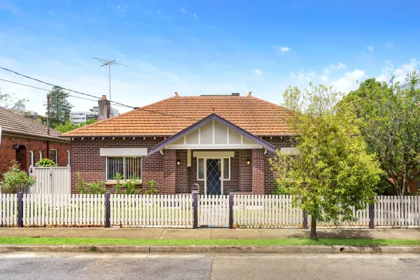
Description: NO HERITAGE OR CONSERVATION! Held by the same Family for in excess of 65 years & perfectly positioned in a premium, ultra convenient setting approximately 500 metres away from Burwood Station, only moments to Westfield, Burwood Park, Plaza, MLC School & also being an easy walk to Santa Sabina, Meriden College, Strathfield Station & Shopping Plaza. This charmingly picturesque double fronted full brick character residence displays immaculate interiors throughout & is set on a wide 18.2m (approx) frontage & 434.8m2 land size (approx). Currently a comfortable family home offering loads of future potential with scope to further renovate or rebuild (subject to Council approval). * 3 spacious bedrooms with built ins, formal lounge & separate dining + sunroom/study * Polished timber floors, high patterned ceilings + picture rails & updated gas kitchen * Ample bathroom, side driveway with carport & off street parking for an additional vehicle * Undercover entertaining area overlooking leafy child friendly yard with established gardens * Excellent location with all of Burwood & Strathfield's amenities being within close proximity
Agent: Nick Begetis - nick@begetis.com.au - 02 0744 2300
Burwood, NSW 2134
Property Type: House
Listing Type: Residential
Status: Active
Summary: PRIME CORNER BLOCK WITH EXCEPTIONAL REDEVELOPMENT POTENTIAL (STCA)
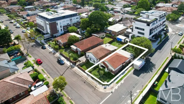
Description: Positioned on a sought-after corner block in the heart of Burwood, this freestanding double brick residence offers a rare and exciting opportunity for homeowners, investors, developers and land bankers looking to capitalise on strong local growth Surrounded by a growing number of completed and ongoing redevelopment projects, the property sits in a high-demand precinct with excellent future upside Its prominent corner block position provides enhanced accessibility, flexibility in design, and excellent potential for redevelopment, extension, or a complete rebuild (subject to council approval) Freestanding double brick home with immediate liveability or rental income Separate living and dining areas, with air conditioning in the lounge room Functional kitchen equipped with gas cooking Three spacious bedrooms, main with built-in wardrobe Neat rear garden and car space Just a short stroll to Burwood Station, Burwood Plaza, Westfield Shopping Centre, and a vibrant selection of cafes, restaurants, and schools, this blue-chip Inner West address is an opportunity not to be missed Please be aware that open home times are subject to change at short notice. Please check the listing on the day of the inspection to confirm the scheduled time. Disclaimer: All information contained herein is gathered from sources we believe reliable. We have no reason to doubt its accuracy. However, we cannot guarantee it. All interested parties are strongly advised to conduct their own due diligence and should make and rely upon their own enquiries. Please be advised that some images used in this advertisement may have been digitally altered or virtually staged. These images are intended for illustrative purposes only and may not accurately reflect the current condition, appearance, or layout of the property.
Agent: Eric Yining Cao - Eric.C@McConnellBourn.com.au - 02 9427 8999
Burwood, NSW 2134
Property Type: Apartment / Unit / Flat
Listing Type: Residential
Status: Active
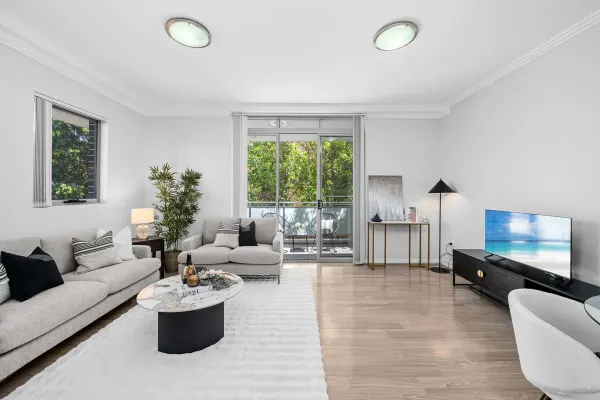
Summary: North-Facing Full-Brick Apartment | Light-Filled Interiors | Prime Burwood Convenience
Description: Enjoying a prized north-facing position and abundant natural light throughout, this well-designed full-brick apartment delivers comfortable, low-maintenance living in the heart of Burwood. Set within a secure and well-maintained complex, it presents an outstanding opportunity for both owner-occupiers and investors seeking strong lifestyle appeal and long-term value. Property Features: • Corner block with desirable northern aspect • Enjoy abundant natural light throughout the day • Sun-drenched open-plan living and dining area • Seamlessly flowing to a private balcony, perfect for relaxed everyday living and entertaining • Solid full-brick construction • Providing excellent insulation, durability, and timeless appeal • Generous bedroom with built-in wardrobe and private balcony access • Well-proportioned and filled with natural light, offering direct access to its own balcony for enhanced comfort and airflow • Timber flooring throughout with new LED lighting • Creating a modern and low-maintenance living environment • Practical and functional kitchen • Featuring ample storage and generous bench space to accommodate daily cooking needs • Neatly presented bathroom • Well-maintained with clean finishes and a smart, easy-care layout • Secure complex in an ultra-convenient location Ideally positioned within easy walking distance to Burwood railway station, Westfield Burwood, local cafés, shops, and reputable schools. Located in one of Burwood's most connected and high-demand pockets, this is a fantastic opportunity to secure a solid, light-filled apartment offering both lifestyle appeal and strong investment potential. Disclaimer: The above information contained herewith, including but not limited to the general property description, price, and the address, is provided to Raine & Horne Rhodes by third parties, we have obtained this information from sources we believe to be reliable. However, we cannot guarantee the accuracy of this information and nor do we accept responsibility for its accuracy. Any interested parties should rely on their own enquiries and judgment to determine the accuracy of this information for their own purposes.
Agent: Angell YANG - angell.yang@rhodes.rh.com.au - 0434 259 336
Agent: Faye Li - faye.li@rhodes.rh.com.au - 0434 135 666
Burwood, NSW 2134
Land Size: 110 m²
Property Type: Apartment / Unit / Flat
Listing Type: Residential
Status: Active
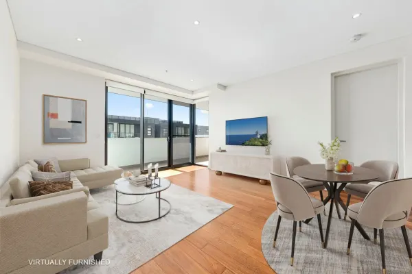
Summary: Sold By Rong You
Description: Contemporary Elegance with Exceptional Convenience Positioned on the 10th floor of Tower B within the renowned 'Burwood Grand' complex, this beautifully appointed two-bedroom apartment with a separate study offers refined modern living in one of Burwoodâs most convenient lifestyle locations. The residence features a well-considered layout with two spacious bedrooms, each fitted with built-in wardrobes, complemented by a versatile study space ideal for working from home. Two contemporary bathrooms and a sleek, designer kitchen with stone benchtops and quality appliances add to the apartment's sense of style and practicality. The open-plan living and dining zone extends seamlessly to a generous balcony, creating an inviting space for everyday living and entertaining. Comfort is assured year-round with ducted air conditioning, while timber flooring throughout, an internal laundry, and secure basement parking further enhance the home's appeal. Enjoy the ultimate in convenience with Burwood Plaza, Emerald Square, Westfield Shopping Centre, Burwood Train Station, Burwood Park, popular cafes, restaurants, and reputable schools all just a short stroll away. Offering a premium address, lifestyle ease, and strong rental demand, this apartment represents an outstanding opportunity in the heart of Burwood.
Agent: Rong You - rong@ljhburwood.com.au - 9745 3999